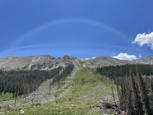
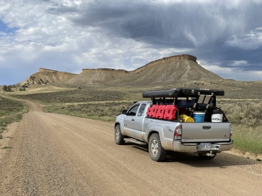
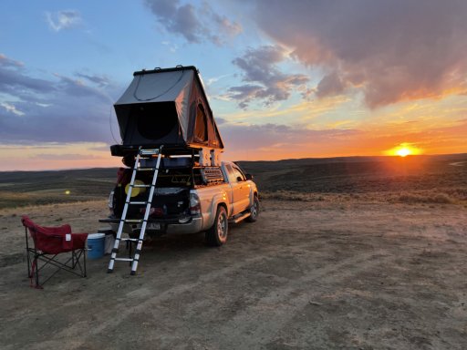
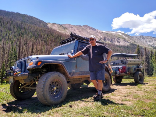
US East Running the Trans America Trail (TAT) from WV to the OR coast

  • HTML tutorial

Mrprez

Rank IV

Enthusiast III

1,146
Wildwood, FL, USA
First Name
John
Last Name
Kennedy
Member #

28913

Ham/GMRS Callsign
KJ4WMZ
Paul, If you are bypassing OK then you will be in front of me, I’m leaving Tuesday and I think I have about 195 to get to Trinidad, CO and plan on driving until I get there or until I get tired which ever comes first, I have to do my chores Tuesday morning before I can leave
We made it from Liberal KS to Trinidad in one day. Left at predawn and arrived early afternoon.
 

T. Stanley

Rocky Mountain Region Member Rep Kansas
Launch Member

Member III

2,551
Clay Center, Kansas
First Name
Tim
Last Name
Stanley
Member #

25893

We made it from Liberal KS to Trinidad in one day. Left at predawn and arrived early afternoon.
From home, (Clay Center, KS) it shows me just short of 8 hours on blacktop to Trinidad, so I should be there late afternoon/early evening.
 
  • Like
Reactions: Mrprez

Neal A. Tew

US Rocky Mountain Local Expert
Mod Team
Member
Member

Member III

3,817
Pueblo West, CO
First Name
Neal
Last Name
Tew
Member #

12384

Ham/GMRS Callsign
N1TEW
I've continued to follow the TAT 2.0 trackers when available. I was really apprehensive on the mornings I awakened to find they had spent the night on the south side of Pueblo. That's like the highest crime area of Colorado. Judging by @Zombie 's video it seems my fears were founded. If I had known of their plans I would have cautioned against it.


@runswithscissors came through a few weeks ago and I warned him about it. He ultimately stayed in Pueblo West near me and didn't have any issues.
 
  • Like
Reactions: M Rose

No_Pavement_Pls

Rank IV
Launch Member

Enthusiast III

1,116
SE Pennsylvania, USA
First Name
Peter
Last Name
Lampmann
Member #

17759

It's raining way more than normal.

BTW, you'll be passing really close to this in case you want to check it out:

Thanks so much for the recommendation, definitely a highlight! Looking forward toTin Cup Pass this week. SOR 3 and 4 scenery outstanding, and Salina a great find.
 

Neal A. Tew

US Rocky Mountain Local Expert
Mod Team
Member
Member

Member III

3,817
Pueblo West, CO
First Name
Neal
Last Name
Tew
Member #

12384

Ham/GMRS Callsign
N1TEW
Thanks so much for the recommendation, definitely a highlight! Looking forward toTin Cup Pass this week. SOR 3 and 4 scenery outstanding, and Salina a great find.
You are welcome! Thanks for the kind feedback.

There are some really amazing trails right along your route just before Tincup Pass Trail. I'll create a new post about them in a bit. You'll also be going right through the Mt. Princeton Hot Spring resort area. Besides the pools, etc, there are places in the creek to soak in the hot waters as well. Also, be sure to visit St. Elmo ghost town before making your turn onto Tincup Pass.
 

Neal A. Tew

US Rocky Mountain Local Expert
Mod Team
Member
Member

Member III

3,817
Pueblo West, CO
First Name
Neal
Last Name
Tew
Member #

12384

Ham/GMRS Callsign
N1TEW
Notable trail options along the route to Tincup Pass:

(If the following links require a login, I encourage you to create a free account. It's an excellent resource.)

This group of 3 trails makes a fun run together and are only a couple miles off TAT. I take all newcomers on a loop that includes these each year at June Jam. It exposes you to some rocky shelf roads and switchbacks without the higher elevations of the others. There are some good camp sites and not much traffic:
Bald Mountain Gulch
Bald Mountain Loop Highest point 9500'. I recommend doing the loop counter clockwise so the switchbacks are uphill and you have better visibility.
Little Cottonwood Creek Waypoint 8 is a great campsite with amazing views (as long as the weather is good, exposed)

This run up Mt Princeton culminates at a shoulder below the summit at 12100'. Trailhead only a couple miles off TAT. Much of the trail is just undulating dirt until you get around the tree line. Then it becomes rockier and there are a few switchbacks. There is one long shelf section near the top. Passing is only possible in a few spots so watch way ahead, spread out and stay in radio communications with your group. This is a beautiful trip on a fair weather day. Not so much if the weather isn't good. There might be a lot of traffic and parking at the lower elevations on the weekends because of those hiking to the top. This wouldn't be my first choice of camping locations.
Mount Princeton Trail

Mount Antero kicks it up a notch by taking you to 13,800'. Lots of elevation and switchbacks. Trail head right off TAT. There is a spur trail to Baldwin Lake for more scenery and camping options without the elevation. There's also a side trip up Boulder Mountain which I've never done. It's discouraged for full sized vehicles.
Mount Antero
Baldwin Lake
EDIT: Mount Antero may still be blocked by snow before the summit. Trying to get an update.

And here's the same info for Tincup:
Tincup Pass 12,115'

I think all of these trails are a blast and I just hate for you guys to drive right by without at least knowing about them.

You can download the GPX files straight to Gaia. Look for that option. If you decide to do the Bald Mountain series, let me know and I'll make one just for your trip.

To help you judge, I've done all of the above except Baldwin Lake in my nearly stock full size Chevy. I do have a lot of experience, however. Let me know if you do decide to run any of them in case I have any additional info. I'm tentatively planning to be up there this week with Paul and Tim to at least run Tincup. Please let me know if I can be of any service to anyone!

Also, BE SURE TO AIR DOWN to at least about 20 psi for each of the above trails. It's not about traction as much as comfort. Don't underestimate this.
 
Last edited:

M Rose

Local Expert
Mod Team
Member

Advocate III

5,584
Northeast Oregon, United States
First Name
Michael
Last Name
Rose
Member #

20990

Ham/GMRS Callsign
W7FSB
Service Branch
US ARMY Retired
I've continued to follow the TAT 2.0 trackers when available. I was really apprehensive on the mornings I awakened to find they had spent the night on the south side of Pueblo. That's like the highest crime area of Colorado. Judging by @Zombie 's video it seems my fears were founded. If I had known of their plans I would have cautioned against it.


@runswithscissors came through a few weeks ago and I warned him about it. He ultimately stayed in Pueblo West near me and didn't have any issues.
I used to live on south side… Lake and Pueblo Blvd. I was more scared living there than being deployed to Afghanistan. Bad bad neighborhood.
 

Neal A. Tew

US Rocky Mountain Local Expert
Mod Team
Member
Member

Member III

3,817
Pueblo West, CO
First Name
Neal
Last Name
Tew
Member #

12384

Ham/GMRS Callsign
N1TEW
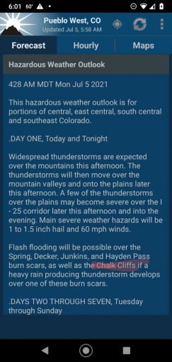
More interesting weather this week along the front range.

The Chalk Cliffs mentioned below are along the TAT in the Mt. Princeton area on the approach to the Tincup trailhead.
 

Attachments

armyRN

Rank V
Launch Member

Member III

1,683
Longview, WA
First Name
Paul
Last Name
Dickinson
Member #

22047

Ham/GMRS Callsign
KI7TSP
TAT 1.1. Because of the pending bad weather, Neal invited Tim and me to come straight to his place in NW Pueblo. So here we are.

So tomorrow we're going to explore some of the many trails and passes CO has to offer with Neal leading the way. Wednesday we'll do Tincup. I'm excited.

Once we get out of the CO mountains and the TAT turns back into miles of dusty gravel roads with just trees or farmland on either side, we'll start skipping sections. I saw parts of the TAT as I was driving the highway to Ripley (Idaho stands out in my mind) where it paralleled highway and it was just a dusty looking dirt road. Sometimes a little of that goes a long way.
 

DEADBEEF

Rank II

Enthusiast III

473
Upstate South Carolina, SC, USA
First Name
Michele
Last Name
Lary
TAT 1.1. Because of the pending bad weather, Neal invited Tim and me to come straight to his place in NW Pueblo. So here we are.

So tomorrow we're going to explore some of the many trails and passes CO has to offer with Neal leading the way. Wednesday we'll do Tincup. I'm excited.

Once we get out of the CO mountains and the TAT turns back into miles of dusty gravel roads with just trees or farmland on either side, we'll start skipping sections. I saw parts of the TAT as I was driving the highway to Ripley (Idaho stands out in my mind) where it paralleled highway and it was just a dusty looking dirt road. Sometimes a little of that goes a long way.
Glad to see you guys got together. Enjoy!
 
  • Like
Reactions: Neal A. Tew

T. Stanley

Rocky Mountain Region Member Rep Kansas
Launch Member

Member III

2,551
Clay Center, Kansas
First Name
Tim
Last Name
Stanley
Member #

25893

I left home yesterday morning just before 8 am and headed west and Neal rerouted Paul and I because of bad weather inTrinidad, CO, where we were headed to meet up
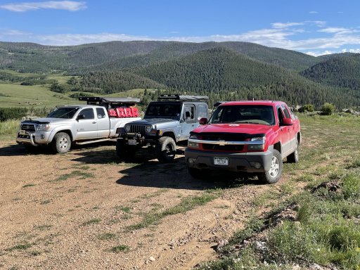
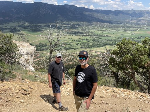
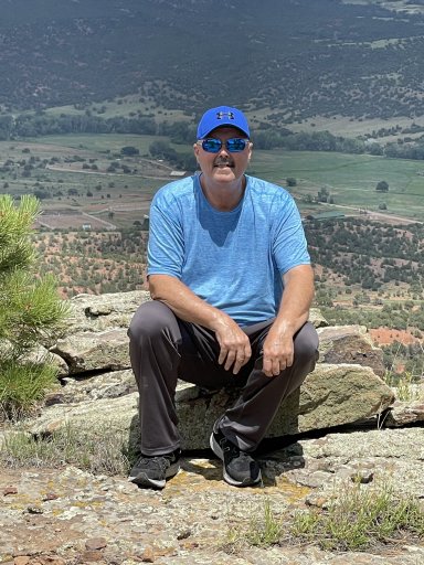
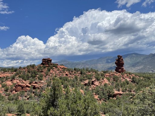
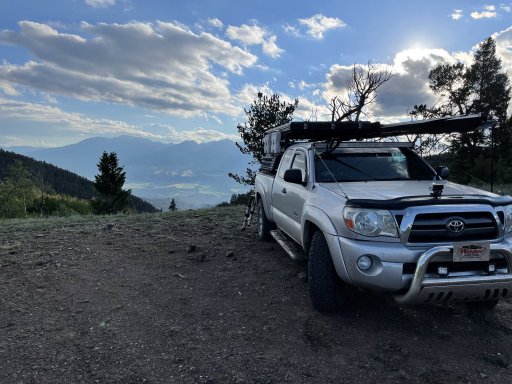
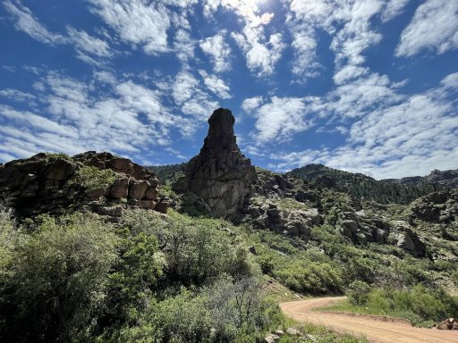
We overnighted at Neal’s house and we are getting ready to head out to connect to the TAT. Here are a few pictures from our day today.AE2F0AFD-4673-4F73-A2E5-99C0621FA91C.jpegC50493CB-9E49-44E7-A852-63671294A1CD.jpegDD84C754-2486-4C42-81BE-82779102B060.jpegE861B17E-1E1F-4718-9AC2-3E7768AE55DA.jpeg90D765A7-CD62-48A0-A572-A774C48F13D9.jpeg4D73C272-4E0A-413B-8DA4-876F06BD8256.jpeg80163F83-A133-40AB-8338-B06AF00899EF.jpeg.
 

armyRN

Rank V
Launch Member

Member III

1,683
Longview, WA
First Name
Paul
Last Name
Dickinson
Member #

22047

Ham/GMRS Callsign
KI7TSP
TAT 1.1. Neal took us on some awesome trails for two days, ending with Tincup. Beautiful views.

After finishing up yesterday, we went our separate ways. Neal headed home, and Tim had plans to meet up with a friend, so I'm back to driving solo.

Last night I slept in an open field... very peaceful. Colorado is beautiful. I've been following the TAT since Tincup.

Currently in Rifle CO having my trailer tires flipped on the rims (outside tread now on the inside). The trailer axle might be bent, the tires are wearing heavily on the inside. This'll get me home and I'll deal with it then. Clutch throw out bearing is starting to squeal, another thing to deal with once I'm home.

Edit: Tim is meeting with a friend after doing the TAT, not during.
 
Last edited:

Solo Saga

Rank IV
Launch Member

Enthusiast III

1,210
Crouse, NC, USA
First Name
Dave
Last Name
Binderup
Member #

23453

I REALLY appreciate all the info on this thread. As some may remember, I was one of the first to sign on to this trip, AND one of the first to withdraw for mechanical/mod progress (or more aptly, non-progress) reasons. I had hoped to head out a week late and meet along the trail, but continued gremlins forced a departure reschedule to 05Sept21. I wasn't following the thread, but returned yesterday and read through. I feel saddened by the circumstances some have experienced. But, I want to say thanks to everyone for their contributions, both fortunate and unfortunate, as they will definitely help with my run (attempt?).

My trip includes the Northern "Loop" Section. Given the season, I plan to do the trail counterclockwise, following the northern section (connecting from the East via the TMOT, TMORR, IEAT & TWAT) to OR. Then following the original route south and back East with some sight seeing detours along the way. I've heard there are some areas that are one-way (clockwise) on the original route. I contacted Sam C, and he replied that the tracks are two-way and routes are one-way. But, filtering on GAIA shows all of the files I bought/downloaded are tracks. So, not much help there. I am very much interested in confirmation or denial, and or any other general input/suggestions for this routing choice. Thanks.
 

T. Stanley

Rocky Mountain Region Member Rep Kansas
Launch Member

Member III

2,551
Clay Center, Kansas
First Name
Tim
Last Name
Stanley
Member #

25893

here is a picture i took yesterday while on the trail to tincup pass, can anyone explain the spaceship looking cloud like formations over the mountain?
Neal, thank you for being an awesome host and leading us on some memorable trails.
4521B35F-7ED5-4136-9D34-CA6936FD7E04.jpeg
I am slowly trudging along the TransAmerica Trail, just not very fast.
 

FishinCrzy

Rank V

Advocate I

2,595
South Carolina, USA
First Name
Rob
Last Name
Duncan
Member #

19015

Service Branch
StateHazmatResponder
here is a picture i took yesterday while on the trail to tincup pass, can anyone explain the spaceship looking cloud like formations over the mountain?
Neal, thank you for being an awesome host and leading us on some memorable trails.
View attachment 203679
I am slowly trudging along the TransAmerica Trail, just not very fast.
Yup, that's definitely the Mothership!
 

armyRN

Rank V
Launch Member

Member III

1,683
Longview, WA
First Name
Paul
Last Name
Dickinson
Member #

22047

Ham/GMRS Callsign
KI7TSP
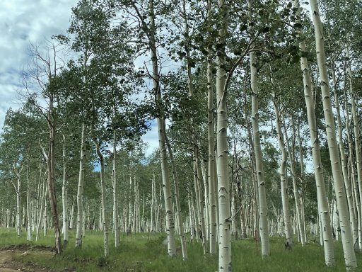
So this morning I broke camp and continued on the TAT to WY. Beautiful views, driving through Aspen tree forests… almost dreamlike.

Eventually that went away, and it became dusty gravel roads with sagebrush on either side. But I stayed on the TAT till the WY border. Then I took a paved road straight up to I-80, then west to Rock Springs for the night (cabin at the KOA).

Tomorrow I’ll take 191 off I-80 up to Farson and get back on the TAT heading towards Idaho. If it is still dusty gravel roads I’ll bounce forward again.
 

Solo Saga

Rank IV
Launch Member

Enthusiast III

1,210
Crouse, NC, USA
First Name
Dave
Last Name
Binderup
Member #

23453

here is a picture i took yesterday while on the trail to tincup pass, can anyone explain the spaceship looking cloud like formations over the mountain?
Neal, thank you for being an awesome host and leading us on some memorable trails.
View attachment 203679
I am slowly trudging along the TransAmerica Trail, just not very fast.
Wow! That's spectacular!
 

Neal A. Tew

US Rocky Mountain Local Expert
Mod Team
Member
Member

Member III

3,817
Pueblo West, CO
First Name
Neal
Last Name
Tew
Member #

12384

Ham/GMRS Callsign
N1TEW
TAT 1.1. Neal took us on some awesome trails for two days, ending with Tincup. Beautiful views.

After finishing up yesterday, we went our separate ways. Neal headed home, and Tim had plans to meet up with a friend, so I'm back to driving solo.

Last night I slept in an open field... very peaceful. Colorado is beautiful. I've been following the TAT since Tincup.

Currently in Rifle CO having my trailer tires flipped on the rims (outside tread now on the inside). The trailer axle might be bent, the tires are wearing heavily on the inside. This'll get me home and I'll deal with it then. Clutch throw out bearing is starting to squeal, another thing to deal with once I'm home.

Edit: Tim is meeting with a friend after doing the TAT, not during.

As for Tincup Pass, the technical section I mentioned is no longer there. It has been filled in to prevent future erosion. Also, the lake crossing was virtually nonexistent due to lower water levels.

Here's @armyRN on the approach to Tincup Pass:

1625849515659.png
 
Last edited: