Just wanted to brainstorm with my plan. I have been scouting out the area making sure I get plenty of time in the forests while I wait for the opportunity to make it a trip.
I always hear that Pennsylvania just doesn't offer the experiences the west does. But I noticed a lot of people assume Pennsylvanians live in Philadelphia or Pittsburgh. And it is completely overlooked that we have forests...
And I know alot of people like to follow a known route, like the MABDR or Appalachian By way. But these drive you right past some of the best off pavement travel on the east coast. Everything on this route will be public roadways. So no special group to join to access all there is to offer.
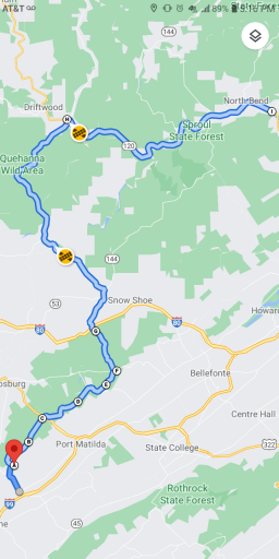
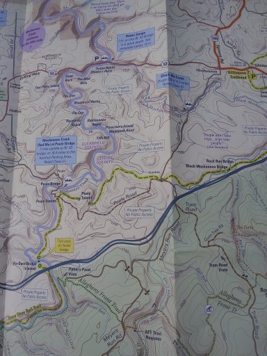
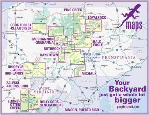
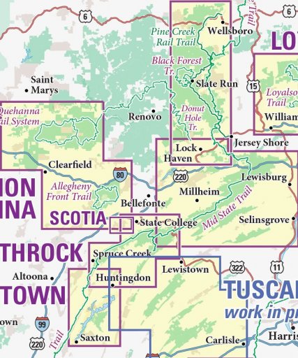
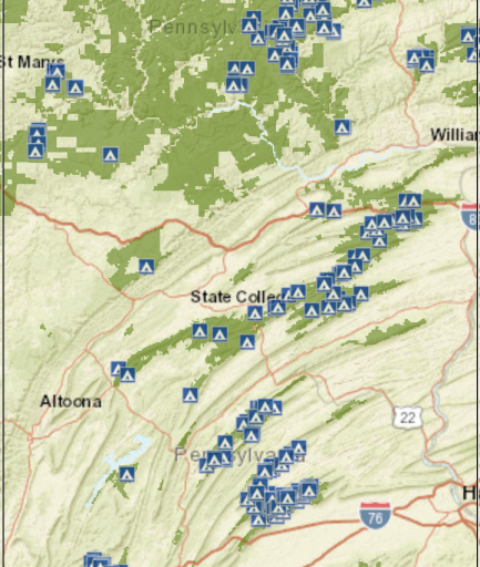
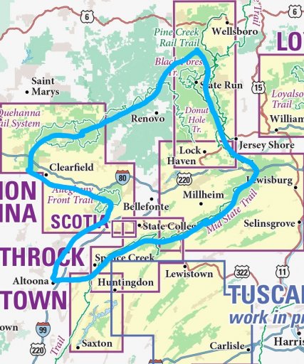
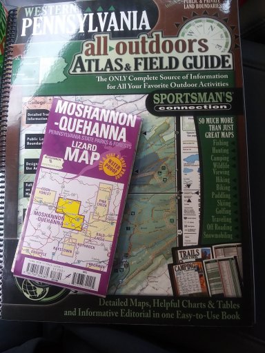
So. Onto my journey. I have been planning and scouting a trip around Central PA. I included a pic showing what is available in Central PA and then the overview route. I am just using paper maps and atlases and am so glad i found the Purple Lizard Maps . They have made exploring along this route so much more in depth.
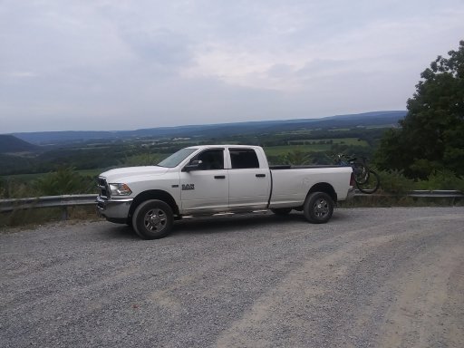
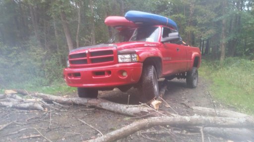
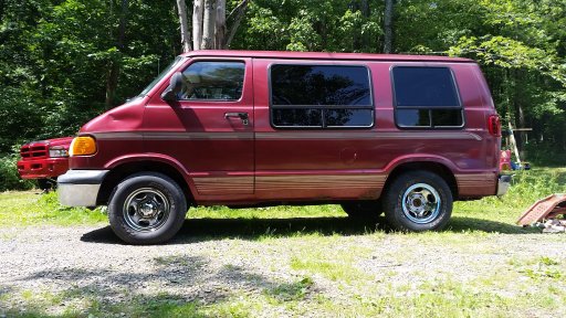
I have also pictured my 3 vehicles. My current vehicle is a 2015 RAM that has done the majority of the scouting and camping (also use our 2015 Cherokee) But I also have a 99 RAM that may be getting the dedicated treatment...and a 99 RAM Van that is on the back burner of a stealth camper project.
I have expanded my route since learning about all the other state forests...but for this thread I will stick to the original.
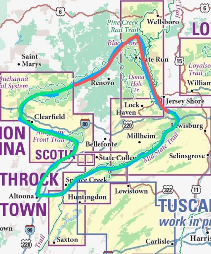
Leaving from home near Altoona I will head to Rothrock. Following forest roads and 4x4 High Clearance trails i will arrive in Bald Eagle. Then, making the best route I can incorporating dirt to the max, I will head to Tiadoghton. These 3 areas will be traveled using the lizard maps. Rothrock, Bald Eagle and Pine Creek. Then the journey will go through Sproul. This is the only area missing the purple lizard and I will be using the sportsman atlas and day use maps for this area. Then into Quehanna and Moshannon. Then a back road drive home.
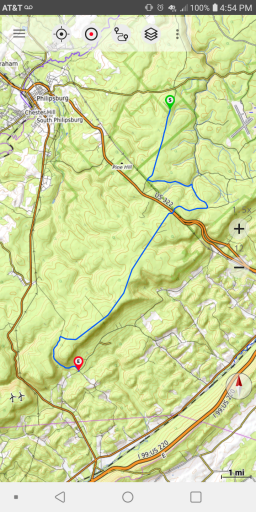
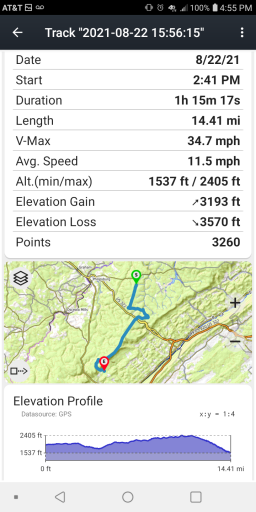
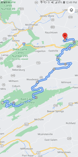
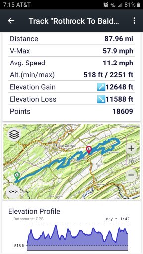
I included a screenshot of my travel from Rothrock to Bald Eagle. Even the most direct route is over 80 miles of dirt. I can easily zig zag through both forests, doubling that number of miles easily.
So I got the route through Rothrock Bald Eagle and Moshannon scouted. I need to get to areas in the Pine Creek map and it has been a few years since i have been in Sproul.
So any thoughts, recommendations and info would be appreciated. The biggest issue right now is finding time. And deciding how many days I spend at each campsite. 3 works best for me...but that starts to make this a multiple week trip. 2 days may work...but one is not enough.
One of the things that shouldn't be of much concern is fuel and resupply. I have found 10 MPG to be a safe bet for overland travel for my rigs. I have 30 gallons of useable fuel on my rig. So 300 mile range. And being I have no special setup for food storage...i figure I will need to stop for the food more than the fuel. I plan to only use local stores, gas stations and the occasional diner. When I head from the dirt to the needed pavement will be when I make these stops.
The good thing is that this is all a short day trip away for scouting and I can run any section of it any time I get the opportunity. (I have started avoiding the hiways and travel to State College through Rothrock and Bald Eagle now.)
People in the group are always asking where they can go...right here in PA, are some great forests to explore.
I always hear that Pennsylvania just doesn't offer the experiences the west does. But I noticed a lot of people assume Pennsylvanians live in Philadelphia or Pittsburgh. And it is completely overlooked that we have forests...
And I know alot of people like to follow a known route, like the MABDR or Appalachian By way. But these drive you right past some of the best off pavement travel on the east coast. Everything on this route will be public roadways. So no special group to join to access all there is to offer.
So. Onto my journey. I have been planning and scouting a trip around Central PA. I included a pic showing what is available in Central PA and then the overview route. I am just using paper maps and atlases and am so glad i found the Purple Lizard Maps . They have made exploring along this route so much more in depth.


I have also pictured my 3 vehicles. My current vehicle is a 2015 RAM that has done the majority of the scouting and camping (also use our 2015 Cherokee) But I also have a 99 RAM that may be getting the dedicated treatment...and a 99 RAM Van that is on the back burner of a stealth camper project.


I have expanded my route since learning about all the other state forests...but for this thread I will stick to the original.
Leaving from home near Altoona I will head to Rothrock. Following forest roads and 4x4 High Clearance trails i will arrive in Bald Eagle. Then, making the best route I can incorporating dirt to the max, I will head to Tiadoghton. These 3 areas will be traveled using the lizard maps. Rothrock, Bald Eagle and Pine Creek. Then the journey will go through Sproul. This is the only area missing the purple lizard and I will be using the sportsman atlas and day use maps for this area. Then into Quehanna and Moshannon. Then a back road drive home.
I included a screenshot of my travel from Rothrock to Bald Eagle. Even the most direct route is over 80 miles of dirt. I can easily zig zag through both forests, doubling that number of miles easily.

So I got the route through Rothrock Bald Eagle and Moshannon scouted. I need to get to areas in the Pine Creek map and it has been a few years since i have been in Sproul.
So any thoughts, recommendations and info would be appreciated. The biggest issue right now is finding time. And deciding how many days I spend at each campsite. 3 works best for me...but that starts to make this a multiple week trip. 2 days may work...but one is not enough.
One of the things that shouldn't be of much concern is fuel and resupply. I have found 10 MPG to be a safe bet for overland travel for my rigs. I have 30 gallons of useable fuel on my rig. So 300 mile range. And being I have no special setup for food storage...i figure I will need to stop for the food more than the fuel. I plan to only use local stores, gas stations and the occasional diner. When I head from the dirt to the needed pavement will be when I make these stops.
The good thing is that this is all a short day trip away for scouting and I can run any section of it any time I get the opportunity. (I have started avoiding the hiways and travel to State College through Rothrock and Bald Eagle now.)
People in the group are always asking where they can go...right here in PA, are some great forests to explore.


