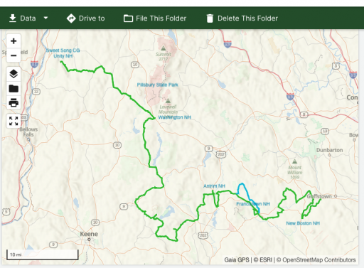
Enthusiast I
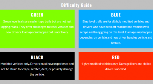
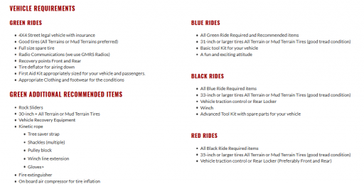
Most guide services and websites that advertise "runs" or trips use a trail rating system like ski resorts. (Green-Easy, Blue-Moderate, Black-expert, Red-insane!) and then describe the level of vehicle (mods) and potential damage related to each level. This just ensures all that participate in a run/trip/adventure know what they are getting into and are prepared. I've adopted this for anything I do.