11.11.0 Ironhorse Release - Route Planning with Route Snapping

  • HTML tutorial

Firemom

US Full-time/Long Term Travel Ambassador
Member
Member

Pioneer III

9,026
Rapid City, Meade County, South Dakota, United States
First Name
Deb
Last Name
Lee (Ironhorse Overland)
Member #

14314

Ham/GMRS Callsign
KM6YKU
Service Branch
Army Reserves
@Michael
This is on android (maybe other platforms) but sattelite view on the map, esspecially for Idaho is no longer sattelite view but adventure view. I attached a picture of what it looks like. I much prefer sattelite view to plan trips in hopes of seeing possible camping area.
. HUGE DITTO on the satellite view. It’s hands down my favorite.
 
  • Like
Reactions: Michael

Firemom

US Full-time/Long Term Travel Ambassador
Member
Member

Pioneer III

9,026
Rapid City, Meade County, South Dakota, United States
First Name
Deb
Last Name
Lee (Ironhorse Overland)
Member #

14314

Ham/GMRS Callsign
KM6YKU
Service Branch
Army Reserves
11.11.0 Ironhorse Release (@Firemom @Magic Mike ) - Route Planning with Route Snapping
Overland Bound Members Mike and Deb aka Ironhorse Overland are full-time overlanders in their 4Runner. One of the must have features for Deb, and many overland travelers is route planning! Now we have it.

It wasn't enough to create just a route planner that snaps to the roads with multiple routing types, or to be able to change the color of your route for better visibility or organization, we also had to make routes shareable because Overland Bound is founded on community. Routes can also be exported as a GPX.

Release List:
Feature
Route Planning
Feature Route sharing
Feature Save/Delete a route
Feature Add "never sleep" option to settings
Improvement Pop Up when selecting "Off-Road" routing mode - first time
Improvement Route Planning Intro Tutorial Pop-up
Improvement
On Route Waypoint Edit, Show a Magnifying Glass
Improvement Route Planning: Ability to delete a waypoint that is in edit mode
Improvement Add waypoint numbers in route planner waypoints
Improvement Route line is under gpx tracks
Improvement Haptic vibrate on waypoint edit mode
Improvement Show waypoints on saved routes
Improvement Change Route banner color to blue
Improvement Edit Route Button
Improvement Disable share for quick saves
Improvement Share Route as GPX Button
Improvement Remove privacy for Routes - they are private by default
Improvement Privacy notification the first time a shared Route is opened by a user
Improvement Create "Delete Account" button in settings
Improvement Add Route Planning Icon to POI type
Improvement Filter Route location type client side to not show up in Add Location list
Improvement In the change color picker screen, change button text to “Change color”
Improvement Quick-Saves do not show saved trail color in Detail screen map
Improvement Clean up Map and GPX button spacing in POI location detail screens
Improvement Make the Route color swatch tappable to edit color
Improvement Allow app font icons to be used for information types
Improvement Disable (or hide) Reviews in Private Routes
TaskNew POI Location Type "Route"
Task Go Live: Marketing Website
Task Create Route Icon
Bug Bad Platform Redirect: Rally Point Announcement comments button
Bug w3w Lookup Crashing
Bug App is not "locking" conversations to replies on Rally Point invite conversations.
Bug Editing Rally Point Dates switches it to day of month rather than day of week.
Bug Dark mode mile and kilometer button font color
Bug Editing the start date of a rally point crashes the app iOS 15.5, Latest app ver
Bug fix default repeat mode when CREATING rally point
Bug Messages don't find user, event though they exist
Bug Sending message to user that is not found results in white screen
Bug Pasting a YouTube link hard crash in forums
Bug Opening the Member tab on the map crashes the app
Bug Tapping the Message Members button on the Member tab crashes app

WOW. So many new and improved. One of the many thing I love about the OB1 app is the responsiveness of the development team. They listen and rapidly implement doable suggestions. They are on a mission to make OB1 thee must have app for overlanding. Keep up the great work. Ok now I’m off to figure out how to use all the new features
 

kunstmilch

Rank V
Member

Advocate II

1,597
Pomona, CA, USA
First Name
Erich
Last Name
Wise
Member #

29953

Ham/GMRS Callsign
GMRS call sign: WRFL229
Alright so I went ahead and screwed around with it on my phone (iPhone 12 Pro Max super duper nonsense names) and I got to hand it to you guys. It was so simple I kinda flinched, seriously. Maybe its cause I was fooling around with it on the iPad earlier, but hot damn.

I decided to try and recreate the route I had tried to make previously to Idyllwild from my house, which before the update was honestly a bit of a pain in the ass. Not really much worse then say Gaia though, but enough of a paint that id likely just not use it, and also if a plan changed and a different route needed to be used it would be frustrating...that was my baseline going in.

I started it up hit the plan route thingy on the right...clicked away adding waypoints at each "Y" or turn then when I got the the destination point I was like hmm...quick save, and whoa! Very smart, very easy, this is fantastic...did it really do that just like that? wow. I dig it. It literally took longer to type this up then it did to recreate the route I took (which before the update was too frustrating to do).

Most excellent.

Obviously this was a simple route and theres gonna be lots of improvements im sure...but I was so impressed that I had to jump on here and post.

This was a MASSIVE update.
 
Last edited:

kunstmilch

Rank V
Member

Advocate II

1,597
Pomona, CA, USA
First Name
Erich
Last Name
Wise
Member #

29953

Ham/GMRS Callsign
GMRS call sign: WRFL229
You are seeing the USFS 2016 layer I believe. Turn it off in the layers screen and see if that does it.
This is the same on iOS. That layer covers. (not an intuitive thing to know...but having used Gaia its basically the same kind of logic where you kinda have to get used to knowing what layers are doing what) Maybe some kind of dot, or in the training vid have a reminder about that or likely a bunch of people will be pointing at it.
 
  • Like
Reactions: Michael

El-Dracho

Ambassador, Europe
Moderator
Member
Supporter
Investor

Off-Road Ranger III

13,288
Lampertheim, Germany
First Name
Bjoern
Last Name
Eldracher
Member #

20111

Ham/GMRS Callsign
DO3BE
Wow, that is a MASSIVE update. Can´t wait to get out again and try everything of it. Thanks to @Michael and team for the excellent work. It's absolutely awesome what you develop and implement and always involve the community. Great.

Thank you,
Bjoern
 

Michael

Rank IX
Staff member
Founder 500
Member

Benefactor

15,584
Auburn, California, United States
First Name
Michael
Last Name
Murguia
Member #

0000

Ham/GMRS Callsign
KM6YSL
I’ve been using it the last few days. I have some pro tips:
- When offline or In spotty service, use as-the-bird-flies mode. This mode does not require a ping-back to a routing server, and will allow quick routes in these conditions.
- routing modes are very important! If you drop a waypoint and the routing does something funny, check your mode!
- dropping a few extra waypoints along the way will give you some good handles to edit the route if needed
- Quick save is very handy for quick routes you don’t intend to keep! You can delete quick saves easily. Full detail saves are uploaded to the server, and will persist.
 

Michael

Rank IX
Staff member
Founder 500
Member

Benefactor

15,584
Auburn, California, United States
First Name
Michael
Last Name
Murguia
Member #

0000

Ham/GMRS Callsign
KM6YSL
Alright so I went ahead and screwed around with it on my phone (iPhone 12 Pro Max super duper nonsense names) and I got to hand it to you guys. It was so simple I kinda flinched, seriously. Maybe its cause I was fooling around with it on the iPad earlier, but hot damn.

I decided to try and recreate the route I had tried to make previously to Idyllwild from my house, which before the update was honestly a bit of a pain in the ass. Not really much worse then say Gaia though, but enough of a paint that id likely just not use it, and also if a plan changed and a different route needed to be used it would be frustrating...that was my baseline going in.

I started it up hit the plan route thingy on the right...clicked away adding waypoints at each "Y" or turn then when I got the the destination point I was like hmm...quick save, and whoa! Very smart, very easy, this is fantastic...did it really do that just like that? wow. I dig it. It literally took longer to type this up then it did to recreate the route I took (which before the update was too frustrating to do).

Most excellent.

Obviously this was a simple route and theres gonna be lots of improvements im sure...but I was so impressed that I had to jump on here and post.

This was a MASSIVE update.
So great to hear! We will continue to improve and iterate as we get feed back from ya’ll, and expand capabilities.
 

Corrie

Rank VII
Staff member
Moderator
Founder 500
Member
Supporter

Protector II

5,652
Placer County, California, United States
First Name
Corrie
Last Name
Murguia
Member #

0000

Alright so I went ahead and screwed around with it on my phone (iPhone 12 Pro Max super duper nonsense names) and I got to hand it to you guys. It was so simple I kinda flinched, seriously. Maybe its cause I was fooling around with it on the iPad earlier, but hot damn.

I decided to try and recreate the route I had tried to make previously to Idyllwild from my house, which before the update was honestly a bit of a pain in the ass. Not really much worse then say Gaia though, but enough of a paint that id likely just not use it, and also if a plan changed and a different route needed to be used it would be frustrating...that was my baseline going in.

I started it up hit the plan route thingy on the right...clicked away adding waypoints at each "Y" or turn then when I got the the destination point I was like hmm...quick save, and whoa! Very smart, very easy, this is fantastic...did it really do that just like that? wow. I dig it. It literally took longer to type this up then it did to recreate the route I took (which before the update was too frustrating to do).

Most excellent.

Obviously this was a simple route and theres gonna be lots of improvements im sure...but I was so impressed that I had to jump on here and post.

This was a MASSIVE update.
I am so stoked to read this! Like @Michael mentioned, look for rapid iteration and improvements to follow.

(And if you're inclined, a review in the iOS store about your experience would be helpful. But no pressure there. :)
 

kunstmilch

Rank V
Member

Advocate II

1,597
Pomona, CA, USA
First Name
Erich
Last Name
Wise
Member #

29953

Ham/GMRS Callsign
GMRS call sign: WRFL229
Alright so I went ahead and screwed around with it on my phone (iPhone 12 Pro Max super duper nonsense names) and I got to hand it to you guys. It was so simple I kinda flinched, seriously. Maybe its cause I was fooling around with it on the iPad earlier, but hot damn.

I decided to try and recreate the route I had tried to make previously to Idyllwild from my house, which before the update was honestly a bit of a pain in the ass. Not really much worse then say Gaia though, but enough of a paint that id likely just not use it, and also if a plan changed and a different route needed to be used it would be frustrating...that was my baseline going in.

I started it up hit the plan route thingy on the right...clicked away adding waypoints at each "Y" or turn then when I got the the destination point I was like hmm...quick save, and whoa! Very smart, very easy, this is fantastic...did it really do that just like that? wow. I dig it. It literally took longer to type this up then it did to recreate the route I took (which before the update was too frustrating to do).

Most excellent.

Obviously this was a simple route and theres gonna be lots of improvements im sure...but I was so impressed that I had to jump on here and post.

This was a MASSIVE update.
I am so stoked to read this! Like @Michael mentioned, look for rapid iteration and improvements to follow.

(And if you're inclined, a review in the iOS store about your experience would be helpful. But no pressure there. :)
Thanks for the reminder about App Store review, done and done.
 

Michael

Rank IX
Staff member
Founder 500
Member

Benefactor

15,584
Auburn, California, United States
First Name
Michael
Last Name
Murguia
Member #

0000

Ham/GMRS Callsign
KM6YSL
Route creation on an iPad with a Magic Mouse works well and gives me near the experience that I am looking for; the one caveat is that I am not seeing how to zoom the map out with the mouse. I can zoom in by double clicking with the mouse but no form of gesturing, etc., allows me to zoom out (or zoom in via gesture). I mention this in case someone else tries it - once web planning is available I will likely not plan much on the device.

Kudos
- The magnifier that pops up when clicking/poking to move a waypoint is brilliant! Not only does it signal that you are now in "move mode" but it is also very helpful to get it in the right spot. Awesome!
- In a very quick look routing between points works well
- I am thrilled at how well this is working! This is very usable and I will be exploring it in more depth over the upcoming weeks/months! Kudos!!!

Nits
- I am unable to create a route point on or near a previously saved waypoint (temporary pin). Tried starting my route at home which has a temporary pin, no amount of clicking/poking will start the route, I have to move down the street to start the route. Verified it is temporary pin related by starting a route in a random spot which worked fine, then canceled route and added a temporary pin in that random spot and could no longer start a route there. Possibly this is related to the collision detection that does not allow me to drop route points on top of each other? This likely affects continuing a route but I noticed it starting a route.
- The route planning panel takes up a lot of screen real estate and cannot be hidden.
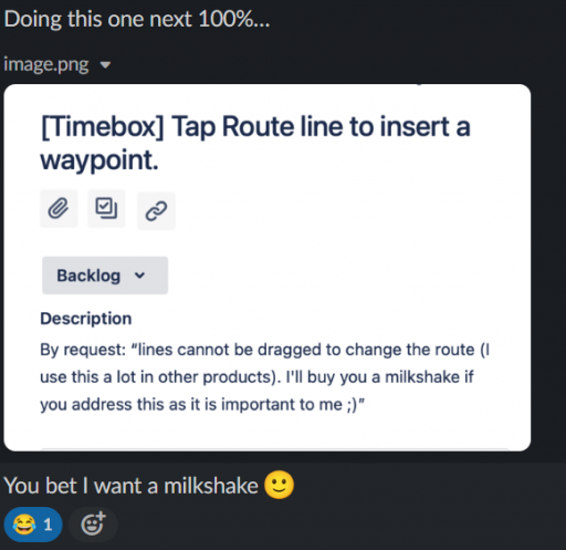
- As reported by @kunstmilch lines cannot be dragged to change the route (I use this a lot in other products). I'll buy you a milkshake if you address this as it is important to me ;)
- While the route snaps to roads the actual route points do not. Upon zooming into my route and looking around I see many of the route points are off of the road (but the route is on the road other than to go to that point and back to the road
View attachment 238489
- When changing the color of my route I cannot exit the color picker panel. A set of static standard colors would be nice here ;)

Other
- I cannot remove a single temporary pin? I have to remove all temporary pins? That is unfortunate :(
- Request. If I create a route that passes another road and then add a route point to the "other road" the route backtracks to the other road instead of directing me along the other road first. Perhaps a picture will help. Notice that route point 4 is created and then backtracks to route point 5. IMO it would be better if route point 5 became route point 4 and route point 4 became route point 5.
View attachment 238490
I tried dragging route points 4 and 5 around to get the affect that I desire and the route went a little cray cray - why does it extend beyond route point 4?
View attachment 238491

I'll continue to use this AWESOME feature and will let all y'all know what I like and dislike ;) Super happy with it!!!
As always, thank you so much for your detailed feedback! It is so helpful! As an overlander out busting rear end suspension on the daily ( @socialpants ) - I know what I want, but I am so close to the product that I require the community to make sure we are focused on the tools you guys need! Community feedback moved this feature forward!

The nits have been added as a "Timebox" for our awesome dev team. They will look into each for one hour to try and reproduce, then suggest a fix, or report on the findings.

"The route planning panel takes up a lot of screen real estate and cannot be hidden." You can go into full screen mode while route planning. May help.

"lines cannot be dragged" Investigating taping line to insert a waypoint.

For now, I will call this "by design" until we have reproduction steps that are a bug - the rationale for now: It is VERY important what routing mode is selected. you might have a secondary and primary road right next to each other, and it avoids the secondary road because you are in "Street" mode. Then the line appears to do whacky things, but it is doing what it should.

"I cannot remove a single temporary pin? I have to remove all temporary pins? That is unfortunate :(" Not correct. To remove a single temp pin, click "remove" in its summary card.

"When changing the color of my route I cannot exit the color picker panel." you can. Hit "Cancel"

"Set of standard colors" Timebox!
 

Ubiety

Rank VI
Member

Explorer I

5,221
Sammamish, WA, USA
First Name
Greg
Last Name
Ubiety
Member #

6193

Ham/GMRS Callsign
Ribs
As always, thank you so much for your detailed feedback! It is so helpful! As an overlander out busting rear end suspension on the daily ( @socialpants ) - I know what I want, but I am so close to the product that I require the community to make sure we are focused on the tools you guys need! Community feedback moved this feature forward!

The nits have been added as a "Timebox" for our awesome dev team. They will look into each for one hour to try and reproduce, then suggest a fix, or report on the findings.

"The route planning panel takes up a lot of screen real estate and cannot be hidden." You can go into full screen mode while route planning. May help.

"lines cannot be dragged" Investigating taping line to insert a waypoint.

For now, I will call this "by design" until we have reproduction steps that are a bug - the rationale for now: It is VERY important what routing mode is selected. you might have a secondary and primary road right next to each other, and it avoids the secondary road because you are in "Street" mode. Then the line appears to do whacky things, but it is doing what it should.

"I cannot remove a single temporary pin? I have to remove all temporary pins? That is unfortunate :(" Not correct. To remove a single temp pin, click "remove" in its summary card.

"When changing the color of my route I cannot exit the color picker panel." you can. Hit "Cancel"

"Set of standard colors" Timebox!
As always THANK YOU for listening to us whine and for your desire to make OB1 the BEST! I am really loving it and it is now my preferred app for navigating.

>>You can go into full screen mode while route planning. May help.
Awesome possum! Great tip!

>>Not correct. To remove a single temp pin, click "remove" in its summary card.
Noticed this over the weekend. Awesome!

>>you can. Hit "Cancel"
I don't have a Cancel button in the iPad in landscape mode. Will take another look.


Thank you for the response and for caring!
 

Michael

Rank IX
Staff member
Founder 500
Member

Benefactor

15,584
Auburn, California, United States
First Name
Michael
Last Name
Murguia
Member #

0000

Ham/GMRS Callsign
KM6YSL
Route creation on an iPad with a Magic Mouse works well and gives me near the experience that I am looking for; the one caveat is that I am not seeing how to zoom the map out with the mouse. I can zoom in by double clicking with the mouse but no form of gesturing, etc., allows me to zoom out (or zoom in via gesture). I mention this in case someone else tries it - once web planning is available I will likely not plan much on the device.

Kudos
- The magnifier that pops up when clicking/poking to move a waypoint is brilliant! Not only does it signal that you are now in "move mode" but it is also very helpful to get it in the right spot. Awesome!
- In a very quick look routing between points works well
- I am thrilled at how well this is working! This is very usable and I will be exploring it in more depth over the upcoming weeks/months! Kudos!!!

Nits
- I am unable to create a route point on or near a previously saved waypoint (temporary pin). Tried starting my route at home which has a temporary pin, no amount of clicking/poking will start the route, I have to move down the street to start the route. Verified it is temporary pin related by starting a route in a random spot which worked fine, then canceled route and added a temporary pin in that random spot and could no longer start a route there. Possibly this is related to the collision detection that does not allow me to drop route points on top of each other? This likely affects continuing a route but I noticed it starting a route.
- The route planning panel takes up a lot of screen real estate and cannot be hidden.
- As reported by @kunstmilch lines cannot be dragged to change the route (I use this a lot in other products). I'll buy you a milkshake if you address this as it is important to me ;)
- While the route snaps to roads the actual route points do not. Upon zooming into my route and looking around I see many of the route points are off of the road (but the route is on the road other than to go to that point and back to the road
View attachment 238489
- When changing the color of my route I cannot exit the color picker panel. A set of static standard colors would be nice here ;)

Other
- I cannot remove a single temporary pin? I have to remove all temporary pins? That is unfortunate :(
- Request. If I create a route that passes another road and then add a route point to the "other road" the route backtracks to the other road instead of directing me along the other road first. Perhaps a picture will help. Notice that route point 4 is created and then backtracks to route point 5. IMO it would be better if route point 5 became route point 4 and route point 4 became route point 5.
View attachment 238490
I tried dragging route points 4 and 5 around to get the affect that I desire and the route went a little cray cray - why does it extend beyond route point 4?
View attachment 238491

I'll continue to use this AWESOME feature and will let all y'all know what I like and dislike ;) Super happy with it!!!
You are going to owe a milkshake!

1661563051192.png
 

Ubiety

Rank VI
Member

Explorer I

5,221
Sammamish, WA, USA
First Name
Greg
Last Name
Ubiety
Member #

6193

Ham/GMRS Callsign
Ribs
You are going to owe a milkshake!

View attachment 239132
Bring. It. On!
It looks like central OR is about halfway between us - do you want an OR milkshake or should we do it up right and seek out milkshakes in MT? ;)
The OB $100 Milkshake Run - not adjusted for inflation. Overlanding's version of the $100 hamburger! ;)
 

El-Dracho

Ambassador, Europe
Moderator
Member
Supporter
Investor

Off-Road Ranger III

13,288
Lampertheim, Germany
First Name
Bjoern
Last Name
Eldracher
Member #

20111

Ham/GMRS Callsign
DO3BE
A cool and helpful feature now is the altitude, speed and position information at the top of the map - exactly the same things I display when I use OruxMaps, for example. Well done. Quick question, how do I change this from ft to m and from miles to km? Does that work already, like with the distance measurement? Thanks.
 

Michael

Rank IX
Staff member
Founder 500
Member

Benefactor

15,584
Auburn, California, United States
First Name
Michael
Last Name
Murguia
Member #

0000

Ham/GMRS Callsign
KM6YSL