Those fancy mapping apps will not save you...

  • HTML tutorial

WYWander

Rank III
Member

Off-Road Ranger I

676
Wyoming
First Name
Ken
Last Name
Veltkamp
Member #

47213

Ham/GMRS Callsign
WSDA676
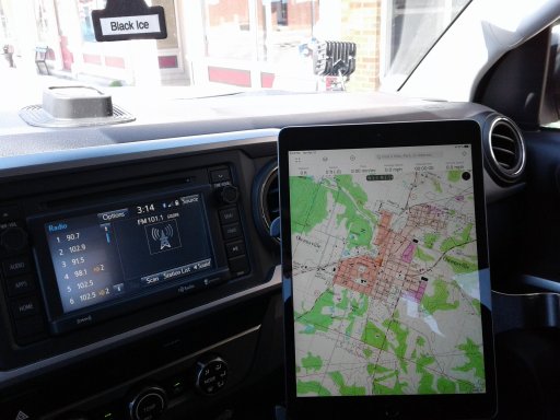
So I tried to exercise my mapping skills for a short trip this weekend and discovered I need more edumacation, or at least a reminder that we should not rely on the fancy GPS maps where we're exploring:

  • Google Maps does not let you save a route. It will let you save locations, but not a route. I created a start and 2 stop route and after much wailing and gnashing of teeth, I discovered Google removed any internal save functions. It used to be there, but no more. The workaround was to email the link for that route to myself. I really used it to share my routes with home base. That has limitations though, when there is more than one choice for a route. It didn't save the secondary route I picked, just went straight to the primary with the additional route choices available. And of course, it's useless when internet is not available.
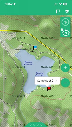
  • Figured out how to download a map area within onX. Also created a piece of the route in it. Wasn't really useful beyond the map, where I was anyway. There weren't any off-road trails nearby.
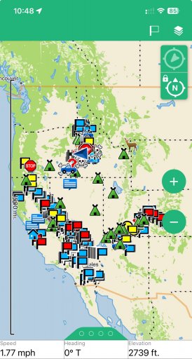
  • Created a route on Gaia. Never bothered to see about downloading a map area. Beyond the layers, it seems to have the same information and usability as onX.
  • I did like Gaia's Verizon service overlay, but it wasn't really all that accurate. Which I didn't really expect it to be. I found a few bars up there and it was semi-useful for check-ins.
  • I also used the free Avenza Maps, downloading free MVUM's from the ranger districts I wanted. I did not use the tools this time but there are navigation, route creation, route tracking, and other features like that. Additional features may be only available in the paid version of the app. The MVUM's, in addition to the ranger districts website, was the most useful in knowing exactly where camping would be allowed.
All in all, the lesson learned was that no matter how fancy the app, you still need to know what road you're on. In getting back out from my camp spot, I missed an intersection in my mental map and ended up backtracking for about 15 minutes. No biggie but being in an unfamiliar area without very distinctive landmarks, it could have easily been worse.

(For what it's worth, the "dispersed" camping in the South Platte Ranger District of Pike National Forest isn't really dispersed. It's designated and there are no amenities, but the sites themselves are immediately on the roads and only some are further apart than you would see in a developed campground. Not as much "dispersion" as I had in mind.)
 
  • Like
Reactions: Red_Leaf_Overland

KonzaLander

Rank VI
Member

Traveler II

3,402
Junction City, Kansas, USA
Member #

15814

Ham/GMRS Callsign
KE0EBF
It is important to be proficient with your preferred mapping app BEFORE heading out. Practice, try it, turn off your devices data connection and reboot the device to see if everything you NEED to work in an app actually works when disconnected. The best tool in your toolbox is worthless if you don't know how it works or what it's limitation are.

Simply downloading a .gpx file and dropping it into your device, then blindly following it, definitely poses a problem if/when your electronic device fails. This seems to be the preferred method of trip planning by most people thanks to apps like Gaia and the OB1 app since they make it so easy. The problem is you have no idea where the file is taking you and you are ignorant of anything outside the narrow predetermined line on your screen. Not only does this cause you to miss out on everything the area you are travelling has to offer, it also means you are not familiar with any other road, landmarks or POI's that would be helpful along the way.
 

pluton

Rank IV

Member I

951
Santa Monica, CA, USA
First Name
Keith
Last Name
BBB
Member #

43443

  • Created a route on Gaia. Never bothered to see about downloading a map area. Beyond the layers, it seems to have the same information and usability as onX.
Yeah, Gaia is intended to be used by downloading the maps for the area ahead of time. Then it functions like an animated paper map that shows you where you are as you move along. Greatest thing since sliced bread IMO. I don't usually use routes, but once created a route using gaiagps.com just to see how to do it; I created the route on gaiagps.com, and then it synced over to the phone GaiaGps app.
 
Last edited:

MOAK

Rank V
Launch Member

Off-Road Ranger I

2,865
Wherever we park it will be home !!
First Name
Donald
Last Name
Diehl
Member #

0745

Ham/GMRS Callsign
WRPN 506
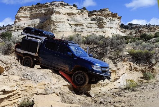
A good friend of mine loves his electronic maps. However, they don't tell you anything about what is " really " ahead of you. Me? Off the pavement I use paper maps and seat of the pants navigation. I think since this incident my friend relies less on the modern navigation gizmos and more upon instinct and seat of the pants navigation. In all seriousness though, I don't care for digital maps because there is no relativity. You can't open it up, see all the details, and at the same time, see where you are located relative to the region. I'd much rather stop once in a while, spread the map out and take a look. IMG20221003115235.jpeg
 
Last edited:

Cypress

Rank V
Member

Off-Road Ranger I

1,451
Goose Creek, SC, USA
First Name
Allen
Last Name
Murray
Member #

27152

Ham/GMRS Callsign
WRJY639
The correct answer is to use both. I use GIAI for 95% of my mapping. I run it on a dedicated tablet. It has worked perfectly every time and with all the layers, gives more and better information than a paper map. But, for that one time it doesn't, I have US and the state-specific atlas in the truck just in case.

I don't think you can blame the above image on a digital map. The most important item for navigation is the Mk1 eyeball and the brain it's attached to. No map in the world will replace them.
 

MOAK

Rank V
Launch Member

Off-Road Ranger I

2,865
Wherever we park it will be home !!
First Name
Donald
Last Name
Diehl
Member #

0745

Ham/GMRS Callsign
WRPN 506
The correct answer is to use both. I use GIAI for 95% of my mapping. I run it on a dedicated tablet. It has worked perfectly every time and with all the layers, gives more and better information than a paper map. But, for that one time it doesn't, I have US and the state-specific atlas in the truck just in case.

I don't think you can blame the above image on a digital map. The most important item for navigation is the Mk1 eyeball and the brain it's attached to. No map in the world will replace them.
Distracted driving; looking at a screen gets all drivers into a lot of mishaps.
 
  • Like
Reactions: DMS1

North American Sojourner

Rank VI
Member

Inventor I

3,886
Mid-Missouri, MO, USA
First Name
Dave
Last Name
Zimmer
Member #

30139

Service Branch
USN (ret)
Boy Scouts should be mandatory. LOL Paper maps and a compass are very important. Always have been. Mapping apps are far more accurate than you think. Location +/- 3 feet is pretty accurate. Knowing your relationship to the map is paramount.
I'd go into large housing subdivision and find your way out without "retracing" your steps. LOL
Good luck Sir.
Zim
 
  • Like
Reactions: WYWander

WYWander

Rank III
Member

Off-Road Ranger I

676
Wyoming
First Name
Ken
Last Name
Veltkamp
Member #

47213

Ham/GMRS Callsign
WSDA676
I suppose I'm most curious about which app does the best at the transition from the GPS functionality to none. Where I go there is no cell service/GPS connection more often than not. Looking at a mapping app on a phone is not conducive to success. Is that why a lot of you use tablets?
 

North American Sojourner

Rank VI
Member

Inventor I

3,886
Mid-Missouri, MO, USA
First Name
Dave
Last Name
Zimmer
Member #

30139

Service Branch
USN (ret)
I suppose I'm most curious about which app does the best at the transition from the GPS functionality to none. Where I go there is no cell service/GPS connection more often than not. Looking at a mapping app on a phone is not conducive to success. Is that why a lot of you use tablets?
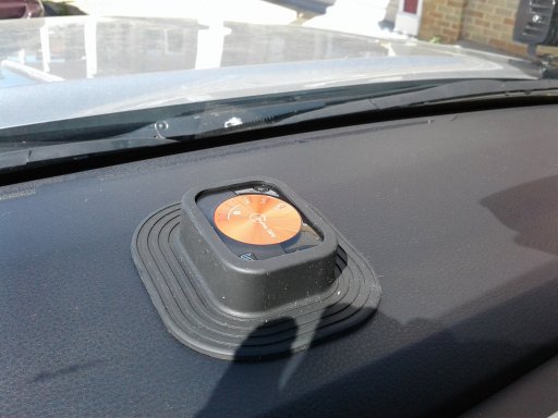
I use a "Dual" brand GPS signal finder and "Bluetooth" it to my ipad which does not have GPS. Confused yet? LMAO I'm making it hard but I did not have the money for a full blown pad. I use onX maps and Gaia. I don't like Gaia at all. Never updates well for me but does okay for basic things. Unless you're in a steep valley both should work okay but remember phones work off of cell towers and GPS works off of satellites. You need triangulation to see where you are at and GPS provides that in most cases.
Zim

IMG-0333.JPG

IMG-0332.JPG
 
  • Like
Reactions: Viking1204

Cypress

Rank V
Member

Off-Road Ranger I

1,451
Goose Creek, SC, USA
First Name
Allen
Last Name
Murray
Member #

27152

Ham/GMRS Callsign
WRJY639
I suppose I'm most curious about which app does the best at the transition from the GPS functionality to none. Where I go there is no cell service/GPS connection more often than not. Looking at a mapping app on a phone is not conducive to success. Is that why a lot of you use tablets?
I use a tablet for the larger screen. I keep most of the Eastern USA maps on my tablet. I load specific maps on the cell phone and use it for backup and taking pictures. Giai will sync your photos, POIs, tracks, and maps across all platforms. Then when I'm looking for a picture or notes on a specific spot, I can look it up on my tablet, phone, and PC without worrying about where something ended up.
 
  • Like
Reactions: whiskey7backroads

pluton

Rank IV

Member I

951
Santa Monica, CA, USA
First Name
Keith
Last Name
BBB
Member #

43443

I suppose I'm most curious about which app does the best at the transition from the GPS functionality to none. Where I go there is no cell service/GPS connection more often than not. Looking at a mapping app on a phone is not conducive to success. Is that why a lot of you use tablets?
Tablets beat phones, absolutely. Closer to a paper map because of size. Plus, you can't look at a paper map while driving either.
BTW, unless World War 3 is breaking out, there is no place on Earth** that doesn't have GPS functionality. That's the whole idea of it.
**With a clear view of enough of the sky to "see" the required number of satellites.
 

Cypress

Rank V
Member

Off-Road Ranger I

1,451
Goose Creek, SC, USA
First Name
Allen
Last Name
Murray
Member #

27152

Ham/GMRS Callsign
WRJY639
Distracted driving; looking at a screen gets all drivers into a lot of mishaps.
That's not a mapping issue or a screen issue. That's a driver issue. If he can't not look at the screen, that's on him. There isn't a map in the world that will save him from being distracted. Tell him not to buy a car made in the last 10 years.