The OFFICIAL Trans NJ Trail Thread

  • HTML tutorial

keithcroshaw

Rank II

Traveler III

295
NJ, USA
First Name
Keith
Last Name
Croshaw
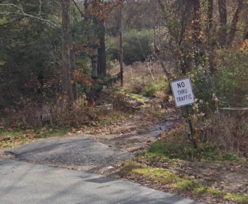
Has anybody been through the Flatbrook Roy WMA area this year? We went on the only snow day of the year of course and the gravel road turned into what didn't look like a road any more after we passed someone's house in the woods.
We were in our Subi Forester Wilderness, not the Jeep unfortunately so I didn't want to risk it...

After that up north there was a spot where it turned to dirt next to some rehab building and the sign said NO THRU TRAFFIC, not sure if anybody has encountered that.
Screenshot 2023-07-26 at 1.56.05 PM.png
(Google Maps)
Maybe you'll think my mom was driving with me by my wife shook her head no on that one with the kids in the back, so we turned around.
If the answer is don't ask don't tell perhaps I'll just have to go without the family one weekend if I ever make a real life friend who can help pull me out of sticky situations...

Just thought I'd ask around before heading back up north to try and fix my failures.
Thanks for all the hard work on this, I really appreciate finding ways to have fun exploring the state I grew up in and had always believed was so boring.
 

keithcroshaw

Rank II

Traveler III

295
NJ, USA
First Name
Keith
Last Name
Croshaw
The “no thru traffic” is just a sign, we had 22 Broncos that went thru there on 7/1 and was slightly over grown but passable. There were a few downed trees that were cut back since last years trip.
Great thanks for the info.
Reinforces my desire to grab a battery powered chainsaw.
I always worry being in this state I'll be breaking some law even if it's on a legal named street...
 

ramblinChet

Rank II

Enthusiast III

443
Yorktown, VA, USA
First Name
Chet
Last Name
Szymecki
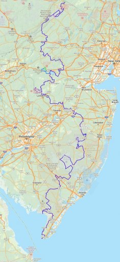
Next I begin the Trans New Jersey Trail which is "a 450+ mile route that spans from High Point, NJ to Cape May, NJ. The trail consist of asphalt, gravel, sand, dirt, and some mud. The trail is 100% legal for all street legal vehicles. This means you must be registered, insured, and compliant with all DOT regulations (headlights, taillights, seat belts, turn signals, and so on)."

I had never really considered the possibility of an off-road adventure route in New Jersey so I was excited to begin my track in High Point and point my ship south towards my final destination in Cape May. While researching I discovered that nearly one-quarter of all land in New Jersey is referred to as the Pine Barrens, or Pinelands, which are 1.1 million acres of open land available for public recreation! Here is a shot of the route as viewed in Gaia GPS which displays on my Uconnect 4 with 8.4" touchscreen via Android Auto and a Google Pixel 7.
TNJTxx.jpg


Since my recent Cross Pennsylvania Adventure Trail concluded in the north-east corner of Pennsylvania on the New York border, the beginning of the Trans New Jersey Trail was just a few minutes of a drive to the south. What a perfect combination! The northern terminus of the TNJT was at High Point, New Jersey, and was named so because it is the highest point in New Jersey at 1,803 feet above mean sea level.
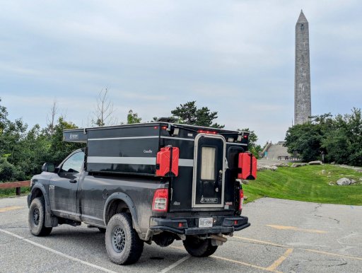
image000000(365).jpg

The initial few hours of driving amounted to two-lane paved roads through mostly country, but some residential areas. I was very excited as I pulled off onto the first dirt and gravel section but that changed as I began to sense that the trail had not been traveled on a regular basis. I checked my instruments to confirm that I was on the correct track and proceeded with caution.
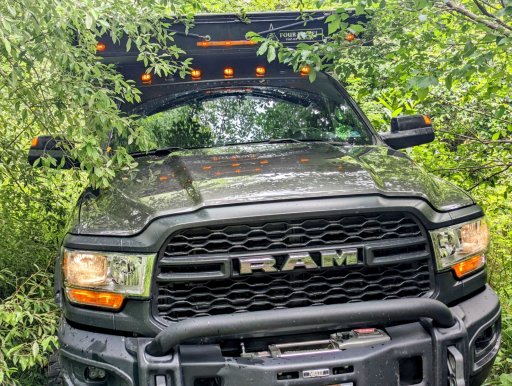
image000000(367).jpg

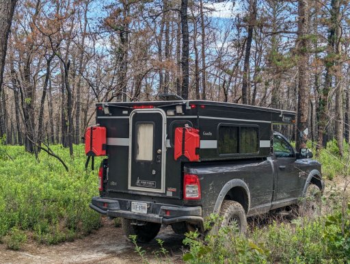
The first dirt section was a tease and after only a few miles I was back on pavement for what seemed like several more hours. It was a pretty ride but nothing special so once again I was overjoyed to pull off onto another off-road section of Jenny Jump State Forest. Just prior to this picture there was actually a rocky climb which required me to shift into four-wheel-drive so things we becoming fun now. Soon thereafter, I came upon this washed out section of trail, stopped to check for recent tracks, and seeing none checked my navigation instruments again. Everything checks good on deck so let's roll...and then the trail became so tight and overgrown I was unable to see anything in front of me. While looking up and inching forward, I noticed a utility line that had fallen and was crossing the trail so low that in another ten feet the top of my pop-up camper would contact the downed line. Time to gracefully back out and find a go-around.
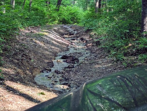
image000000(366).jpg

Just a mile or so past Buttermilk Falls, I came upon a heavy duty tow truck on a forest road. The driver pulled over and I we both jumped out for a quick discussion. He asked if I was familiar with the area since he had never been here and was going to rescue an 18-wheeler stuck in the mud. I asked if it was a logging truck and he stated that it was a flatbed from a big-box retailer performing a home delivery. I jumped into the lead and we drive a few more miles and found the truck which had been trying to turn around due to a bridge closure when it became stuck. The driver only had intermittent service and even if the bridge was open, it has a 10-ton weight limit.g

I offered to act as a spotter and together we pulled the truck back up onto the forest road but facing the wrong way towards the closed bridge. I recommended that the young female driving the truck call her office to ask for a senior driver to be brought out to assist her but she was the only driver and the general manager placed it all on her. Maybe she should not have been there in the first place although she reviewed the route with another driver in the store and that driver said all was fine. The tow truck driver was done and he left immediately. The poor inner-city girl was not familiar with the forest and there was no damn way she was going to back that 18-wheeler down the trail for several miles.

I let her know I was going to stay and offer the little support that I could so I walked back on the trail and found an abandoned and closed spur which was a straight shot back. It took a solid hour but together we backed the truck up to the spur and eventually got her turned around. I jumped in front of her and lead hear out. It felt good to be able to have the time and above-average knowledge of the forest roads to help her and the tow-truck driver out. What an interesting day!
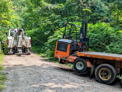
image000000(364).jpg

Yet another closed road which provided me with an opportunity to research my map and identify a go-around. Gaia GPS has a great feature which allows you to download areas of a map prior to beginning your adventure so in case you are without cellular service, you still have the map area loaded and available.
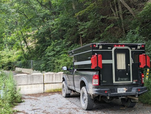
image000000(368).jpg

Much of northern half of the TNJT has been two-lane blacktop with only a few miles of dirt or gravel here or there. Again, not a bad track but nothing exciting to report with the exception of a few sections here or there. This short stretch ran between two beautiful neighborhoods and pretty and short, just like most of the MILFs smiling at me here in NJ. Seriously, there are a surplus of good-looking healthy girls here and I smile back each and every time.
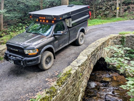
image000000(370).jpg

Some of the highlights so far included driving through the middle of the Trump National Golf Club in Bedminster. While driving though I slowed down to try and figure out what all the excitement was about - I was able to notice unique vehicles and personnel who were really paying extra special attention to my AEV Prospector with my Four Wheel Camper on the back. I pulled over and pulled out my Zeiss Conquest HD binoculars and confirmed that we were all checking each other out. I smiled and rolled only finding out the next day that President Trump arranged a private screening at Bedminster for the summer blockbuster: Sound of Freedom.

When I awoke in the morning I heard a man walking towards my vehicle - I could hear his was and was able to conclude that he was old and weak, even before I could see him. Minutes later he came around the corner and we greeted each other and ended up talking for the better part of an hour. What is most interesting is that this man was blind and exploring the forest by himself - what a brave man. After talking for a bit and covering a range of subjects he continued on his way and had to search for that rut in the road to guide him. I smiled and said many prayers for the man and was so happy to see him out in the forest, alone, and living life. He's not a quitter and that's the simple secret to success. Never. Ever. Quit.
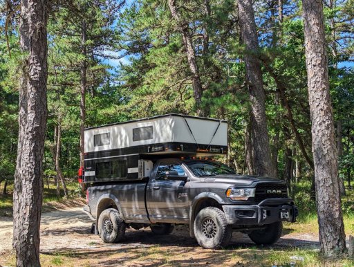
image000000(369).jpg
 

ramblinChet

Rank II

Enthusiast III

443
Yorktown, VA, USA
First Name
Chet
Last Name
Szymecki
Another overland trail is in the books - I completed the Trans New Jersey Trail (450+ mi) in five days and covered a total of 563 miles of mixed roads. The northern half was approximately 95% paved roads and 05% dirt or gravel whereas the southern section was approximately 80% dirt of gravel and 20% paved roads. My combined drive time was 28-hours and I averaged 12.4 mpg. If you have time available and desire to complete the entire trails I say go for it. If you only have a two or three day weekend I would recommend the southern half of the trip and maybe even squeeze in an extra day and visit Atlantic City which is in the middle of the southern half.

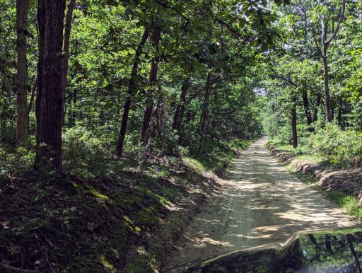
Once I entered the Brendan T. Byrne State Forest the look and feel of the forest around me continued to remind me of Florida. The white sandy two-track, burned pines everywhere, and ferns, confused me since I had never expected to encounter this type of habitat this far north. The forests in the southern section of New Jersey are just beautiful and the original creator of this trail, @Xplorr313, rightfully deserves all the credit for a job well done. So much fun to be had - in New Jersey!
image000000(372).jpg

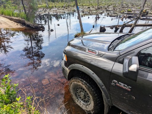
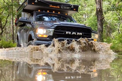
Even some of the tea-colored water crossings reminded me of past adventures in the Blackwater River State Forest in Florida. The water turns this tea-like colors due to the tannic acid from nearby trees. As I ventured south I began to encounter many more "puddles" that were on average 20-30 feet in diameter and one to two feet deep. There were a few that were a full three feet deep although those usually had a shallower section. My recommendation is to physically verify the depth and bottom conditions prior to attempting to cross. I have often considered purchasing an ultra-light pair of chest waders for this purpose.
image000000(373).jpg

It was confusing to me since I was passing in and out of so many different areas in the southern section but all were beautiful and although similar to others nearby, each had it's own distinct flavor. This was in the Greenwood Forest Wildlife Management Area.
image000000(376).jpg

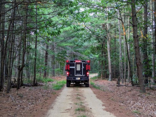
Much of my time exploring the southern half of the TNJT looked just like this section of forest service road. There were not many areas that were cleared and available for camping but I am guessing if you really did some work and spoke with the rangers in the specific areas, some would be pointed out. Again, much of the confusion I encountered was related to passing through different areas controlled by different public service entities. I recall driving down a gravel road with the Warren Grove Recreational Area on one side and the West Penn Pygmy Forest on the other. I am not complaining but instead pointing out my confusion and suggesting you may require a deep dive into maps depending upon where you plan to camp along this trail.
image000000(371).jpg

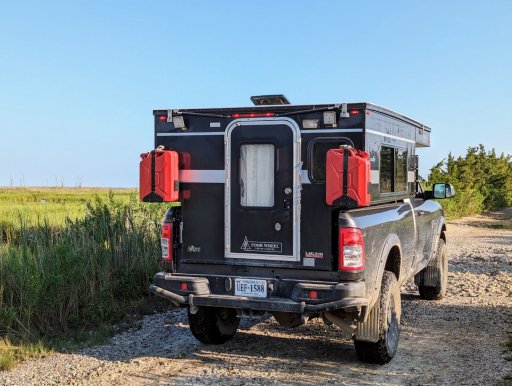
Out of the forest and heading to the shore of Delaware Bay. I know I have mentioned this a few times already but this southern of the TNJT trail never stopped surprising me. I considered spending much time in this area on the shore but unfortunately my adventure rig was swarmed by dozens of Greenhead horse flies. These were the most violent little insects I have encountered in many years.
image000000(375).jpg

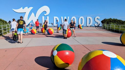
After I completed my adventure I scanned the map and noticed that Wildwoods was only minutes away. What an amazing coincidence! If you want, you can always cross the water from the southern tip of New Jersey to Lewes, Delaware, by way of the Cape May-Lewes Ferry. I decided it was too expensive for my full-time budget plus I had already scheduled a visit to Wilmington and Dover which were both up north.
image000000(377).jpg

I will close with my favorite picture from this north to south New Jersey overland adventure. After all of this I have a different impression of the state and look forward to visiting again soon - I hope you do too!
image000000(374).jpg
 
Last edited:

SpookyII

Rank III

Enthusiast II

539
Danbury, CT, USA
First Name
Chris
Last Name
SmoothOperators
Member #

41423

Ham/GMRS Callsign
KC10IM
Def adding this to my list of must do. Between the SCAR, NEBDR, and MABDR, I can no longer use the excuse of living in the northeast as to why I cant find trails close by. I sense an exhaustive Trans Eastern Route on the horizon. Thanks for all the hard work!
 

SpookyII

Rank III

Enthusiast II

539
Danbury, CT, USA
First Name
Chris
Last Name
SmoothOperators
Member #

41423

Ham/GMRS Callsign
KC10IM
And on that note: For all you Gaia users, I converted all routes to tracks, removed all the turn waypoints, and color coded all bypasses, attractions, fuel stops, campsites etc. This one (should) read much better in Gaia. All credit still goes to OP. Thanks again!
 

Attachments

Ethan N

Local Expert, East Region USA
Member

Expedition Master III

10,785
Ocean County, NJ, USA
First Name
Ethan
Last Name
Newago
Member #

30968

Service Branch
US Army
I've done this trail straight through once, from North to South. This weekend I'm leading a fellow from another forum through the central section Northward starting in Egg Harbor City.

Saturday the 4th. If anyone wants to join, 1 or 2 rigs max, send a DM.
 

SpookyII

Rank III

Enthusiast II

539
Danbury, CT, USA
First Name
Chris
Last Name
SmoothOperators
Member #

41423

Ham/GMRS Callsign
KC10IM
I've done this trail straight through once, from North to South. This weekend I'm leading a fellow from another forum through the central section Northward starting in Egg Harbor City.

Saturday the 4th. If anyone wants to join, 1 or 2 rigs max, send a DM.
Just Dm'd - sounds like fun!
 
  • Like
Reactions: ramblinChet

Ethan N

Local Expert, East Region USA
Member

Expedition Master III

10,785
Ocean County, NJ, USA
First Name
Ethan
Last Name
Newago
Member #

30968

Service Branch
US Army
Successful daytrip on the TNJT with @SpookyII :sunglasses:

We did the southern/middle section from Egg Harbor City (by Renault Winery) northward until Whiting/Manchester (Wawa on the intersection of 70 and 539). There have been SIGNIFICANT repairs done to the trail, we barely came across so much as a puddle. There are piles and piles of sand being used to fill in holes and erosion. Even the large section with go-round labelled "only go straight if you have a snorkel" was totally flat and repaired.

XmtATjVp.jpeg
 

Firemarshallvin

Rank II
Member
Investor

Contributor II

327
New Providence, Union County, New Jersey, United States
First Name
Vinny
Last Name
Wycko
Member #

31573

Successful daytrip on the TNJT with @SpookyII :sunglasses:

We did the southern/middle section from Egg Harbor City (by Renault Winery) northward until Whiting/Manchester (Wawa on the intersection of 70 and 539). There have been SIGNIFICANT repairs done to the trail, we barely came across so much as a puddle. There are piles and piles of sand being used to fill in holes and erosion. Even the large section with go-round labelled "only go straight if you have a snorkel" was totally flat and repaired.

View attachment 268878
Was an awesome time out there with @Ethan N and @SpookyII
 

MuckSavage

Rank V
Launch Member

Member III

2,268
South Jersey, NJ, USA
First Name
Tim
Last Name
McG
Member #

15570

And on that note: For all you Gaia users, I converted all routes to tracks, removed all the turn waypoints, and color coded all bypasses, attractions, fuel stops, campsites etc. This one (should) read much better in Gaia. All credit still goes to OP. Thanks again!
WOW! Thank you for that! That's awesome & a great way to keep the trail alive!
 
  • Like
Reactions: TSO_NJ and SpookyII