I just joined the group and am new to the idea of off road navigation. First stupid question, does anyone use an Android device for the files?
The OFFICIAL Trans NJ Trail Thread
- Thread starter Xplorr313
- Start date
-
Guest, UPDATE We went through the site migration runbook and completed all steps. We will need to complete the migration next week, but will leave the forums up for the weekend. A few days after maintenance, a major upgrade revision to the forum site will occur.
Yes. And any free GPS viewer will work with them.I just joined the group and am new to the idea of off road navigation. First stupid question, does anyone use an Android device for the files?
And there is a whole rabbit hole full of other options.
I used Gaia on Android.I just joined the group and am new to the idea of off road navigation. First stupid question, does anyone use an Android device for the files?
Thanks for doing this, looked everywhere for some way to navigate this journey and came up empty. Paid for the app and it's worth it.Hey guys, and gals, I decided to create an “official” Trans New Jersey Trail thread. This is where you can find the “official” route and any route info you need to know. Also, this thread will be good for those to post info about the route; like road closures, detours, dangers, trees down, and anything else that may restrict access to the trail.
If anyone wants a copy of the route, it is FREE and available at the bottom of this post. I will accept donations if you feel inclined to donate to the beer fund. The donations can be sent to xplorr313@gmail.com. The donations are not required though!
Previously I charged for the route due to keeping the route out of the hands of those who were only looking to “off-road” or “wheel” illegally on state land. I received a lot of backlash from the off-roading / Overlanding community for charging for the route. I put over 2 years of my life into making this route, please stay on the path and DO NOT “off-road” or “wheel” off of the path. This could cause closures and could also land you in major trouble with the state, for example: a hefty fine or even vehicle impoundment. I’ve seen and heard about it happening. Do not think it won’t happen to you. The state does have trail cameras along some of the more “prone to off-roading” spots. You will get caught.
The route is current and up to date as of 1-16-2020. The most recent revision of the route was done on 1-16-2020. If you have any version older than 1-16-2020 please reach out to me for an updated version. I will keep this post updated with the most recent version of the route.
I HIGHLY RECOMMEND THE LEADNAV APP FOR THE BEST EXPERIENCE. LeadNav is only for iPhones and iPads. The route can be used on other devices, but the route was made with and for LeadNav.
For those of you who are just learning about the Trans New Jersey Trail, the trail is a 450+ mile route that spans from High Point, NJ to Cape May, NJ. The trail consist of asphalt, gravel, sand, dirt, and some mud. The trail is 100% legal for all street legal vehicles. This means you must be registered, insured, and compliant with all DOT regulations (headlights, taillights, seat belts, turn signals, and so on).
The TNJT can be completed in a Subaru as long as the driver is experienced. There is NOTHING complicated on this route. There ARE bypasses for those who do not have a snorkel or the ability to traverse deep mud holes. The bypasses are clearly marked as separate routes. The Zillon Bypass is recommended for those who do not wish to traverse down an extremely tight trail and do not want to risk the couple extremely sloppy mud holes along that part of the TNJT. The Zillon Bypass is 100% asphalt that bypasses the tight trail and sloppy mud holes.
The whole route CAN be done in 3 days. I completed the route in 4 days when I ran it start to end non stop in 2017. My 4th day on the trail only consisted of 50 miles and I could have just finished it on day 3.
The trail has 3 sections North, Central, and South. I consider the North section to go from High Point, NJ to Round Valley Reservoir (Spruce Run Recreation Area [campground]). The Central section to go from Round Valley Reservoir to Brendan T. Byrne State Forest (camping is available in Brendan T. Byrne State Forest). The South section to go from Brendan T. Byrne State Forest to Cape May, NJ. If you feel inclined to turn it into a 4 day trip, I recommend stopping at Belleplain State Forest for an overnight stay.
I do plan to offer 4 versions of the TNJT. A full length version, which is what I have been passing out to everyone, and the three sections. This will allow daytrippers to do the route one section at a time. I will post when the 4 versions are available. Right now just the whole route is available.
Anyone have any questions, please reach out to me by email or ask here!
I've got a Subaru Impreza, so I can't navigate the more aggressive sections taken by trucks. The original poster said Subarus can handle the trail, but they might not have had the Imprezas in mind. I live in Essex county, so even the northern parts of the trail are far from me. I was wondering whether there are any spots that I could hop on that go straight to gravel or dirt so I can get the technical challenge and experience of driving those conditions. The only off road specific modification I plan on eventually installing is a 2 inch lift; would I be better off tackling even the modest sections of the trail only after I lift it? Any advice is appreciated.
Downloaded Gaia and opened the file without issue. ThanksI used Gaia on Android.
does anyone plan to run the TNJT this summer? looking for a partner for a trip.
I'm planning this trip July 14-17/18 with a buddy of mine. I have a 2 in lifted P4X and 33s. He has a stock outback lol so we won't be going crazy (I already lost one frontier in the Pines to a deeper and more rutted out water hole). Just need to make sure I have an up to date route with planned camping spots.

Member III
The route from Six Flags - south is good as of March '23. Sorry, I haven't checked the north portion. Note that Lower Bank (Batsto Village area)received 7" of rain this weekend but it's been awful dry down here.I'm planning this trip July 14-17/18 with a buddy of mine. I have a 2 in lifted P4X and 33s. He has a stock outback lol so we won't be going crazy (I already lost one frontier in the Pines to a deeper and more rutted out water hole). Just need to make sure I have an up to date route with planned camping spots.
Ah okay. Thank you for the info. We're def not planning on doing major water crossings. I'm hoping it won't be a water park when we take the trail. We're going to start from summit point. Do you know what campsites are recommended for the overnight stays?The route from Six Flags - south is good as of March '23. Sorry, I haven't checked the north portion. Note that Lower Bank (Batsto Village area)received 7" of rain this weekend but it's been awful dry down here.

Member III
Depending on how you want to space out your trip/how long/ far you want to travel each day but High Point of course. I usually do a night at Spruce Run, then either a spot at Brendan Byrne SF or Batona Camp in Wharton SF (Carranza Memorial is practically across the street). Or, if you wanted to push further south, a commercial campground "Turtle Run" is close to the trail & has secluded tent sites, hot showers & a luncheonette. Beyond that would be camping at Belleplaine S.F. which would only be an hour or so to Cape May. This section is mostly paved back-roads so an easy cruise.

Member III
In a marathon day performing a trail maintenance run, I left home in Camden County, drove to High Point then began heading south on the trail. I stopped & cut a few trees blocking the path, visited Buttermilk Falls, picked up trash along the way, etc. I made it to Six Flags then headed for home. THAT was a long day on the trail!
Awesome! I'm thinking about bringing a gas chainsaw with me just in case there are fallen trees, but looks like you're reducing the amount of work I'll have to put in lol!In a marathon day performing a trail maintenance run, I left home in Camden County, drove to High Point then began heading south on the trail. I stopped & cut a few trees blocking the path, visited Buttermilk Falls, picked up trash along the way, etc. I made it to Six Flags then headed for home. THAT was a long day on the trail!

Member III
That was a few years ago. My last maintenance run was from Six Flags to Batsto. I performed that mid-March 2023Awesome! I'm thinking about bringing a gas chainsaw with me just in case there are fallen trees, but looks like you're reducing the amount of work I'll have to put in lol!
I plan on beginning the TNJT most likely on the 15th - I am running the Cross PA Adventure Trail right now and hitting all three optional loops. I have completed over 300 miles and have 600-700 remaining. It is easiest to PM me on Instagram - my handle is "ramblinChet"I'm planning this trip July 14-17/18 with a buddy of mine. I have a 2 in lifted P4X and 33s. He has a stock outback lol so we won't be going crazy (I already lost one frontier in the Pines to a deeper and more rutted out water hole). Just need to make sure I have an up to date route with planned camping spots.
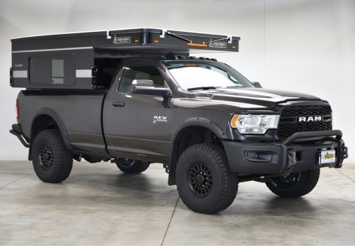
Here is my current rig:


Member III
Awesome! I'm still hoping to do a TNJT trip but I was up in the Adirondacks of NY since t Tuesday with my son's Boy Scout troop doing a canoe trek in the Saranac region. Lots of lakes and seasonal roads lined with first come first serve camp sites there. It was in the mid 40's way back in Floodwood where we camped last night. I wore my hoodie and gym pants inside my sleeping bag.

Member III
@atc250r you spend time with your Son & his scout troop. They are the future of us! I'm 55 y.o. & when people say "you're pretty smart, how do you know all of that?" I say "on my path towards Eagle Scout".
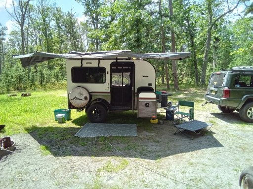
Come autumn, I gonna do the whole thing north to south towing the camper.
Come autumn, I gonna do the whole thing north to south towing the camper.
Thanks. I'm only 4 years behind you. This is the 5th year I've done trek with them. Next year is Maine for whitewater rafting then he ages out.@atc250r you spend time with your Son & his scout troop. They are the future of us! I'm 55 y.o. & when people say "you're pretty smart, how do you know all of that?" I say "on my path towards Eagle Scout".
Come autumn, I gonna do the whole thing north to south towing the camper.
Brooks638
Rank IV

Influencer II
I did the north portion 3 weeks ago. Besides the bridge closed on walpack flatbrook and mountain rd the trail was fine. Had to do some trimming in the trails but I have a full-size truck


