Rothrock to Bald Eagle connection
- Thread starter DevilDodge
- Start date
-
Guest, UPDATE We went through the site migration runbook and completed all steps. We will need to complete the migration next week, but will leave the forums up for the weekend. A few days after maintenance, a major upgrade revision to the forum site will occur.
Well, I become less impressed with the MABDR the more I look at it.
I guess the good part is we know those roads are passable.
In order for me to hit it in Mcalvys Fort i will be quite a bit off my original course.
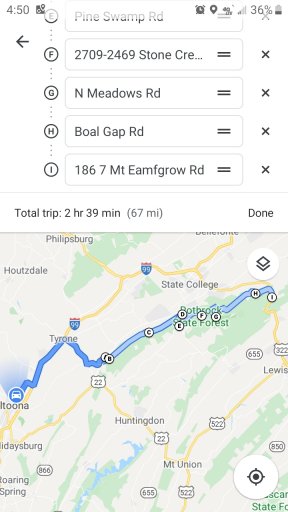
NOTE: Google maps seems to use an avg speed of 20mph on the Forest roads.
I have a few routes planned now. Debating on doing a first trip through Rothrock to Bald Eagle then at route 322 before I enter Bald Eagle, take a different route back through Rothrock.
This will allow me to hit all 8 campsites, while making sure an offroad route exists to Bald eagle.
And then another weekend drive to where I met Bald Eagle on 322 and explore those campsites in BESF.
Decisions

Expedition Master I
- 5,079
- First Name
- Drew
- Last Name
- Hawley
- Member #
-
1537
- Ham/GMRS Callsign
- WRBZ674
- Service Branch
- USN veteran
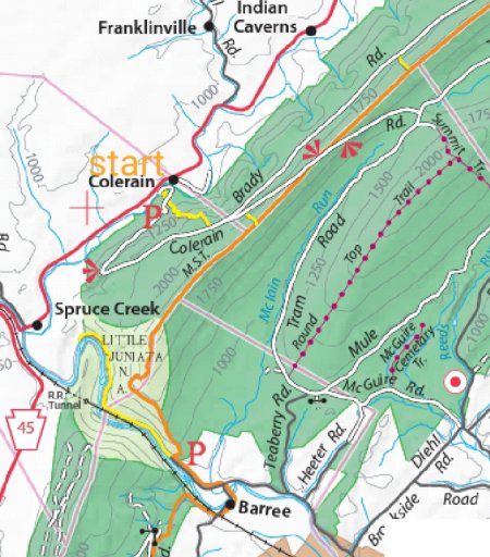
Are you attempting to plan a route on the Mid State Trail?The start of the connection View attachment 137474
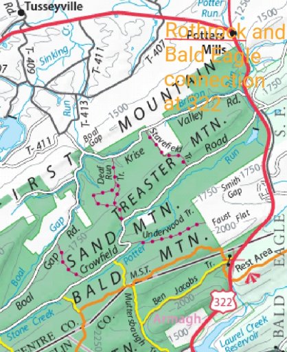
The connectionView attachment 137475
Not real sure of the route in Bald Eagle yet. It is a bit larger and more things to scout.
No. That is the hiking trail, correct? And I lost interest in the MABDR, except for the one section they list as experienced riders.
I can give you each road I plan to drive, which is my next step when i have time.
I will be going from campsite to campsite through Rothrock. When i hit the last campsite i will be heading to the crossover at 322. Then there will start the Bald Eagle section, which will basically be where I begin just scouting, as i have no real plan for it as there is so much more to explore there.
But, I see now why you asked that @Wawa Skittletits .
It shows up in both screenshots, lol. (And I just noticed MST is the same color as my text...total coincidence)
I will be using colerain rd to start. It loops around to the first campsite (which doesn't show on this map)
And then from there weave throught to hit all 7 campsites.(as said before the 8th one I have been to and is in the opposite direction of travel)
Then on the other screenshot I will be coming across on Crowfield Rd.
This is where I plan to cross 322 and begin in to Bald Eagle.
Hope that clears that up.
Any thoughts @Wawa Skittletits on Crowfield RD starting into Bald Eagle, ultimately driving slightly south to sand mountain road to see campsites 48 and 45. (Got to check again to see if there is a lower road that crosses under...but I think I have to cross with crowfield and drive down to sand mountain rd And not continue on decker rd)
I now see how confusing that was with my color choice of text. It was literally just to mark the screen shot.
I will be more thorough in the future.
Last edited:
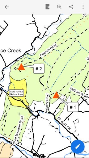
Maybe this will explain better
Starting in by Spruce Creek. Going to site 2 then site one. Then across Rothrock hitting sites 3 to 5 ( site 7 and 8 are the other direction and 6 may get passed up if time isn't on my side) and then taking Crowfield Rd to 322. Where then I will switch to the Bald Eagle map and set out on Sand Mountain Rd to sites 48 and 45. And then just roam around til it is time to head home...for the scouting trip.
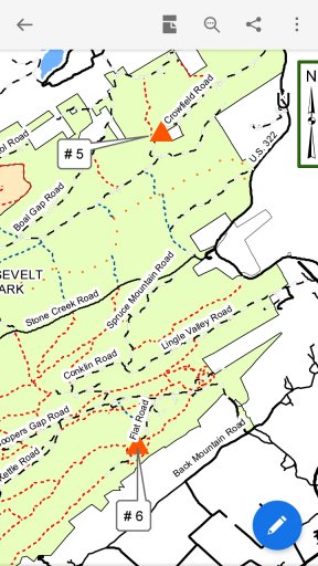
EDIT: actually will be exiting Rothrock on Krise valley Road.
Last edited:
Got some time with the maps. Entering Rothrock near the town of Colerain...on Colerain rd and then exiting on Krise Valley Road.
Got the route planned and just a few spots to be sure are open for travel.
Be back in a bit.
Got the route planned and just a few spots to be sure are open for travel.
Be back in a bit.
I'm using purple lizard maps and combined with their blog planning a route. Target is the end of Feb. Are you confirming the 4x4 roads are icy and not fun to drive on? I'm about 5 hours away so it's impossible for me to scout it ahead of time.
i.e. Negro Hollow Road, Longwell Draft Rd, Duncan Trail
i.e. Negro Hollow Road, Longwell Draft Rd, Duncan Trail
The roads last weekend about 45 mins southwest were icy. Since then it has all melted. There is no way to predict what they will be in a month...especially in February.
I am offroad every weekend, so I can give updates, and will definitely give updates the best I can.
I am actually headed to Bloomsburg this weekend for a family trip...hoping to maybe sneak onto a Forest road or 2.
I am offroad every weekend, so I can give updates, and will definitely give updates the best I can.
I am actually headed to Bloomsburg this weekend for a family trip...hoping to maybe sneak onto a Forest road or 2.
Today's trip allowed me a few things.
It showed me within 30 mins I can be to state Forest land and then could spend the rest of my time until I was ready to head home...off pavement.
It allowed me to scout 2 more campsites and hopefully continue my families excitement for dispersed camping.
It allowed me the chance to try a few navigation devices.
First...google maps...it got me there and showed where we where when I wanted.
Second...good old paper maps and compass. Their detail was enough I would have needed no other device...that makes me feel calm and collected with being off pavement.
Third...I use the topo maps app and was impressed with the usability of it for this recreation.
And fourth...I got to pass some people in the opposite direction and was pleased there was enough room for both vehicles.
That was calming aswell.
Got my maps gathered. Got the dispersed camping info in there also.
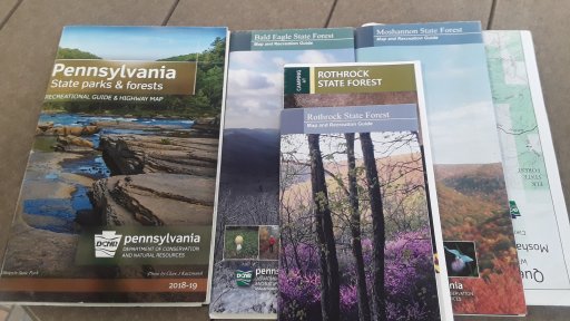
I think I may change the heading here to include Moshannan State Forest in the connection. Or just start another thread, haven't decided
Just got to do some research about the area in between.
Eventually I plan to incorporate Elk, Sproul, and Tiadaghton into large 2 week track. But that won't be for some time.
Although I do believe I can travel to each in a full day of exploring. But gonna start with one at a time.
I plan to have the Purple lizard maps soon. But with these maps, and my topo app I am more than prepared
I think first will be a weekend in Rothrock. Then a long weekend there, exploring into Bald eagle.
Then a weekend in Bald Eagle followed by a long weekend into Bald Eagle
Then a weekend in Bald Eagle followed by a long weekend into Bald Eagle
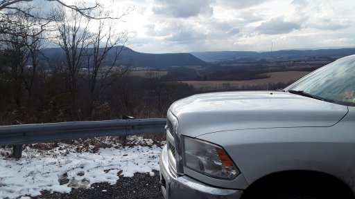
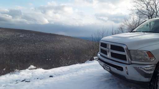
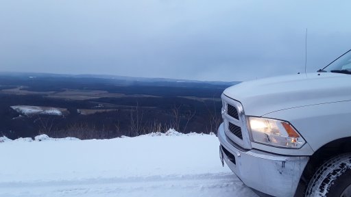
We headed out to Rothrock today. We completed most of the connection between it and Bald Eagle.
The connection is definitely doable. It is just easy Forest roads. But there is lots to see and take in. It was much nicer taking the Forest Roads to State College than it was taking I99 home.
We got a pretty good idea that our first dispersed camping trip will be to site 3 in Rothrock.
We hit a couple trails on foot too.
We cut the full connection short. We exited at Tussey Mountain Ski resort. Which was kinda cool. We weren't expecting it, so seeing the snow and the skiers took us by surprise.
A great day in beautiful Pennsylvania.
Looks like it is about 47 miles off pavement. The Forest is divided by route 26. You have to spend 3/4 of a mile on it.
Seems like each Forest has a similar setup of off pavement with a short paved road crossing.
Once I get to Bald Eagle I will drive north east in an attempt to converge into Sproul Forest then a north west direction into Elk Forest. Then a sort of south west trip to Moshannan Forest then will just have to take pavement home. Figuring about 50 miles in each Forest hoping for almost 250 miles off pavement. Should be able to do the round trip on one tank of gas.
Just getting this route planned to just make sure the main roads are passable and do connect and to scout all the camping. Will start a thread for this big trip once I complete the trip I set forth here.
The hardest part will be not getting sidetracked in each Forest. Lol.
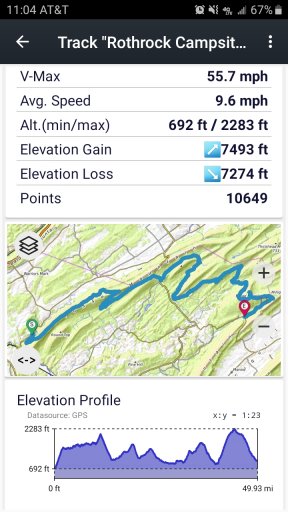
We made the connection
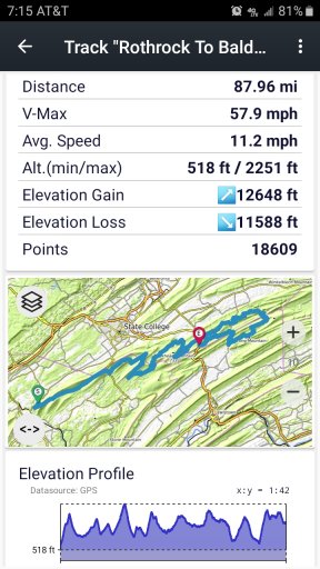
It is very easy to get from one to the other. And it can be done with very very minimal pavement.
Crossing 322 was a bit exciting and annoying.
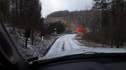
There is a more direct route than the one we took. But we wanted as little pavement as possible.
There are also multiple places to make the connection.
So we spent almost 8hrs in the Forests and 90 miles on forest roads.
More info to come later. We had a great day.

It is very easy to get from one to the other. And it can be done with very very minimal pavement.
Crossing 322 was a bit exciting and annoying.

There is a more direct route than the one we took. But we wanted as little pavement as possible.
There are also multiple places to make the connection.
So we spent almost 8hrs in the Forests and 90 miles on forest roads.
More info to come later. We had a great day.


