Pioneer II
- 6,020
- First Name
- Dustin
- Last Name
- Helms
- Member #
-
24720
- Ham/GMRS Callsign
- KD2UNH
- Service Branch
- USAF
I once heard “the best laid plans work until the first shot is fired” and it has stuck with me ever since. I typically do a deal of research and occasional reconnaissance before taking my wife and truck on any adventure but I have found there are certain things you can’t exactly plan for.
In the military we have an acronym for everything, and for this we used “METT-TC…” which can also mean “I didn’t plan for that” but I guess I still kinda use this when planning our trips. … I usually make a quasi OPORD for our trips as well (outlining the destination and purpose of the trip, expected timeline, planned stops, methods of contact, and what we brought, etc).
I got curious, does anyone else consider this stuff? How do others factor this?
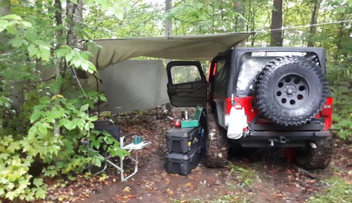
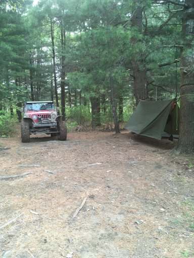
Two trips come to mind regarding this: our trip on the NEBDR from NY to VT, and our first trip to Flagpole Knob. Although I started tracking the weather in the vicinity of where I thought we would be spending most of our time on the trips there were still unknowns going into both trips. It had previously rained already in the area and rain was possible on our journey.
Do these routes flood? Would it still be possible for my vehicle?
Will there be snow/ice? The elevation and latitude differences combined with the time of year could mean rain in one place and snow in the other. And that would be local info I wouldn’t know until I got there. At flagpole knob the large puddle water crossings had a pretty thick layer of ice…also that water submerged our fog lights, it was deeper than I expected.
Rain and snow also leads to fog. I really didn’t think about that, but we found ourselves in the thickest fog on flagpole knob and we ascended up Dunkle Hollow rd at night.
I really have to thank @corgily for his videos of flagpole knob. Having a good baseline of what to expect in good conditions I was pretty comfortable going into my trip there.
And from here I developed a little scale for my “Maximum Planned Level of Adventure (MPLA)”. With this scale I gauge a trip based on the difficulty of the route in perfect conditions.
At zero would be an interstate highway. Basically the best possible road conditions.
At level 1 for example is the Appalachian Byway from PA through NY. Very very easy route, all paved but a few backroads and blind turns.
I guess a maintained gravel/dirt road would be a 2, a Camry can do it comfortably.
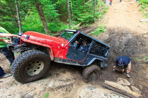
I would put the NEBDR and TNJT at a 3. There’s dirt and definitely ways to either get stuck or do damage if you try hard enough, but this is basically as tame as “off-road can be. You might even use 4WD.
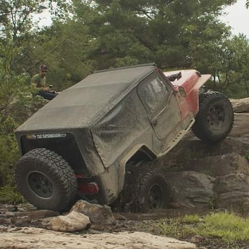
I ranked Peters Mill Run and Flagpole Knob a 4 and a 5 respectively. PMR I feel could easily be done with a stock 4WD.
I haven’t done the following places but it seems Big Levels in VA would be a 6 or 7 and I’m sure you can imagine some epic trail that would be a 10 and would be stupid to try with any rig in the wet.
FPK is just about the maximum I plan for, a 5. That’s based on a few factors including what the wife and I seem to enjoy and the point our truck is at. Even in the dark, rain and fog FPK wasn’t too challenging and we really enjoyed it.
I try to keep this reference in mind so that when the trip doesn’t go quite as expected we still have a good time. Because I think a 5 could quickly become a 7 if the conditions hate you.
As for our NEBDR trip, the weather held off until we were on the Taconic driving home… in the worst rain I’ve ever seen. It was the most soothing and enjoyable ride so far. Had the rain came earlier some of those spots would have been VERY interesting.
I’m sure everyone isn’t as systematic as I am. I’m genuinely curious how do you pick out your routes? What method do you use to decide if you and you’re rig is ready for a certain trail/route? Do you factor the weather? Are there any other factors you consider?
In the military we have an acronym for everything, and for this we used “METT-TC…” which can also mean “I didn’t plan for that” but I guess I still kinda use this when planning our trips. … I usually make a quasi OPORD for our trips as well (outlining the destination and purpose of the trip, expected timeline, planned stops, methods of contact, and what we brought, etc).
I got curious, does anyone else consider this stuff? How do others factor this?
Two trips come to mind regarding this: our trip on the NEBDR from NY to VT, and our first trip to Flagpole Knob. Although I started tracking the weather in the vicinity of where I thought we would be spending most of our time on the trips there were still unknowns going into both trips. It had previously rained already in the area and rain was possible on our journey.
Do these routes flood? Would it still be possible for my vehicle?
Will there be snow/ice? The elevation and latitude differences combined with the time of year could mean rain in one place and snow in the other. And that would be local info I wouldn’t know until I got there. At flagpole knob the large puddle water crossings had a pretty thick layer of ice…also that water submerged our fog lights, it was deeper than I expected.
Rain and snow also leads to fog. I really didn’t think about that, but we found ourselves in the thickest fog on flagpole knob and we ascended up Dunkle Hollow rd at night.
I really have to thank @corgily for his videos of flagpole knob. Having a good baseline of what to expect in good conditions I was pretty comfortable going into my trip there.
And from here I developed a little scale for my “Maximum Planned Level of Adventure (MPLA)”. With this scale I gauge a trip based on the difficulty of the route in perfect conditions.
At zero would be an interstate highway. Basically the best possible road conditions.
At level 1 for example is the Appalachian Byway from PA through NY. Very very easy route, all paved but a few backroads and blind turns.
I guess a maintained gravel/dirt road would be a 2, a Camry can do it comfortably.
I would put the NEBDR and TNJT at a 3. There’s dirt and definitely ways to either get stuck or do damage if you try hard enough, but this is basically as tame as “off-road can be. You might even use 4WD.
I ranked Peters Mill Run and Flagpole Knob a 4 and a 5 respectively. PMR I feel could easily be done with a stock 4WD.
I haven’t done the following places but it seems Big Levels in VA would be a 6 or 7 and I’m sure you can imagine some epic trail that would be a 10 and would be stupid to try with any rig in the wet.
FPK is just about the maximum I plan for, a 5. That’s based on a few factors including what the wife and I seem to enjoy and the point our truck is at. Even in the dark, rain and fog FPK wasn’t too challenging and we really enjoyed it.
I try to keep this reference in mind so that when the trip doesn’t go quite as expected we still have a good time. Because I think a 5 could quickly become a 7 if the conditions hate you.
As for our NEBDR trip, the weather held off until we were on the Taconic driving home… in the worst rain I’ve ever seen. It was the most soothing and enjoyable ride so far. Had the rain came earlier some of those spots would have been VERY interesting.
I’m sure everyone isn’t as systematic as I am. I’m genuinely curious how do you pick out your routes? What method do you use to decide if you and you’re rig is ready for a certain trail/route? Do you factor the weather? Are there any other factors you consider?