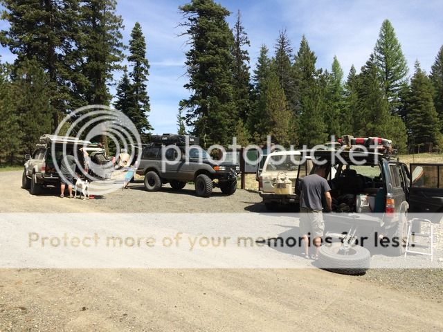
Well we just got back from a couple days on the OBDR. We knew we were pretty early in the season going into this trip but thought we would give it a shot anyway. The original plan was to go from Prineville to just outside of Seneca. Then from Seneca up to the Olive Lake area outside of Granite. Then from Granite up to Meacham. And from Meacham up to Walla Walla. Well as we all know as overlanders, plans dont always go as planned and this trip was no different. We had 9 vehicles and a great group of people.
Day #1
We left Prineville at 6:15 am and headed out on Route 4 of the OBDR. We wanted to get a good early start because we knew it would be a long day. The total miles that day was supposed to be 155.

It was a beautiful sunny day with nice warm weather. The trail climbs out of Prineville up into the Ochoco National Forest and up toward Big Summit Prairie. The OBDR follows the "Summit Trail" which is conveniently named because it pretty much follows the highest elevations from peak to peak. Our first issues came when trying to get up and over Mount Pisgah. Although it has been pretty warm the last few weeks, the snow fall this winter was very high and there are spots on the northern facing slopes that still have super deep snow drifts. We were forced to reroute back down the way we came and head south and then east to get around Mt Pisgah.


By the time we got back to the route it was time for lunch!

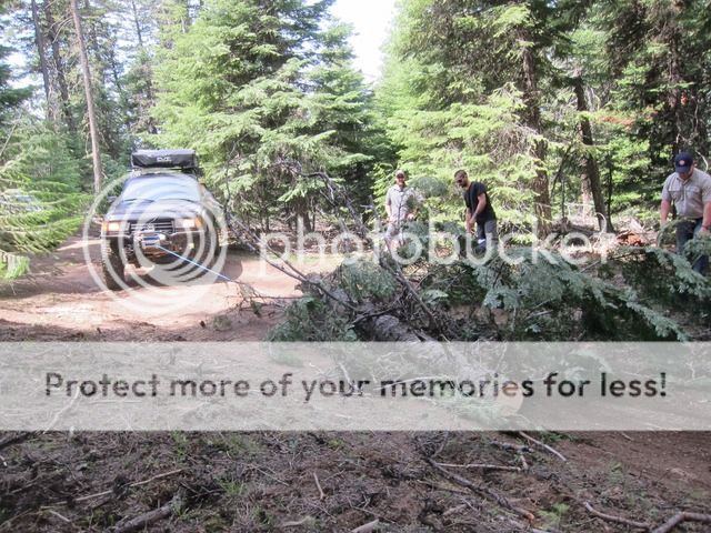
After Lunch the route became more of a trail than a gravel road and since we were the first people on the route for the season we were definitely breaking trail. The high snow fall this year created a lot of dead fall. We had 4 chainsaws in our group and need them for sure. Progress was very slow as every couple hundred feet it seemed like we were cutting trees and pulling them out of the way with winches. We went 7 miles in the 3 hours after lunch. Ouch!!


After we got out of the thick stuff the route opened up to beautiful views and vast meadows. It was all about speed at that point as we were hoping to be into camp by 5 pm and we still had a very long way to go.


We got close to the end of our route and decided to take a little quicker detour so we could get to camp before dark. We really didnt want to but we ended up in camp at 7 pm instead of possibly getting in at 10 pm or later. We stopped in the huge metropolis of Seneca and got fuel before heading out to camp.

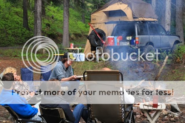
The campspot for night #1 was an awesome spot just outside of Seneca. It was a nice clear field right on a little creek. Plenty big to fit all 9 vehicles. Just as we had set up camp it started to rain!! We knew we were going to have some rain but the forecast wasnt calling for rain until later in the day Saturday and it was only Friday. Oh well. Its an adventure.


I will post day #2 in the next post. I apologize that I am no photographer and most of my pics are on an iphone and a cannon point and shoot. Some of the other guys had awesome cameras and even drones. I will get those later on when everyones done compiling their footage.
Day #1
We left Prineville at 6:15 am and headed out on Route 4 of the OBDR. We wanted to get a good early start because we knew it would be a long day. The total miles that day was supposed to be 155.

It was a beautiful sunny day with nice warm weather. The trail climbs out of Prineville up into the Ochoco National Forest and up toward Big Summit Prairie. The OBDR follows the "Summit Trail" which is conveniently named because it pretty much follows the highest elevations from peak to peak. Our first issues came when trying to get up and over Mount Pisgah. Although it has been pretty warm the last few weeks, the snow fall this winter was very high and there are spots on the northern facing slopes that still have super deep snow drifts. We were forced to reroute back down the way we came and head south and then east to get around Mt Pisgah.


By the time we got back to the route it was time for lunch!

After Lunch the route became more of a trail than a gravel road and since we were the first people on the route for the season we were definitely breaking trail. The high snow fall this year created a lot of dead fall. We had 4 chainsaws in our group and need them for sure. Progress was very slow as every couple hundred feet it seemed like we were cutting trees and pulling them out of the way with winches. We went 7 miles in the 3 hours after lunch. Ouch!!


After we got out of the thick stuff the route opened up to beautiful views and vast meadows. It was all about speed at that point as we were hoping to be into camp by 5 pm and we still had a very long way to go.


We got close to the end of our route and decided to take a little quicker detour so we could get to camp before dark. We really didnt want to but we ended up in camp at 7 pm instead of possibly getting in at 10 pm or later. We stopped in the huge metropolis of Seneca and got fuel before heading out to camp.

The campspot for night #1 was an awesome spot just outside of Seneca. It was a nice clear field right on a little creek. Plenty big to fit all 9 vehicles. Just as we had set up camp it started to rain!! We knew we were going to have some rain but the forecast wasnt calling for rain until later in the day Saturday and it was only Friday. Oh well. Its an adventure.


I will post day #2 in the next post. I apologize that I am no photographer and most of my pics are on an iphone and a cannon point and shoot. Some of the other guys had awesome cameras and even drones. I will get those later on when everyones done compiling their footage.


