Contributor I
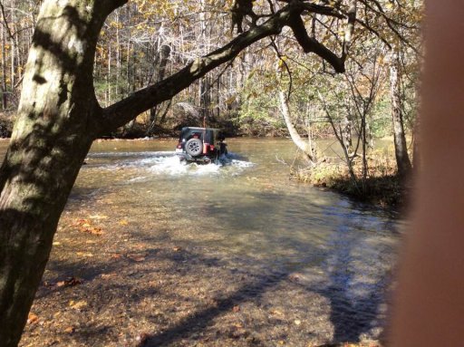
We are going to be in Hiawassee and was thinking about doing the Charles Creek portion of the Georgia Traverse. Anyone have a report of trail conditions/ water levels. We’re a leveled JK with no snorkel.

Contributor I

Contributor I

Contributor I


Advocate II
Looks awesome! Are there places to camp along this stretch?Thanks Eric! The Charles Creek stretch was beautiful! Weather was perfect! Leaves probably peaked on most of the trail last week but the stretch going down into Dillard on Betty’s Creek Rd was peaking now. The rock climb up on the west end of Charles Creek Rd was fun (we don’t have rocks in South Georgia....or elevation change for that matter. lol). The first small creek crossing was up to the bottom of the doors but the river crossing was no issue. Glad we beat this weeks rain though.
Thanks to the Georgia Overland crew for mapping the Traverse on Gaia. We’re seeing much more of the North Georgia mountains thanks to that resource!View attachment 75671

Contributor I
There are several beautiful spots that appear to be used often. Most are marked on the Gaia download if you have it.Looks awesome! Are there places to camp along this stretch?

Advocate II
I just found it and downloaded it. I'll certainly check it out! ThanksThere are several beautiful spots that appear to be used often. Most are marked on the Gaia download if you have it.

Contributor I
The download for The Georgia Traverse is at www.georgiaoverland.com. There’s one file for the tracks and one for the waypointsI just found it and downloaded it. I'll certainly check it out! Thanks
