Moshannan State Forest in a RAM or 2
- Thread starter DevilDodge
- Start date
-
Guest, UPDATE We went through the site migration runbook and completed all steps. We will need to complete the migration next week, but will leave the forums up for the weekend. A few days after maintenance, a major upgrade revision to the forum site will occur.


Used to frequent Black Moshannon years ago and I highly recommend visiting!

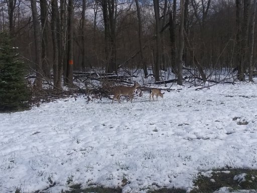
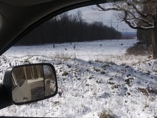
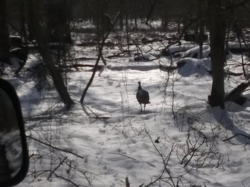
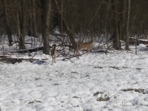
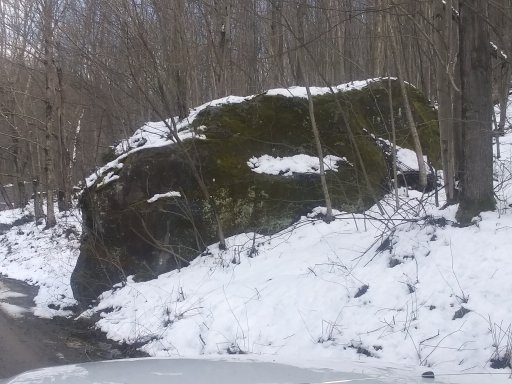
I have been using the newest section of the Moshannon Forest for my viewing pleasure.
Lots of things to see. There is no opportunity for overlanding here, but quite an interesting trail system.
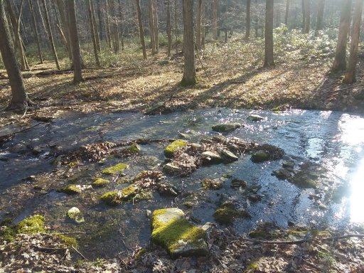
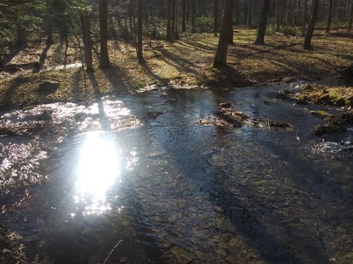
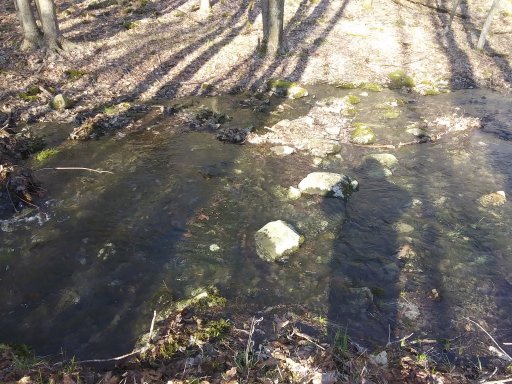
The Little Muddy Run creek runs through here.
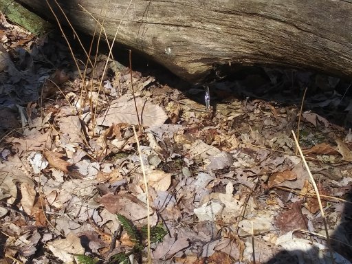
I also seen the print of our largest mammal that day...but didnt get a glimpse of it.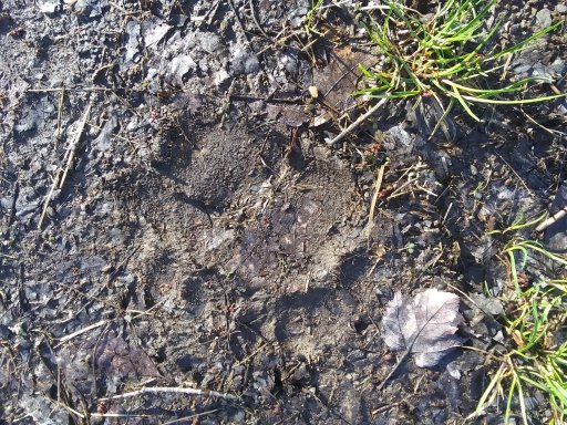
Lots of things to see. There is no opportunity for overlanding here, but quite an interesting trail system.
The Little Muddy Run creek runs through here.
I also seen the print of our largest mammal that day...but didnt get a glimpse of it.
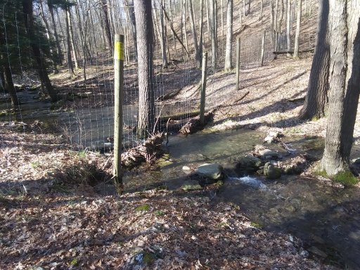
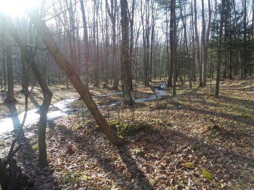
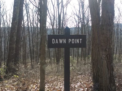
The trail from the parking lot is Dawn Trail.
As you go up it you cone to Dawn Point and realize the idea of the trail.
As you go up it you cone to Dawn Point and realize the idea of the trail.
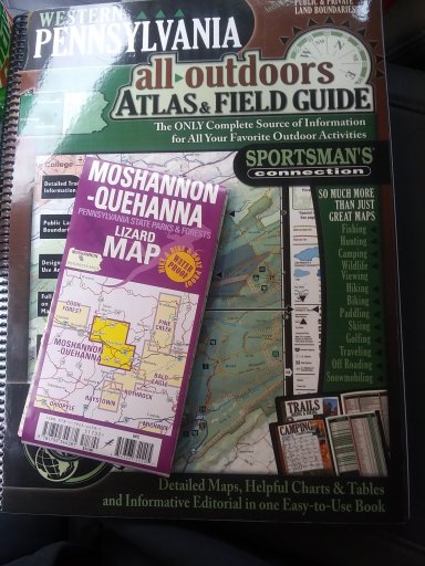
Purple Lizard was out of the Moshannon Quehanna maps. If anyone knows a retailer that sells them and may have them. Please let me know.
So we got back into Moshannon State Forest.
We scouted Parker Dam State Park and found most all of the sites are acceptable...juat have to make sure your equipment fits.
In the pic above...i thought I found one site and missed the other 2. As it turns out, this is all 3 of them grouped on this spur.
We didn't get up to see the other dispersed sites. But, if we do camp there innthe coming weeks, I will get them scouted.

First timer in PA, here for a family visit. Anybody willing to help me with some good driving trails? Right down the way from Moshannon (kylertown).
Purple Lizard posted today that they are out revising the Moshannon/Quehanna map.
They moved the release from June to July.
Hope to get the map soon.
I am ready to go explore this section of PA
They moved the release from June to July.
Hope to get the map soon.
I am ready to go explore this section of PA
I must have missed this post. Did you get out in the forest? Anything interesting to repirt?First timer in PA, here for a family visit. Anybody willing to help me with some good driving trails? Right down the way from Moshannon (kylertown).
We did! Loved it, especially being from Texas. I saw elk, black bear, timber rattlers, Turkey, and more trees than I’ve ever seen in my life.I must have missed this post. Did you get out in the forest? Anything interesting to repirt?
Purple Lizard finished their new edition of the Moshannon/Quehanna map.
Just ordered mine. Can not wait for it to get here.
Just ordered mine. Can not wait for it to get here.
Got my map today. It very interestingly has my hometown in the bottom starting corner. And my hometown is about to become my hometown again.
Can not wait to get some seat time on the trails
Can not wait to get some seat time on the trails
Here are the motorized/dispersed sites in Moshannon State Forest
Attachments
-
 705.1 KB Views: 152
I have been a bit off on updates I see.
We did get up and checked out the dispersed motorized campsites. We toured some of the forest roads.
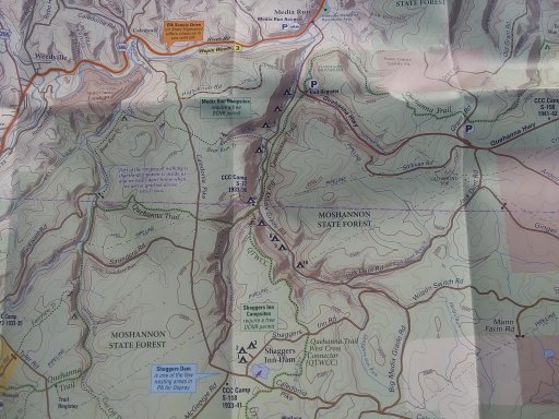
I have a plan to do a few county loop around central PA. So I was studying the map today. Although the trip will be in a North to south travel...the scouting will be south to north.
I think no can get almost as much dirt time as Rothrock and Bald Eagle. I found some drivable trails that will be a large part of the connection between North and South.
Found 2 fire towers to scout out. Rockton and the Knobs.
Will have to see if there are any geocache present and plan to do a little hiking to find the purple lizards from their maps.
Hope to hit the dirt soon.
We did get up and checked out the dispersed motorized campsites. We toured some of the forest roads.
I have a plan to do a few county loop around central PA. So I was studying the map today. Although the trip will be in a North to south travel...the scouting will be south to north.
I think no can get almost as much dirt time as Rothrock and Bald Eagle. I found some drivable trails that will be a large part of the connection between North and South.
Found 2 fire towers to scout out. Rockton and the Knobs.
Will have to see if there are any geocache present and plan to do a little hiking to find the purple lizards from their maps.
Hope to hit the dirt soon.
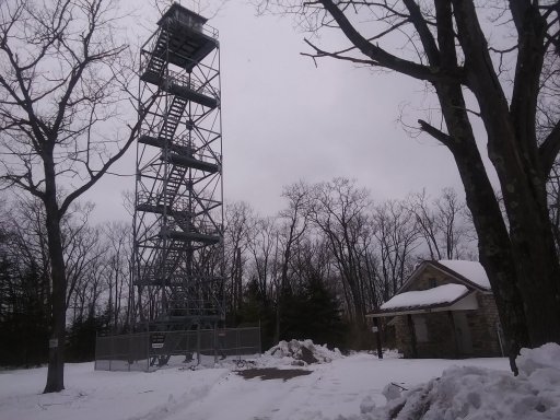
So, in the last post I listed 2 firetowers. Well looking at the map the other day I saw a 3rd. We located it today. Spent some time exploring...but the snow and more importantly the ice kept us to the cleared roads.
The tour guide for today. Scouted out some of the roads I plan to use for my overland trip circling central PA.
Made sure both the map and the atlas showed similar roads. Was very happy with both.
Found the 4x4 high clearance roads to still have significant snow and the north sides had slick ice. So we did not get to traverse them...but we got outdoors and explored.
Now with the information I checked today. I can start planning more.
Got to hit the 4x4 High Clearance road I wanted to in the last post.
All snow and ice is gone. Dug Road is the one we hit. Going up the South side is like climbing a deer path up hill. When you hit the switchback it starts to level out and then proceeds out across the top fairly flat. We hit a couple other forest roads...but the purpose of our trip was to take the kids to a skate and bike park we found. Can not wait to explore more
All snow and ice is gone. Dug Road is the one we hit. Going up the South side is like climbing a deer path up hill. When you hit the switchback it starts to level out and then proceeds out across the top fairly flat. We hit a couple other forest roads...but the purpose of our trip was to take the kids to a skate and bike park we found. Can not wait to explore more
