Member III
- 3,509
- First Name
- Jared
- Last Name
- Thomsen
- Member #
-
43113
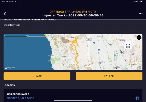
I tried asking this in the “Trail Q & A” forum but didn’t get much response or any clarity - so I’m trying here too.
My question is: I’ve heard about the Mendocino Backcountry Discovery Trail as being a really great and beautiful trail and have found articles and videos about it online - but I don’t see that trail (or any info about it) listed on the Overland Bound map section of the app. Am I missing something or has no one ever added and reviewed it on here? I’m sure others in the overland bound community (besides myself) would benefit from having the trail with info listed here within the app and on the map. Thanks in advance!
My question is: I’ve heard about the Mendocino Backcountry Discovery Trail as being a really great and beautiful trail and have found articles and videos about it online - but I don’t see that trail (or any info about it) listed on the Overland Bound map section of the app. Am I missing something or has no one ever added and reviewed it on here? I’m sure others in the overland bound community (besides myself) would benefit from having the trail with info listed here within the app and on the map. Thanks in advance!