Hey all - many things mentioned in this thread - let me offer some info!
90% of our attention is the Overland Bound One app - worldwide, and most of the features mentions are done or slated for completion very soon. Furthermore, we will be providing detailed info for free.
For the web map, will be making a complete replacement of the Overland Bound web map next year - to bring it's features in parity with Overland Bound One. All of our offline mode, offline map download, GPX import share, and details track recording are currently in Beta testing - so this is not far away.
The overland community needs a better mapping and navigation app, built by the community (from feedback and actual use), and by folks who use it. I know there are apps out there, but oh boy, is there a good one?
We won't make our community pay for location details. We prefer to make location information available for free. You can pay OLB to be a Member and get all the social, planning, and offline features - but information is free in keeping with our founding principles.
Lots of great features in the works - and we are also collection feedback and other feature requests for the app here. You can also upvote features:
Overland Bound One Feature Upvote
Some feature details:
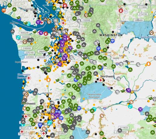
A pro tip: if a location on our map is grey - it is not verified. If it is colored, it has been verified by an Overland Bound Member:
View attachment 208560
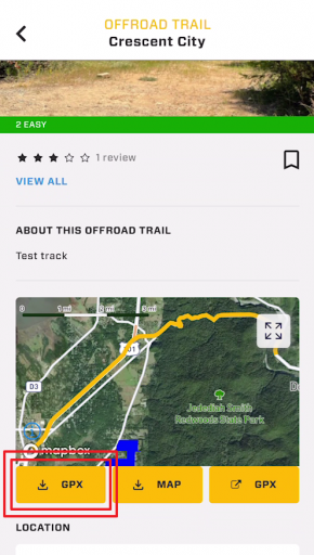
GPX Support:
Members can currently import and share GPX files. Its kind of a pain, and when you add a GPX file it has to go through admin approval which takes 24 hours. We are fixing all of this to make much easier. You can also navigate along a GPX trail even if you are offline.
View attachment 208562
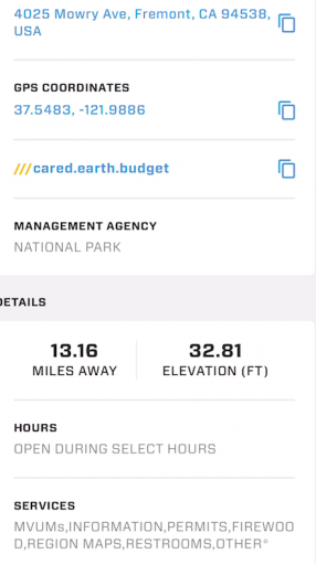
Locations and POI
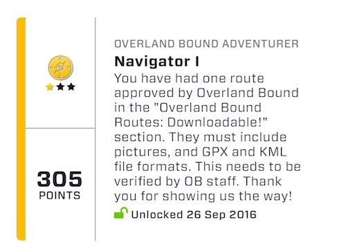
Anyone can add a location, and we are at a 300 location per month rate currently. We are planning to increase this rate significantly by rewarding the community in addition to the badge system:
View attachment 208563
I mean real rewards like discounts, useful gear, or physical challenge coins.
@Corrie is working on this program now.
Pour POI have "all the details" and each POI type has different details appropriate to the type. For example, Ranger stations have office hours, Camp Sites do not, etc.
Some Expedition features in Beta Testing:
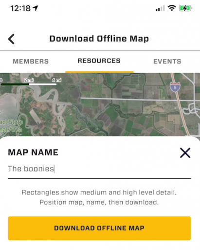
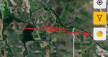
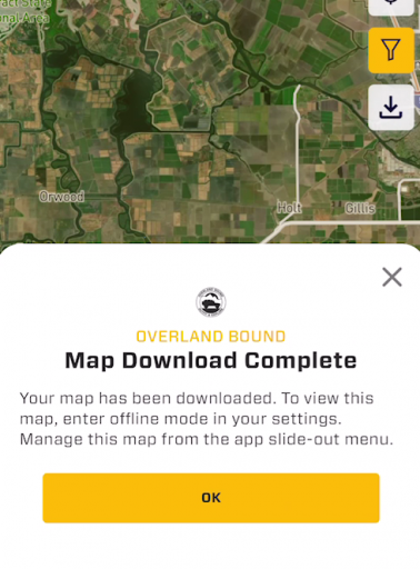
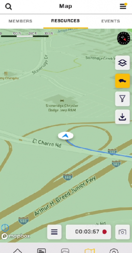
Offline Map Download:
View attachment 208564
This feature is simple to use. You just center the map and hit download. Boom. Done. Easy of use is of primary importance to us.
View attachment 208565
View attachment 208566
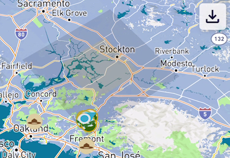
You can easily see areas that are available offline:
View attachment 208567
and manage them from the slide out menu.
Also, there are buttons to automatically download maps around Rally Points waypoints or GPX tracks with a single tap.
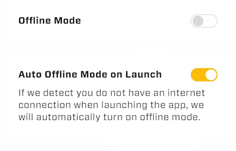
Offline Mode:
View attachment 208570
This allows the usage of the app when offline for navigation and location lookup when there is no cell connection. It also insures you will not get an "App update required" when you have no connection and are 20 miles off grid :) We think about these things cause built by overlanders for overlanders. :)
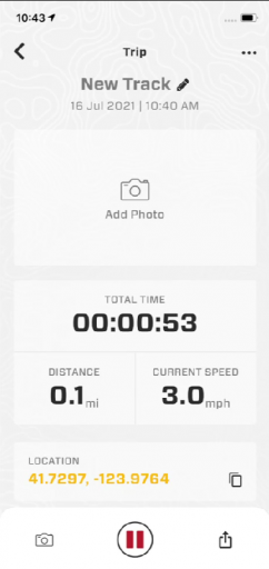
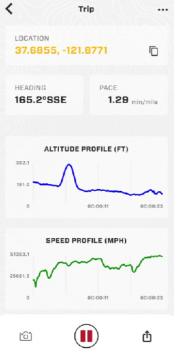
GPX Track Recording
Track recording is a science, and we have spent countless hours on our tech. We will continue to improve this, but out of the gate it will do what you expect, and again - one tap to start recording. Peasy-peasy.
View attachment 208574
View attachment 208571
View attachment 208572
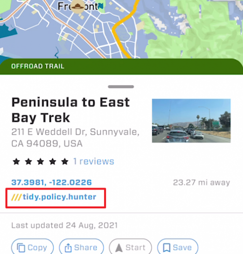
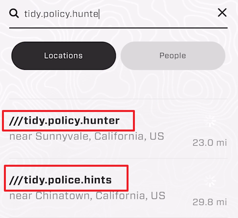
Three Word Navigation
GPS coordinates are hard to remember, and street addresses are insufficient for Overlanders. In our app, every 10x10 ft square on the planet has a 3 word designation which can be shared and searched:
View attachment 208575
View attachment 208576
but wait there is more... haha


 682.7 KB Views: 132
 1 MB Views: 65