US Northwest June 2020 WABDR - Washington Backcountry Discovery Route

  • HTML tutorial

Ubiety

Rank VI
Member

Explorer I

5,221
Sammamish, WA, USA
First Name
Greg
Last Name
Ubiety
Member #

6193

Ham/GMRS Callsign
Ribs
I have the smaller of the two on demand water heaters from Camp Chef; these are meant to be connected to a pressurized water source; e.g. the garden hose. For camping look at a 12v RV water pump to push water through the system. We locate the shower far from camp typically by a stream or other clean-ish water source. For the trailer mounted water heater I think I'd go with either a long hose or an easily removable heater to keep showers/mud out of camp.

My output side hose broke shortly after purchase and they sent out a new hose quickly and no questions asked. Super awesome. I had original hose fixed before backup arrived and now I have two. I like Camp Chef gear.
 

armyRN

Rank V
Launch Member

Member III

1,683
Longview, WA
First Name
Paul
Last Name
Dickinson
Member #

22047

Ham/GMRS Callsign
KI7TSP
I've found one that has a 12-volt pump, but it is too big for my trailer.


They also seem like more work than they're worth. I'll probably just keep using what I've got for now. With my Zodi, you just need to start heating up the water and go do something else for a bit till it reaches operating temperature as it has to heat up the whole tank of water.
 

Ubiety

Rank VI
Member

Explorer I

5,221
Sammamish, WA, USA
First Name
Greg
Last Name
Ubiety
Member #

6193

Ham/GMRS Callsign
Ribs
Well the Jeep is all but packed. Made some last minute orders of a few physically smaller things to replace their larger counterparts in order to make a little more room. The new belt is in the tool bin and the compressor has been moved to an easier to access spot. Down to just about clothes, food and occupants.

I have been watching the WX and it looks like we are in for rain the first couple days - through Packwood anyway. We had talked about making the first short day a longer day in order to find camping. I'd like to try to out run the rain as well. Looks like pavement past Packwood to close to the start of Bethel Ridge where it looks like we will start seeing dryer country. Anybody know if Bethel ridge area has camping in a dryer area? Yakima and Ellensburgh are not calling for rain Mon/Tues.
 

Ubiety

Rank VI
Member

Explorer I

5,221
Sammamish, WA, USA
First Name
Greg
Last Name
Ubiety
Member #

6193

Ham/GMRS Callsign
Ribs
Who's interested (beside's Greg) in running the Alaska Highway?

I'm a planner. I may also have tossed in a few of my own opinions on this post.

The Milepost book (updated yearly) is literally "the Bible" for anyone traveling in western Canada or Alaska. It is also just a fun book to read and mentally plan different trips in the region. Anyone who knows anything about traveling up there has one. Many book stores sell them, and you can get it on-line. Here's a link:


Here you go: Alaska Highway proposed itinerary (with options). This is a popular bucket-list trip. I've done it, but not all in one trip or in the same vehicle (but my trailer was on all trips). Get out your Milepost book (it will be a requirement for this trip anyways if you don't already have one) and follow along with the maps on the first few pages of the book:

It is about 850 miles from Seattle to Dawson Creek (the start of the Alaska Highway). You can cut some of that time/mileage by starting at Sumas WA and crossing there, but still figure a good 2 to 2.5 days of traveling to get to Dawson Creek. We could plan on everyone initially meeting in Dawson Creek, or cross into Canada and do these 800-something miles as a group (meeting place and time TBD).

For planning purposes for this trip, figure 300 - 400 miles a day driving for estimating days on the road (somedays more; somedays less - of course). It shouldn't be a race - you want to soak it all in.

Advantage of going solo to Dawson Creek:

1. You can set your own itinerary/pace.
2. Don't have to worry about anyone else till you get to Dawson Creek.

Disadvantages:

1. You're kinda on your own. There's traffic out there, but lots of places are pretty desolate if you get stuck.
2. You're less likely to want to camp off-the-grid.
3. You've got to wait for everyone else to show up.

Advantages of doing this stretch as a group:

1. Safety in numbers.
2. You're more likely to be willing to camp off-the-grid.

Disadvantages to doing this stretch to Dawson Creek as a group:

1. It will just take a bit longer (although can be mitigated with someone in charge keeping stop times to a minimum, and having a hard start time every morning & no screwing around).
2. If someone has a major vehicle breakdown, it will delay some if not all of the group to get them to a place they can get repairs done (but again, an advantage if you're the one that breaks down).

There's really not a lot to do or see in Dawson Creek (in my opinion). Photo ops of course, a small museum or two, stock up on food and gas... figure a couple hours in town. Most likely you'll be chomping-at-the-bit wanting to get this show on the road!

So from Dawson Creek to Fairbanks, it is another 1500 miles - figure another 4-5 days driving. The first day or so on the road you'll be like "This is it?", but then after that suddenly it is like "OMG - this is awesome". You might want to spend a day or half-day in Whitehorse (really cool museum in town, and restocking supplies), so possibly add that in. Fairbanks didn't really do much for me when I was there. I mean... spend a day checking it out (it was your end-goal to get there). Others who've been there might have a different opinion.

Much of the Alaska Highway is a lot of wilderness (and places you'll want to stop and take a picture - beautiful scenery) with small towns in between . You might think they are going to be a big town looking at a map, but trust me; some of them are just a gas station and a campground (if you're lucky). Always fill-up on gas when you're in a little town. Get out and stretch your legs. Anyways....

When leaving Fairbanks, you have a couple options:

1. Turn around and go back the way you came (boring - you've just came that way). Round trip to Fairbanks and to get you home would be around two weeks or just over doing an out-and-back. If you crossed into Canada on a Saturday morning (maybe late Friday?), you could possibly be home by Sunday sometime two weeks/16 days later. Some folks are on a time limit and are lucky they can do this much; got-it. See notes at the end of this post about return trip options doing an out-and-back.

2. Run the Dalton Highway (another bucket-list trip for many). In Fairbanks you're already essentially at the start of the Dalton Highway, and you never know when you'll be this far into Alaska again. Figure about another 500 miles each way, so add another 3 (3 would be pushing it) to 4-5 days to the trip. You have to make arrangements to see the ocean at the end - you can't just drive to it. Then to (4.) just below.

3. Drive down to Anchorage. Figure another 350 miles (a long day of driving). You'll want to spend at least a day-or-two in Anchorage - it is a big city. Personally, I'd save an Anchorage trip for another day (so I could add-in driving the Seward and Sterling Highway, and check out Homer). Then drive about 350 miles to Tok (about a long day's drive) on the Glenn Highway and Tok Cutoff.

Another option is to drive from Anchorage to Tok to Haines - about 750 miles or so, and take the ferry from Haines to Bellingham. I've done the Ferry; the Ferry's not cheap, but it makes for an awesome trip. Figure a four-day ferry ride (I forget if 3 or 4 days; might be 3 days up and 4 days back to Bellingham) to get back to Bellingham. The ferry only gets to Haines and leave Haines one day a week, so plan accordingly.

4. Head back down the Alaska Highway from Fairbanks to Tok (about 200 miles). Get off the Alaska Highway at Tok and head north another 75 miles on the Taylor Highway to Chicken (and camp there - kind-of a funky little place), and then take the Top-of-the-World Highway the next morning to Dawson City (about 100 miles). Spend at least one full day in Dawson City. You'll be glad you did - it is a cool western gold-rush mining town. Visit Diamond Tooth Gertie's Saloon while you're there. Get a Hostel room in town so you can clean-up and feel free to walk around town late into the evening after visiting Gerrie's (think 24hr daylight during the summer). There's also a campground outside of town.

Then you have options leaving Dawson City on the Klondike Loop after you've stocked-up on supplies:

1. Run the Dempster Highway all the way to Tuktoyaktuk (at the Beaufort Sea/Arctic Ocean). The Dempster starts about 30 miles out of Dawson City. Figure 600 miles each way on the Dempster, so another 5 (maybe 6) days traveling round-trip. Would add a lot of time to this already long trip. Another bucket-list trip for many. Or you could save it for another day (but don't just say "Next time" - plan on it and do it)! And bring a kayak next time so you can say you kayaked in the Arctic Ocean. Then to (2.) next.

2. Head east/south out of Dawson Creek on the Klondike Loop back to Whitehorse (about 325 miles). You can keep going on the Alaska Highway to Watson Lake (another 200 miles), or stop for the night in Whitehorse and then head-out to Watson Lake in the morning.

Side-trips outside of Whitehorse include Skagway and Atlin.

Once at Watson Lake (just before) you have two options:

1. Just stay on the Alaska Highway the way you originally came; back to Dawson Creek and back home (about 1450 miles or so). It might look different seeing it from the other direction.

2. Instead of staying on the Alaska Highway, head south on the Cassiar Highway (for about 450 miles) to the Yellowhead Highway and on to Prince George (about a 300 mile stretch). Side trips off the Cassiar and Yellowhead include Telegraph Creek (70 miles each way), Stewart Hyder (40 miles each way) or Prince Rupert (150 miles each way).

Once at Prince George, head south on the West Access Route to just before Cache Creek (for about 275 miles) and then take the Sea to Sky Highway to Vancouver Canada (about 200 miles).

Cross back into the USA in Vancouver.

So you can just check-off doing the Alaska Highway and back in about two weeks/16 days, or you can stretch this thing out to 3 - 4 weeks (or more easily). There is no right answer - most folks have time limits they can be gone. Out-and-back would be a glorious trip you would always remember.

If you were doing the out-and-back (as I call it), you could change it up some on the way back (see something different), and instead of taking the Alaska Highway all the way back to Dawson Creek (and then working your way back home), as previously mentioned you could get off just before Watson Lake and take the Cassiar Highway to the Yellowhead Highway, and then take the West Access Route at Prince George all the way to Hope (and then to Vancouver), or before Cache Creek take the Sea to Sky Highway to Vancouver.

Just tossing this out there to see what might be the response, and to get people thinking.

Either way, order a Milepost Book and start dreaming. We are at such an advantage living so close to the start of the Alaska Highway.
We almost did the ferry option but ended up riding back and then down through Jasper/Banff into Montana. Jasper is definitely worth seeing. My vote is for the ferry as that will help engage my wife - a little "Alaska Cruise" after the drive.
 

MrWilsonWJ

Rank V
Launch Member

Member III

1,691
Kennewick, WA
First Name
Dustin
Last Name
Wilson
Member #

23384

Well the Jeep is all but packed. Made some last minute orders of a few physically smaller things to replace their larger counterparts in order to make a little more room. The new belt is in the tool bin and the compressor has been moved to an easier to access spot. Down to just about clothes, food and occupants.

I have been watching the WX and it looks like we are in for rain the first couple days - through Packwood anyway. We had talked about making the first short day a longer day in order to find camping. I'd like to try to out run the rain as well. Looks like pavement past Packwood to close to the start of Bethel Ridge where it looks like we will start seeing dryer country. Anybody know if Bethel ridge area has camping in a dryer area? Yakima and Ellensburgh are not calling for rain Mon/Tues.
46.77622, -121.08801 and 46.78423, -121.08706 are two places I marked as a possible group camp sites with the second one being a little better if I remember. Both are off of NF 1500 which is the alt route for Bethel ridge on the BDR. Not sure how long it would make your day to try for those, but It would allow you to get up early and do some exploring of spur roads on your way over to the Ridge. The road over from the start of the ridge to those spots is easy gravel and only about 8 miles. When I was up there last weekend we camped not far from those spots and that ridge was in a nice rain shadow, raining on the ridge and all around but when we got back to camp it was bone dry.
 
  • Like
Reactions: Ubiety

Ubiety

Rank VI
Member

Explorer I

5,221
Sammamish, WA, USA
First Name
Greg
Last Name
Ubiety
Member #

6193

Ham/GMRS Callsign
Ribs
46.77622, -121.08801 and 46.78423, -121.08706 are two places I marked as a possible group camp sites with the second one being a little better if I remember. Both are off of NF 1500 which is the alt route for Bethel ridge on the BDR. Not sure how long it would make your day to try for those, but It would allow you to get up early and do some exploring of spur roads on your way over to the Ridge. The road over from the start of the ridge to those spots is easy gravel and only about 8 miles. When I was up there last weekend we camped not far from those spots and that ridge was in a nice rain shadow, raining on the ridge and all around but when we got back to camp it was bone dry.
Awesome! Thanks for the report. I'll add these waypoints to my Gaia soup.

Not trying to rush or push, just want to avoid rain if possible and it starts looking dryer East of Packwood.
 
  • Like
Reactions: Joshua Buss

mtn

Rank IV
Member

Influencer II

1,213
Washington, USA
First Name
Ole
Last Name
H
Member #

30318

Ham/GMRS Callsign
KA7OLE
46.77622, -121.08801 and 46.78423, -121.08706 are two places I marked as a possible group camp sites with the second one being a little better if I remember. Both are off of NF 1500 which is the alt route for Bethel ridge on the BDR. Not sure how long it would make your day to try for those, but It would allow you to get up early and do some exploring of spur roads on your way over to the Ridge. The road over from the start of the ridge to those spots is easy gravel and only about 8 miles. When I was up there last weekend we camped not far from those spots and that ridge was in a nice rain shadow, raining on the ridge and all around but when we got back to camp it was bone dry.
I think I stayed at one of those 3 years ago. Plenty of space and plenty of mosquitoes that day.

I was actually thinking we could camp by Bear Lake, or somewhere on the section after we get up the hill and before we go into the woods. That area should have some nice views, although I suppose it could get windy.
 
  • Like
Reactions: SCS and Ubiety

Ubiety

Rank VI
Member

Explorer I

5,221
Sammamish, WA, USA
First Name
Greg
Last Name
Ubiety
Member #

6193

Ham/GMRS Callsign
Ribs
I was confused and thought we ended near Packwood the first day, took a look at some of @mtn's proposed stops and they are well short of Packwood. Oh well, I guess we will have one wet night worst case.
 

mtn

Rank IV
Member

Influencer II

1,213
Washington, USA
First Name
Ole
Last Name
H
Member #

30318

Ham/GMRS Callsign
KA7OLE
I have been watching the WX and it looks like we are in for rain the first couple days - through Packwood anyway. We had talked about making the first short day a longer day in order to find camping. I'd like to try to out run the rain as well. Looks like pavement past Packwood to close to the start of Bethel Ridge where it looks like we will start seeing dryer country. Anybody know if Bethel ridge area has camping in a dryer area? Yakima and Ellensburgh are not calling for rain Mon/Tues.
Right now, even Rimrock looks more like Ellensburg weatherwise rather than Packwood, so Bethel Ridge looks like it could be a good goal for Monday night. Let's just make sure we fly through the snow!

One more thing though, let's make sure we do stop and take breaks as we go. Drivers often can go longer, but we don't want it to be too much of just driving for the passengers (spouses/kids/dogs) that are coming along.
 
  • Like
Reactions: Ubiety

mtn

Rank IV
Member

Influencer II

1,213
Washington, USA
First Name
Ole
Last Name
H
Member #

30318

Ham/GMRS Callsign
KA7OLE
I was confused and thought we ended near Packwood the first day, took a look at some of @mtn's proposed stops and they are well short of Packwood. Oh well, I guess we will have one wet night worst case.
From what the ranger said, those first stops I had in mind won't be accessible, nor will the campgrounds be open.
 
  • Like
Reactions: Ubiety

Ubiety

Rank VI
Member

Explorer I

5,221
Sammamish, WA, USA
First Name
Greg
Last Name
Ubiety
Member #

6193

Ham/GMRS Callsign
Ribs
Right now, even Rimrock looks more like Ellensburg weatherwise rather than Packwood, so Bethel Ridge looks like it could be a good goal for Monday night. Let's just make sure we fly through the snow!

One more thing though, let's make sure we do stop and take breaks as we go. Drivers often can go longer, but we don't want it to be too much of just driving for the passengers (spouses/kids/dogs) that are coming along.
Yep, keeping my wife and son happy are top of the list. If its sunny/dry they will want to see the sites, if it is dumping rain they will want to motor on to dryer locales. Thanks everybody for being flexible and seeking adventure!
Funny, I had seen Bear Lake on the map and thought it looked like a sweetheart of a spot.

@SCS what is your dog's name?

I have updated the spreadsheet a bit and plan on bringing a printout for everybody.
 

oldmopars

Rank V
Launch Member

Member III

2,865
Selah Wa
First Name
Scott
Last Name
Solomon
Member #

20486

Who's interested (beside's Greg) in running the Alaska Highway?

I'm a planner. I may also have tossed in a few of my own opinions on this post.

The Milepost book (updated yearly) is literally "the Bible" for anyone traveling in western Canada or Alaska. It is also just a fun book to read and mentally plan different trips in the region. Anyone who knows anything about traveling up there has one. Many book stores sell them, and you can get it on-line. Here's a link:


Here you go: Alaska Highway proposed itinerary (with options). This is a popular bucket-list trip. I've done it, but not all in one trip or in the same vehicle (but my trailer was on all trips). Get out your Milepost book (it will be a requirement for this trip anyways if you don't already have one) and follow along with the maps on the first few pages of the book:

It is about 850 miles from Seattle to Dawson Creek (the start of the Alaska Highway). You can cut some of that time/mileage by starting at Sumas WA and crossing there, but still figure a good 2 to 2.5 days of traveling to get to Dawson Creek. We could plan on everyone initially meeting in Dawson Creek, or cross into Canada and do these 800-something miles as a group (meeting place and time TBD).

For planning purposes for this trip, figure 300 - 400 miles a day driving for estimating days on the road (somedays more; somedays less - of course). It shouldn't be a race - you want to soak it all in.

Advantage of going solo to Dawson Creek:

1. You can set your own itinerary/pace.
2. Don't have to worry about anyone else till you get to Dawson Creek.

Disadvantages:

1. You're kinda on your own. There's traffic out there, but lots of places are pretty desolate if you get stuck.
2. You're less likely to want to camp off-the-grid.
3. You've got to wait for everyone else to show up.

Advantages of doing this stretch as a group:

1. Safety in numbers.
2. You're more likely to be willing to camp off-the-grid.

Disadvantages to doing this stretch to Dawson Creek as a group:

1. It will just take a bit longer (although can be mitigated with someone in charge keeping stop times to a minimum, and having a hard start time every morning & no screwing around).
2. If someone has a major vehicle breakdown, it will delay some if not all of the group to get them to a place they can get repairs done (but again, an advantage if you're the one that breaks down).

There's really not a lot to do or see in Dawson Creek (in my opinion). Photo ops of course, a small museum or two, stock up on food and gas... figure a couple hours in town. Most likely you'll be chomping-at-the-bit wanting to get this show on the road!

So from Dawson Creek to Fairbanks, it is another 1500 miles - figure another 4-5 days driving. The first day or so on the road you'll be like "This is it?", but then after that suddenly it is like "OMG - this is awesome". You might want to spend a day or half-day in Whitehorse (really cool museum in town, and restocking supplies), so possibly add that in. Fairbanks didn't really do much for me when I was there. I mean... spend a day checking it out (it was your end-goal to get there). Others who've been there might have a different opinion.

Much of the Alaska Highway is a lot of wilderness (and places you'll want to stop and take a picture - beautiful scenery) with small towns in between . You might think they are going to be a big town looking at a map, but trust me; some of them are just a gas station and a campground (if you're lucky). Always fill-up on gas when you're in a little town. Get out and stretch your legs. Anyways....

When leaving Fairbanks, you have a couple options:

1. Turn around and go back the way you came (boring - you've just came that way). Round trip to Fairbanks and to get you home would be around two weeks or just over doing an out-and-back. If you crossed into Canada on a Saturday morning (maybe late Friday?), you could possibly be home by Sunday sometime two weeks/16 days later. Some folks are on a time limit and are lucky they can do this much; got-it. See notes at the end of this post about return trip options doing an out-and-back.

2. Run the Dalton Highway (another bucket-list trip for many). In Fairbanks you're already essentially at the start of the Dalton Highway, and you never know when you'll be this far into Alaska again. Figure about another 500 miles each way, so add another 3 (3 would be pushing it) to 4-5 days to the trip. You have to make arrangements to see the ocean at the end - you can't just drive to it. Then to (4.) just below.

3. Drive down to Anchorage. Figure another 350 miles (a long day of driving). You'll want to spend at least a day-or-two in Anchorage - it is a big city. Personally, I'd save an Anchorage trip for another day (so I could add-in driving the Seward and Sterling Highway, and check out Homer). Then drive about 350 miles to Tok (about a long day's drive) on the Glenn Highway and Tok Cutoff.

Another option is to drive from Anchorage to Tok to Haines - about 750 miles or so, and take the ferry from Haines to Bellingham. I've done the Ferry; the Ferry's not cheap, but it makes for an awesome trip. Figure a four-day ferry ride (I forget if 3 or 4 days; might be 3 days up and 4 days back to Bellingham) to get back to Bellingham. The ferry only gets to Haines and leave Haines one day a week, so plan accordingly.

4. Head back down the Alaska Highway from Fairbanks to Tok (about 200 miles). Get off the Alaska Highway at Tok and head north another 75 miles on the Taylor Highway to Chicken (and camp there - kind-of a funky little place), and then take the Top-of-the-World Highway the next morning to Dawson City (about 100 miles). Spend at least one full day in Dawson City. You'll be glad you did - it is a cool western gold-rush mining town. Visit Diamond Tooth Gertie's Saloon while you're there. Get a Hostel room in town so you can clean-up and feel free to walk around town late into the evening after visiting Gerrie's (think 24hr daylight during the summer). There's also a campground outside of town.

Then you have options leaving Dawson City on the Klondike Loop after you've stocked-up on supplies:

1. Run the Dempster Highway all the way to Tuktoyaktuk (at the Beaufort Sea/Arctic Ocean). The Dempster starts about 30 miles out of Dawson City. Figure 600 miles each way on the Dempster, so another 5 (maybe 6) days traveling round-trip. Would add a lot of time to this already long trip. Another bucket-list trip for many. Or you could save it for another day (but don't just say "Next time" - plan on it and do it)! And bring a kayak next time so you can say you kayaked in the Arctic Ocean. Then to (2.) next.

2. Head east/south out of Dawson Creek on the Klondike Loop back to Whitehorse (about 325 miles). You can keep going on the Alaska Highway to Watson Lake (another 200 miles), or stop for the night in Whitehorse and then head-out to Watson Lake in the morning.

Side-trips outside of Whitehorse include Skagway and Atlin.

Once at Watson Lake (just before) you have two options:

1. Just stay on the Alaska Highway the way you originally came; back to Dawson Creek and back home (about 1450 miles or so). It might look different seeing it from the other direction.

2. Instead of staying on the Alaska Highway, head south on the Cassiar Highway (for about 450 miles) to the Yellowhead Highway and on to Prince George (about a 300 mile stretch). Side trips off the Cassiar and Yellowhead include Telegraph Creek (70 miles each way), Stewart Hyder (40 miles each way) or Prince Rupert (150 miles each way).

Once at Prince George, head south on the West Access Route to just before Cache Creek (for about 275 miles) and then take the Sea to Sky Highway to Vancouver Canada (about 200 miles).

Cross back into the USA in Vancouver.

So you can just check-off doing the Alaska Highway and back in about two weeks/16 days, or you can stretch this thing out to 3 - 4 weeks (or more easily). There is no right answer - most folks have time limits they can be gone. Out-and-back would be a glorious trip you would always remember.

If you were doing the out-and-back (as I call it), you could change it up some on the way back (see something different), and instead of taking the Alaska Highway all the way back to Dawson Creek (and then working your way back home), as previously mentioned you could get off just before Watson Lake and take the Cassiar Highway to the Yellowhead Highway, and then take the West Access Route at Prince George all the way to Hope (and then to Vancouver), or before Cache Creek take the Sea to Sky Highway to Vancouver.

Just tossing this out there to see what might be the response, and to get people thinking.

Either way, order a Milepost Book and start dreaming. We are at such an advantage living so close to the start of the Alaska Highway.
I have been dreaming about a trip to Deadhorse for many years. If you were to drive up and take the ferry back, what kind of time would you need for this? It is sounding like 3-4 weeks, is this right? Or would it be longer?
For me to be able to take that much time off of work all at once would be a challenge, but with a lot of advanced notice I could make it happen. I would be thinking not this next year, but the following. That would give me time to really shake down the rig and make sure it is ready for the trip and I have saved the funds for the trip also.
 
  • Like
Reactions: Ubiety

Ubiety

Rank VI
Member

Explorer I

5,221
Sammamish, WA, USA
First Name
Greg
Last Name
Ubiety
Member #

6193

Ham/GMRS Callsign
Ribs
I have been dreaming about a trip to Deadhorse for many years. If you were to drive up and take the ferry back, what kind of time would you need for this? It is sounding like 3-4 weeks, is this right? Or would it be longer?
For me to be able to take that much time off of work all at once would be a challenge, but with a lot of advanced notice I could make it happen. I would be thinking not this next year, but the following. That would give me time to really shake down the rig and make sure it is ready for the trip and I have saved the funds for the trip also.
Probably three weeks - very much a "plan, save and prepare for" trip. The ferry is not cheap and they have a range of accommodations to pick and choose from.
Going North through BC is incredible, especially up North as you near the Yukon. There is a desert North of us in BC. I did not know that until we were there.
 

armyRN

Rank V
Launch Member

Member III

1,683
Longview, WA
First Name
Paul
Last Name
Dickinson
Member #

22047

Ham/GMRS Callsign
KI7TSP
I would strongly suggest taking the ferry at the start of your trip. The ferry only leaves Haines once-a-week, and if you miss it... you'll be hanging out in Haines for a week (or you could start driving back to WA). As mentioned previously, figure three weeks to do the ferry to Haines, Haines to Fairbanks (skipping Anchorage), Dalton Highway up-and-back to Fairbanks, and drive back to WA doing the Alaska Highway in reverse. You could do this in three weeks and not be too rushed.

This past summer I got stuck in Ft Nelson BC for a few days (long story... short version: U-joint went bad and NAPA was closed till Monday morning). Poop happens and causes delays. Oh - and it was in August, and I got snowed on - travel advisories were in effect heading north - it was crazy. I wasn't on a time limit though, so it was fine (part of the adventure, and punishment for not carrying a spare U-joint - I kept putting off getting one before the trip). Now if I had a ferry to catch and not much wiggle room time-wise... I'd have been screwed (and doubt I'd get a refund - but don't quote me). Do the ferry up front.

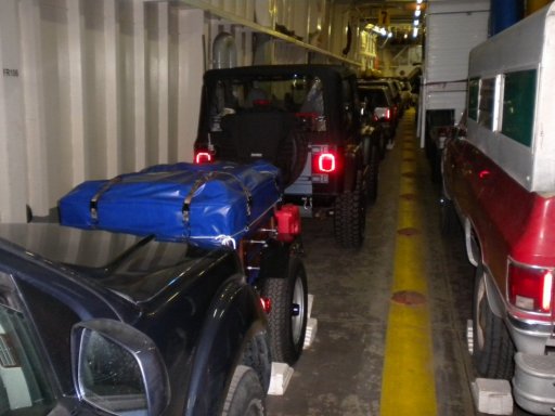
The ferry leaves Bellingham on a Friday afternoon, and arrives in Haines on Monday morning. There are multiple stops along the way, and sometimes you can get off the ferry for a little bit.

The ferry has multiple options price-wise. They also charge by the length of your vehicle (and trailer if you're towing one - ouch). Literally, they charge by the foot. The ferry ride is extremely relaxing - if you can afford it, you should do it at least once (I'm trying to convince my wife we need to do this together). One thing though; they require you to keep your pets in your vehicle, and only have certain times you can go visit them (and let them out to go potty and such). We didn't have a dog with us either time we were on the ferry, but we would still go down to the vehicles during doggy break time to visit and help folks with their dogs (it was actually fun - we looked forward to it). I'm sure some folks snuck their dogs into their rooms (I would have - just sayin'). If you had a room that is.

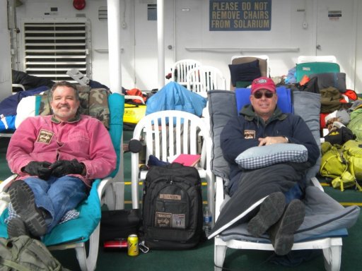
Figure about $3000 for the ferry ride from Bellingham to Haines (leave Friday afternoon, get to Haines Monday morning). Add another $400 for a room. You can sleep on the deck under heat lamps for free (or pretty much anyplace you can stretch out - they're pretty mellow). One time we had a room; another time we didn't. Not having a room actually adds to the adventure (next time I go, I'll probably skip getting a room; it was totally cool sleeping on the deck). They have showers and such so that's not an issue if you don't have a room. They also have food on board - depending on the ferry that's running it will be either basic diner fair, or they may also have a nicer restaurant in addition to the diner. We made it a point to have an MRE every day for lunch (because that how my buddy and I rolled). As I recall, the food wasn't cheap, but not too outrageous.

The drive though BC is also awesome; that's why I suggested a different route coming back if you were driving the whole thing (Alaska Highway). There are no bad choices for heading up there; it depends on what you can afford and how long you can be gone. If going to drive the Dempster Highway (not to be confused with the Dalton Highway), you need to make sure the two river crossings (free ferry) are not still frozen over.
 

Attachments

Last edited:

SCS

Rank V
Launch Member

Advocate III

2,066
Happy Valley, OR, USA
First Name
Steven
Last Name
S
Member #

21001

Yep, keeping my wife and son happy are top of the list. If its sunny/dry they will want to see the sites, if it is dumping rain they will want to motor on to dryer locales. Thanks everybody for being flexible and seeking adventure!
Funny, I had seen Bear Lake on the map and thought it looked like a sweetheart of a spot.

@SCS what is your dog's name?

I have updated the spreadsheet a bit and plan on bringing a printout for everybody.
The dog's name is Twiggy. She may not join us after all -- probably be a game time decision.
 
  • Like
Reactions: Ubiety

SCS

Rank V
Launch Member

Advocate III

2,066
Happy Valley, OR, USA
First Name
Steven
Last Name
S
Member #

21001

My first preference would be to have a longer drive on Monday. That said I'm planning to be super flexible and I'll be having fun regardless of where we stop.
 
  • Like
Reactions: Ubiety

Ubiety

Rank VI
Member

Explorer I

5,221
Sammamish, WA, USA
First Name
Greg
Last Name
Ubiety
Member #

6193

Ham/GMRS Callsign
Ribs
@TheGreyhound will be leading a trip out of Seattle to the East side of the state next weekend. They will be at the Grouse Mt campground Friday night which is near our track through Chelan on the same day. I have alerted them to keep listening on GMRS channel 15 and have sent @TheGreyhound and @Geotaco my cell number. Might be fun to meetup if the schedule allows and the stars align.

I know that @mtn will be running APRS as I do. Feel free to pass out the following link to anyone "back home" that might want to track us. I cannot guarantee what kind of coverage that we will get but it should provide something interesting.

Jeep is nearly packed and waiting on the last of the Amazon deliveries ;) The JKU is stuffed, 10 pounds in a 5 pound bag...
 
  • Like
Reactions: DIYTaco15

Hogman

Rank V
Launch Member

Influencer II

1,683
Everett, WA, USA
First Name
Scott
Last Name
Balsley
Member #

23615

Ham/GMRS Callsign
WRHS363
Yep, keeping my wife and son happy are top of the list. If its sunny/dry they will want to see the sites, if it is dumping rain they will want to motor on to dryer locales. Thanks everybody for being flexible and seeking adventure!
Funny, I had seen Bear Lake on the map and thought it looked like a sweetheart of a spot.

@SCS what is your dog's name?

I have updated the spreadsheet a bit and plan on bringing a printout for everybody.
@TheGreyhound will be leading a trip out of Seattle to the East side of the state next weekend. They will be at the Grouse Mt campground Friday night which is near our track through Chelan on the same day. I have alerted them to keep listening on GMRS channel 15 and have sent @TheGreyhound and @Geotaco my cell number. Might be fun to meetup if the schedule allows and the stars align.

I know that @mtn will be running APRS as I do. Feel free to pass out the following link to anyone "back home" that might want to track us. I cannot guarantee what kind of coverage that we will get but it should provide something interesting.

Jeep is nearly packed and waiting on the last of the Amazon deliveries ;) The JKU is stuffed, 10 pounds in a 5 pound bag...
Greg, do you have a latest and greatest GPX for the trip. Trying to get all my electronic stuff up to date.
 
  • Like
Reactions: Ubiety

DIYTaco15

Rank V
Launch Member

Enthusiast III

1,747
Vancouver, WA, USA
First Name
Chris
Last Name
Stewart
Member #

23246

@TheGreyhound will be leading a trip out of Seattle to the East side of the state next weekend. They will be at the Grouse Mt campground Friday night which is near our track through Chelan on the same day. I have alerted them to keep listening on GMRS channel 15 and have sent @TheGreyhound and @Geotaco my cell number. Might be fun to meetup if the schedule allows and the stars align.

I know that @mtn will be running APRS as I do. Feel free to pass out the following link to anyone "back home" that might want to track us. I cannot guarantee what kind of coverage that we will get but it should provide something interesting.

Jeep is nearly packed and waiting on the last of the Amazon deliveries ;) The JKU is stuffed, 10 pounds in a 5 pound bag...
This sounds like fun if it all works out. Ill be with the group at Grouse Mt
 
  • Like
Reactions: Ubiety