Fall foliage, vistas and 4x4 High Clearance trails. An easy route in Bald Eagle State Forest and nearby Rothrock SF

  • HTML tutorial

DevilDodge

Rank IV

Advocate I

1,135
Altoona, Pennsylvania, USA
First Name
David
Last Name
Spencer
FALL FOLIAGE, VISTAS AND 4X4 HC TRAILS

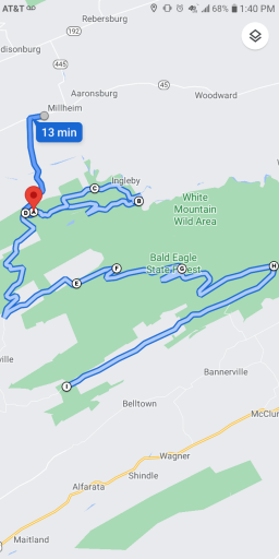
Thought I would share a route I take in the fall and early summer to check out the beauty of PA.

I have had both my RAM 2500 and Jeep Cherokee on these trails. So they are Full size and cute ute friendly. Expect pinstripes on full size and Poe Paddy drive will take a bit of skill in a cute Ute.

There should be no need for recovery gear...but I highly recommend a full size spare and tire plug kit.

Obviously the autumn colors will be all around you...but this also hits all the vistas and four of the 4x4 High Clearance Trails...in what is probably the most popular part of BESF...the area south of Route 45.

This starts at Burkholder's Country Market. They have a great covered parking area, fuel and groceries. It is a great place to start any meet up, group ride or adventure in BESF.

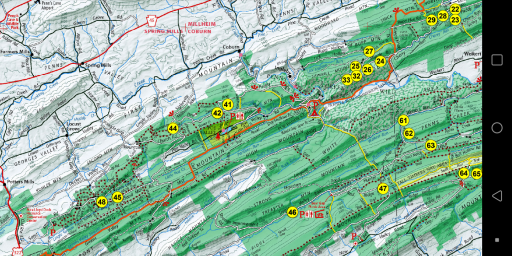
This will also take you past some of the motorized sites...including the very popular site 47.

You will first come to Bell's Majestic Vista. Then as you turn onto pine swamp road you will pass site 42 and head to Chocolate Drop Vista.

After there you will come to the entrance road to Poe Valley state park as you head to Poe Paddy SP (restrooms and camping) and begin the 4x4 HC trail Poe Paddy Dr. Here you will find 3(4) vistas. Ravens Knob, Ingleby View and Penn's View.

You will then head back to Siglerville-Millheim pike passing sites 41 and 44 and a vista that i can not remember the name of.

You will then head into 2 more 4x4 HC trails. Flat Hollow RD and Strong's Mtn Rd.

Then you will come to Bear Gap Picnic area (restrooms and picnic tables).

You will then head up to Treaster Valley Vista. There is a geocache here if anyone does that. And then you will head past site 47.

Then the last 4x4 HC trail, Knob Ridge Rd, will take you to the area of sites 64, 65 and 66

And finally, head out to Reed's Gap SP (restrooms, picnic tables, camping)

Just thought I would share the route.

Fall Foliage, Vistas and 4x4 HC Trails

From 107 Market Dr to Reeds Gap State Park

2 hr 28 min (53 mi)


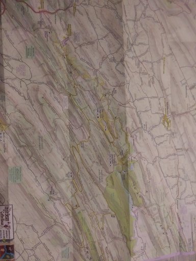
I did this on Google maps so everyone can use it. Purple Lizard Maps would be a great idea to get...or get the day use map from the forest office or download on your phone.


Screenshot_20210917-134022.pngScreenshot_20210917-135550.png20210917_133541.jpg
 

Vagrant Forever

Rank IV

Advocate III

1,059
Holland, Hunterdon County, New Jersey, United States
First Name
Jarred
Last Name
Oberman
Member #

40769

FALL FOLIAGE, VISTAS AND 4X4 HC TRAILS

Thought I would share a route I take in the fall and early summer to check out the beauty of PA.

I have had both my RAM 2500 and Jeep Cherokee on these trails. So they are Full size and cute ute friendly. Expect pinstripes on full size and Poe Paddy drive will take a bit of skill in a cute Ute.

There should be no need for recovery gear...but I highly recommend a full size spare and tire plug kit.

Obviously the autumn colors will be all around you...but this also hits all the vistas and four of the 4x4 High Clearance Trails...in what is probably the most popular part of BESF...the area south of Route 45.

This starts at Burkholder's Country Market. They have a great covered parking area, fuel and groceries. It is a great place to start any meet up, group ride or adventure in BESF.

This will also take you past some of the motorized sites...including the very popular site 47.

You will first come to Bell's Majestic Vista. Then as you turn onto pine swamp road you will pass site 42 and head to Chocolate Drop Vista.

After there you will come to the entrance road to Poe Valley state park as you head to Poe Paddy SP (restrooms and camping) and begin the 4x4 HC trail Poe Paddy Dr. Here you will find 3(4) vistas. Ravens Knob, Ingleby View and Penn's View.

You will then head back to Siglerville-Millheim pike passing sites 41 and 44 and a vista that i can not remember the name of.

You will then head into 2 more 4x4 HC trails. Flat Hollow RD and Strong's Mtn Rd.

Then you will come to Bear Gap Picnic area (restrooms and picnic tables).

You will then head up to Treaster Valley Vista. There is a geocache here if anyone does that. And then you will head past site 47.

Then the last 4x4 HC trail, Knob Ridge Rd, will take you to the area of sites 64, 65 and 66

And finally, head out to Reed's Gap SP (restrooms, picnic tables, camping)

Just thought I would share the route.

Fall Foliage, Vistas and 4x4 HC Trails

From 107 Market Dr to Reeds Gap State Park

2 hr 28 min (53 mi)


I did this on Google maps so everyone can use it. Purple Lizard Maps would be a great idea to get...or get the day use map from the forest office or download on your phone.

View attachment 210001View attachment 210002View attachment 210003
Absolutely will be doing this in the coming weeks! Thanks for the info!
 

DevilDodge

Rank IV

Advocate I

1,135
Altoona, Pennsylvania, USA
First Name
David
Last Name
Spencer
Fall foliage and vistas in Rothrock

here is one that can be easily incorporated with the one above.

If coming from west of central PA. you could travel through here to get to the Bald Eagle Route.

This one does include a 4x4 HC trail and if you like to take short hikes...a fire tower and some other cool features. It takes you past 3 of the motorized sites also.

This one starts at a parking lot near Spruce Creek, Pa on Colerain road. You head straight up the mountain and are at a vista in no time. You will next pass motorized site 2 and then...with a short hike...can go out to the Indian lookout. You then will head down a road with 2 more vistas.

As you trek down into the valley you will start to head back up in elevation and then drive across the top until you come to Route 26 and a very popular vista area.

You will then take a short drive on pavement down to whipple dam area and then back to dirt for the remainder of the route.

You will again rise in elevation and then you will come to Gettis Ridge Rd...a 4x4 HC trail that becomes Wampler Road with one of my favorite vistas. This road is nothing crazy...but you will want something with some clearance and good tires.

You will then go past motorized site 4 and into Alan Seeger Natural Area...another great place for a hike.

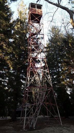
You will then head back up in elevation and will come to the gate for the Greenwood Tower. It is a short hike if you would like to check it out.

The next vista area at the power line...if you look north with binoculars...you can see Little Flat tower and the next vista is a wonderful place to watch the sun set.

You will then travel to Penn Roosevelt SP and a neat little area to explore.

You will then head out Crowfield Rd past motorized site 5 and then to route 322. From here you can travel to Millhiem for the Bald Eagle Route...or just cross 322 right into Bald Eagle and head onto the route from there.

Again...i highly suggest Purple Lizard Maps or you can get the day use map from the forest office or download on your phone... Rothrock State Forest Maps

Fall foliage and vistas in Rothrock.

2 hr 36 min (54 mi)


Any questions...ask away...i am here very often.

I added a picture of the Little Flat Tower...since it is off of the route...but easy to drive over too...so I do not ruin the hike to see Greenwood Tower, but give an idea what you will see.20200217_164406.jpg
 

Arailt

Rank V
Launch Member

Pathfinder I

2,055
Prosper, TX, USA
First Name
Brian
Last Name
Arailt
Member #

1723

Very nice, @DevilDodge, thank you for sharing! We go to PSU games about once a year and pre-kids we used to camp in Rothrock. We'd enter near the Tussey Mountian Ski area. My avatar is actually from a trip out there years ago. We were parked just near one of the amazing vistas near the fire tower.
 

DevilDodge

Rank IV

Advocate I

1,135
Altoona, Pennsylvania, USA
First Name
David
Last Name
Spencer
Appreciate you posting the recent photos via drone!

My wife and I are heading out to Ohiopyle PA for a bike (tandem) ride along the Great Allegheny Passage Trail, a Laurel Highlands road trip, and to take photographs along our routes (hotel reservation in Somerset PA) from October 2 to 4.

Yep, I know it's a little early for the brilliant colors but it is the only time we could both take off from work in October.
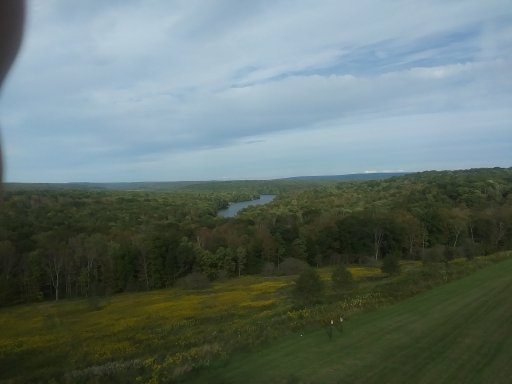
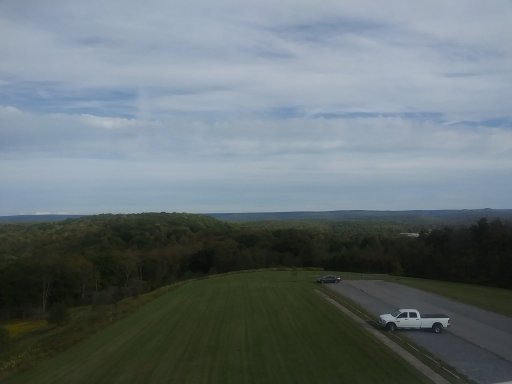
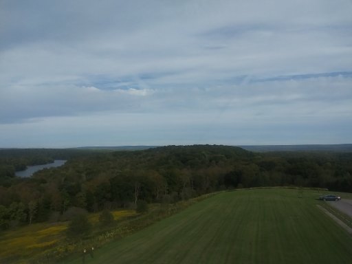
The shot was taken from atop a water tower. Although we do have a drone...i am glad we did not use it. 2 Eagles where there...they may have had their way with it.
 

DevilDodge

Rank IV

Advocate I

1,135
Altoona, Pennsylvania, USA
First Name
David
Last Name
Spencer
@brewsky
Rothrock and Bald eagle connect. Look at some of my other threads about it. I have shared the connection to Rothrock and Moshannon and Pine Creek area.

If you can not find them let me know. I have lots of info about these 4 areas
 
  • Like
Reactions: TSO_NJ

brewsky

Rank I

Enthusiast I

231
Pennsylvania, USA
First Name
Sebastian
Last Name
Marin
@brewsky
Rothrock and Bald eagle connect. Look at some of my other threads about it. I have shared the connection to Rothrock and Moshannon and Pine Creek area.

If you can not find them let me know. I have lots of info about these 4 areas
I was thinking on starting out at Wampler road then heading east and connect to BESF starting around the Penns View and Poe Paddy Dr area. Cutting it a bit shorter since we’re coming up from York for a morning drive.

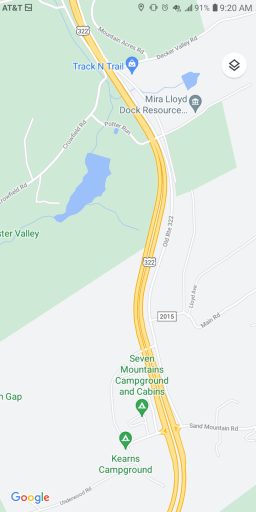
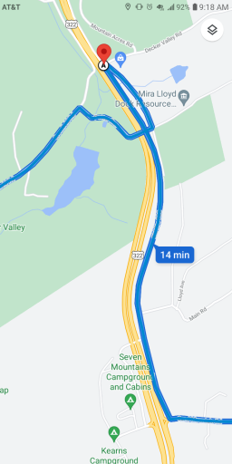
Looking at the map you shared with both. Would you say it’s best to cross over to BESF from Crowfield Rd to Sand Mountain Rd? Trying to avoid paved roads once I air down a bit.
 
  • Like
Reactions: TSO_NJ

DevilDodge

Rank IV

Advocate I

1,135
Altoona, Pennsylvania, USA
First Name
David
Last Name
Spencer
I was thinking on starting out at Wampler road then heading east and connect to BESF starting around the Penns View and Poe Paddy Dr area. Cutting it a bit shorter since we’re coming up from York for a morning drive.

Looking at the map you shared with both. Would you say it’s best to cross over to BESF from Crowfield Rd to Sand Mountain Rd? Trying to avoid paved roads once I air down a bit.
Yes. With the new traffic pattern...that is the best routeScreenshot_20211029-092027.pngScreenshot_20211029-091854.png
 
  • Like
Reactions: TSO_NJ

DevilDodge

Rank IV

Advocate I

1,135
Altoona, Pennsylvania, USA
First Name
David
Last Name
Spencer
Great, can't wait. Hope it doesn't rain much when we're out there to enjoy the view a bit more.

If anyone happens to be out there tomorrow wave! We'll be starting around 7AM.
Considering the weather today...i cancelled my thoughts of leaf peeping.

Hope your trip went well...minus the crappy weather
 
  • Like
Reactions: TSO_NJ

brewsky

Rank I

Enthusiast I

231
Pennsylvania, USA
First Name
Sebastian
Last Name
Marin
Great, can't wait. Hope it doesn't rain much when we're out there to enjoy the view a bit more.

If anyone happens to be out there tomorrow wave! We'll be starting around 7AM.
Considering the weather today...i cancelled my thoughts of leaf peeping.

Hope your trip went well...minus the crappy weather
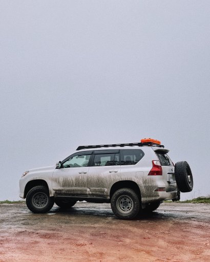
We got there around 8am and left BESF around 2pm. It was raining on/off and while the fog made it very hard to enjoy the vistas it made it a pretty eerie experience - very appropriate for Halloween

This was Penns View.
 

Attachments

  • Like
Reactions: DevilDodge