
Influencer I
- 3,231
- First Name
- Larrie is
- Last Name
- sharing our travels with the world.
- Member #
-
19319
- Ham/GMRS Callsign
- KG7WDX
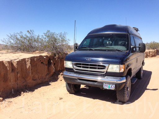
Some friends and I decided t0 tour around the Copper Canyon area of Mexico. The week before the trip I picked up the 2002 Ford E350 van from Agile Offroad after they installed their 4WD conversion. I had a week to get from Santee, CA to Douglas, AZ so decided to drive as close as possible to the California Arizona Mexico border. The route would take us on the Camino Del Diablo (The Devils Road) through a bombing range, a wildlife refuge, and a national monument. After that we would travel through an Indian reservation, national forest, a huge ranch and a national monument. You can read the the entire trip report and my other travels on my blog.
My thanks to the members in the Four Corners section of the forum for the help they gave me in plotting the route along the border and answering my questions.
The members of the Border Patrol that we met were very friendly and helpful. The only other people we saw on the trip were researchers from the University of Arizona and the Arizona Game and Fish Department. We did not feel threatened at any time along the 700 mile route.
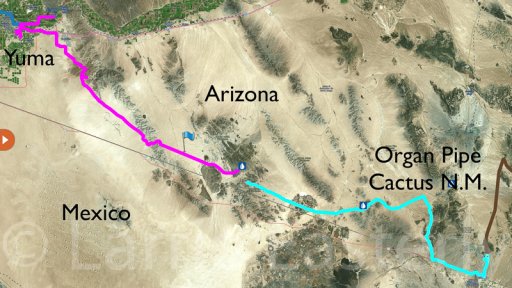
This is the approximate route of El Camino Del Diablo. It crosses the Barry M. Goldwater (bombing) Range, Cabeza Prieta National Wildlife Refuge and the Organ Pipe Cactus National Monument
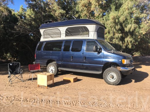
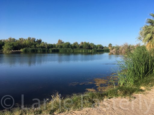
The first night was spent at Fortuna Pond near Yuma, AZ
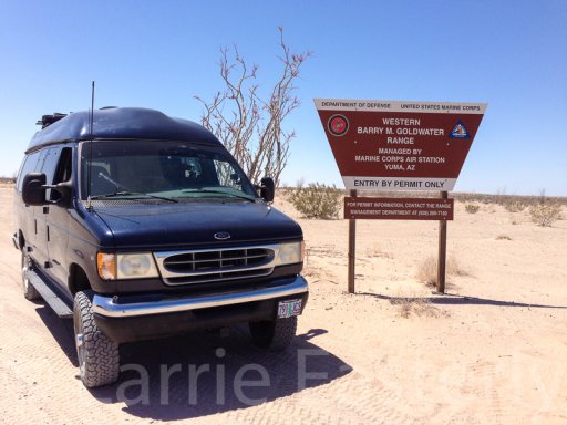
The next day we got our permits to cross through the area at the Marine Corps Air Station in Yuma
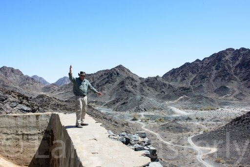
Our first stop was the La Fortuna Mine site. Very rough road to get there but worth it. Bruce, my traveling companion is standing on the wall of the old water tank.
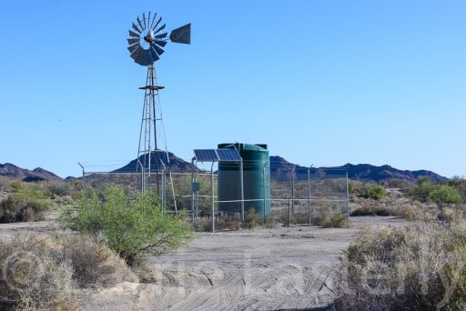
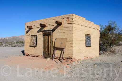
Camp that night was at Tule Well. The Border Patrol officer we met said it was safer than Papago Well which gets a lot of illegal immigrant traffic. It turned out that the campground was much better than Papago Well too. This is Tule Well. There is a building that is open to the public.
The Camino Del Diablo gets pretty deep in some areas.
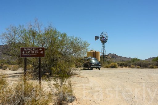
Papago Well
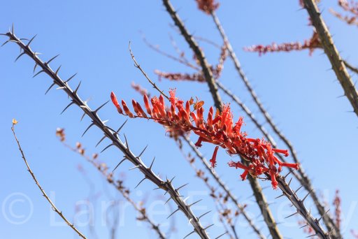
We were there in time to see the desert in bloom
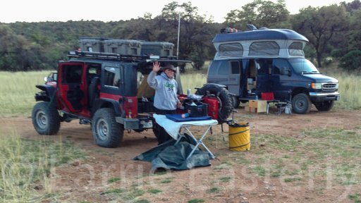
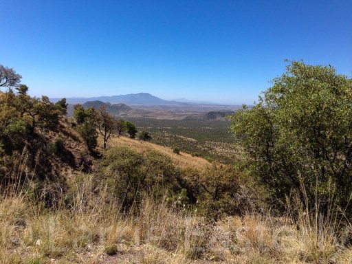
After we finished the Camino Del Diablo we continued following the border along Duquense Road east of Nogales. We camped at a dispersed site with a view of the San Rafael Valley.
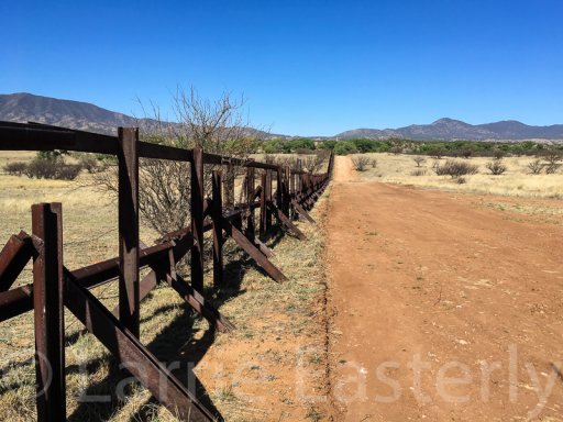
We were able to get right next to the border fence is a couple of areas. The current fence is designed to keep vehicles from crossing, not people. Just remember that someone is always watching the fence. After we left a Border Patrol agent flagged us down and asked if we were the ones who were at the fence. We said yes. He said have a good trip and left.
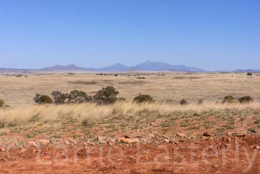
From there we crossed into the San Rafael Ranch towards the Coronado National Memorial.
My thanks to the members in the Four Corners section of the forum for the help they gave me in plotting the route along the border and answering my questions.
The members of the Border Patrol that we met were very friendly and helpful. The only other people we saw on the trip were researchers from the University of Arizona and the Arizona Game and Fish Department. We did not feel threatened at any time along the 700 mile route.
This is the approximate route of El Camino Del Diablo. It crosses the Barry M. Goldwater (bombing) Range, Cabeza Prieta National Wildlife Refuge and the Organ Pipe Cactus National Monument

The first night was spent at Fortuna Pond near Yuma, AZ


The next day we got our permits to cross through the area at the Marine Corps Air Station in Yuma

Our first stop was the La Fortuna Mine site. Very rough road to get there but worth it. Bruce, my traveling companion is standing on the wall of the old water tank.

Camp that night was at Tule Well. The Border Patrol officer we met said it was safer than Papago Well which gets a lot of illegal immigrant traffic. It turned out that the campground was much better than Papago Well too. This is Tule Well. There is a building that is open to the public.


The Camino Del Diablo gets pretty deep in some areas.

Papago Well

We were there in time to see the desert in bloom

After we finished the Camino Del Diablo we continued following the border along Duquense Road east of Nogales. We camped at a dispersed site with a view of the San Rafael Valley.


We were able to get right next to the border fence is a couple of areas. The current fence is designed to keep vehicles from crossing, not people. Just remember that someone is always watching the fence. After we left a Border Patrol agent flagged us down and asked if we were the ones who were at the fence. We said yes. He said have a good trip and left.

From there we crossed into the San Rafael Ranch towards the Coronado National Memorial.


