Enthusiast III
Just finished running the route about a week ago. We were on the trail for three weeks. Fantastic route.

Enthusiast III

Traveler II
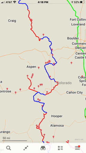
I spent a week along part of the CDR and part of my own routing in Colorado not to long ago. I don't understand why most of the CDR tracks send folks so far east in Southern, CO... away from the divide.Just finished running the route about a week ago. We were on the trail for three weeks. Fantastic route.

Enthusiast III

Traveler II

Enthusiast III
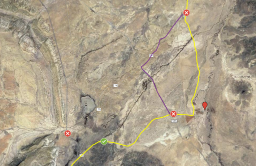
I am very familiar with public roads through private property. The best roads and views Kansas has to offer are the same deal. My assumption was the same for this road in NM. The part which turned me away was the sign stated, 'No Trespassing for ANY reason!' I had also missed a turn before this and encountered no trespassing signs that mentioned the use of explosives. I'll make a note on my map about the public road through ranch land.

Traveler II
I thought the routing through the cattle pens was odd (and intrusive) so I planned to go around. Next time I am through the area I'll trust my research a bit more through the ranch land.Doh!
Well then they should post a corresponding sign on the north end. Also they should tell the Continental Divide mountain bike race that they need to re-route as well. We were travelling north to south--for the second time in three years--and saw no such warning.
Looking at the map, hooking around on 75, a couple hundred yards behind the cattle guard, would put you right back on the "official" route in a mile or two. Through that cattle loading facility is an unnecessary routing anyway.


Enthusiast III

Traveler II

Enthusiast III
Not in Wyoming that I can recall. The only real trouble from the GPSKevin route is in lower Montana and upper Idaho. Montana has a bit of trail that is so steep, it is very unlikely a truck can climb it, and in Idaho there is a section that is OHV only. Easy re-routes on both.@Rollin Dirty Overland - Looking forward to your video clips. I am planning to run the route again this summer/fall, starting at Salida and heading north. Any got-ya's in WY?

Pathfinder III
1632

Influencer I

Enthusiast III

Enthusiast III

Enthusiast III

Enthusiast III

Member I

Influencer I
7010
A bud of mine mapped it with Hema. He was the photojournalist that captured the story. I have it on file, but it’s not mine to give. And even though I share lots of routes, I can tell you, it is much more gratifying building and following your own route. The CDT and BDR share a lot of roads. This would be a great start.So I looked through this old thread. Id like to pick up the "Continental Divide" trail from Durango, CO and take it North to Yellowstone next July 2021, so Im in the planning phase. But as far as I can tell, no one has actually posted any actual trail routes at all here. Are these routes some sort of guarded secret? I suppose it takes work and effort to map your own trail, so I would be willing to pay for that service if its not freely available somewhere on the internet. Is the Hema App the way to go? Do they have a good trail mapped out?


Member I

Enthusiast III
