Continental Divide 2021

  • HTML tutorial

Kent R

OB Executive Director
Staff member
Mod Team
Moderator
Member

Pathfinder III

5,200
El Dorado, Ca
First Name
Kent
Last Name
Reynolds
Member #

1632

Ham/GMRS Callsign
K6KNT
Service Branch
Retired Firefighter
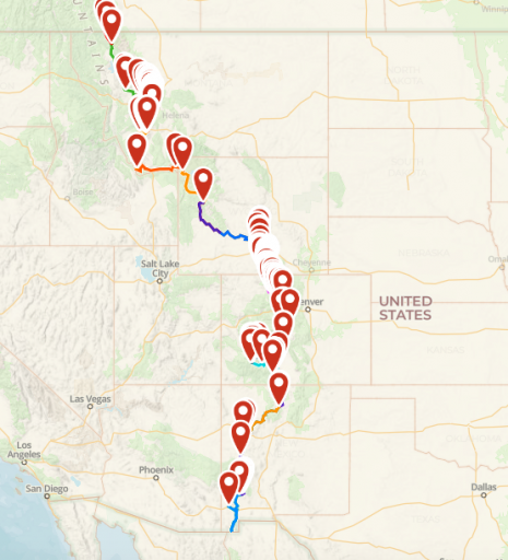
Four months from today, we start the Great Divide Route. Our group will follow the Continental Divide from the Mexican boarder to the Canadian boarder. 2700 miles in 16+- days. #adventureisneccessary #outfitandexplore

Screen Shot 2021-03-26 at 6.55.45 AM.png
 

genocache

Rank V
Launch Member

Advocate I

1,872
Boulder Creek, CA, USA
First Name
gene
Last Name
L
Member #

24181

Morning Kent,

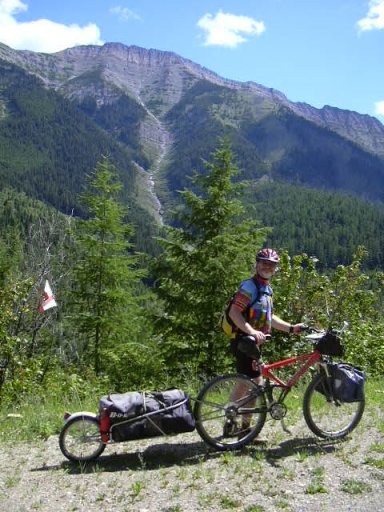
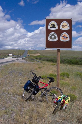
I mountain biked the top half of the GDMBR in the early part of this century, Canada to Silverthorne, over several years as vacation allowed. It was great, until I crashed, but that's not my point. Just my creds.

In the 90's among cyclists there used to be a saying; There are 3 ways to bicycle tour, 1) stop and smell the roses and take pictures, 2) stop and smell the roses, 3) what roses?

It looks like you have around 170mi average planned per day. That's doable in a car. Just don't loose sight of the journey to check off another bucket list item.

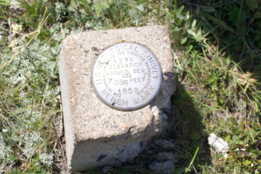
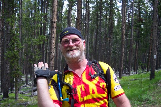
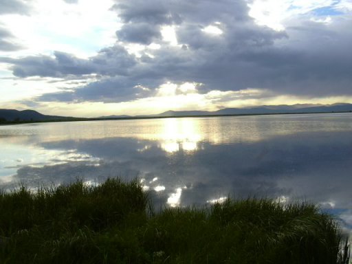
Stop at Crystal Park and dig for crystals, if Elkhorn Hot Springs is open, stop and soak, swim in the lakes, Take the hike down to Clearwater Lake, visit the Big Hole in Butte, see the Tie Hack Memorial, if you have a freezer take some popscicles to hand out to overheated cyclist!139.JPG786.jpg828.jpg883.jpg1012.jpg
 
Last edited:

GrumpyRam

Rank V
Member

Inventor I

2,489
Nevada
First Name
Dan
Last Name
DeV
Member #

27220

Service Branch
USAF (ret)
Kent,
Any chance you could upload your Gaia files? i saw a couple YouTubers do that trek and it intrigued me to put this on my trip list.
 
  • Like
Reactions: M Rose and Kent R

Kent R

OB Executive Director
Staff member
Mod Team
Moderator
Member

Pathfinder III

5,200
El Dorado, Ca
First Name
Kent
Last Name
Reynolds
Member #

1632

Ham/GMRS Callsign
K6KNT
Service Branch
Retired Firefighter
Kent,
Any chance you could upload your Gaia files? i saw a couple YouTubers do that trek and it intrigued me to put this on my trip list.
PM sent
 
  • Like
Reactions: M Rose

The Roach ...

Rank IV

Member III

1,116
Frisco, TX, USA
First Name
Steve
Last Name
V
Member #

25749

did Pie NM to a bit north of Silverton Colo. last year in my f250. kid got altitude sick and had to come back. I might be in ... this year in Defender 110 or Land cruiser... depending on where the LC's build is at. anyone taking a trailer?
 
  • Like
Reactions: Kent R

Kent R

OB Executive Director
Staff member
Mod Team
Moderator
Member

Pathfinder III

5,200
El Dorado, Ca
First Name
Kent
Last Name
Reynolds
Member #

1632

Ham/GMRS Callsign
K6KNT
Service Branch
Retired Firefighter
did Pie NM to a bit north of Silverton Colo. last year in my f250. kid got altitude sick and had to come back. I might be in ... this year in Defender 110 or Land cruiser... depending on where the LC's build is at. anyone taking a trailer?
Our group has been full for some time. But if you want when we get done I can send you the GPX file. We would have gone last year but our plans got changed by Covid.
 
  • Like
Reactions: M Rose

KonzaLander

Rank VI
Member

Traveler II

3,402
Junction City, Kansas, USA
Member #

15814

Ham/GMRS Callsign
KE0EBF
16 days to complete the route seems grueling. I have no doubt it could be driven in that amount of time, but you will constantly be pushing it hard each day and missing so much. If you add another week to your travel itinerary and take the time to soak in the sites/sights and smells, I think the journey will be more fulfilling.
 
  • Like
Reactions: Kent R

Kent R

OB Executive Director
Staff member
Mod Team
Moderator
Member

Pathfinder III

5,200
El Dorado, Ca
First Name
Kent
Last Name
Reynolds
Member #

1632

Ham/GMRS Callsign
K6KNT
Service Branch
Retired Firefighter

The Roach ...

Rank IV

Member III

1,116
Frisco, TX, USA
First Name
Steve
Last Name
V
Member #

25749

Great, ours is based on Kevins GPS file but honed in more on the dirt trails very close to the divide.
there are a few places in my files the road is more boulder trail... but it is RIGHT on the divide line.. the black tubing put in is tight next to the trail. the new mexico part is interesting... but after three days we were begging to see SOME form of water. lol
 
  • Like
Reactions: Kent R

rho

Rank V
Launch Member

Member III

2,031
SF bae area
First Name
Juliette
Last Name
Penning
Member #

18700

Ham/GMRS Callsign
AG6YB
That looks like an amazing trip! I feel there is something to be said about taking your time and taking in the sights, but generally I'm down for hauling ass on the trail all day, so 150-250 miles a day isn't a lot IMO. My only comment is when trying to hit that mileage and pace in the dirt is to not push the trucks too hard... Shocks, control arm bushings, mounts and so on really start taking a beating when doing trails at speed.
 
  • Like
Reactions: genocache

TRED LYT

Rank VI
Launch Member
Member

Influencer I

3,002
Laguna Beach, CA
First Name
Richard
Last Name
Sherman
Member #

11229

Ham/GMRS Callsign
KM6ZPJ
I've been planning a solo trip myself. That's pretty much how I roll most of the time. I do this to be away from people and commune with nature. I'd be super interested in knowing your route. I was planning on leaving Southern California in the 3rd week of July and taking whatever time it takes to go from the Mex border to Banff NP. I was planning about a month to do it all, including both legs to and from home. Question for y'all: What tools did you use to map your trail? I'd appreciate whatever intel you guys have come up with. I know there is no avoiding pavement on this trip, but I'd like to log as many miles in the dirt as possible. If you're using either GAIA maps or Magellan TRX, I have both if convenient to share. I'll be posting pictures along the way. Will be traveling with my wife and dog. Should be an epic journey. Also, for those of you who have done this, I'm assuming during the time of year we'll be traveling that there will be plenty of other folks doing the same thing. Going solo can be risky sometimes depending on the trail, but I'm thinking...not that risky. Penny for your thoughts. Based on what I've heard, there's a pretty good number of folks out doing the same thing and if I were to break down, chances are someone would happen by assuming we're not too far off the beaten path.
 
  • Like
Reactions: MeliMK

Kent R

OB Executive Director
Staff member
Mod Team
Moderator
Member

Pathfinder III

5,200
El Dorado, Ca
First Name
Kent
Last Name
Reynolds
Member #

1632

Ham/GMRS Callsign
K6KNT
Service Branch
Retired Firefighter
I've been planning a solo trip myself. That's pretty much how I roll most of the time. I do this to be away from people and commune with nature. I'd be super interested in knowing your route. I was planning on leaving Southern California in the 3rd week of July and taking whatever time it takes to go from the Mex border to Banff NP. I was planning about a month to do it all, including both legs to and from home. Question for y'all: What tools did you use to map your trail? I'd appreciate whatever intel you guys have come up with. I know there is no avoiding pavement on this trip, but I'd like to log as many miles in the dirt as possible. If you're using either GAIA maps or Magellan TRX, I have both if convenient to share. I'll be posting pictures along the way. Will be traveling with my wife and dog. Should be an epic journey. Also, for those of you who have done this, I'm assuming during the time of year we'll be traveling that there will be plenty of other folks doing the same thing. Going solo can be risky sometimes depending on the trail, but I'm thinking...not that risky. Penny for your thoughts. Based on what I've heard, there's a pretty good number of folks out doing the same thing and if I were to break down, chances are someone would happen by assuming we're not too far off the beaten path.
See PM
 

genocache

Rank V
Launch Member

Advocate I

1,872
Boulder Creek, CA, USA
First Name
gene
Last Name
L
Member #

24181

I've been planning a solo trip myself. That's pretty much how I roll most of the time. I do this to be away from people and commune with nature. I'd be super interested in knowing your route. I was planning on leaving Southern California in the 3rd week of July and taking whatever time it takes to go from the Mex border to Banff NP. I was planning about a month to do it all, including both legs to and from home. Question for y'all: What tools did you use to map your trail? I'd appreciate whatever intel you guys have come up with. I know there is no avoiding pavement on this trip, but I'd like to log as many miles in the dirt as possible. If you're using either GAIA maps or Magellan TRX, I have both if convenient to share. I'll be posting pictures along the way. Will be traveling with my wife and dog. Should be an epic journey. Also, for those of you who have done this, I'm assuming during the time of year we'll be traveling that there will be plenty of other folks doing the same thing. Going solo can be risky sometimes depending on the trail, but I'm thinking...not that risky. Penny for your thoughts. Based on what I've heard, there's a pretty good number of folks out doing the same thing and if I were to break down, chances are someone would happen by assuming we're not too far off the beaten path.
Check out Adventure Cycling; Discover What Awaits
 

Sparksalot

Rank VI
Launch Member

Influencer III

4,312
Bastrop County, TX, USA
First Name
Rex
Last Name
Drake
Member #

19540

Ham/GMRS Callsign
KI5GH
Service Branch
Air Force
Morning Kent,

I mountain biked the top half of the GDMBR in the early part of this century, Canada to Silverthorne, over several years as vacation allowed. It was great, until I crashed, but that's not my point. Just my creds.

In the 90's among cyclists there used to be a saying; There are 3 ways to bicycle tour, 1) stop and smell the roses and take pictures, 2) stop and smell the roses, 3) what roses?

It looks like you have around 170mi average planned per day. That's doable in a car. Just don't loose sight of the journey to check off another bucket list item.

Stop at Crystal Mtn and dig for crystals, if Elkhorn Hot Springs is open, stop and soak, swim in the lakes, Take the hike down to Clearwater Lake, visit the Big Hole in Butte, see the Tie Hack Memorial, if you have a freezer take some popscicles to hand out to overheated cyclist!View attachment 192600View attachment 192601View attachment 192602View attachment 192603View attachment 192604
Which crystal mountain, Colorado or Idaho?
 

Kent R

OB Executive Director
Staff member
Mod Team
Moderator
Member

Pathfinder III

5,200
El Dorado, Ca
First Name
Kent
Last Name
Reynolds
Member #

1632

Ham/GMRS Callsign
K6KNT
Service Branch
Retired Firefighter
If anyone is interested in the GPX file for the route, message me here on the forum. @Kent R
 

TRED LYT

Rank VI
Launch Member
Member

Influencer I

3,002
Laguna Beach, CA
First Name
Richard
Last Name
Sherman
Member #

11229

Ham/GMRS Callsign
KM6ZPJ
Check out Adventure Cycling; Discover What Awaits
Thanks for your tip. I really appreciate it. I'm reading up on just about anything Continental Divide. Having some fun mapping out my route on GAIA Maps and my Magellan TRX7 as a back up. I usually just point and go. This planning stuff takes a lot of time. But I am interested in making the best of the time I have, so points of interest are high on my list of places to stop by along the way...even if they're a little out of the way. I have been watching YouTube videos of the MTB race from Banff NP to Mexico. So much of it is single track and not 4WD compatible, but I will have my moto in tow, so I'll be able to do some exploring from my base camps should time permit. Much thanks again!!
 

Kent R

OB Executive Director
Staff member
Mod Team
Moderator
Member

Pathfinder III

5,200
El Dorado, Ca
First Name
Kent
Last Name
Reynolds
Member #

1632

Ham/GMRS Callsign
K6KNT
Service Branch
Retired Firefighter
If anyone is interested in following along on our InReach track we start the trail on July 27 at Crazy Cook Monument in NM and end in Montana at the Canadian border.