Which tablet or Laptop?

  • HTML tutorial

1Louder

Rank VI
Launch Member

Member II

4,187
AZ
First Name
Chris
Last Name
K
Member #

1437

Ham/GMRS Callsign
K1LDR
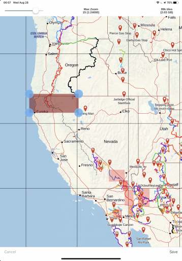
For nav I tried a n Android. Lenovo. But kept running up against. A problem with detail on the maps. I finally figured out that all programs for nav Gaia Bcn topo USA that I have tried all have a 100,000 tile limit which sounds like a lot but isn’t when you are trying to load large areas. Based on that alone there is a strong argument for a dedicated gps with. Preloaded topo. For the whole country that you can zoom to say a level 15 not sure what scale that is guessing somewhere around 1” = 100 ft Just a guess. But with decent enough detail and resolution I really like apple products but. I just don’t see any of them having enough memory to preload a large area like the northern Sierras. If someone can tell me how to do that then I’ll happpily go buy another apple product.
Someone?
Anyone?
Thanks
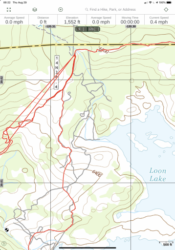
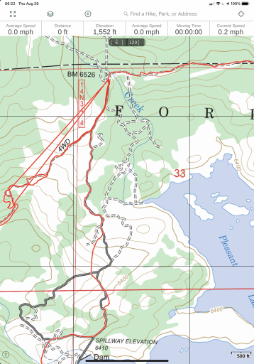
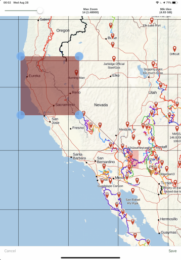
Your question is very dependent on the map layer type. For example in Gaia, the Gaia top layer at level 14 (max zoom) would be around 15gb for the state of CA. US Topo probably 4 times that size for California. Start adding multiple layers who knows. My 128go iPad works well. Look at the storage difference between the 2 map layers for around 100,000 tiles.

The Garmin/Delorme app that works with my InReach has basic maps which you can download for the entire country.

IMHO you need to download specific areas as you go to get the most useful data. An app like Gaia provides this. I think Gaia is the most useful app out there based on 6 years of use. If you want to discuss its merits or lack thereof it would be helpful to do this in the Ask About Gaia GPS thread.

There are stand alone products like the new Garmin Overlander (I think that’s what it’s called) but I think the level of detail for the maps is weak.
8F89E0DB-82D9-41FA-B61B-9BFFDB280739.png
Gaia Topo Layer

4E601819-76B8-4755-B63E-77AA51D73008.png

US Topo Layer
 

Wanderer

Rank III
Launch Member

Enthusiast III

646
Carlsb CA
First Name
Ralph
Last Name
Jeffery
Member #

14615

Looking at the scale you have Gaia at 1:48000. That’s twice as big as a standard 7.5 minute usgs quad That’s really not very good even at a 1:24000 1” =2000’. Is just basic. I am a geologist and have the last 45 years looking at topo maps I can tell you that even a well drawn accurate topo map where 1”=2000 feet is missing detail. If you are out in rough country trying to view. A map at 1:2000 let alone. 1:4000 you are gonna miss stuff. Using a map like that say in the Oregon desert where you don’t have a lot of relief could be problematic. Think of the contour intervals whole hills disappear with large enough contour intervals. A good map with a decent scale is a work of art
 
  • Like
Reactions: Schake

1Louder

Rank VI
Launch Member

Member II

4,187
AZ
First Name
Chris
Last Name
K
Member #

1437

Ham/GMRS Callsign
K1LDR
Looking at the scale you have Gaia at 1:48000. That’s twice as big as a standard 7.5 minute usgs quad That’s really not very good even at a 1:24000 1” =2000’. Is just basic. I am a geologist and have the last 45 years looking at topo maps I can tell you that even a well drawn accurate topo map where 1”=2000 feet is missing detail. If you are out in rough country trying to view. A map at 1:2000 let alone. 1:4000 you are gonna miss stuff. Using a map like that say in the Oregon desert where you don’t have a lot of relief could be problematic. Think of the contour intervals whole hills disappear with large enough contour intervals. A good map with a decent scale is a work of art
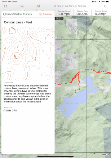
All I can say is Gaia provides plenty of detail. It depends on the map layer you choose. No dedicated GPS is going to provide the same level as what Gaia can. Yes it is time consuming to download the maps but you can get the level of detail. US Topo offers some contour lines. You can zoom down to 50’ although 500-1000’ is fine for me.

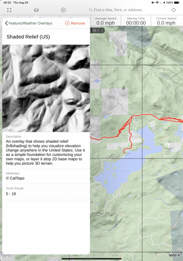
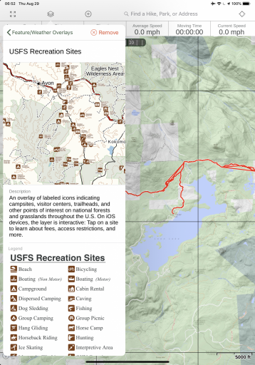
71F5943F-ED69-4F1B-9EDA-C192CA4514C9.png

0DCD6826-00B0-4E8A-8C6A-86242A80F5DB.png

USFS 2016 Layer

2FEAE815-E4EE-4CFF-B323-99A063C90533.png

46EE29CE-DA24-4BAF-9374-171ADE77B5BA.png

762B78B4-4B63-43EE-A0BA-D910DF647973.png

Many other map layers available. A complete list is available on the Gaia GPS website.

Good luck in your search.
 
Last edited:

Dualsportrider

Rank III
Launch Member

Enthusiast III

676
DFW
First Name
Mike
Last Name
Rizzo
Member #

21327

Ham/GMRS Callsign
NA
Tab S3 for maps, Retired wife's S5 Active for wireless backup camera, my retired S5 Active for WiFi to my Dometic frig to monitor if it came unplugged while hitting bumps. Has happened, Kodaik to power the fridge.
Pumpkin Android stereo that replaced stock stereo.
Samsung S8 Active for hot spot for Pumpkin and Tab S3 to have internet connection.
 

rsweet

Rank V

Member III

2,298
Huntington Beach, CA, USA
First Name
Robert
Last Name
Sweet
Member #

17264

Ham/GMRS Callsign
KN6IHR
Another question: I was told by someone at the apple store that Apple tablets lack GPS connectivity on their own, and must have cellular capability, like my smartphone. Is that correct?
If you have a cellular enabled iPad (why would you not?) it has GPS. It works without cellular just like an iPhone. I use all Apple because I am a unix nerd. Using in conjunction with a Garmin inReach, you will never be completely off the grid. I use the inReach for SMS incase kids/work needs to get a hold of me in emergencies. iPad is permanently mounted with a RAM mount. I charge via solar or my dometic lithium.
 

SinisterJK

Rank VI
Launch Member

Educator I

3,947
Orlando, FL, USA
First Name
Bryant
Last Name
S
Member #

20141

Ham/GMRS Callsign
GMRS: WRFC851
Not gona lie I run Gaia on an Ipad on my jeep and I love it. You don't need the subscription however I do have the subscription and use the hell out of it. Between Gaia and all the premium maps and Avenza free version I'm definitely a happy camper. I don't know what android does. I'm an apple guy but regardless of the platform I know Siri cant do half of what Gaia does. I don't think the platform such as IOS or Android is such a thing its more of what the stand alone app can do. I'm sure shes just as mighty on either one to be honest.
 
  • Like
Reactions: tangrignon

m_lars

Rank V
Launch Member

Off-Road Ranger I

2,041
Heber City, Utah
First Name
Matt
Last Name
Larson
Member #

8212

Ham/GMRS Callsign
KJ7ATX
If you have a cellular enabled iPad (why would you not?) it has GPS.
Expense...
I just bought a new samsung tab A 8 LTE for my jeep tablet. I was going to use Gaia on my ipad, but it's just too big, and 49.99 for subscription services, NAH! I think im moving to android with all my devices.
What subscription services are you referring to? Gaia premium? If that’s not available on Android I’d say that makes iOS a no-brainer.
 

m_lars

Rank V
Launch Member

Off-Road Ranger I

2,041
Heber City, Utah
First Name
Matt
Last Name
Larson
Member #

8212

Ham/GMRS Callsign
KJ7ATX
I mean, I am using mapping on android now, I paid one time payement of 12.00. If I move to Gaia, i pay 50 bucks a year. NOPE. Android it is. I was using gaia for a bit, BCN is a better system.
Yeah, a premium subscription is not required. It does have some very nice maps and overlays that are handy, the private landowners overlay comes to mind. It overlays private land over your chosen base layer and includes the landowner of record, giving you the opportunity to reach out for permission during trip planning. One thing I do like about paid apps (even though I’m cheap and usually avoid them) they are usually maintained at a WAY higher level. Back when I used android it seemed like there were tons of apps available that were initially thrown out in the store and then abandoned. Glad you found something you like.
 

Schake

Rank V
Launch Member

Enthusiast III

2,191
Ellicott City, MD, USA
First Name
Ken
Last Name
Schaffer
Member #

14859

I mean, I am using mapping on android now, I paid one time payement of 12.00. If I move to Gaia, i pay 50 bucks a year. NOPE. Android it is. I was using gaia for a bit, BCN is a better system.
Please explain what BCN is. I would like to check it out.
 

Dualsportrider

Rank III
Launch Member

Enthusiast III

676
DFW
First Name
Mike
Last Name
Rizzo
Member #

21327

Ham/GMRS Callsign
NA
Expense...

What subscription services are you referring to? Gaia premium? If that’s not available on Android I’d say that makes iOS a no-brainer.
I have Gaia premium on android devices. But there's other mapping software like Back Country Navigator, has a subscription of $20 a year. Seems about as good as Gaia. Then US Topo Maps is good and free. with Gaia it seems really slow sometimes, downloading maps while the others seem much faster. I just around and usually run different ones to compare. Earthmate is ok too and you can overlay their maps with USGS Topo maps.
 

1Louder

Rank VI
Launch Member

Member II

4,187
AZ
First Name
Chris
Last Name
K
Member #

1437

Ham/GMRS Callsign
K1LDR
Please explain what BCN is. I would like to check it out.
Back Country Navigator

Someone else asked about Gaia Subscription. They are the same on both operating systems. Also, pay once and use on all of your devices.
 
  • Like
Reactions: Schake

Enthusiast III

1,212
Grand Falls-Windsor, NL, Canada
First Name
Steve
Last Name
Adams
I have gaia on my ipad. it's just basic mapping for canada unless you pay for the premium services. Where as BCN, I paid a one time cost of 12 dollars, unlocked to pro version and I have topo, terrain, sat imaging etc all at my fingertips. Its a much better deal, and I can create trips using the Mobile Atlas Creator on my Windows desktop. BCN for the win. More useful, cheaper, and easy to use.
 
  • Like
Reactions: Schake

m_lars

Rank V
Launch Member

Off-Road Ranger I

2,041
Heber City, Utah
First Name
Matt
Last Name
Larson
Member #

8212

Ham/GMRS Callsign
KJ7ATX
I have gaia on my ipad. it's just basic mapping for canada unless you pay for the premium services. Where as BCN, I paid a one time cost of 12 dollars, unlocked to pro version and I have topo, terrain, sat imaging etc all at my fingertips. Its a much better deal, and I can create trips using the Mobile Atlas Creator on my Windows desktop. BCN for the win. More useful, cheaper, and easy to use.
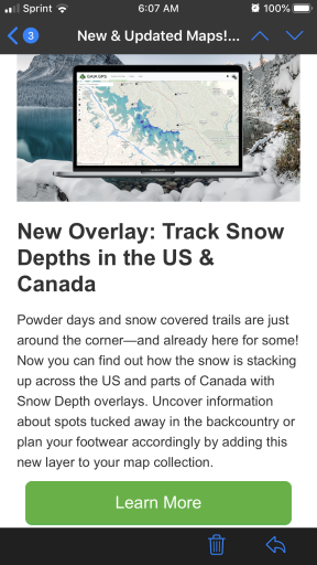
Gaia started out as free with a one time premium upgrade as well, though I think it was $20. I was a little perturbed when I got the email stating that they were moving to subscriptions. I think they realized it was an unsustainable model if they were going to stay/become the premier mapping service. So far they have continued to add and improve things. I just got an email last night that they are adding a snow depth layer. 68DF9BB6-8FA3-42B8-9CEB-4117CE5BBF80.png
 
  • Like
Reactions: Schake

1Louder

Rank VI
Launch Member

Member II

4,187
AZ
First Name
Chris
Last Name
K
Member #

1437

Ham/GMRS Callsign
K1LDR
I have gaia on my ipad. it's just basic mapping for canada unless you pay for the premium services. Where as BCN, I paid a one time cost of 12 dollars, unlocked to pro version and I have topo, terrain, sat imaging etc all at my fingertips. Its a much better deal, and I can create trips using the Mobile Atlas Creator on my Windows desktop. BCN for the win. More useful, cheaper, and easy to use.
BCN is not available on iOS. The lone developer has been trying for a long time, had a successful Kickstarter campaign (in terms of generating funds) and still has not produced a product. Is is cheaper on Android? I think it depends on which membership level.

Is it better than Gaia? I would say that depends on the user. For me Gaia is the most feature rich and what I choose to use. If someone doesn't need all of those then yes there are alternative apps.

A complete comparison of the Gaia membership levels is here, Gaia GPS Membership - Hiking Trails, Hunting, Camping, 4x4 | Gaia GPS. I would suggest folks read and decide for themselves what they need vs what any of us say, INCLUDING me. With that said Gaia has built a strong development team, not a team of 1 or 2. They have dedicated custom support people (who you should reach out to if you have questions) and yes they continue to improve the product nearly every month.

I guess my argument, ad nauseam, is buy what works for you. What works for any of us does not make it the "best" app.

@m_lars mentioned the switch from a one time for, with premium option, to 3 tier (including basic free) membership model. The app has been improved many times over since this change. It was a change at least 2 years ago.

Here's a year old comparison of the apps: Navigation App Review: Gaia GPS vs Backcountry Navigator Pro Gaia has been updated close to 25 times since this review with minor and major updates. Not sure how often BCN has been updated in the same timeframe.

For ANY app you are considering take a look at the apps support site, when was the app last updated, how often is it updated, and then consider reviews.
 
  • Like
Reactions: Schake

El-Dracho

Ambassador, Europe
Moderator
Member
Supporter
Investor

Off-Road Ranger III

13,288
Lampertheim, Germany
First Name
Bjoern
Last Name
Eldracher
Member #

20111

Ham/GMRS Callsign
DO3BE
Hi,
I have a Samsung Tab with built in GPS and a 10" screen. This is in use now for 6 years. At the beginning with a ruggedized case which was broken after some years. Now since 2 years the tablet only sits in the RAM mount - no issues at all even in rough terrain. As the tablet is quite old it has 16GB space only, so I use a microSD expansion for all the maps. For navgation I run Oruxmaps. I think I will replace the tablet soon (as mentioned above quite old now and a bit slow in compariosn to newer ones), I will go again for a 10'' tablet with bigger memory space.
Safe, travels, Bjoern
 

Citizen Rob

Rank IV
Launch Member

Enthusiast III

945
Stockton, CA, USA
Member #

9983

Ham/GMRS Callsign
KM6YSM
I run a Samsung S4 with Backcountry Navigator PRO and its absolutely fantastic. I have all of California and Nevada saved to the highest detail and still have plenty of storage. Mount the entire thing on a ram mount and I've never had a problem. Grabs GPS quickly an has a really great battery life.
 

wvjeeper

Rank IV
Launch Member

Off-Road Ranger I

971
WV
First Name
Derek
Last Name
T
Member #

20441

Ham/GMRS Callsign
K8CD
I've been using an iPad Air 2 with a Garmin GPS/GLONASS blutooth receiver for a couple of years now. Software is Gaia as I use it for a lot of different uses including VFR sectional charts and topographic charts. I've been pretty happy with it.
 

tangrignon

Rank II
Launch Member
Member

Enthusiast I

404
san francisco, ca
Member #

2671

IPad Pro (10.5") 512GB with Gaia GPS Premium, Earthmate (connected via bluetooth to my Garmin InReach Mini communicator). Also use Google maps (offline), and Ultimate CG (Ultimate US Public Campground project). Just used it on a 2 week 2000 mile tour of SoCal deserts and was a great combination.
 
Last edited: