What would your dream overlanding car computing setup include?

  • HTML tutorial

1Louder

Rank VI
Launch Member

Member II

4,187
AZ
First Name
Chris
Last Name
K
Member #

1437

Ham/GMRS Callsign
K1LDR
For all that want satellite views why would you use an app on a tablet which supports that? Gaia, BCN, many other options? If you are bold install an Android Radio in dash and run these types of apps in it. You would just need a large SD card for all of the maps.

I have a bluetooth Ultragauge for iOS to track vehicle parameters. I don't have a need to look at it all the time. It's nice. I almost like the old style unit with its dedicated display better. Not sure what I would run on a raspberry pi. They are super cool devices but some many apps available on tablets now. Maybe integrate a tablet into your dash. Lots of folks have done that and add an amplifier to them for music.

As for APRS there is an app called APRS Pro that claims it can take radio signals and show everyone's location but I have found it does not work well outside of cell coverage. Using a Baofeng Radio and even an external antenna it still could not grab the signals reliably. It would be nice if Kenwood or other manufacturers could make this easier to do.

For solar I have seen a few solar controllers with associated apps to read the data. Thing is that is not something I need to stare at all day. It's something I can glance at on a standard controller every so often. NOW BREAKING NEWS! I just got back from Lowes and they have an Samsung oven you can control over wifi! I mean while driving just open the app and pre-heat your oven! They also have a fridge that has cameras in it. So when you are at the store you can log into your fridge and see what you might need to buy. Thank goodness for innovation....... :)

As for internet you could always spend BIG bucks and get a hotspot satellite device.
 
Last edited:

Ubiety

Rank VI
Member

Explorer I

5,221
Sammamish, WA, USA
First Name
Greg
Last Name
Ubiety
Member #

6193

Ham/GMRS Callsign
Ribs
I don't have a need to look at it all the time.
Totally agree with that. I want the info in one convenient place, a central hub if you will. I typically have several GPS units running and realize that could be one GPS with its data shared via gpsd. Tablets are great and get you most of the way there re: form factor but they (ios at least) tend to be fairly locked down. Yes I could get the dev kit...

As for internet you could always spend BIG bucks and get a hotspot satellite device.
For cheap RX only "internet" via sats take a look at outernet, supposedly you can route APRS to outernet making a poor man's satcom. I'm going to be giving this a try in Sept from the wilds of MT, started a thread over in the comm section.

<shameless plug>
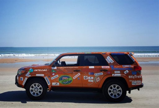
This is what I am waiting for - this overlander maintains satellite IP connectivity while in motion with a revolutionary new satellite antenna (solid state, no moving parts, unicorn dust). You cannot see the antenna because it fits in the headliner (roof is not steel).

connectedCar.jpg

</shameless plug>
 
  • Like
Reactions: Tinker

1Louder

Rank VI
Launch Member

Member II

4,187
AZ
First Name
Chris
Last Name
K
Member #

1437

Ham/GMRS Callsign
K1LDR
I've had a similar thought too. Radio hookup would be great, could use it to send/receive messages via Winlink or APRS as well. I think my biggest want/need would be for Google Earth. Almost every single time I'm out run into a situation where I'd love to just be able to pop up satellite images of the surrounding area to help with mapping/exploration. If I had a full computer I could download LOTS of offline google earth data and I'd also be able to more easily plan or reroute routes to export to Hema/Gaia for navigation. I typically plan my routes in Google Earth before I head out, but once i'm out, if there's a curious looking side trail that i didn't route, or a locked gate that i wasn't expecting, it can be kind of a bummer. I mean, I can still navigate around with USGS or CalTopo maps, but it's really really nice to just be able to peek at some satellite images to get a quick sense of the area.
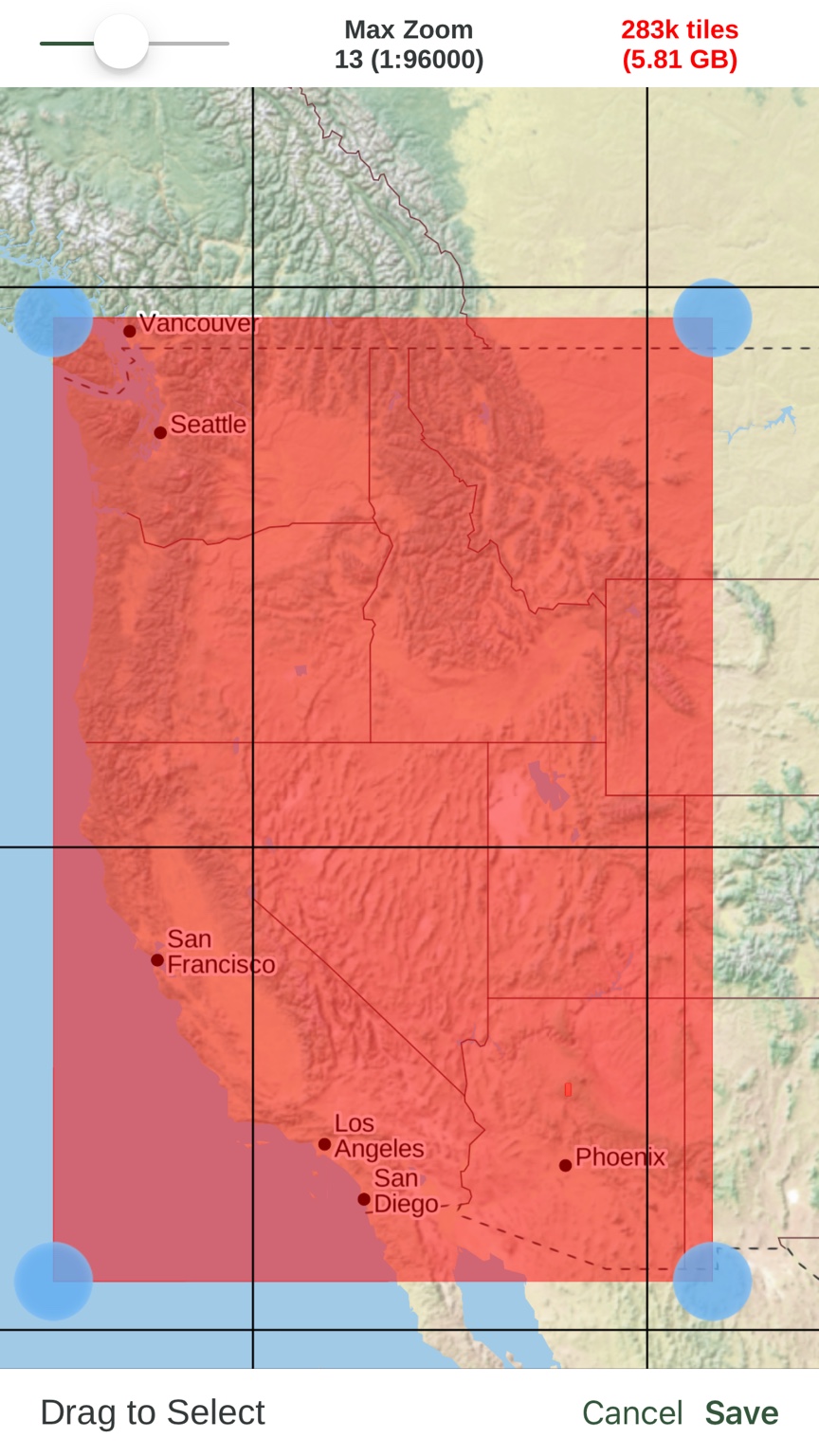
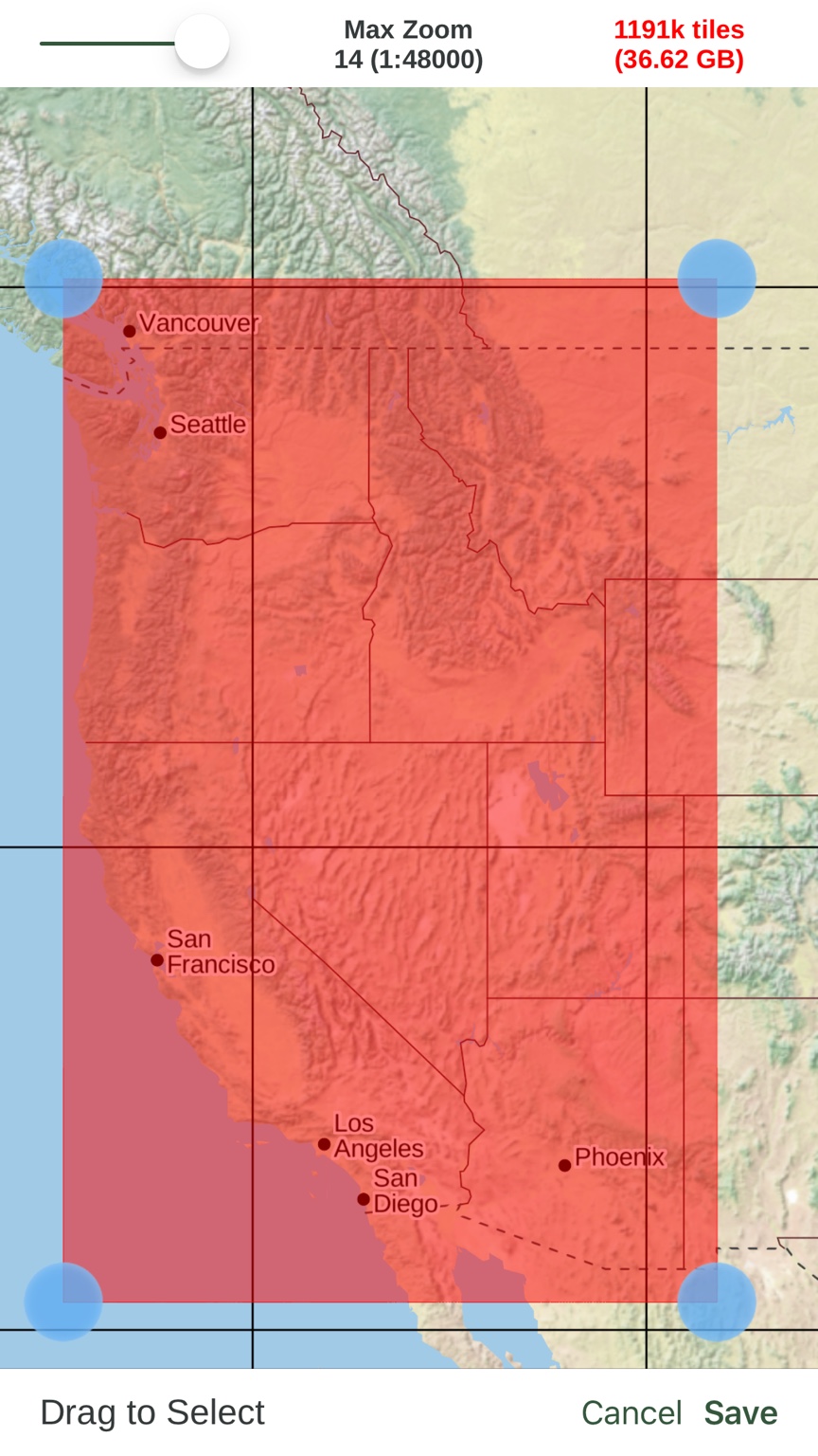
I did a test in Gaia to see how large the download files would be for Google Sat. Get above 14 and you need terabytes of space. However, these examples get you pretty good zoom levels. I would always break these down to smaller files. For example, by state.


Here are some topo layer examples:


If you have a 128gb or more device you should have plenty of room. I generally don't do these big wide views/downloads. Smaller more specific regions take up much less space. A 10.5" iPad Pro with 512GB of storage is $949. Just a wee bit more than a Raspberry PI device! But a more simplified solution. I get wanted to build something totally custom. If I did that I would want a really good "retina" like touchscreen display and would run Android on the RP.


Sent from my iPhone expect typos, grammatical errors, and any other invalid excuse.
 
Last edited:

Ubiety

Rank VI
Member

Explorer I

5,221
Sammamish, WA, USA
First Name
Greg
Last Name
Ubiety
Member #

6193

Ham/GMRS Callsign
Ribs
I did a test in Gaia to see how large the download files would be for Google Sat.
Thanks! I'll need about 1/5 (or less really) of this to cover my Sept trip. Would you reccomend Google Sat over topos, or in addition to? I already have tracks/waypoints for the areas that we are going, but we want to be covered ;)

Just a wee bit more than a Raspberry PI device!
Hahaha - but oh so much more useful! One alternative is a cheap android tablet - but I am completely unfamiliar with android.
 

1Louder

Rank VI
Launch Member

Member II

4,187
AZ
First Name
Chris
Last Name
K
Member #

1437

Ham/GMRS Callsign
K1LDR
Thanks! I'll need about 1/5 (or less really) of this to cover my Sept trip. Would you reccomend Google Sat over topos, or in addition to? I already have tracks/waypoints for the areas that we are going, but we want to be covered ;)
I think there are a lot better options than satellite but that was the question you asked. It really is going to depend on the application you choose to use. Gaia has the most options of any map application out there. Here's a complete list, https://help.gaiagps.com/hc/en-us/articles/115003524587 Where available I like the USFS 2016 and USFS Classic maps. They provide the most detail on trail names and forest road names. Again a lot depends on where you are going. I don't what to derail this thread so if you have further questions pop into one of the other app related threads.

Thanks!
Chris
 

Ubiety

Rank VI
Member

Explorer I

5,221
Sammamish, WA, USA
First Name
Greg
Last Name
Ubiety
Member #

6193

Ham/GMRS Callsign
Ribs
I don't what to derail this thread
No derailment, appreciate your input!
Discovered the Duet app today that allows an iPad to act as an input/display device for a Mac/Win PC. Giving a try now :)
 

1Louder

Rank VI
Launch Member

Member II

4,187
AZ
First Name
Chris
Last Name
K
Member #

1437

Ham/GMRS Callsign
K1LDR
No derailment, appreciate your input!
Discovered the Duet app today that allows an iPad to act as an input/display device for a Mac/Win PC. Giving a try now :)
Hey thanks a lot for costing me $9.99. :grinning:
I think that would be nice with a 12.5" iPad Pro. For my purposes, not yours.
 

Ubiety

Rank VI
Member

Explorer I

5,221
Sammamish, WA, USA
First Name
Greg
Last Name
Ubiety
Member #

6193

Ham/GMRS Callsign
Ribs
Has anyone tapped into an iPad Mini? Looks like a great size...
They are a great size! My Mac zealot buddy prefers the mini (he has them all) and my son has one which I occasionally steal to fly the drone. I keep talking about the iPad2 because I have one and want to see a continued use for it - rather than buy a new one.
 

Ubiety

Rank VI
Member

Explorer I

5,221
Sammamish, WA, USA
First Name
Greg
Last Name
Ubiety
Member #

6193

Ham/GMRS Callsign
Ribs
Oh yeah, did see the CarPlay enable alpine unit for the jeep. $1700 of awesomeness (on sale)
 

brien

Sonoran Space Program
Staff member
Moderator
Member

Off-Road Ranger I

3,402
Tucson, AZ
First Name
Brien
Last Name
Wankel
Member #

3553

Ham/GMRS Callsign
K7XPO
Absolutely! Part of my hope is for "group participation" - something easy/cheap that more folks than just I would enjoy. Trying to get a feel for folk's comfort level, etc. - and to learn what others are doing to embetter what I am thinking about.

Thanks for making me think about it :) I am leaning towards RasPi3 with some graphical software to wrap it all in that provides a unified look and feel. Will have to look and see what open source projects could be assimilated.
Yeah, I agree, in the spirit of easier and more affordable group participation/collaboration, RaspberryPi, and other similar linux-based devices, is probably our best bet to start.
 

brien

Sonoran Space Program
Staff member
Moderator
Member

Off-Road Ranger I

3,402
Tucson, AZ
First Name
Brien
Last Name
Wankel
Member #

3553

Ham/GMRS Callsign
K7XPO
I did a test in Gaia to see how large the download files would be for Google Sat. Get above 14 and you need terabytes of space. However, these examples get you pretty good zoom levels. I would always break these down to smaller files. For example, by state.

If you have a 128gb or more device you should have plenty of room. I generally don't do these big wide views/downloads. Smaller more specific regions take up much less space. A 10.5" iPad Pro with 512GB of storage is $949. Just a wee bit more than a Raspberry PI device! But a more simplified solution. I get wanted to build something totally custom. If I did that I would want a really good "retina" like touchscreen display and would run Android on the RP.
Yeah, to clarify, my original comment about Google Earth was about both the offline mode and and the ease and usability of creating routes and mapping and such in the context of having a vehicle mounted /laptop/. I already use Hema or Gaia for downloading satellite data from time to time but it's currently 100% ideal for actual route creation in the field. Following routes i've already mapped out or created in Google Earth it works great and that's realistically 90% of my use cases. To give some context, my process for creating and researching routes in Google Earth typically involves quite a bit of semi-random searching around for interesting looking areas (things that look like mines, ruins, plane crashes, interesting looking geological features, possible epic views, etc) and then using a combo of satellite data, usgs map overlays, usfs map overlays and the like to try and route my way backwards from the interesting spot back to some sort of a starting point that I know is open. This can be quite tedious at times, even with my 3D mouse, and I glean a lot of information by being able to see and navigate through the full 3D renders in Google Earth. There is no real analogy to my process available on a mobile device yet. Possibly someday if Google Earth mobile app ever lets you download offline data and import map overlays like the desktop client.

My desire of having a vehicle mounted laptop (which is not really an option for me anyway, due cab space) has now morphed into the main theme of this thread which is to *make* something to integrate into the vehicle itself. Sure, most of the stuff we'd probably use it for could be done on a phone or tablet, but with a homebrew device we can make use of the GPIO ports to actually hard-wire bits of the vehicle into the computer. That sounds like my kind of fun.
 

Christian Schrader

Rank IV
Launch Member

Advocate II

1,027
San Clemente, CA
Member #

4598

I have a tiny touchscreen from Adafruit on a RasPi but it uses pins off of the I/O block for the "monitor" connection - I'll have to take a look for the dedicated spot. The RasPi3 has the power to do it me thinks and is along the lines of what I am thinking about.

Had the iPad running on the way in to work this AM and thought of another thing - night driving mode :) Man that thing was bright.
They have an after hours setting/dim the display [emoji1362]


Sent from my iPad using OB Talk
 

brien

Sonoran Space Program
Staff member
Moderator
Member

Off-Road Ranger I

3,402
Tucson, AZ
First Name
Brien
Last Name
Wankel
Member #

3553

Ham/GMRS Callsign
K7XPO
I just ran across this RPI + 7" touchscreen display case, but according to page, the holes don't align with the RPI3

would be perfect. maybe holes could be retrofitted for an RPi3 with a dremel. Might be worth the $25 just to find out at some point.

there is a similar case that does fit the RPi3 but it doesn't have that great adjustable mount:

I did a quick search to see what's available on thingiverse and found this: https://www.thingiverse.com/thing:1384316 we could modify it to add an adjustable hinge point. Maybe i'll dig around there some more and see if there is one buried that has the hinge already designed. My local uni has a 3d printer lab that takes print jobs from the public for just a few bucks a print.
 

brien

Sonoran Space Program
Staff member
Moderator
Member

Off-Road Ranger I

3,402
Tucson, AZ
First Name
Brien
Last Name
Wankel
Member #

3553

Ham/GMRS Callsign
K7XPO
I just ran across this RPI + 7" touchscreen display case, but according to page, the holes don't align with the RPI3
I misread the listing, this DOES work with the RPi3!
 

brien

Sonoran Space Program
Staff member
Moderator
Member

Off-Road Ranger I

3,402
Tucson, AZ
First Name
Brien
Last Name
Wankel
Member #

3553

Ham/GMRS Callsign
K7XPO
Linky linky? :) Thanks for the input - all good stuff. Causing me to really think about what I am after!
You must also use adblock like me? :D

I posted the links and they didn't show up in my posts. Took me a few minutes but I figured it out. OB converts amazon links to display ads which adblock then blocks. I disabled adblock for overlandbound.com and then they started showing up as expected
 

brien

Sonoran Space Program
Staff member
Moderator
Member

Off-Road Ranger I

3,402
Tucson, AZ
First Name
Brien
Last Name
Wankel
Member #

3553

Ham/GMRS Callsign
K7XPO
OK, i've been noodling on this for a couple of months now, and while I was ripping apart the innards of my Jeep this weekend to relocate some of the poorly located USB ports, I figured now would be a good time to also wire in a new connection to the CAN bus. I've ordered a CAN bus shield for arduino and raspberry pi and an extra stereo wiring harness that I can use for creating a t-connection off the radio for the new CAN bus connection without mucking with the factory wiring. Everything should arrive tomorrow so I can fully dive in to the project.

While I was in there, I also noticed how simple the connections are for the climate controls. I might be able to tap into those and control them through the raspberry pi as well if they are not signed signals. I'll jump down that rabbit hole some other day though.

Here's the current state of my dash and center console :sweatsmile: :
 
  • Like
Reactions: Jimmy P