hey NW neighbors! We're getting ready for our 3 week Roadtrip north from CA through WA into Canada. The plan is to run the length of WABDR into Canada. I've accepted the fact there will be portions that we can't run due to snow, just wondering if any local OB members have any additional info about which sections may be closed or impassible? And if anyone would like to join for portions of the trail, let me know.
WABDR 6/23
- Thread starter daPitbull
- Start date
-
Guest, UPDATE We went through the site migration runbook and completed all steps. We will need to complete the migration next week, but will leave the forums up for the weekend. A few days after maintenance, a major upgrade revision to the forum site will occur.
I've never run the WABDR, but your best source for up-to-date trail status would be the folks at Northwest Overland. I would check in on the forums there and state your inquiry. A lot of those folks live in and around the cascades and WABDR sections, and will likely have traversed the region more recently. Good luck on your trip, sounds like a blast!
Thanks for the lead!I've never run the WABDR, but your best source for up-to-date trail status would be the folks at Northwest Overland. I would check in on the forums there and state your inquiry. A lot of those folks live in and around the cascades and WABDR sections, and will likely have traversed the region more recently. Good luck on your trip, sounds like a blast!
Yes we're starting the WABDR 6/23 in Cascade Locks, OR. Plan is to stay at the KOA in Cascade Locks and start the trail mid morning. I'll message you my info, let's try and coordinate something.Are you starting on the 23rd at Oregon? If so I could be interested in joining in on the Ellensburg-cashmere route which I believe would be Saturday if you run it as the wabdr page says. If you could get cell coverage to send me a camp location I could meet Friday night.

Pathfinder II
I should just be finishing it when you are starting it... I'll try to remember to get a quick update for you when I get back.
According to the information I've found, there is only one section (small) that looks like it might pose a challenge. I'm more worried about down trees up north.
According to the information I've found, there is only one section (small) that looks like it might pose a challenge. I'm more worried about down trees up north.
Thanks. According to my research, Section 1 and Section 5(ish) may have snow issues. Do you have any better info of Sections 1 through 6?I should just be finishing it when you are starting it... I'll try to remember to get a quick update for you when I get back.
According to the information I've found, there is only one section (small) that looks like it might pose a challenge. I'm more worried about down trees up north.

Pathfinder II
If you're on Instagram and you search #wabdr you can get up to date pics of the trails. One guy encountered snow on section 5 and turned around. There was some recent snow too based on recent posts on advrider.com
Are you running the whole thing, starting at Cascade Lock?
Are you running the whole thing, starting at Cascade Lock?

Pathfinder II
I have a few bars... These messed with me. North of Chelan. I don't have the coordinates at the moment.
When the sign says "road closed" it's best to heed the warning.
Also, you will make better progress, faster, without having to re-route if you have a chainsaw.
Also, I'm not sure anything much larger than my Commander will make the route...
I don't have many pictures in my phone. But this is some of it.
The little Trailhawk is kicking ass.


So is this section 3 or 4? Thanks for the heads upI have a few bars... These messed with me. North of Chelan. I don't have the coordinates at the moment.
When the sign says "road closed" it's best to heed the warning.
Also, you will make better progress, faster, without having to re-route if you have a chainsaw.
Also, I'm not sure anything much larger than my Commander will make the route...
I don't have many pictures in my phone. But this is some of it.
The little Trailhawk is kicking ass.


Pathfinder II
I'm not sure if you'll get this notification...
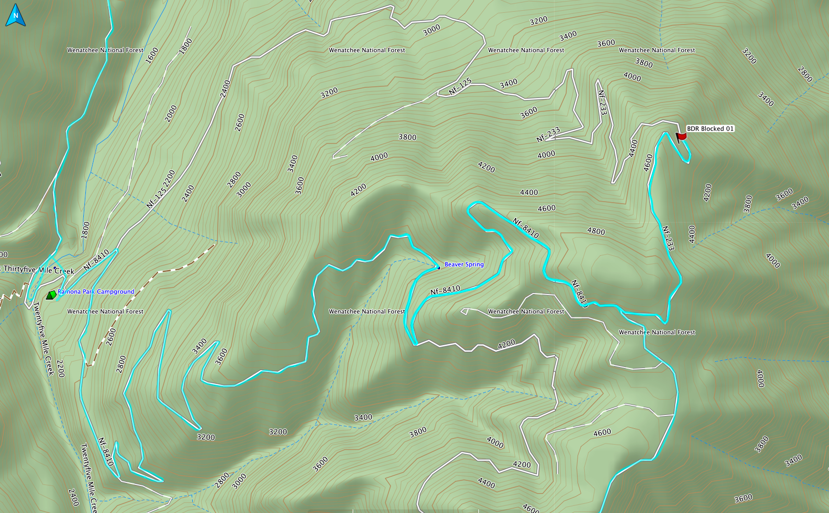
They were toward the end... somewhere between 4 and 5... The blocks are at the locations of the red flags...

N47° 58.032' W120° 14.387'


N48° 07.732' W120° 09.970'


Just past the edge of view, there as a tree that I wasn't entirely sure that I could get under with the loaded XK. One of the factors that made me decide to find another way.
They were toward the end... somewhere between 4 and 5... The blocks are at the locations of the red flags...

Pathfinder II

Pathfinder II
Yeah, that was a pretty good one. I decided not to take the XK over it.
Yup I had to reverse out, with a trailer mind you. Pretty sketch with the drop off to the driver side.
Yeah, that was a pretty good one. I decided not to take the XK over it.
I keep looking at that picture and got to guess it was 4'-0" deep. In any case...a nightmare of a hole. And you had to back up with a trailer? LOL...Yup I had to reverse out, with a trailer mind you. Pretty sketch with the drop off to the driver side.
That's like biting your heart in half to keep from loosing it while on a white knuckled double diamond mountain bike drop.
Kudos for good driving.
Sent from my iPad using OB Talk


