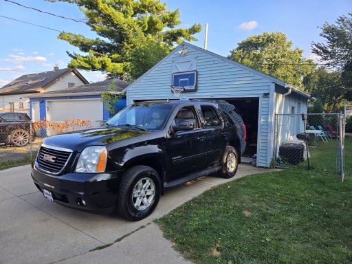
I've looked all over the internet for overlanding routes in Wisconsin. I've only been able to find two longer routes. the T.W.A.T which doesn't interest me much and the 7-Hour Plane Crash route which starts in northern Wisconsin and goes all the way up to High Rock Bay in the UP. My wife and I did this route this spring and had a blast. I plotted a route west of Pound Wisconsin that added another 100 miles to the track. I've since updated that route to a 2.0 version that starts farther west between Mountain and Breed Wisconsin and adds more dirt forest roads/trails. That section is approximately 65% gravel road, 25% dirt road/trail, 10% paved.. I've also created the "Up North" overland route that starts in the same spot. It shares the same route for about the first half and then diverges.
The Up North route goes through Oconto and Marinette county forests as well as the Nicolet National Forest. It's approximately 45% gravel roads, 45% dirt forest roads/trails, and 10% pavement. This route can and hopefully will change in the future as others and I find new roads/trails before, along, and after this current V1.0 route. I want to develop the best route possible because there are not many options here in Wisconsin. Please use this route as a guide and try and find other hidden gems along it. We took multiple detours down out-and-back trails and explored areas along this route. My goal is to create a base route that uses as many connecting forest roads and trails.
I would recommend having a high-clearance vehicle, with 4WD and A/T tires. There are certain sections where this will definitely be useful. It's not necessary and the sections of road/trail that it would be useful to have can be bypassed. Overall, I would say the difficulty of the route is a 3/10, but if you take this route and think I'm off with that rating let me know. Additionally, some of these roads are seasonal (closed late fall through early spring), so make sure they are open before using them.
Trails 2267, 3877C, 2101H, 2053, 2259E, 2259R, 2259A, 2329, 2002 are open 4/01-11-30
I use Gaia with the MVUM (USFS) as my base map along with the Gaia Overland layer and Public Lands layer.
Please go out and try this route and feel free to make suggestions and improvements to the route.
-Update 10/7/2023- V2
Recently went up exploring and found some new technical trails where full-size vehicles are allowed. This update adds around 12 miles of technical trails as well as some minor reroutes.
I also updated the 7-Hour Plane Crash to V3. This adds an additional 15 miles of technical trails as well as some minor reroutes.
Up North Gaia Page - GaiaGPS - Up North Overland Route V2
7 Hour Plane Crash +100 Gaia Page - GaiaGPS - 7 Hour Plane Crash +100 V3
GPX viewer
GPX viewer
Attachments
-
404.1 KB Views: 28
-
381.1 KB Views: 23
Last edited:


