SW Idaho Overlanding West/East Idaho Overlanding Route. This is something that I have been thinking about for a few years now. I know about the IDBDR that runs North/South, but there is no West/East route. Although the IDBDR is there, it is really just a lot of forest and back country road travel. A Idaho West/East route could easily be built using the same idea with forest and back country roads for sure. I decided however to make a more challenging route. I gave myself some criteria to go by.
-10% or less paved roads
-No using already known Back Country Routes
-Try and use roads less often used
-Try and go through some areas that are interesting to see
-Stay 100% in Idaho
-Try and keep the route as low as possible in elevation
-Stay as isolated as possible
This proved to be more difficult than it sounded in my head.
South West Idaho and Central Idaho I already knew pretty well. The difficult area was to the east of American Falls, Idaho. I did not really want to get into the Fort Hall Indian Reservation and there is a lot more populated areas over there as well as mountains that go North/South with less roads. There really was no way to avoid these areas that I could find.
One of the biggest issues in East Idaho was where to cross the populated areas and keep the pavement time down to a minimum. I also wanted to stay as isolated as possible without going through multiple towns. This proved to take quite a bit of time to figure out. Finally, I think, I found a route that keeps the pavement down to a minimum. More than I wanted at one time, 13.17 miles, but with no other options it is what it is. This does however keep it down to one town which is perfect for a fuel/supplies stop.
For the rest of the state I had good knowledge of the roads and routes I would be taking. There are some new to me roads, at this time, that I have not been on. Drawing from previous trips I was able to piece a lot of them or portions of them into this West/East Route.
How did I do with my criteria? Well, if the route works out the way I have it now it is quite good I feel.
-10% or less paved roads. I have achieved this one. The Route, as it stands now, is 541.3 miles border to border. This is with 35.76 miles of pavement total with the longest stretch being 13.17 miles. This comes in at 6.6% dirt/gravel for the entire route.
-No using already known Back Country Routes. Well there is one point where I had to use 5.28 miles of the Owhyee Back Country Byway in two locations. Being that far out in the middle of nowhere there really was no other option that made sense. I had to take a bit of a hit on that one, but I feel it is acceptable due to the area.
-Try and use roads less often used. This one is a bit tricky since what I think is less often used may be different to the next person. I feel, however, pretty good about this criteria for the most part of this route. Once I got to the Eastern part of the state, I feel this slip a bit. Sure, still probably less used roads, but I was limited to country dirt/gravel or forest roads. The population and terrain just does not allow for roads that I generally like to use. Sure I could find roads that I like to use, they just don't go to where I wanted to go. Usually they were dead ends. So I give this one a 3/4 success. Which I feel is not too bad considering it is a 541.3 mile route across Idaho's widest part. You are bound to find limitations.
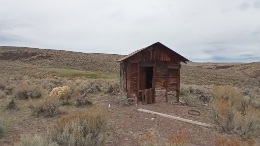
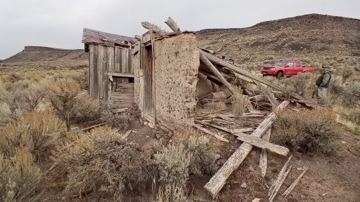
-Try and go through some areas that are interesting to see. I did manage to hit some interesting areas. Most are divided by large areas that may not be too interesting. Just the nature of the beast of trying to get from one boarder to the other using mostly dirt. There are some long miles of nothing as well. Once I get a run through all this I will know more of where to camp and update the info as time moves on.
-Stay 100% in Idaho. This was achieved. After all it is the Idaho West/East Route.
-Try and keep the route as low as possible in elevation. I wanted to keep the entire route low in elevation in hopes that the route would be open for use during the spring and fall. This would leave the IDBDR available for the summer season since it would be too hot to be in the desert in the summer anyway. Most of the route is in the 5000-6000 foot range. there are two high points. One on the west side at 6228 feet and one on the east side at 7028 feet. I will have to do more research on these areas to see when they may be open for travel. Most of the interior could probably be used in the wintertime as well. If that is you thing.
-Stay as isolated as possible. As with using roads less often used, this would be considered different to each person. For most of the trip I believe you will feel pretty isolated. And again, once you get to the eastern part of the state that feeling may go away a bit. Depending on your idea of isolation.
The route will not be for the average overlander. I intend for it to be a bit of a challenge, in some areas, for driver and vehicle. The route will not be for AWD's or low clearance 4x4's. No Subaru is going to feel at home on portions of this route. A bit of clearance and a two-speed transfer case will be needed in areas. A big portion of the roads I chose on this route are not maintained by anyone.
I have come up with 4 legs to the route. Each leg being different in their own way. Each leg begins and ends with a resupply point for food and fuel.
-Leg 1 205.3 total miles. 7.33 paved
-Leg 2 89.4 total miles 4.09 paved
-Leg 3 160.0 total miles 10.67 paved
-Leg 4 86.6 total miles 13.17 paved
Well, I am running leg 1 of the route next month. It is the longest and most remote of the 4 legs. Next spring, I am planning on doing legs 2-4 to verify the route is doable. If all goes well, I will release the route to fellow overlanders to enjoy. I hope the SW Idaho Overlanding's West/East Idaho Overland Route will be a success for us all. George.
-10% or less paved roads
-No using already known Back Country Routes
-Try and use roads less often used
-Try and go through some areas that are interesting to see
-Stay 100% in Idaho
-Try and keep the route as low as possible in elevation
-Stay as isolated as possible
This proved to be more difficult than it sounded in my head.
South West Idaho and Central Idaho I already knew pretty well. The difficult area was to the east of American Falls, Idaho. I did not really want to get into the Fort Hall Indian Reservation and there is a lot more populated areas over there as well as mountains that go North/South with less roads. There really was no way to avoid these areas that I could find.
One of the biggest issues in East Idaho was where to cross the populated areas and keep the pavement time down to a minimum. I also wanted to stay as isolated as possible without going through multiple towns. This proved to take quite a bit of time to figure out. Finally, I think, I found a route that keeps the pavement down to a minimum. More than I wanted at one time, 13.17 miles, but with no other options it is what it is. This does however keep it down to one town which is perfect for a fuel/supplies stop.
For the rest of the state I had good knowledge of the roads and routes I would be taking. There are some new to me roads, at this time, that I have not been on. Drawing from previous trips I was able to piece a lot of them or portions of them into this West/East Route.
How did I do with my criteria? Well, if the route works out the way I have it now it is quite good I feel.
-10% or less paved roads. I have achieved this one. The Route, as it stands now, is 541.3 miles border to border. This is with 35.76 miles of pavement total with the longest stretch being 13.17 miles. This comes in at 6.6% dirt/gravel for the entire route.
-No using already known Back Country Routes. Well there is one point where I had to use 5.28 miles of the Owhyee Back Country Byway in two locations. Being that far out in the middle of nowhere there really was no other option that made sense. I had to take a bit of a hit on that one, but I feel it is acceptable due to the area.
-Try and use roads less often used. This one is a bit tricky since what I think is less often used may be different to the next person. I feel, however, pretty good about this criteria for the most part of this route. Once I got to the Eastern part of the state, I feel this slip a bit. Sure, still probably less used roads, but I was limited to country dirt/gravel or forest roads. The population and terrain just does not allow for roads that I generally like to use. Sure I could find roads that I like to use, they just don't go to where I wanted to go. Usually they were dead ends. So I give this one a 3/4 success. Which I feel is not too bad considering it is a 541.3 mile route across Idaho's widest part. You are bound to find limitations.
-Try and go through some areas that are interesting to see. I did manage to hit some interesting areas. Most are divided by large areas that may not be too interesting. Just the nature of the beast of trying to get from one boarder to the other using mostly dirt. There are some long miles of nothing as well. Once I get a run through all this I will know more of where to camp and update the info as time moves on.
-Stay 100% in Idaho. This was achieved. After all it is the Idaho West/East Route.
-Try and keep the route as low as possible in elevation. I wanted to keep the entire route low in elevation in hopes that the route would be open for use during the spring and fall. This would leave the IDBDR available for the summer season since it would be too hot to be in the desert in the summer anyway. Most of the route is in the 5000-6000 foot range. there are two high points. One on the west side at 6228 feet and one on the east side at 7028 feet. I will have to do more research on these areas to see when they may be open for travel. Most of the interior could probably be used in the wintertime as well. If that is you thing.
-Stay as isolated as possible. As with using roads less often used, this would be considered different to each person. For most of the trip I believe you will feel pretty isolated. And again, once you get to the eastern part of the state that feeling may go away a bit. Depending on your idea of isolation.
The route will not be for the average overlander. I intend for it to be a bit of a challenge, in some areas, for driver and vehicle. The route will not be for AWD's or low clearance 4x4's. No Subaru is going to feel at home on portions of this route. A bit of clearance and a two-speed transfer case will be needed in areas. A big portion of the roads I chose on this route are not maintained by anyone.
I have come up with 4 legs to the route. Each leg being different in their own way. Each leg begins and ends with a resupply point for food and fuel.
-Leg 1 205.3 total miles. 7.33 paved
-Leg 2 89.4 total miles 4.09 paved
-Leg 3 160.0 total miles 10.67 paved
-Leg 4 86.6 total miles 13.17 paved
Well, I am running leg 1 of the route next month. It is the longest and most remote of the 4 legs. Next spring, I am planning on doing legs 2-4 to verify the route is doable. If all goes well, I will release the route to fellow overlanders to enjoy. I hope the SW Idaho Overlanding's West/East Idaho Overland Route will be a success for us all. George.