Years ago, with the daughter off at school, we started taking trips to explore our area. In late 2013 we were in the book store looking for a magazine to get ideas for another trip when we ran across Overland Journal. Looking through this issue we started thinking back to a trip we did to the Great Smoky Mountain National Park and our experience on the Rich Mountain Road. We became intrigued by Overlanding and started reading everything we could find. As we began learning about it we saw similarities to what we were already doing but also saw there was much more we could do. With Overlanding we saw a new way of doing something we enjoyed while bringing in a new approach to it. We also saw this would open up whole new opportunities to see things we never thought of.
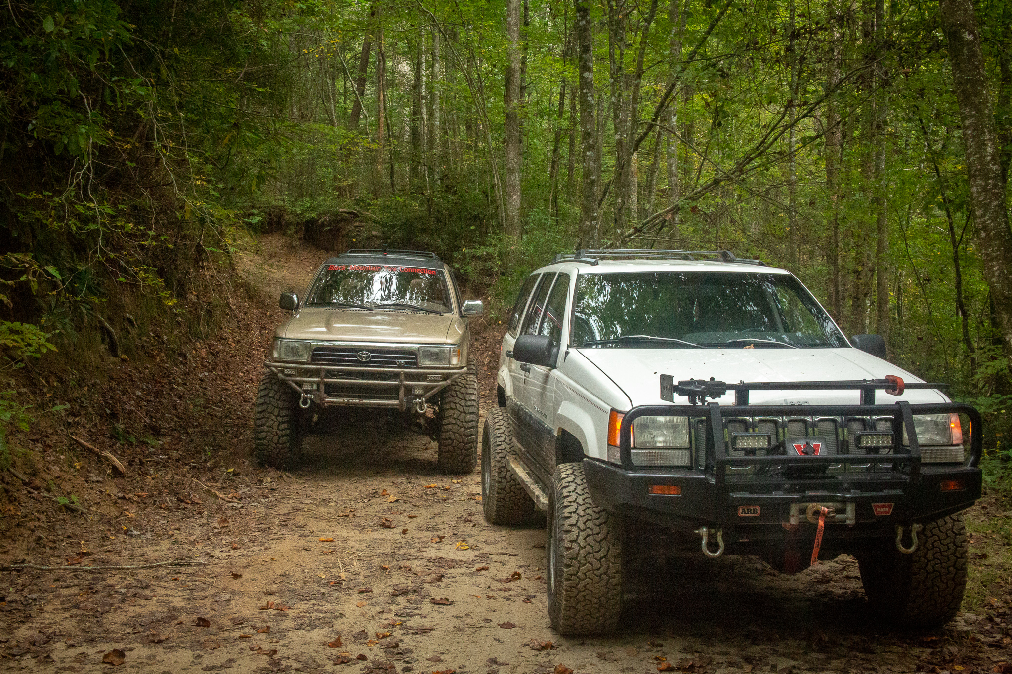
What we learned was Overlanding can be as simple as traveling in a Subaru with a ground tent, cooler, and a camp stove. Most of what we saw were Overlanders in safari type Land Rover Defender 110’s with roof tents and all the stuff necessary to live in the woods for a week. We were surprised to learn there were even specialized high clearance 4x4 RV’s people can live out of for a month without going to town. What we took away from this was the vehicle we needed mainly depended on what we wanted to do with it, or how we wanted to Overland. We started calling this our Overland style. Its basically how aggressive are you willing to be to get somewhere, how long do you want to be out between towns, and how comfortable do you want to be.
Determining our Overland style required us to take a long look at what we wanted to do with our trips in the future and answer some specific questions. Our approach to answering these questions was to not do it in one night but work our way up to it. Our first outing was a two-week trip along the Appalachian Mountains to see if this is for us. We learned several things, like maximum hours we are comfortable driving in a day, but mainly we learn that Overlanding is something we love. We just had to find our style.
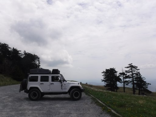
Since that first trip we have been defining our overland style, from what we like to see all the way to how many hours of driving per day we are comfortable with. At the same time, we have been slowly working on modifications on our Jeep to meet that overland style, figuring out what works, and find out what it is we absolutely need. Recently we added some new modifications and a bunch of new equipment added to the Jeep which resulted in a giant step closer to our goal. We now feel we can move on to the next level in our overland adventure. The next level for us is to venture across the Mississippi to the canyons, mountains, and deserts we long to explore.
As we began seriously talking about our first trip west we found the discussion turned in a completely different direction. As much as we want to hit the road and head west we still needed to try out all the new stuff to see if it works for us, did we take the right path. To accomplish this, we wanted a short distance trip that had enough miles to test vehicle handling and fuel mileage. The main focus had to be on the gear, getting used to using it, and finding the best way to store it.
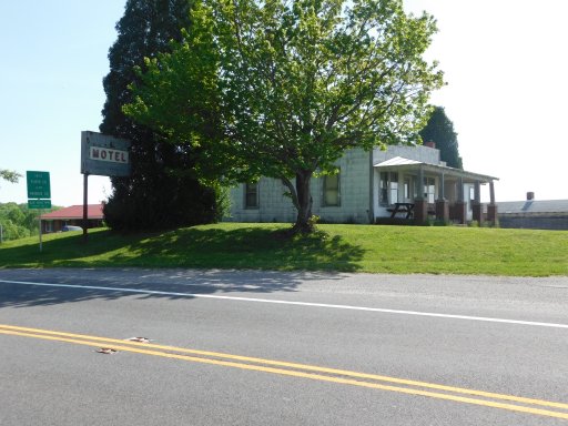
With several of our recent trips being epic big mile journeys, we wanted something a bit shorter to allow us to focus on the basics. In a way we asked our self, if we had unlimited time to actually stop and smell the roses, what would we do. We thought the best place to accomplish this would be the Appalachians but it had to be stuff we hadn’t seen before. We had done the Blue Ridge Parkway on a past trip (July 2015) and absolutely loved that trip but we didn’t want to repeat what we had already done. We came up with the idea of using the Parkway as a kind of backbone, allowing us to hit some of the things we missed in 2015 but mainly allow us to explore many of the State Parks along the Parkway. Our path would start in North Carolina, work our way up into Virginia and back into North Carolina to the Great Smoky Mountains National Park. As we developed the plan, trying not to repeat areas we had already explored, our route changed taking us into Tennessee then back into North Carolina. Before day 1 arrived, we started having our doubts about this trip, problems with the Jeep, the new kitchen was still unfinished, and the tablet running the navigation system was acting goofy, all led us to think things wouldn’t go well. Still fighting with the tablet, we set off on day 1. Getting off I-95 outside of Florence, we crossed the Orangeburg Escarpment (where the ocean’s beach was thousands of years ago). Once on route 52 we headed up to Mocksville to end our first day.
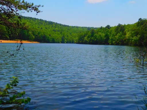
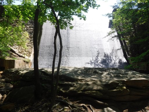
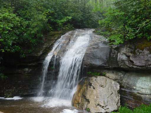
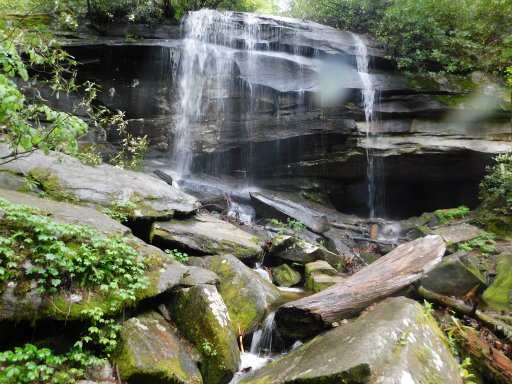
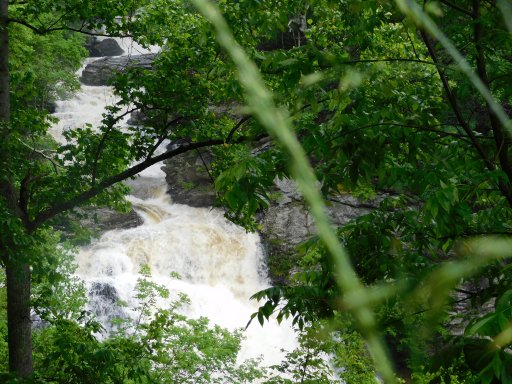
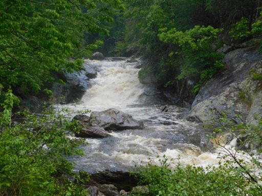
The next morning, we stocked up on supplies then got on route 601. Route 268 and route 89 led us to Hanging Rock State Park. Our first stop at the park was the visitor center where we found upwards of 100 cars. This place was packed. From the visitor center parking lot, we took the hiking trail leading to Hidden Falls and Window Falls. After our morning hike we headed to the lake, found a shady spot in the parking lot and fixed up some Brats for lunch. We thought a nice after lunch walk around the lake would be perfect and was topped off by running across the dam. Next on the list was Upper Cascade Falls and another great, but short, hike. Just prior to reaching the falls we came across a set of stairs leading to a platform overlooking the falls. Off this platform was another set of stairs leading down. Looking over the rail to see how far down they went, the movie “Journey to the Center of the Earth” came to mind. Our day ended at the Hanging Rock State Park Campgrounds. We were told at the visitor center we should show up a bit later than normal as the campground was completely packed Saturday night and it would take longer to clean everything up. We were concerned, the park was pretty crowded through the day and the campground was completely full the night before. To our surprise, we were told we could pick any spot we wanted as we had the entire campgrounds almost to our self. The highlight of the day was the small herd of deer roaming through our campsite.
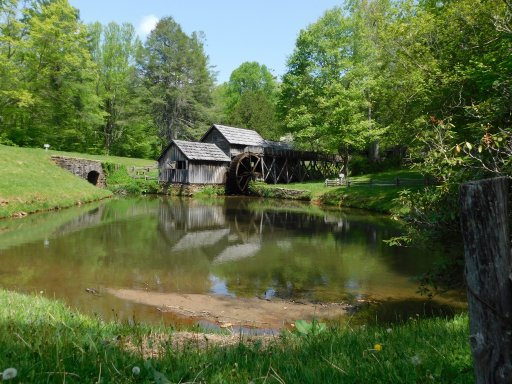
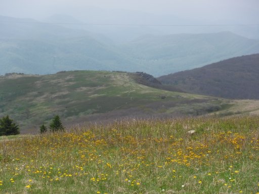
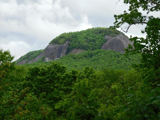
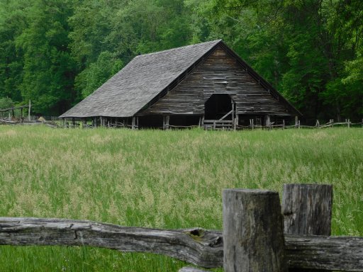
Day 3 found us up at the usual time with breakfast and pack up completed and rolling out by 07:30. Getting back on the main road we turned off on route 8 but took time for a quick stop in Floyd to resupply before hitting the Parkway. On the Parkway we took a break at Mabry Mill and walked around the historic buildings. Reaching what was to be our planned destination for lunch, Groundhog Meadow Overlook, we found it to be close so we began looking for a suitable spot. We ended up finding a small trail heading a short distance into the woods and found it to be perfect for our break. At the Stone Mountain State Park visitor center, we learned that our hiking plans would have to be altered just as our lunch location. Stone Mountain is a great hiking location but with no easy trails and only a few moderate trails, it wasn’t a good hiking park when you are still getting over the hike from the day before. Rolling into the Stone Mountain State Park Campgrounds we found the same situation as Hanging Rock, we had the pick of just about any of the campsites. There were a few more people here than at Hanging Rock but it was just as quiet. They have a section set aside on top of a hill for tent campers. Being well above and a fair distance away from the RV’s, it way like they weren’t even there. This place has to be one of the best campground we have stayed at yet.
After two days of driving few miles, day 4 was much more like how we normally drive with a little over 150 miles requiring four and a half hours of drive time. Leaving the park, we got on Route 21 and crossed the Blue Ridge Parkway. Our first stop was in Sparta to once again pick up supplies. Route 21 took us to Route 221 before hitting Route 93. The further we ventured into Virginia the more twists and turns we encountered. Shortly before our northern most point on this trip, we pulled into Virginia’s Grayson Highlands State Park. On the drive in we stopped at one of the overlooks and found a couple in a Jeep JKU. While talking with them we learned they we RV’ers flirting with the idea of Overlanding. They said the Jeep is normally towed behind the RV but they talked about doing modifications to the Jeep to allow them to be more adventurous with it. Grayson Highlands is a beautiful park and well known as being park of the Appalachian Trail. Naturally we stopped by the visitor center and had a great talk with the two ladies working there. We really didn’t have a choice in the matter, this was the first day using a new system to ring up purchases. To complicate matters, Grayson Highlands is way up on top of a mountain and their internet, when it does work, has a lot to be desired. As usual, we took turns staying outside with Lydi. While I was watching her, she insisted on keeping an eye on Mom. Knowing she was not allowed in the building, Lydi decided to test how far she could get inside. Standing at the door she put her paws on the threshold and, with one eye on the two ladies, stretched her noise in the doorway as much as she could. Leaving Grayson Highliands, we got back on Route 93 and headed to Whitetop Mountain. Mud Creek Lane winds up Whitetop Mountain and although it’s not particularly challenging, it is none the less gravel, steep, and full of washouts. The prize for climbing Whitetop Mountain has to be the views. Near the top there is a parking lot, from this point on until the top of the Mountain is the Appalachian Trail. A short distance past the parking lot a vehicle was parked on the side of the road. These were Trail Angles. Out of the back of their Subaru they were handing out snacks and drinks to the Appalachian Trail hikers passing by. Trail Magic at its finest. On most of this trip we had been having problems with the tablet running our navigation system. To this point it hadn’t really been an issue but leaving Whitetop Mountain it did. We had a really cool route laid out through the back roads to our final destination but our plans got changed. Grayson Highlands wasn’t on our schedule so the stop tacked on a couple hours, taking time away from our cultural stop. Debating whether to continue on as planned or make up time, the decision was helped along with the death of nav system. We decided to take a less challenging route to our next stop, pretty much the way we had come. Lunch was a stop at New River State Park. We picked this stop not only because it was on our way but mainly because of our trip to New River Gorge National River. While there we learned about the history of the New River and its course, including its course through the New River State Park. When we saw we would be close to New River State Park, we knew we had to stop to, in a manner of speaking, complete our exploration of the New River. It’s not a large park but it had a perfect spot right next to the river for our lunch break. Our day ended in Blowing Rock and our cultural exploration of the trip. We took our time walking downtown but strangely all of the shops in town close at either five or six so we didn’t get to do any shopping. Dinner was at the Six Pence Pub with our little miss joining us. Unfortunately, she wasn’t allowed to eat with us but Lydi did enjoy herself in town. Except for the navigation issue, it turned out to be a great day.
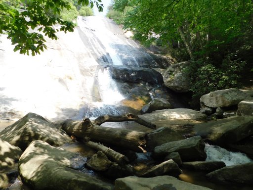
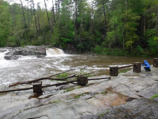
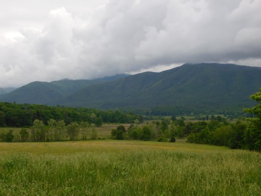
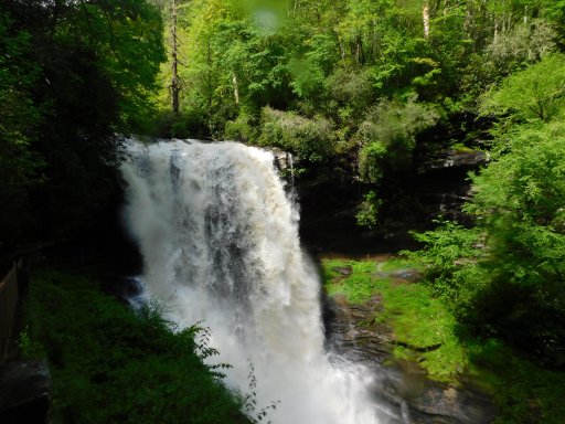
About an hour after we finished exploring downtown Blowing Rock the rain started. We had been watching the weather over the last couple days and knew the rains were coming. We had been very lucky with the rain so far this trip but that luck was about to end. Day 5 would be a rain day. This wouldn’t affect our plans for the day, our concerns were for the evening as our planned stop for the end of day 5 was to be Davidson River Campgrounds. With severe thunderstorms predicted for that evening, we decided to play it safe and schedule appropriate shelter. The day would be mostly along the Blue Ridge Parkway but the first part, before Grandfather Mountain, would be along Route 221 due to the closure of Linville Viaduct. Route 221 in this area was considerably different from the section we had been on the day before. We quickly learned the road was much narrower with much tighter turns. With the rain, the road was an adventure to drive but it did hold some pleasant surprises along the way. Back on the Blue Ridge Parkway we found there wasn’t much good in stopping at the overlooks due to the low hanging clouds but there were a few where the clouds allowed us some views. Our hike for the day was to Linville Falls. With the recent rain the falls were well worth the hike and the rain falling on us. The biggest interest at the falls turned out to be the damage caused by a floor earlier in the year, showing us just how powerful water can be. On the hike back to the Jeep the rain stopped and the sky began to clear. With a stop at the Art Center and visitor center we turned off the Parkway into Asheville to resupply and top off the fuel. Our next stop was the Cradle of Forestry on Route 276. Further down 276 we got off on FS 475B for our second off road excursion. This gave us a great view of the back side of Looking Glass Rock while taking us to Slick Rock Falls. At the end of 475B is the Pisgah Center for Wildlife Education. Due to it being very close to the Center’s closing time we didn’t stay long but long enough to learn just a little more about the Civilian Conservation Corps (CCC). With our overnight plans changed, we now had an hour drive to get to our final destination instead of only a few minutes. Our overnight would be in Maggie Valley, cutting out much of the driving planned for the next day but allowing us to get a good night sleep. It would not be a repeal of Blue Heron Campgrounds.
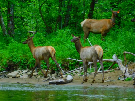
In Overlanding you make plans but you know in the back of your mind that these plans are simply a guideline for what you are going to do that day. Since we stayed in Maggy Valley instead of just outside of Brevard, our plan for the day was pretty much out the window and we would be winging it. We were supposed to travel back up Route 276 to the Blue Ridge Parkway then into the Great Smoky Mountains National Park and end our day at the Cades Cove Campgrounds but getting back to 276 would add too many driving hours to our day. Our new plan for day 6 had us making the short drive to Cherokee with our first stop at the Native American Craft Shop. Little did we know the Craft Shop didn’t open until 10 and the lady running the place would be twenty minutes late. While we waited we took the time to explore Cherokee, again. Back on the road we headed into the Great Smoky Mountains National Park and a stop at the Oconaluftee Visitor Center. This place has to be our favorite place in the Great Smoky Mountains National Park, with the historic farm and the river, it is just beautiful and relaxing. Every time we come we walk the River Trail but this was Lydi’s first time coming here and she was eager for a walk in the woods. We soon noticed she was a lot more eager about the walk than normal and was determined to get to the woods. Lydi guided us into the woods and to the river then doubled back to followed the trail for a few hundred yards before turning towards the river. Coming out of the woods onto the river bank we saw a small herd of Elk hanging out on the bank across the river. On the road into the park, just past Newfound Gap, we had a small bear cub attempt to cross the road in front of us. I started to hit the brakes but the cub turned around and started to climb back up the embankment. With two car loads of tourist close behind us, our first concern was getting the cub back to its mom. I blew the horn which seemed to work as the cub started to scramble up the embankment with a great deal of motivation. Our second concern was that one or both of the cars behind us would be dumb enough to stop to take pictures of the cub, not aware momma bear would be close by. Fortunately, the second car slowed considerably but neither stopped. Moving deeper into the Park, we stopped at the Sugerland Visitor Center before moving onto Cades Cove. Our last attempt to explore this section of the Park was a disaster when we ran into one of Cades Cove’s famous traffic jams. That time we made it to Sparks Lane before giving up on Cades Cove. This time we made it all the way around but it took several hours of sitting while others far ahead of us stopped to look at bears and other things. At one of the parking areas we pulled in to take a short break only to have someone (a Jeep) park behind us blocking us in. The visitor center at the end of Cades Cove was an absolute mad house. One of the things we wanted to explore on our last trip here was the Parson Branch Road but it was closed due to problems with falling trees. We thought, if the road were open this time, we could escape the madness of Cades Cove. You guessed it, the road was still closed. While sitting in traffic we started looking at the weather situation again. Although we had had beautiful weather all day, we knew we had more severe thunderstorms due to hit the area. With tons of tourist clogging Cades Cove, and the threat of more severe thunderstorms, we opted for a hotel in Townsend. Although we had cut out nearly one hundred miles from our planned day and we were a good four hours ahead of schedule getting to the Great Smoky Mountains National Park, we ended up getting to the hotel later than we normally would due to the tourist traffic. To give our self a reward for making it through a tough day, we opted for a great steak dinner at the Trailhead Steakhouse, which happened to be right across the street.
The essences of Overlanding are exploring and adventure, day 7 fit that perfectly. The original plan was to wake up early at the Cades Cove Campgrounds and get on the loop before passing through Townsend. Not wanting to repeat the issues we had with the tourist the day before, we gave up on the idea of back tracking to Cades Cove and just move forward with our planned day. Heading out of Townsend we were soon on the Foothills Parkway, one of the National Park Service’s Scenic Parkways. We quickly found we still had the tail end of the clouds of the early morning storm moving through making views at the overlooks less than impressive. Several spots along the first part of the parkway were fogged in but as we progressed the skies began to slowly clear and by the end of the Parkway we had several overlooks where we could see for miles. As the roads dried and visibility improved, we started to get a bit nervous as we began seeing more vehicles out enjoying the corners rather than the scenery. After completing the Parkway we heading for our next adventure but along the way we decided to make a quick stop in Madisonville to do a little family history research at one of the town’s graveyards. Getting on Route 68, we headed to our third off road adventure, which turned out to be our most adventurous. Part of what made this our most adventurous was our navigation system stopped working completing but we managed to find our turn, Witts Road, and began heading to Conasauga Falls. The trail was in pretty good shape but deteriorated the further we traveled, broken asphalt at first then gravel then worse. We found the trailhead to be a small turnout that was completely under water so we moved further up the trail to find another spot to park the Jeep. As we progressed along the trail it got narrower and we found much more clay making the going very slippery. After several miles it was clear we would not be able to get to our goal, and with the trail getting much more difficult, we decided to turn around and head back rather than risk skidding off the trail into the beautiful scenery below. Lunch on this day was an old favorite spot, the visitor center in Tellico Plains. Our next adventure would be Bald River Road and several waterfalls. Our first was a small one shortly after turning onto the road to the ranger station. Back on Bald River Road we soon realized we did not have the road to our self. Bald River Road is a beautiful road with lots of twists and turns but very narrow. It’s a great driving road and the boy racers were out in force trying to prove their manhood on this road which resulted in a number of near misses. It didn’t take many of these near misses to realize the reward was not worth the risk of a head on crash so we chose to switch over to the Cherohala Skyway. Strangely, the Cherohala Skyway had little traffic on it and it turned out to be an enjoyable drive. The rest of the drive to Murphy we a relaxing drive on wide roads with beautiful scenery the entire way. Although we had missed a couple waterfalls we had been trying to see for the past couple years, the day turned out to be very enjoyable. What made it enjoyable was the day was actually one of the most challenging days we’ve had yet.
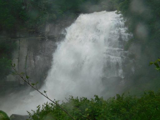
Day 8, wet, challenging, exhausting, a true adventure day. We started the day by working our way onto Route 64 heading east. At first the weather was pleasant but soon the rain began then became heavy. Most of 64 was an easy country drive through small towns and open fields but once you get into the Highlands area things change drastically. This section of 64 will make one think of the Bolivian Death Road, a narrow road with a rock face on one side and a shear drop off on the other, and a margin of only a few inches on either side of the road. To make matters even more challenging, the heaviest rain began just before entering this section. Our first stop was Cullasaja Falls. This stop turned out to be the most dangerous thing we have done to date. The pull off for the falls is almost nonexistent, with the left tires on the roads white line, there was only about a foot of space between the Jeep and the guard rail to get the door open. Sitting between two sharp blind corners, and visibility severely limited by the heavy rain, the thought of being struck by another vehicle was foremost on our mind. Visibility of the falls from the road is not the best due to trees which forces one to hop over the guard rail and work their way down a steep embankment. Our next stop was Bust Your Butt Falls. No, I did not make this name up. This falls has a pull off that won’t put you in fear for your life which is a good thing because the falls isn’t as dramatic as the other three in this area. Further down the road is Dry Falls. Between the heavy rain that was still falling and the falls itself, this falls was anything but dry. This is by far the best falls in this area with a dramatic drop and an accessible area behind the falls. Just as we were getting ready to leave Dry Falls the rain stopped and the rest of the day was pleasant. A very short drive further along 64 is Bridal Veil Falls. A short distance down the road we turned south then entered Gorges State Park. As always, we stopped at the visitor center first to get information on the park and trails but also got a bit of a surprise. At all the parks we have been at one of us goes in while the other stays outside with Lydi since she isn’t allowed in. We did the same at Gorges with me going in first. When I finished and started to exit to take over puppy sitting, the lady at the desk saw Lydi looking through the glass door. She asked if Lydi was well behaved. After I stated that she was, the lady said she could come in. When I told Lydi that she was allowed in, she hesitated, as if she didn’t believe me. Needless to say, Lydi was beyond excited to be allowed into the visitor center, her first. Moving on to the trailhead we started one of the most challenging hikes we’ve done since the John Muir Trail in Tennessee, the Rainbow Falls trail. Along the way we came upon two young ladies standing in the middle of the trail. When they noticed us they quickly turned and said “there is a snake in the middle of the trail”. They explained there was a snake in the middle of the trail but is now near a large rock to one side of the trail. Yes, it was a snake and it was on the trail but the snake was only eight inches long. The quick solution was to just walk over the rock. Rainbow Falls was probably the second most dramatic falls of this trip and the wettest, even with the rain and walking behind Dry Falls. Due to the gorge, the wind blows the mist from the falls onto the trail soaking anyone taking time to admire the falls. After the hike our plans called for us to take the 4x4 trail at the trailhead and run it as far as the bridge at the river. After we changed out of our wet boots three 4x4’s came out of the trail and parked near us. I spoke with them for a short time to get information on the condition of the trail and learned that doing the trail alone would not be a good idea. All the rain over the last few days had made for some of the best waterfalls we have seen but was making the trail more challenging than we cared for. What set our final decision in stone was when we were told the bridge was under water. With lunch finished, we moved on to our final destination of the day, Seneca. In the morning we would be heading home.
Intended to be a short simple trip to try out new gear turned into a challenging trip with tough trails, less than perfect weather, incredible water falls, and an unreliable navigation system. In the end we traveled 1,900 miles and proved that many of the State Parks are just as incredible as our National Parks.
What we learned was Overlanding can be as simple as traveling in a Subaru with a ground tent, cooler, and a camp stove. Most of what we saw were Overlanders in safari type Land Rover Defender 110’s with roof tents and all the stuff necessary to live in the woods for a week. We were surprised to learn there were even specialized high clearance 4x4 RV’s people can live out of for a month without going to town. What we took away from this was the vehicle we needed mainly depended on what we wanted to do with it, or how we wanted to Overland. We started calling this our Overland style. Its basically how aggressive are you willing to be to get somewhere, how long do you want to be out between towns, and how comfortable do you want to be.
Determining our Overland style required us to take a long look at what we wanted to do with our trips in the future and answer some specific questions. Our approach to answering these questions was to not do it in one night but work our way up to it. Our first outing was a two-week trip along the Appalachian Mountains to see if this is for us. We learned several things, like maximum hours we are comfortable driving in a day, but mainly we learn that Overlanding is something we love. We just had to find our style.
Since that first trip we have been defining our overland style, from what we like to see all the way to how many hours of driving per day we are comfortable with. At the same time, we have been slowly working on modifications on our Jeep to meet that overland style, figuring out what works, and find out what it is we absolutely need. Recently we added some new modifications and a bunch of new equipment added to the Jeep which resulted in a giant step closer to our goal. We now feel we can move on to the next level in our overland adventure. The next level for us is to venture across the Mississippi to the canyons, mountains, and deserts we long to explore.
As we began seriously talking about our first trip west we found the discussion turned in a completely different direction. As much as we want to hit the road and head west we still needed to try out all the new stuff to see if it works for us, did we take the right path. To accomplish this, we wanted a short distance trip that had enough miles to test vehicle handling and fuel mileage. The main focus had to be on the gear, getting used to using it, and finding the best way to store it.
With several of our recent trips being epic big mile journeys, we wanted something a bit shorter to allow us to focus on the basics. In a way we asked our self, if we had unlimited time to actually stop and smell the roses, what would we do. We thought the best place to accomplish this would be the Appalachians but it had to be stuff we hadn’t seen before. We had done the Blue Ridge Parkway on a past trip (July 2015) and absolutely loved that trip but we didn’t want to repeat what we had already done. We came up with the idea of using the Parkway as a kind of backbone, allowing us to hit some of the things we missed in 2015 but mainly allow us to explore many of the State Parks along the Parkway. Our path would start in North Carolina, work our way up into Virginia and back into North Carolina to the Great Smoky Mountains National Park. As we developed the plan, trying not to repeat areas we had already explored, our route changed taking us into Tennessee then back into North Carolina. Before day 1 arrived, we started having our doubts about this trip, problems with the Jeep, the new kitchen was still unfinished, and the tablet running the navigation system was acting goofy, all led us to think things wouldn’t go well. Still fighting with the tablet, we set off on day 1. Getting off I-95 outside of Florence, we crossed the Orangeburg Escarpment (where the ocean’s beach was thousands of years ago). Once on route 52 we headed up to Mocksville to end our first day.
The next morning, we stocked up on supplies then got on route 601. Route 268 and route 89 led us to Hanging Rock State Park. Our first stop at the park was the visitor center where we found upwards of 100 cars. This place was packed. From the visitor center parking lot, we took the hiking trail leading to Hidden Falls and Window Falls. After our morning hike we headed to the lake, found a shady spot in the parking lot and fixed up some Brats for lunch. We thought a nice after lunch walk around the lake would be perfect and was topped off by running across the dam. Next on the list was Upper Cascade Falls and another great, but short, hike. Just prior to reaching the falls we came across a set of stairs leading to a platform overlooking the falls. Off this platform was another set of stairs leading down. Looking over the rail to see how far down they went, the movie “Journey to the Center of the Earth” came to mind. Our day ended at the Hanging Rock State Park Campgrounds. We were told at the visitor center we should show up a bit later than normal as the campground was completely packed Saturday night and it would take longer to clean everything up. We were concerned, the park was pretty crowded through the day and the campground was completely full the night before. To our surprise, we were told we could pick any spot we wanted as we had the entire campgrounds almost to our self. The highlight of the day was the small herd of deer roaming through our campsite.
Day 3 found us up at the usual time with breakfast and pack up completed and rolling out by 07:30. Getting back on the main road we turned off on route 8 but took time for a quick stop in Floyd to resupply before hitting the Parkway. On the Parkway we took a break at Mabry Mill and walked around the historic buildings. Reaching what was to be our planned destination for lunch, Groundhog Meadow Overlook, we found it to be close so we began looking for a suitable spot. We ended up finding a small trail heading a short distance into the woods and found it to be perfect for our break. At the Stone Mountain State Park visitor center, we learned that our hiking plans would have to be altered just as our lunch location. Stone Mountain is a great hiking location but with no easy trails and only a few moderate trails, it wasn’t a good hiking park when you are still getting over the hike from the day before. Rolling into the Stone Mountain State Park Campgrounds we found the same situation as Hanging Rock, we had the pick of just about any of the campsites. There were a few more people here than at Hanging Rock but it was just as quiet. They have a section set aside on top of a hill for tent campers. Being well above and a fair distance away from the RV’s, it way like they weren’t even there. This place has to be one of the best campground we have stayed at yet.
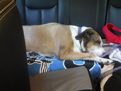
After two days of driving few miles, day 4 was much more like how we normally drive with a little over 150 miles requiring four and a half hours of drive time. Leaving the park, we got on Route 21 and crossed the Blue Ridge Parkway. Our first stop was in Sparta to once again pick up supplies. Route 21 took us to Route 221 before hitting Route 93. The further we ventured into Virginia the more twists and turns we encountered. Shortly before our northern most point on this trip, we pulled into Virginia’s Grayson Highlands State Park. On the drive in we stopped at one of the overlooks and found a couple in a Jeep JKU. While talking with them we learned they we RV’ers flirting with the idea of Overlanding. They said the Jeep is normally towed behind the RV but they talked about doing modifications to the Jeep to allow them to be more adventurous with it. Grayson Highlands is a beautiful park and well known as being park of the Appalachian Trail. Naturally we stopped by the visitor center and had a great talk with the two ladies working there. We really didn’t have a choice in the matter, this was the first day using a new system to ring up purchases. To complicate matters, Grayson Highlands is way up on top of a mountain and their internet, when it does work, has a lot to be desired. As usual, we took turns staying outside with Lydi. While I was watching her, she insisted on keeping an eye on Mom. Knowing she was not allowed in the building, Lydi decided to test how far she could get inside. Standing at the door she put her paws on the threshold and, with one eye on the two ladies, stretched her noise in the doorway as much as she could. Leaving Grayson Highliands, we got back on Route 93 and headed to Whitetop Mountain. Mud Creek Lane winds up Whitetop Mountain and although it’s not particularly challenging, it is none the less gravel, steep, and full of washouts. The prize for climbing Whitetop Mountain has to be the views. Near the top there is a parking lot, from this point on until the top of the Mountain is the Appalachian Trail. A short distance past the parking lot a vehicle was parked on the side of the road. These were Trail Angles. Out of the back of their Subaru they were handing out snacks and drinks to the Appalachian Trail hikers passing by. Trail Magic at its finest. On most of this trip we had been having problems with the tablet running our navigation system. To this point it hadn’t really been an issue but leaving Whitetop Mountain it did. We had a really cool route laid out through the back roads to our final destination but our plans got changed. Grayson Highlands wasn’t on our schedule so the stop tacked on a couple hours, taking time away from our cultural stop. Debating whether to continue on as planned or make up time, the decision was helped along with the death of nav system. We decided to take a less challenging route to our next stop, pretty much the way we had come. Lunch was a stop at New River State Park. We picked this stop not only because it was on our way but mainly because of our trip to New River Gorge National River. While there we learned about the history of the New River and its course, including its course through the New River State Park. When we saw we would be close to New River State Park, we knew we had to stop to, in a manner of speaking, complete our exploration of the New River. It’s not a large park but it had a perfect spot right next to the river for our lunch break. Our day ended in Blowing Rock and our cultural exploration of the trip. We took our time walking downtown but strangely all of the shops in town close at either five or six so we didn’t get to do any shopping. Dinner was at the Six Pence Pub with our little miss joining us. Unfortunately, she wasn’t allowed to eat with us but Lydi did enjoy herself in town. Except for the navigation issue, it turned out to be a great day.
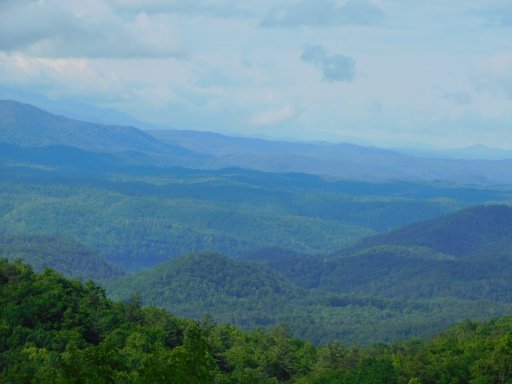
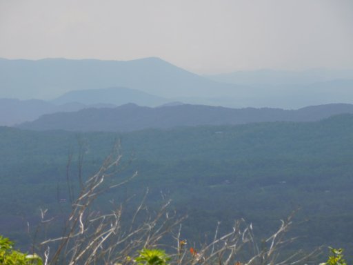
About an hour after we finished exploring downtown Blowing Rock the rain started. We had been watching the weather over the last couple days and knew the rains were coming. We had been very lucky with the rain so far this trip but that luck was about to end. Day 5 would be a rain day. This wouldn’t affect our plans for the day, our concerns were for the evening as our planned stop for the end of day 5 was to be Davidson River Campgrounds. With severe thunderstorms predicted for that evening, we decided to play it safe and schedule appropriate shelter. The day would be mostly along the Blue Ridge Parkway but the first part, before Grandfather Mountain, would be along Route 221 due to the closure of Linville Viaduct. Route 221 in this area was considerably different from the section we had been on the day before. We quickly learned the road was much narrower with much tighter turns. With the rain, the road was an adventure to drive but it did hold some pleasant surprises along the way. Back on the Blue Ridge Parkway we found there wasn’t much good in stopping at the overlooks due to the low hanging clouds but there were a few where the clouds allowed us some views. Our hike for the day was to Linville Falls. With the recent rain the falls were well worth the hike and the rain falling on us. The biggest interest at the falls turned out to be the damage caused by a floor earlier in the year, showing us just how powerful water can be. On the hike back to the Jeep the rain stopped and the sky began to clear. With a stop at the Art Center and visitor center we turned off the Parkway into Asheville to resupply and top off the fuel. Our next stop was the Cradle of Forestry on Route 276. Further down 276 we got off on FS 475B for our second off road excursion. This gave us a great view of the back side of Looking Glass Rock while taking us to Slick Rock Falls. At the end of 475B is the Pisgah Center for Wildlife Education. Due to it being very close to the Center’s closing time we didn’t stay long but long enough to learn just a little more about the Civilian Conservation Corps (CCC). With our overnight plans changed, we now had an hour drive to get to our final destination instead of only a few minutes. Our overnight would be in Maggie Valley, cutting out much of the driving planned for the next day but allowing us to get a good night sleep. It would not be a repeal of Blue Heron Campgrounds.
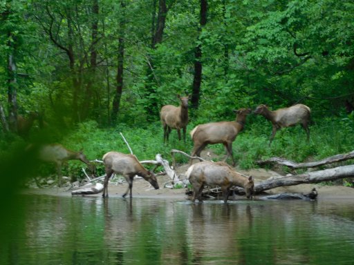
In Overlanding you make plans but you know in the back of your mind that these plans are simply a guideline for what you are going to do that day. Since we stayed in Maggy Valley instead of just outside of Brevard, our plan for the day was pretty much out the window and we would be winging it. We were supposed to travel back up Route 276 to the Blue Ridge Parkway then into the Great Smoky Mountains National Park and end our day at the Cades Cove Campgrounds but getting back to 276 would add too many driving hours to our day. Our new plan for day 6 had us making the short drive to Cherokee with our first stop at the Native American Craft Shop. Little did we know the Craft Shop didn’t open until 10 and the lady running the place would be twenty minutes late. While we waited we took the time to explore Cherokee, again. Back on the road we headed into the Great Smoky Mountains National Park and a stop at the Oconaluftee Visitor Center. This place has to be our favorite place in the Great Smoky Mountains National Park, with the historic farm and the river, it is just beautiful and relaxing. Every time we come we walk the River Trail but this was Lydi’s first time coming here and she was eager for a walk in the woods. We soon noticed she was a lot more eager about the walk than normal and was determined to get to the woods. Lydi guided us into the woods and to the river then doubled back to followed the trail for a few hundred yards before turning towards the river. Coming out of the woods onto the river bank we saw a small herd of Elk hanging out on the bank across the river. On the road into the park, just past Newfound Gap, we had a small bear cub attempt to cross the road in front of us. I started to hit the brakes but the cub turned around and started to climb back up the embankment. With two car loads of tourist close behind us, our first concern was getting the cub back to its mom. I blew the horn which seemed to work as the cub started to scramble up the embankment with a great deal of motivation. Our second concern was that one or both of the cars behind us would be dumb enough to stop to take pictures of the cub, not aware momma bear would be close by. Fortunately, the second car slowed considerably but neither stopped. Moving deeper into the Park, we stopped at the Sugerland Visitor Center before moving onto Cades Cove. Our last attempt to explore this section of the Park was a disaster when we ran into one of Cades Cove’s famous traffic jams. That time we made it to Sparks Lane before giving up on Cades Cove. This time we made it all the way around but it took several hours of sitting while others far ahead of us stopped to look at bears and other things. At one of the parking areas we pulled in to take a short break only to have someone (a Jeep) park behind us blocking us in. The visitor center at the end of Cades Cove was an absolute mad house. One of the things we wanted to explore on our last trip here was the Parson Branch Road but it was closed due to problems with falling trees. We thought, if the road were open this time, we could escape the madness of Cades Cove. You guessed it, the road was still closed. While sitting in traffic we started looking at the weather situation again. Although we had had beautiful weather all day, we knew we had more severe thunderstorms due to hit the area. With tons of tourist clogging Cades Cove, and the threat of more severe thunderstorms, we opted for a hotel in Townsend. Although we had cut out nearly one hundred miles from our planned day and we were a good four hours ahead of schedule getting to the Great Smoky Mountains National Park, we ended up getting to the hotel later than we normally would due to the tourist traffic. To give our self a reward for making it through a tough day, we opted for a great steak dinner at the Trailhead Steakhouse, which happened to be right across the street.
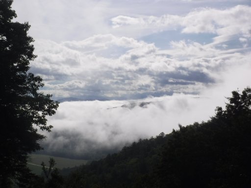
The essences of Overlanding are exploring and adventure, day 7 fit that perfectly. The original plan was to wake up early at the Cades Cove Campgrounds and get on the loop before passing through Townsend. Not wanting to repeat the issues we had with the tourist the day before, we gave up on the idea of back tracking to Cades Cove and just move forward with our planned day. Heading out of Townsend we were soon on the Foothills Parkway, one of the National Park Service’s Scenic Parkways. We quickly found we still had the tail end of the clouds of the early morning storm moving through making views at the overlooks less than impressive. Several spots along the first part of the parkway were fogged in but as we progressed the skies began to slowly clear and by the end of the Parkway we had several overlooks where we could see for miles. As the roads dried and visibility improved, we started to get a bit nervous as we began seeing more vehicles out enjoying the corners rather than the scenery. After completing the Parkway we heading for our next adventure but along the way we decided to make a quick stop in Madisonville to do a little family history research at one of the town’s graveyards. Getting on Route 68, we headed to our third off road adventure, which turned out to be our most adventurous. Part of what made this our most adventurous was our navigation system stopped working completing but we managed to find our turn, Witts Road, and began heading to Conasauga Falls. The trail was in pretty good shape but deteriorated the further we traveled, broken asphalt at first then gravel then worse. We found the trailhead to be a small turnout that was completely under water so we moved further up the trail to find another spot to park the Jeep. As we progressed along the trail it got narrower and we found much more clay making the going very slippery. After several miles it was clear we would not be able to get to our goal, and with the trail getting much more difficult, we decided to turn around and head back rather than risk skidding off the trail into the beautiful scenery below. Lunch on this day was an old favorite spot, the visitor center in Tellico Plains. Our next adventure would be Bald River Road and several waterfalls. Our first was a small one shortly after turning onto the road to the ranger station. Back on Bald River Road we soon realized we did not have the road to our self. Bald River Road is a beautiful road with lots of twists and turns but very narrow. It’s a great driving road and the boy racers were out in force trying to prove their manhood on this road which resulted in a number of near misses. It didn’t take many of these near misses to realize the reward was not worth the risk of a head on crash so we chose to switch over to the Cherohala Skyway. Strangely, the Cherohala Skyway had little traffic on it and it turned out to be an enjoyable drive. The rest of the drive to Murphy we a relaxing drive on wide roads with beautiful scenery the entire way. Although we had missed a couple waterfalls we had been trying to see for the past couple years, the day turned out to be very enjoyable. What made it enjoyable was the day was actually one of the most challenging days we’ve had yet.
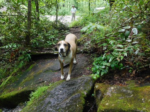
Day 8, wet, challenging, exhausting, a true adventure day. We started the day by working our way onto Route 64 heading east. At first the weather was pleasant but soon the rain began then became heavy. Most of 64 was an easy country drive through small towns and open fields but once you get into the Highlands area things change drastically. This section of 64 will make one think of the Bolivian Death Road, a narrow road with a rock face on one side and a shear drop off on the other, and a margin of only a few inches on either side of the road. To make matters even more challenging, the heaviest rain began just before entering this section. Our first stop was Cullasaja Falls. This stop turned out to be the most dangerous thing we have done to date. The pull off for the falls is almost nonexistent, with the left tires on the roads white line, there was only about a foot of space between the Jeep and the guard rail to get the door open. Sitting between two sharp blind corners, and visibility severely limited by the heavy rain, the thought of being struck by another vehicle was foremost on our mind. Visibility of the falls from the road is not the best due to trees which forces one to hop over the guard rail and work their way down a steep embankment. Our next stop was Bust Your Butt Falls. No, I did not make this name up. This falls has a pull off that won’t put you in fear for your life which is a good thing because the falls isn’t as dramatic as the other three in this area. Further down the road is Dry Falls. Between the heavy rain that was still falling and the falls itself, this falls was anything but dry. This is by far the best falls in this area with a dramatic drop and an accessible area behind the falls. Just as we were getting ready to leave Dry Falls the rain stopped and the rest of the day was pleasant. A very short drive further along 64 is Bridal Veil Falls. A short distance down the road we turned south then entered Gorges State Park. As always, we stopped at the visitor center first to get information on the park and trails but also got a bit of a surprise. At all the parks we have been at one of us goes in while the other stays outside with Lydi since she isn’t allowed in. We did the same at Gorges with me going in first. When I finished and started to exit to take over puppy sitting, the lady at the desk saw Lydi looking through the glass door. She asked if Lydi was well behaved. After I stated that she was, the lady said she could come in. When I told Lydi that she was allowed in, she hesitated, as if she didn’t believe me. Needless to say, Lydi was beyond excited to be allowed into the visitor center, her first. Moving on to the trailhead we started one of the most challenging hikes we’ve done since the John Muir Trail in Tennessee, the Rainbow Falls trail. Along the way we came upon two young ladies standing in the middle of the trail. When they noticed us they quickly turned and said “there is a snake in the middle of the trail”. They explained there was a snake in the middle of the trail but is now near a large rock to one side of the trail. Yes, it was a snake and it was on the trail but the snake was only eight inches long. The quick solution was to just walk over the rock. Rainbow Falls was probably the second most dramatic falls of this trip and the wettest, even with the rain and walking behind Dry Falls. Due to the gorge, the wind blows the mist from the falls onto the trail soaking anyone taking time to admire the falls. After the hike our plans called for us to take the 4x4 trail at the trailhead and run it as far as the bridge at the river. After we changed out of our wet boots three 4x4’s came out of the trail and parked near us. I spoke with them for a short time to get information on the condition of the trail and learned that doing the trail alone would not be a good idea. All the rain over the last few days had made for some of the best waterfalls we have seen but was making the trail more challenging than we cared for. What set our final decision in stone was when we were told the bridge was under water. With lunch finished, we moved on to our final destination of the day, Seneca. In the morning we would be heading home.
Intended to be a short simple trip to try out new gear turned into a challenging trip with tough trails, less than perfect weather, incredible water falls, and an unreliable navigation system. In the end we traveled 1,900 miles and proved that many of the State Parks are just as incredible as our National Parks.