US East Running the Trans America Trail (TAT) from WV to the OR coast

  • HTML tutorial

Mrprez

Rank IV

Enthusiast III

1,146
Wildwood, FL, USA
First Name
John
Last Name
Kennedy
Member #

28913

Ham/GMRS Callsign
KJ4WMZ
I hear warloop is a good one. Did you guys pass the TAT sign in yet? It looks like you were in the Ozark Nat'l Forest. Camp spots should be plentiful.
We stopped in there yesterday. The man who owns the place is interesting to talk to. Actually, the camp spots were far and few between. I will keep an eye out past Oark and west. Warloop is a lot of fun.
 

T. Stanley

Rocky Mountain Region Member Rep Kansas
Launch Member

Member III

2,551
Clay Center, Kansas
First Name
Tim
Last Name
Stanley
Member #

25893

Nice to meet you Tim, I hope you finally got your cup of Joe. Were you going to stay the night there? Looked a good spot. I did see another place further down the road. I couldn’t tell too much about it, as it was shielded from the road by some bushes. It’s on the driver side heading west. Look for a short trail through a mud puddle.

Also, glad you drove back east from Scotland, Ar to meet up with us, I don’t think we would have caught up with you otherwise. We stopped in Oark for lunch, but it was jam packed. We decided to head south off the trail to Clarksville and will head back up there in the morning. We also hit the car wash and off loaded a ton of mud.
Maybe my fuel mileage will be better!

Make sure that you go down Warloop Rd tomorrow! Do not miss that, you will love it! Lots of fun.

John and Sharon
John and Sharon,
it was really nice to meet you both, i hope we can get together again, i will be going exploring more in the next few years before my body won’t let me go anymore
the first thing i did when i pulled into that spot was make coffee, and it was worth the wait
i am at that camping spot right now, i got a fire going and the bugs finally went home for the day, they weren’t mosquitoes but they sure were annoying
i will hit warloop in the morning after i get my coffee made, i got everything all packed except my sleeping gear and that won’t take long to put away. enjoy your trip west, utah is one of my favorite states, i hope i can fit it in next year or 2
catch you later mr and mrs prez
 

Zombie

Local Expert Virginia, USA
Member
Member
Investor

Advocate III

2,159
Richmond, VA USA
First Name
Tom
Last Name
Wright
Member #

14001

Ham/GMRS Callsign
KN4ZTU
@armyRN , I have a few questions that haven't been asked yet. (Unless I missed them) It would be good to set a policy now so we won't need to discuss on the trail.
  1. What will the procedure be if someone has a breakdown and needs a repair that can't be fixed same-day? Will the group wait for the repair or proceed on once the person is safely off the trail?
  2. If the weather turns rainy for days on end, do we keep to the trail in muddy conditions or bypass some parts that might be a bit slick?
  3. If we find that we have too many vehicles for a campsite, should we split up and find separate sites or move on until we find a site that will accommodate us all?
Thanks again for all of your planning!
 

Mrprez

Rank IV

Enthusiast III

1,146
Wildwood, FL, USA
First Name
John
Last Name
Kennedy
Member #

28913

Ham/GMRS Callsign
KJ4WMZ
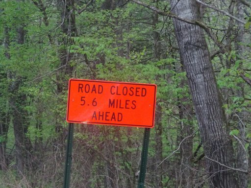
One update on AR-03. When you leave Cass, you will be turning right on to White Rock Mountain Rd. You will see a sign saying the road is closed at 5.6 miles. You can ignore this sign as you will be turning right just at the point where the road is closed. 06AE5194-A898-4A6E-AA70-C0506D46C6CD.jpeg
 

Mrprez

Rank IV

Enthusiast III

1,146
Wildwood, FL, USA
First Name
John
Last Name
Kennedy
Member #

28913

Ham/GMRS Callsign
KJ4WMZ
We bailed on Warloop Rd. We got down to a point where the road was flooded and we didn’t think it was worth the risk. There was about 100’ of water completely across the road and we couldn’t see what was beyond that.
 
  • Like
Reactions: Neal A. Tew

armyRN

Rank V
Launch Member

Member III

1,683
Longview, WA
First Name
Paul
Last Name
Dickinson
Member #

22047

Ham/GMRS Callsign
KI7TSP
@armyRN , I have a few questions that haven't been asked yet. (Unless I missed them) It would be good to set a policy now so we won't need to discuss on the trail.
  1. What will the procedure be if someone has a breakdown and needs a repair that can't be fixed same-day? Will the group wait for the repair or proceed on once the person is safely off the trail?
  2. If the weather turns rainy for days on end, do we keep to the trail in muddy conditions or bypass some parts that might be a bit slick?
  3. If we find that we have too many vehicles for a campsite, should we split up and find separate sites or move on until we find a site that will accommodate us all?
Thanks again for all of your planning!
Good questions! I will answer them all in a bit.

Background. In case you haven't figured it out yet, I put out some very specific... we'll call them "guidelines" (ok; they're rules and requirements). A couple reasons for them all:

1. To keep everyone together. Trying to herd kittens is difficult. Folks getting separated from the group and getting lost can almost be dangerous. I fall into the "start together, finish together" camp. There are always exceptions. But that's why there's hard specific "wheels turning" times. And convoy rules about keeping the vehicle behind you in sight, counting off before we leave, etc. We will never leave a vehicle on the trail unless it broke in half, caught on fire and is now just a molten pile of metal, or something weird like that

2. We'll be on the trail I'm guessing 4-5 weeks at least. Preventing vehicle breakdowns is paramount if you're going to complete the TAT. And I don't care how new or set-up your vehicle is, poop happens to the best of us (including me). So we can't be abusing our vehicles too much or risking damage (ok; we'll try to mitigate damage best we can). Speeds will be kept very reasonable too. Another reason for the requirement of tow points front-and-rear; if we need to tow someone to a repair facility (or get someone over/through an obstacle) we can. And full-size matching spare tires - probably one of the most common "issues" that happen on the trail is flat tires. Always remember, it could be you that has the breakdown, so we will work with the person who's broken to either get it fixed or to a place that can fix it. Oh; and it wouldn't hurt to find out what kind of U-joints your driveshaft(s) use, and grabbing a few spares (even cheap ones from Auto Zone or someplace like that).

If we do have to tow a vehicle off the trail, if the engine can at least be running, then it is much safer (you'll still have power brakes and power steering). I've yet to be in a situation (and I've been doing this for years) where we couldn't get the vehicle off the trail and at least on to pavement. Sometimes you've just got to get a little creative to do so.

So back to the questions:

1. What will the procedure be if someone has a breakdown and needs a repair that can't be fixed same-day? Will the group wait for the repair or proceed-on once the person is safely off the trail?

While it is case dependent, the goal is we all stay together till we get the vehicle to a place where it can be further assessed. And it depends on where we're at. Is it a broken water pump and we're near a town with an auto parts store? Then most likely we'll stay together and wait till the repair is done (even if it is a full day or overnight) - we should be able to replace a water pump (all hands on deck). On flat level ground we can tow a vehicle all day long to get it someplace. Is it a broken transmission that parts need to be ordered and it will be a few days? Now that probably means that person will be staying in town till it is fixed, and we'll keep moving on after making sure they're ok. Maybe they can take the highway and catch up with us later. Depending on where we're at, once we get to a town, the vehicle may still need to be towed to a dealership.

2. If the weather turns rainy for days on end, do we keep to the trail in muddy conditions or bypass some parts that might be a bit slick?

Depends on how muddy the trail is. Is it "dangerous" muddy (vehicles are at risk of damage), or we're just getting filthy dirty. I know early on (day one) there's a bypass around a muddy section/mud hole, and I plan on us taking the bypass. I don't want to play submarine either. But if it is just rainy and muddy, my plan is to keep going, and eventually the rain will stop, we'll get to a town with motels and a car wash and restaurants. And since I know everyone will have tow points front and rear (and tow straps), and some of us have winches, we'll get everyone through. Bring raingear to wear.

3. If we find that we have too many vehicles for a campsite, should we split up and find separate sites or move on until we find a site that will accommodate us all?

That is a possibility. It will be taken on a case-by-case basis. Nobody is to just go off on their own. We'll have plenty of folks with apps showing camping areas, so how close are the other camping areas? Ideally, there will be campsites along the trail where we can have three vehicles camp here, then a half mile down the road another couple vehicles camp, etc. Then in the morning the first group that stopped leaves at a designated time, and the ones further up the line are ready to roll when they come by till we're all back in line. But that requires good communication (which I think we'll be able to do). Part of this adventure is the unknown, and thinking on the fly. But we also can't just scatter. I'd rather us be tightly packed into an area and all be together than be all spread out too far.

Hint: Part of leading and being part of a group like this... is sometimes you're making things up as you go along. We can't anticipate every possible scenario and setting (although I do like to play "what-if" mental games), but we can have guidelines that help us with our decision making.

Does that answer your questions?
 
Last edited:

armyRN

Rank V
Launch Member

Member III

1,683
Longview, WA
First Name
Paul
Last Name
Dickinson
Member #

22047

Ham/GMRS Callsign
KI7TSP
We bailed on Warloop Rd. We got down to a point where the road was flooded and we didn’t think it was worth the risk. There was about 100’ of water completely across the road and we couldn’t see what was beyond that.
I'm hoping things dry out before we hit the trail!
 
  • Like
Reactions: Neal A. Tew

Zombie

Local Expert Virginia, USA
Member
Member
Investor

Advocate III

2,159
Richmond, VA USA
First Name
Tom
Last Name
Wright
Member #

14001

Ham/GMRS Callsign
KN4ZTU
Good questions! I will answer them all in a bit.

Background. In case you haven't figured it out yet, I put out some very specific... we'll call them "guidelines" (ok; they're rules and requirements). A couple reasons for them all:

1. To keep everyone together. Trying to herd kittens is difficult. Folks getting separated from the group and getting lost can almost be dangerous. I fall into the "start together, finish together" camp. There are always exceptions. But that's why there's hard specific "wheels turning" times. And convoy rules about keeping the vehicle behind you in sight, counting off before we leave, etc. We will never leave a vehicle on the trail unless it broke in half, caught on fire and is now just a molten pile of metal, or something weird like that

2. We'll be on the trail I'm guessing 4-5 weeks at least. Preventing vehicle breakdowns is paramount if you're going to complete the TAT. And I don't care how new or set-up your vehicle is, poop happens to the best of us (including me). So we can't be abusing our vehicles or risking damage (ok; we'll try to mitigate damage best we can). Speeds will be kept very reasonable too. Another reason for the requirement of tow points front-and-rear; if we need to tow someone to a repair facility or get someone over/through an obstacle. Always remember, it could be you that has the breakdown, so we will work with the person who's broken to either get it fixed or to a place that can fix it. Oh; and it wouldn't hurt to find out what kind of U-joints your driveshaft(s) use, and grabbing a few spares (even cheap ones from Auto Zone or someplace like that).

If we do have to tow a vehicle off the trail, if the engine can at least be running, then it is much safer (you'll still have power brakes and power steering).

So back to the questions:

1. What will the procedure be if someone has a breakdown and needs a repair that can't be fixed same-day? Will the group wait for the repair or proceed-on once the person is safely off the trail?

While it is case dependent, the goal is we all stay together till we get the vehicle to a place where it can be further assessed. And it depends on where we're at. Is it a broken water pump and we're near a town with an auto parts store? Then most likely we'll stay together till the repair is done (even if it is a full day or overnight) - we should be able to replace a water pump (all hands on deck). On flat level ground we can tow a vehicle all day long to get it someplace. Is it a broken transmission that parts need to be ordered and it will be a few days? Now that probably means that person will be staying in town till it is fixed, and we'll keep moving on after making sure they're ok. Maybe they can take the highway and catch up with us later. Depending on where we're at, once we get to a town, the vehicle may still need to be towed to a dealership.

2. If the weather turns rainy for days on end, do we keep to the trail in muddy conditions or bypass some parts that might be a bit slick?

Depends on how muddy the trail is. Is it "dangerous" muddy (vehicles are at risk of damage), or we're just getting filthy dirty. I know early on (day one) there's a bypass around a muddy section, and I plan on us taking the bypass. I don't want to play submarine. But if it is just muddy, my plan is to keep going, and eventually the rain will stop, we'll get to a town with motels and a car wash and restaurants. And since I know everyone will have tow points front and rear (and tow straps), and some of us have winches, we'll get everyone through.

3. If we find that we have too many vehicles for a campsite, should we split up and find separate sites or move on until we find a site that will accommodate us all?

That is a possibility. It will be taken on a case-by-case basis. Nobody is to just go off on their own. We'll have plenty of folks with apps showing camping areas, so how close are the other camping areas? Ideally, there will be campsites along the trail where we can have three vehicles camp here, then a half mile down the road another couple vehicles camp, etc. Then in the morning the first group that stopped leaves at a designated time, and the ones further up the line are ready to roll when they come by till we're all back in line. But that requires good communication (which I think we'll be able to do). Part of this adventure is the unknown, and thinking on the fly. But we also can't just scatter. I'd rather us be tightly packed into an area and all be together than be all spread out too far.

Hint: Part of leading and being part of a group like this... is sometimes you're making things up as you go along. We can't anticipate every possible scenario and setting, but we can have guidelines that help us with our decision making.

Does that answer your questions?
Questions answered!
 
  • Like
Reactions: Neal A. Tew

T. Stanley

Rocky Mountain Region Member Rep Kansas
Launch Member

Member III

2,551
Clay Center, Kansas
First Name
Tim
Last Name
Stanley
Member #

25893

We bailed on Warloop Rd. We got down to a point where the road was flooded and we didn’t think it was worth the risk. There was about 100’ of water completely across the road and we couldn’t see what was beyond that.
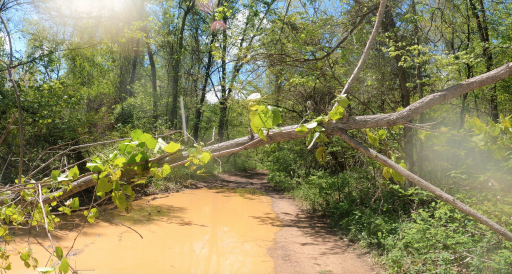
I went through that first section of water and it was not really all that deep, kind of muddy but passable. Then came a problem! There was a big tree across the road right in the middle of a huge “puddle” about a mile or so down the road and I had no way to remove the tree or boots to wade in the muck, so I backed out until I could find a spot to turn around. I had my GoPro on the hood, I will try to get that clip and post it, it was really starting to get fun, and way more challenging than the FS roads.
 

T. Stanley

Rocky Mountain Region Member Rep Kansas
Launch Member

Member III

2,551
Clay Center, Kansas
First Name
Tim
Last Name
Stanley
Member #

25893

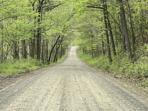
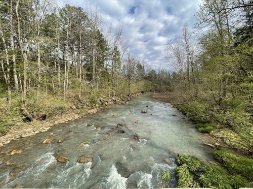
Here are some pictures from my adventure today. It was a long weekend but I learned a bunch about my gear and more.
One thing to note, on AR2 and AR3 you are on mostly FS roads and pavement, and one section of pavement is quite a few miles long, I didn’t air down until I got to Warloop Road and in June, I will air down some for the first parts just to make the ride a bit less bumpy and air down for Warloop Road again.

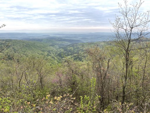
one of my favorite views along AR3. I saw quite a few critters, i think it was an eagle, but I will have to check the video tomorrow, squirrels, a chipmunk, one house I passed they must have had 15 hunting dogs, a bobcat jump out within 15 feet of my truck and I was so mad I didn’t have my GoPro out on the hood yet,

8DBED7F0-7EF6-470C-8DB8-325BB6F1FA28.jpeg

54E40FD4-C0B1-45F8-8734-1AA54516E643.jpeg

4A60DE13-15E3-403C-A7A7-87EAA7B7D994.jpeg

F4608C92-37F0-4C29-85B7-AEC98B7A8D9D.jpeg
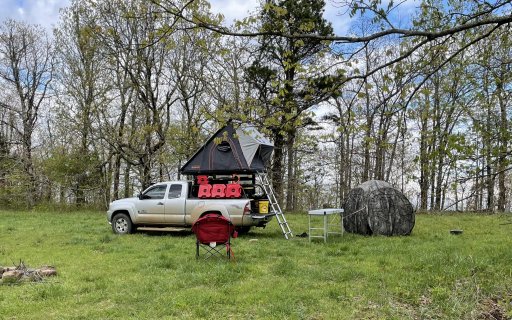
my camping spot for the night, it was an awesome view from up there.
 
Last edited:

T. Stanley

Rocky Mountain Region Member Rep Kansas
Launch Member

Member III

2,551
Clay Center, Kansas
First Name
Tim
Last Name
Stanley
Member #

25893

I took a short video up to the first section of water.

Well you guys made it almost as far as I did. I went through that section and it was muddy but passable, maybe another a1/8 - 1/4 of mile was where I encountered the tree across the trail. I sure hope we get to go through that section in June. I was really starting to enjoy it.
 

Mrprez

Rank IV

Enthusiast III

1,146
Wildwood, FL, USA
First Name
John
Last Name
Kennedy
Member #

28913

Ham/GMRS Callsign
KJ4WMZ
Well you guys made it almost as far as I did. I went through that section and it was muddy but passable, maybe another a1/8 - 1/4 of mile was where I encountered the tree across the trail. I sure hope we get to go through that section in June. I was really starting to enjoy it.
Someone will take care of that tree. We were in the easy part. When you start going downhill is when the fun starts.
 
  • Like
Reactions: Neal A. Tew

T. Stanley

Rocky Mountain Region Member Rep Kansas
Launch Member

Member III

2,551
Clay Center, Kansas
First Name
Tim
Last Name
Stanley
Member #

25893

Here is a screenshot from my video of the tree blocking my path on Warloop Road, man I was just starting to have fun, I started to test how effective my limb risers would be on a branch this size and thought better of it
4D4328C2-2578-4325-924C-C09989B91B5E.png
 

Triple B

Rank IV
Member

Enthusiast III

1,116
Tampa, FL
First Name
Ann
Last Name
Edwards
Member #

26651

One update on AR-03. When you leave Cass, you will be turning right on to White Rock Mountain Rd. You will see a sign saying the road is closed at 5.6 miles. You can ignore this sign as you will be turning right just at the point where the road is closed. View attachment 195333
I've heard of these signs. Those that have driven the route say that some of the signs are installed by owners of the private property that we will drive by because the owners don't want vehicles driving down the road stirring up the dust. and/or just don't want you in the area; even though the owners don't own the road. Basically a fake sign. No clue how to differ fake from real. In this sample I bet that sign deterred some folks and they turned around to re-route themselves
Here are some pictures from my adventure today. It was a long weekend but I learned a bunch about my gear and more.
One thing to note, on AR2 and AR3 you are on mostly FS roads and pavement, and one section of pavement is quite a few miles long, I didn’t air down until I got to Warloop Road and in June, I will air down some for the first parts just to make the ride a bit less bumpy and air down for Warloop Road again.

one of my favorite views along AR3. I saw quite a few critters, i think it was an eagle, but I will have to check the video tomorrow, squirrels, a chipmunk, one house I passed they must have had 15 hunting dogs, a bobcat jump out within 15 feet of my truck and I was so mad I didn’t have my GoPro out on the hood yet,

View attachment 195456

View attachment 195457

View attachment 195458

View attachment 195460
my camping spot for the night, it was an awesome view from up there.
, not knowing that the trail turns in 5 mi.
Here are some pictures from my adventure today. It was a long weekend but I learned a bunch about my gear and more.
One thing to note, on AR2 and AR3 you are on mostly FS roads and pavement, and one section of pavement is quite a few miles long, I didn’t air down until I got to Warloop Road and in June, I will air down some for the first parts just to make the ride a bit less bumpy and air down for Warloop Road again.

one of my favorite views along AR3. I saw quite a few critters, i think it was an eagle, but I will have to check the video tomorrow, squirrels, a chipmunk, one house I passed they must have had 15 hunting dogs, a bobcat jump out within 15 feet of my truck and I was so mad I didn’t have my GoPro out on the hood yet,

View attachment 195456

View attachment 195457

View attachment 195458

View attachment 195460
my camping spot for the night, it was an awesome view from up there.
Your pics are quite lovely. Can't wait to see the area, when trees have their leaves and the wild flowers are in bloom.
 
  • Like
Reactions: Neal A. Tew

Mrprez

Rank IV

Enthusiast III

1,146
Wildwood, FL, USA
First Name
John
Last Name
Kennedy
Member #

28913

Ham/GMRS Callsign
KJ4WMZ
I've heard of these signs. Those that have driven the route say that some of the signs are installed by owners of the private property that we will drive by because the owners don't want vehicles driving down the road stirring up the dust. and/or just don't want you in the area; even though the owners don't own the road. Basically a fake sign. No clue how to differ fake from real. In this sample I bet that sign deterred some folks and they turned around to re-route themselves


, not knowing that the trail turns in 5 mi.


Your pics are quite lovely. Can't wait to see the area, when trees have their leaves and the wild flowers are in bloom.
This is a legit closed road. Check the website for Ozark NF. The road was wiped out by a landslide.
 
  • Wow
Reactions: Neal A. Tew

Neal A. Tew

US Rocky Mountain Local Expert
Mod Team
Member
Member

Member III

3,817
Pueblo West, CO
First Name
Neal
Last Name
Tew
Member #

12384

Ham/GMRS Callsign
N1TEW
Paul, I saw this on Facebook this morning and I was confused by their wording and was hoping for a clarification , do we need a permit as out of state plated vehicles to drive the TAT in Colorado?

I mentioned this back at the beginning of the thread.

I just happened to discuss it again in this thread that I posted this morning.


You only need the permit if you take the hard section of Tincup. The modern route bypasses it.
 
  • Like
Reactions: T. Stanley