Pennsylvania MVU Roads and dispersed camping ideas

  • HTML tutorial

Redbear

Rank IV
Launch Member

Enthusiast III

1,213
Bayville, NJ
First Name
Kenneth
Last Name
Murdoch
Member #

19981

Ham/GMRS Callsign
KD2TQO GMRS: WREQ743
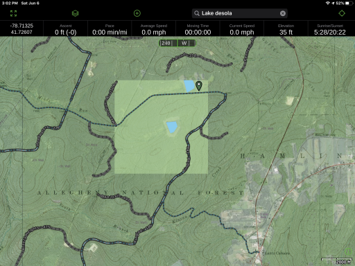
Give the current state of our country I am looking to do some dispersed camping with my son. I was thinking PA, NY, or VT. I saw a cluster of roads on GAIA in the Allegheny State Forest. I will be traveling in my Tacoma w/ an off road camper-trailer. Not looking for anything crazy, just something remote and scenic. Anyone here of Duck Pond?

here is a screenshot of an area I found that seemed interesting (Ignore the search bar I was looking at something else prior).
1591470176008.png

Any ideas?
 

DevilDodge

Rank IV

Advocate I

1,135
Altoona, Pennsylvania, USA
First Name
David
Last Name
Spencer


Here is a few ideas
 

Redbear

Rank IV
Launch Member

Enthusiast III

1,213
Bayville, NJ
First Name
Kenneth
Last Name
Murdoch
Member #

19981

Ham/GMRS Callsign
KD2TQO GMRS: WREQ743
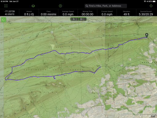
I was thinking about doing a day trip exploring the bald eagle forest tomorrow. Eventually I want to bring my camper trailer but tomorrow would just be driving my Tacoma to get a feel for the land. I am trying to understand what these maps call trails versus roads. There are lots of “trails” interconnecting the route I marked but not sure if they are hiking trails or can be used by 4x4s.


Are you familliar with the miflinburg Reservoir Area?

Any suggestions?
 

Attachments

DevilDodge

Rank IV

Advocate I

1,135
Altoona, Pennsylvania, USA
First Name
David
Last Name
Spencer
I really can not tell what your map is showing.

But I do see where you are at.

The day use map would give a better route than what I see.

I am not sure what you are showing, but I am familiar with that area. Unfortunately, my maps are in the truck and i just got ready for bed.
 

Redbear

Rank IV
Launch Member

Enthusiast III

1,213
Bayville, NJ
First Name
Kenneth
Last Name
Murdoch
Member #

19981

Ham/GMRS Callsign
KD2TQO GMRS: WREQ743
I really can not tell what your map is showing.

But I do see where you are at.

The day use map would give a better route than what I see.

I am not sure what you are showing, but I am familiar with that area. Unfortunately, my maps are in the truck and i just got ready for bed.
Ok, thanks anyway.
 

DevilDodge

Rank IV

Advocate I

1,135
Altoona, Pennsylvania, USA
First Name
David
Last Name
Spencer
Will you be coming from NJ on 80?

I tried zooming in to see the markings. I just can not make them out. The area you are in there has many roads and trails.

Have you looked at the legend for that map system?

I am not familiar with it.

You can cover alot of ground in a day. Good luck on your trip.
 

Redbear

Rank IV
Launch Member

Enthusiast III

1,213
Bayville, NJ
First Name
Kenneth
Last Name
Murdoch
Member #

19981

Ham/GMRS Callsign
KD2TQO GMRS: WREQ743
I wish, my plans got veto’d by my GF. Hpefully we will get out there in two weekends. We would go next weekend but it’s a holiday. :-(
 

DevilDodge

Rank IV

Advocate I

1,135
Altoona, Pennsylvania, USA
First Name
David
Last Name
Spencer
Sorry to hear that. I took a look at that area on the map. There are a few good 4x4 trails there. Negro Hollow to be one of them. It is overall lacking as compared to the southern section but does have some things to see.

Hope you can get out there soon.