For a really long time I was looking for a way to combine proper offline navigation and iOverlander data in one way or another.
iOverlander2 at least gets to the point of offline data and maps, but there is no navigation, the app is phone only (I use an iPad). Maps.me doesn't properly import data, none of the other apps I tried is actually flexible enough to import data to the point I wanted.
GaiaGPS and OnX offroad are utterly useless for "normal navigation" and large area offline maps, so that left me with very few options.
My personaly solution now is: OsmAnd for full offline navigation with OpenStreetMaps and an insane amount of flexibiliy. It also imports GPX point of interest data as favorites if the files are properly done. So, what did I do:
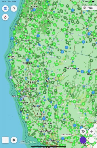
Here's how a massively zoomed out view looks like with POIs enabled:
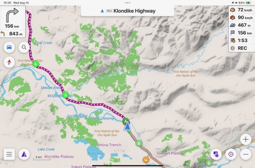
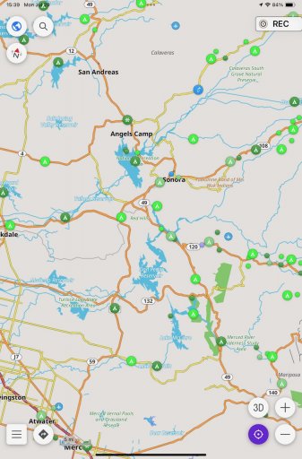
And a zoomed in view into a particular area:
I have to admit that OsmAnd is certainly not for everyone. It isn't the most stable app, it somestimes can't navigate the way I want to go or that would actually be correct and possible, and on a recent trip in Europe it wanted me to cross a large river at a point where there was no crossing ... ;-) So, still have to keep my brain activated when navigating.
Maybe this gives some folks ideas that it isn't all about Gaia, OnX, Google or Apple Maps etc. – all of these have issues to downlad LARGE areas for offline use (think countries or continents).
iOverlander2 at least gets to the point of offline data and maps, but there is no navigation, the app is phone only (I use an iPad). Maps.me doesn't properly import data, none of the other apps I tried is actually flexible enough to import data to the point I wanted.
GaiaGPS and OnX offroad are utterly useless for "normal navigation" and large area offline maps, so that left me with very few options.
My personaly solution now is: OsmAnd for full offline navigation with OpenStreetMaps and an insane amount of flexibiliy. It also imports GPX point of interest data as favorites if the files are properly done. So, what did I do:
- Got OsmAnd with a subscription so I can download more than the free areas, free would probably be okay for a lot of people though.
- Downloaded iOverlander CSV data (because it's the richest download format they have) for the countries I wanted (US and Canada for now).
- Wrote a data conversion tool to convert iOverlander CSV into OsmAnd GPX.
- Imported the data into OsmAnd and voila - it works. I can now see iOverlander POIs when navigating with OsmAnd.
Here's how a massively zoomed out view looks like with POIs enabled:
And a zoomed in view into a particular area:
I have to admit that OsmAnd is certainly not for everyone. It isn't the most stable app, it somestimes can't navigate the way I want to go or that would actually be correct and possible, and on a recent trip in Europe it wanted me to cross a large river at a point where there was no crossing ... ;-) So, still have to keep my brain activated when navigating.
Maybe this gives some folks ideas that it isn't all about Gaia, OnX, Google or Apple Maps etc. – all of these have issues to downlad LARGE areas for offline use (think countries or continents).