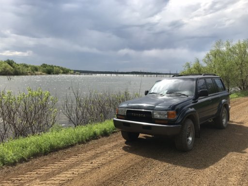
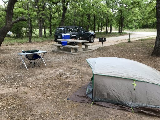
I live up in North texas. im thinking of making some trips to the broken bow area. Any suggestions on some good trails in the area?
Oklahoma overlanders where ya at?
- Thread starter 87comanche
- Start date
-
Guest, UPDATE We went through the site migration runbook and completed all steps. We will need to complete the migration next week, but will leave the forums up for the weekend. A few days after maintenance, a major upgrade revision to the forum site will occur.

Member III
Welcome. Take a look at the MVUM (Motor Vehicle Use Map) for the Oklahoma Ranger District (Ouachita National Forest - Home) to see what routes are open and then go wander around.I live up in North texas. im thinking of making some trips to the broken bow area. Any suggestions on some good trails in the area?
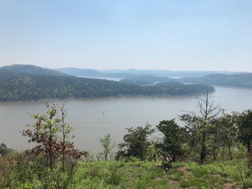
I am not sure you will find a bad trail out there. I would suggest that you at least venture up Holly Mountain Trail, it has a great view overlooking the lake.

Off-Road Ranger I
Overland Bound Rally June 7-9 at Byrds Adv. Center in Ozark Arkansas more information to come

Influencer I
Ironically I was looking for the info on this. I've got it in my calendar but havnt looked too much into it. Was planning on hitting the bonfire this weekend but work got in the way of that. Hopefully I can hit this trip. Seems like every trip I've had has been cold and raining. Would be nice to get the tent out and have the windows open for once.Overland Bound Rally June 7-9 at Byrds Adv. Center in Ozark Arkansas more information to come
I ended up going for a day trip. it is only about a 2.5 hour drive from my house. I saw this post after. I ended up going down the Holly mountain trail. It was an amazing view. Wasn't able to find a secluded place to access the lake though. Ill have to go back soon.Welcome. Take a look at the MVUM (Motor Vehicle Use Map) for the Oklahoma Ranger District (Ouachita National Forest - Home) to see what routes are open and then go wander around.
I am not sure you will find a bad trail out there. I would suggest that you at least venture up Holly Mountain Trail, it has a great view overlooking the lake.
Just joined in... Broken Arrow...Tulsa OK
Hi @Walt Welcome to the crew. Theres a lot of folks up your direction.Just joined in... Broken Arrow...Tulsa OK

Influencer I

Member III
Hello @Walt , welcome.
Here is the link to the forum calendar and Meet-Up event page: Overland Bound Meetups
Or to check out what other members are planning go here: Overland Trip Planning
June 7th – 9th is the OB Rally Southeast in the Ozark National Forest in Arkansas.
If you have any questions let me know.
Here is the link to the forum calendar and Meet-Up event page: Overland Bound Meetups
Or to check out what other members are planning go here: Overland Trip Planning
June 7th – 9th is the OB Rally Southeast in the Ozark National Forest in Arkansas.
If you have any questions let me know.

Off-Road Ranger I

Traveler III
- 1,815
- First Name
- Ryan
- Last Name
- Horner
- Member #
-
16636
- Service Branch
- USAF
Hey let me know if your going back. I've got some trails marked out. It took some time to get to the east side of the lake. Lot of locked gates. But we eventually got to the spot I found on Google maps. Secluded but you could tell some local kids partied out there.I ended up going for a day trip. it is only about a 2.5 hour drive from my house. I saw this post after. I ended up going down the Holly mountain trail. It was an amazing view. Wasn't able to find a secluded place to access the lake though. Ill have to go back soon.
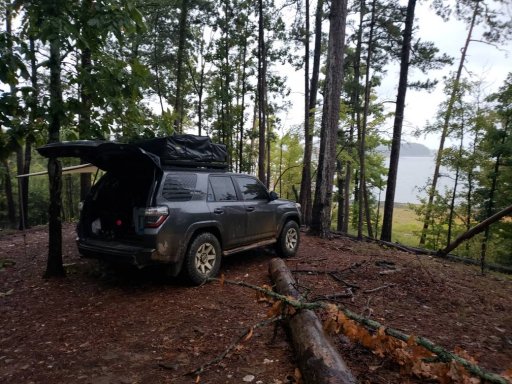
I don't know when at the moment. I want to find a really good camping spot on the shore so that my dogs can do some swimming. From the views I saw at Holly mountain it looks like my best bet is on the east side. I have already marked out a few trails that should get me there in Gaia GPS. My next planned trip though I think I am going to check out lake Ouachita.Hey let me know if your going back. I've got some trails marked out. It took some time to get to the east side of the lake. Lot of locked gates. But we eventually got to the spot I found on Google maps. Secluded but you could tell some local kids partied out there. View attachment 96245
Here is our spot on Google maps. Where it is circled is where we actually camped. It was a pain to get to with all the locked gates. But I have a route if you want itI don't know when at the moment. I want to find a really good camping spot on the shore so that my dogs can do some swimming. From the views I saw at Holly mountain it looks like my best bet is on the east side. I have already marked out a few trails that should get me there in Gaia GPS. My next planned trip though I think I am going to check out lake Ouachita.
View attachment 96265
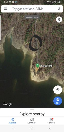
That is one of the areas I marked! it looks like an abandoned boat ramp. Are you able to get to where the end where you put the pin or was that as far as you could get?Here is our spot on Google maps. Where it is circled is where we actually camped. It was a pain to get to with all the locked gates. But I have a route if you want it
View attachment 96266
We drove down there then on the beach for a while going south. But it started getting pretty soft. There is some strange stuff out there. We had some wierd stuff happen lol. But if your not easily spooked by Blair witch type stuff its pretty cool
Lol. I think i know what you mean. That sounds cool. I wanted to go down the shore to the south a little ways and camp out. Not sure when but probably in June some time. If I could get that route from you it would be great. I planned a route heading north from HWY 70 takiing N4750 to N4757 to N4755, it seems like the most direct route. Im not sure which roads may be closed in the area.We drove down there then on the beach for a while going south. But it started getting pretty soft. There is some strange stuff out there. We had some wierd stuff happen lol. But if your not easily spooked by Blair witch type stuff its pretty cool
It's all hunting ground east of the lake. So it was kind of a pain getting in there. But I mapped it coming out. If you want send me a dm with your email.... or on here if you want. And I'll email you the gpx file
I sent you a PM.It's all hunting ground east of the lake. So it was kind of a pain getting in there. But I mapped it coming out. If you want send me a dm with your email.... or on here if you want. And I'll email you the gpx file
Edit:
Thanks @Vandy, I received the GPX files. I look forward to being able to camp right on the shore of Broken Bow.
Last edited:


