New to exploring PNW

  • HTML tutorial

CurrentlyRockhoundin

Rank IV
Launch Member

Enthusiast III

1,310
Spokane, WA
First Name
Jared
Last Name
Goguen
Member #

20084

Oh, another thing is that we are going to try and make our way through the 90 and over to Couer d'Alene Idaho and Whitefish Montana at the end of February. Any advice on that would be 100% helpful! I am a little nervous about the winter weather as this will be our first experience heading east like that.

Thanks in advance for any ideas and thoughts!
Welcome

Driving out here on the east side is pretty good in the winter, WADOT does a damn good job of keeping the HWYs and FWYs clear.

If you have the standard winter weather driving gear you will be more then fine with your Jeep.
 

Dilldog

Rank V
Launch Member
Investor

Influencer I

2,358
Spokane, WA.
First Name
Dillon
Last Name
Wilke
Member #

20298

Ham/GMRS Callsign
KJ7LVO/ WRQL275
Service Branch
USAF
Did someone say geology! That's like blowing a dog whistle to me.

Central and eastern Washington provides so many fantastic geological points of interest.
Especially the hydro-geology from the collapse of the glacial lakes in Montana.
 
  • Like
Reactions: kkriewald

First Settler

Rank II

Enthusiast II

336
Washington, USA
First Name
Grayson
Last Name
Hjaltalin
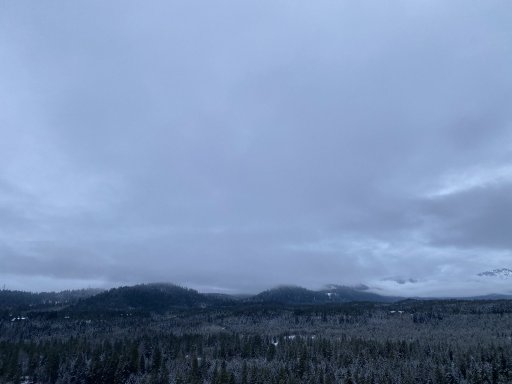
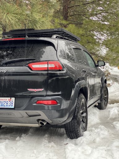
Not much exploring over the holidays but did head to Cle Elum area with the family. We have some camping reservations in April, June, and July in places like Kalaloch, Orcas Island, and maybe head to Bellingham. Excited to explore a bit of the Olympics. The weather in Cle Elum wasn't great but was fun to get out a bit and test the new rig on slush.

IMG_0627.JPG
IMG_0631.JPG
 

PNW EXPLR

Local Expert Southeast Washington, USA
Member
Investor

Explorer I

4,285
Kennewick, WA, USA
First Name
Michael
Last Name
Denniston
Member #

3030

Ham/GMRS Callsign
KJ7LYZ
Welcome to OB and the PNW Grayson.

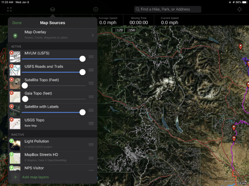
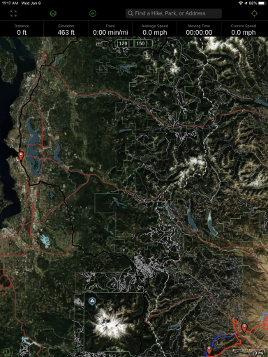
First, I would recommend downloading Gaia Maps. Take a look at the USFS Roads & Trails and the MVUM layers. As you can see from the screenshots, there are hundreds of miles of trails to explore. You can save detailed maps of areas of your choice for when you lose service.
thumbnail.png
thumbnail (1).png
All of the white lines are trails, and as you zoom in more appear!

Next I would outfit yourselves with some gear. Nothing crazy, just some basic camping stuff, SHELTER, WATER, FOOD, WARMTH, FIRST-AID.
Also a set of traction cables. Or a set of All-terrain tires.

Lastly, Pick a general area on the map, Let some friends know where your headed and when to expect you back, hit th "Record a Track" on Gaia, and GO GO GO.

It's tough to say, "Oh, go here" because once you get near the mountains I don't think you will find a bad place. And your favorite place may end up being a view point on a random dirt road that none of us know about.

Just start driving, and try to see if you can drive every road in an area, You will be amazed at what you guys discover together as a family!
 

PNW EXPLR

Local Expert Southeast Washington, USA
Member
Investor

Explorer I

4,285
Kennewick, WA, USA
First Name
Michael
Last Name
Denniston
Member #

3030

Ham/GMRS Callsign
KJ7LYZ
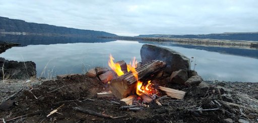
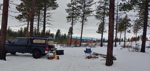
I went driving around 2 weeks ago with no real plan. Here are two places I found and enjoyed....and completely different from one another!
You can also look at the iOverlander app.
thumbnail (1).jpg
thumbnail.jpg
 

First Settler

Rank II

Enthusiast II

336
Washington, USA
First Name
Grayson
Last Name
Hjaltalin
I went driving around 2 weeks ago with no real plan. Here are two places I found and enjoyed....and completely different from one another!
You can also look at the iOverlander app.
View attachment 134316
View attachment 134317
Wow! Those are beautiful shots & locations. This is exactly what I am looking find, something out there enough to enjoy nature & let my little one run around & play. Maybe even prop up a hammock or something. Do you use some type of device when you say hit "record" and go? I was looking at either just using my phone or maybe something a bit bigger. For me, I think I look at the Gaia maps & get instantly overwhelmed.

Thanks so much for all the amazing information. Besides some other things I really want to look at getting better tires that feel a bit more "mind at ease".
 
  • Like
Reactions: kkriewald

PNW EXPLR

Local Expert Southeast Washington, USA
Member
Investor

Explorer I

4,285
Kennewick, WA, USA
First Name
Michael
Last Name
Denniston
Member #

3030

Ham/GMRS Callsign
KJ7LYZ
Wow! Those are beautiful shots & locations. This is exactly what I am looking find, something out there enough to enjoy nature & let my little one run around & play. Maybe even prop up a hammock or something. Do you use some type of device when you say hit "record" and go? I was looking at either just using my phone or maybe something a bit bigger. For me, I think I look at the Gaia maps & get instantly overwhelmed.

Thanks so much for all the amazing information. Besides some other things I really want to look at getting better tires that feel a bit more "mind at ease".
There are hundreds of these spots out there.

The "Record a Track" is a function of Gaia Maps.
Here is a link to a tutorial from @Lifestyle Overland . Kevin does a great job going over it.
It's a great mapping app. You can download it to your phone and tablet and use it online from your PC. It will sync between all three. Really not very difficult.
 

kkriewald

Rank IV
Launch Member

Enthusiast III

1,080
US
First Name
Kurtis
Last Name
Kriewald
Member #

20271

I am over in the western WA area, NEish of Lake Washington. But super happy to drive just about anywhere around WA, OR, ID, MT, Canada, etc. Was actually thinking about maybe driving over to the San Juan island, IDK if there is much over there to explore but sounds like fun. I also really want to drive over to the Olympic national park.
My opinion, Olympics are better in the summer (more open), San Juan Islands are my winter place. Better weather than Seattle, no crowds. Go to Leavenworth in February, you won't have crowds and tge lights are still on with much better snow.
 
  • Like
Reactions: First Settler

kkriewald

Rank IV
Launch Member

Enthusiast III

1,080
US
First Name
Kurtis
Last Name
Kriewald
Member #

20271

As for fishing, get a paper copy of the regulations, they also have an app that is pretty good. Be careful they like to close odd sections of streams and rivers, and have specific regulations for individual little lakes. I fish streams that I have fished my entire life, and sometimes struggle to figure out what the boundaries are that they refer to. That said, it's all good, have fun.
 
  • Like
Reactions: First Settler

Seanm26

Rank IV
Launch Member

Enthusiast III

1,003
Lynden, WA, USA
First Name
Sean
Last Name
Moore
Member #

21121

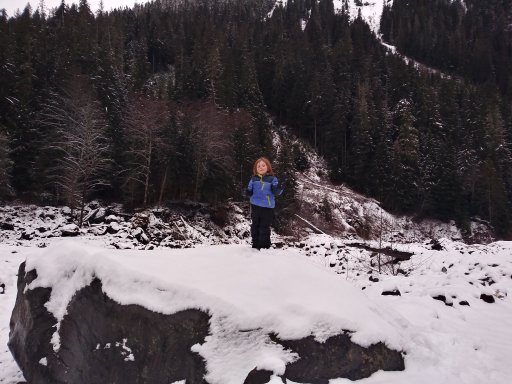
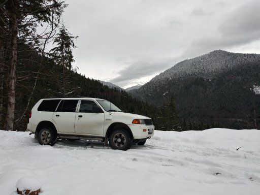
We go exploring all the time and rarely leave Whatcom County! These pics are the past month or so.

I currently have ViewRanger for navigation as a holdover from dirt biking but will be switching to Gaia soon.

20191228_160450_HDR.jpg20191228_141610_HDR.jpg
 

First Settler

Rank II

Enthusiast II

336
Washington, USA
First Name
Grayson
Last Name
Hjaltalin
Awesome! Thanks so much for all the great information. So far we have planned a trip to Leavenworth in Feb ( now thanks to @kkriewald ), A trip to Whitefish, Montana at the end of Feb, Kalaloch in July, and Orcas island in July as well. Lots of fun stuff already booked up for this year. My parents are talking about wanting to go to Moab area in April ( they are in CA, and will most likely be hauling an RV ) which sounds like a lot of fun but it looks like we would have to find a spot in Boise as a mid-way overnight stop. Anybody drive from around here to Moab before?
 

First Settler

Rank II

Enthusiast II

336
Washington, USA
First Name
Grayson
Last Name
Hjaltalin
Also, we really want to take a trip over to Yellowstone sometime this year. I was thinking maybe the end of August or Sept while the animals will be roaming? Again, I am new to all this so I may be totally wrong lol
 

M Rose

Local Expert
Mod Team
Member

Advocate III

5,584
Northeast Oregon, United States
First Name
Michael
Last Name
Rose
Member #

20990

Ham/GMRS Callsign
W7FSB
Service Branch
US ARMY Retired
Awesome! Thanks so much for all the great information. So far we have planned a trip to Leavenworth in Feb ( now thanks to @kkriewald ), A trip to Whitefish, Montana at the end of Feb, Kalaloch in July, and Orcas island in July as well. Lots of fun stuff already booked up for this year. My parents are talking about wanting to go to Moab area in April ( they are in CA, and will most likely be hauling an RV ) which sounds like a lot of fun but it looks like we would have to find a spot in Boise as a mid-way overnight stop. Anybody drive from around here to Moab before?
Finding a spot around Boise to stop is actually quite easy. I go down there about 3 times a year to visit the VA hospital. Normally I go to a hotel on the west side of the city by the airport. But I found a spot a few years ago up by Idaho City that was very pretty with dispersed camping, I will look to see if I can find it on GAIA and get the cordinants for it. Also there is plenty of dispersed camping here in Eastern Oregon and Western Idaho before you get to Boise.
You might start a thread in trip planning about your trip to MOAB, where other members along your rout can post up where you can stay along the way as well.
 
  • Like
Reactions: First Settler

M Rose

Local Expert
Mod Team
Member

Advocate III

5,584
Northeast Oregon, United States
First Name
Michael
Last Name
Rose
Member #

20990

Ham/GMRS Callsign
W7FSB
Service Branch
US ARMY Retired
Also, we really want to take a trip over to Yellowstone sometime this year. I was thinking maybe the end of August or Sept while the animals will be roaming? Again, I am new to all this so I may be totally wrong lol
Animals are most active in early spring and late fall,
 

First Settler

Rank II

Enthusiast II

336
Washington, USA
First Name
Grayson
Last Name
Hjaltalin
Finding a spot around Boise to stop is actually quite easy. I go down there about 3 times a year to visit the VA hospital. Normally I go to a hotel on the west side of the city by the airport. But I found a spot a few years ago up by Idaho City that was very pretty with dispersed camping, I will look to see if I can find it on GAIA and get the cordinants for it. Also there is plenty of dispersed camping here in Eastern Oregon and Western Idaho before you get to Boise.
You might start a thread in trip planning about your trip to MOAB, where other members along your rout can post up where you can stay along the way as well.

That's a great idea! Thanks so much, will do that. I am not 100% sure what my rig can do near Moab but I think it would be fun to just go and do some spring driving.
 

Seanm26

Rank IV
Launch Member

Enthusiast III

1,003
Lynden, WA, USA
First Name
Sean
Last Name
Moore
Member #

21121

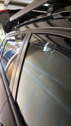
Those window visors are gonna play hell with your windows for bit but will eventually wear in. You will roll them up and they will contact the visor, stop, and roll down an inch. Nothing is wrong. The vehicle thinks someone has their fingers in there.
 
  • Like
Reactions: First Settler

First Settler

Rank II

Enthusiast II

336
Washington, USA
First Name
Grayson
Last Name
Hjaltalin
Haha yeah I’ve noticed this. My auto up works on the passenger but not on the driver. Not a huge deal but kind of weird experience at first. Though I do love having air flow while it’s raining like yesterday and tonight.
 

Seanm26

Rank IV
Launch Member

Enthusiast III

1,003
Lynden, WA, USA
First Name
Sean
Last Name
Moore
Member #

21121

Put a good set of a/t's on there and those things are super capable. The traction control does just that, controls traction in adverse conditions and situations.
 

First Settler

Rank II

Enthusiast II

336
Washington, USA
First Name
Grayson
Last Name
Hjaltalin
Totally agree. I really want to wrap a new set of Falken wild peaks on some method wheels eventually this year. Was hoping to do it before the Whitefish trip in feb but I think our firestone destination a/t should hold up okay for now. I guess we will see! Haha.