

Traveler III
Even though I visit Mendocino NF more frequently than just about anywhere else, for whatever reason, I hadn't done the BDT in a single trip. Typically, we'd do bits and pieces and explore new areas along the way. Before covid hit, you could drive for hours without seeing anyone in the forest (outside of hunting season). Now it seems, a lot of folks in Sac and the SF Bay Area have heard about the once hidden gem, that is the Mendocino NF. But that's hardly bad news, with the thousands of miles of roads and trails to explore, there's still not that many people in the forest compared to placed like Tahoe or El Dorado National Forests! The plan for the weekend was pretty straightforward. The group (all 4 rigs) would meet up in Upper Lake on Friday morning and then we'd head northward into the forest with the primary goal of capturing the video footage that would become the Video Route Guide for the Mendocino BDT, which you can watch HERE.
Day One
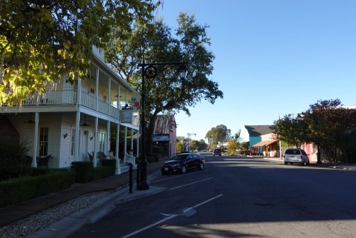
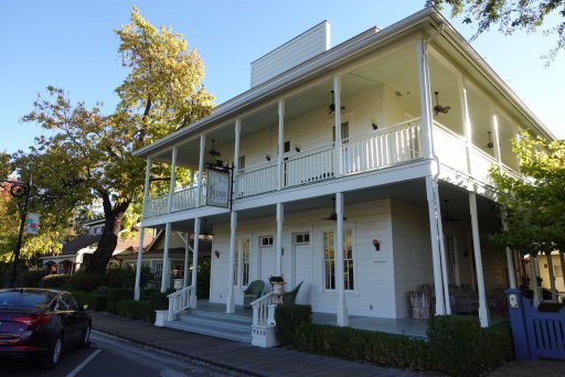
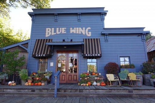
We begin our adventure in historic downtown Upper Lake, which also happens to be the first discovery point along the Mendocino BDT. Because I live only a couple of hours south of Upper Lake, I decided to hit the road before sunrise as I wanted to arrive early to capture some drone footage of upper lake along with short videos and photos-- mission accomplished! Upper Lake has actually come quite a long way in the last 10 years. The town has seen a bit of a revitalization, and the downtown and surrounding farmlands is rather quaint and charming in comparison to some of the other communities around Clear Lake. We ended up with a small group for this trail Run-- Dan, Phil, Sean, and myself would make up this trip's entourage. We'd follow the pavement up the two dozen or so switchbacks up Elk mountain Road and into the National Forest. About a dozen or so miles from Upper Lake, the road finally turns into dirt. About 30' wide in most spots, and from the lack of traffic along this section of M1, we could easily tell it was the off season. This became even more apparent as we rolled into Soda Springs store to top of our tanks, as the owner was concerned the cost of starting the generator would be more profit than he'd make from selling fuel to us. Luckily, he had about 20 gallons of fuel in jerry cans ready to be sold-- score, just enough to get us to Sunday on our way home!
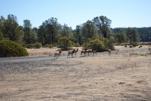
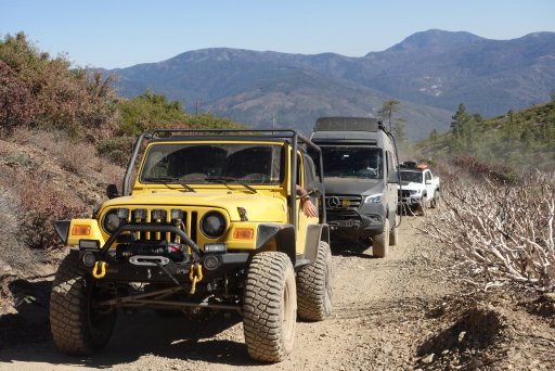
We'd break for lunch at Sunset Point before heading up and over Hull Mountain. I don't think we past a single vehicle going over Hull. Since Dan was driving a Sprint 4x4, we advised him to avoid the last .5 miles up to the top of Hull, and he jumped in one of the guys' rigs. In typical fashion, Hull never seems to disappoint, especially for those who haven't experience it before. Hull Mountains is what I call the dividing point. Most of the crowds in Mendocino NF congregate in and around Lake Pillsbury and the surrounding OHV trail networks (like Stonyford to the east). Once you get north of Hull Mountain, the crowds thing out substantially-- but not an issue during the off season.
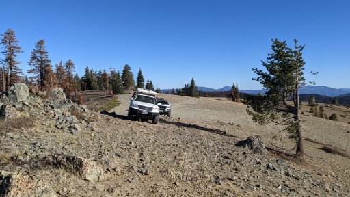
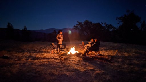
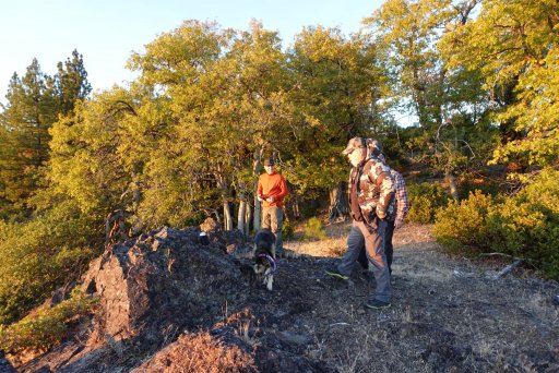
We'd push north making another stop at Bald Mountain, which also has great views, especially looking to the north. We started to notice the trail traffic was picking up, and we soon discovered it was hunting season! It seemed like a truck or tent was in darn near just about every campsite We'd past. I was growing concerned that our plan A campsite might be taken. We split off M1 down the secondary road and past at least one group hunting along the way- not a good sign. The marker of the giant rock outcropping came into view along with the cattle gate we'd need to open. Our site was just over the grassy knoll, and I was feeling anxious we'd ascend the small hill to find a group in my secret camp site within the Mendocino. This would be the 4th time I've camped at this site, and as it turns out, nobody was there just like the previous three times. However, a good 4-5 trucks passed us while hunting for game.

Day 2
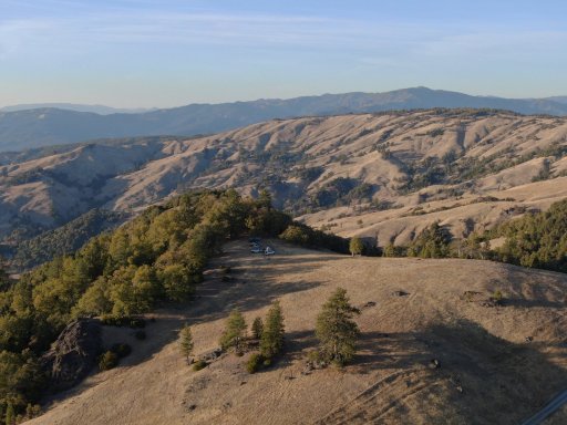
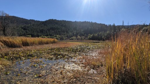
Our camp from day 1 is just north of Grizzly Flats (sorry, that's about as much as I'll give up on this one!), and this section of M1 is incredible. The pine and fir forest gives way to golden rolling hills studded with oak and chaparral, and the occasional rock outcropping. I knew I needed to get some drone footage of this section, which is how the day started off after rolling out of camp. Once the drone activities were wrapped up, we dropped down the M1 to the confluence of where the Black Butte and Eel Rivers meet. We made a quick stop at very small store at the Black Butte River Ranch before continuing north on M1. We decided to make a quick detour over to Howard Lake, and along the way we past Little Doe campground, which is a gem of a campground. Howard Lake is a few more miles past little Doe through a dense and mixed conifer forest. Our arrival at Howard Lake was a bit eery. It was pretty, but the campground was completely deserted, which seemed a bit odd. We decided to hangout and and have lunch here given it was flat with plenty of shade. Before long, we were back on the M1 and rapidly ascending into the mountains.
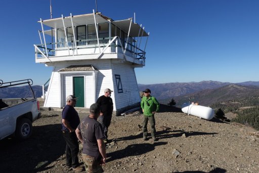
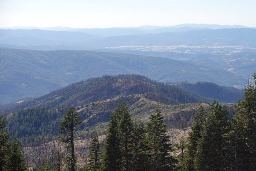
Portions of this section of trail got hit incredibly hard from the 2020 August Complex fires. Expect alternating sections of green, healthy forest, mixed in with stretches where the 2020 August Complex fires completely destroyed everything in it's path. You can spot those sections where the fire absolutely ravished the forest and burned at its hottest-- not a single tree was spared, and quite literally all of the pine needles either burned or were vaporized in the extreme heat. We'd wrap up and around Little Doe Lake, which looked more like a mud pit than a lake. We'd make a quick stop at Green Springs campground. A small campground with maybe 8 total sites, all of which were being used by hunting groups. For our last leg of the journey, we'd head over to Anthony Peak. Even though the busy summer season had past, the USFS was still staffing the fire lookout until colder weather moved in. We talked to the forest service employees for a bit, who shared some interesting stories. Like how the fellow who built the cabin just a few hundred yards from the lookout likes to forego clothing when visiting his cabin. Or how two young men had flipped their vehicle just below the lookout while driving intoxicated one night several years ago (one of them didn't make it).
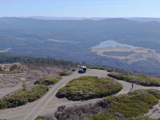
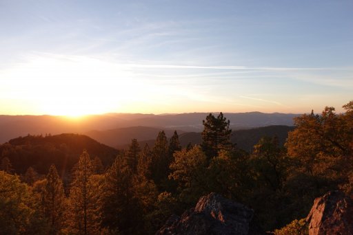
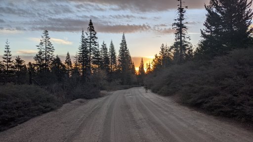
The weather atop Anthony Peak was damn near perfect. On a clear day, the locals say you can see Lassen Peak to the east and the Pacific Ocean to the west. I still haven't been lucky enough to witness either of those during my numerous visits to the lookout. But the folks who staff the lookout are always super friendly and most times will invite you up for a quick tour of the lookout. We decided to do a bit of exploring on the northern flank of the mountain, which has some semi-technical and steep pitches, all along an incredibly scenic ridge line that gives way to a bluff. For this trip, we'd forego the last section over to Keller Lake and Keller Cabin. I'd visited Keller cabin the previous year, but wasn't sure if it was still standing following the 2020 fires, especially since it looked like Black Butte, which Keller Lake and Cabin sit below, got hit hard by the August Complex. We decided that we'd take FH7 to Interstate-5 to head back to our homes on Sunday. We'd camp at Board Tree our last night in the forest, and by 9am on Sunday, camp was broken down and we were all headed back to the daily grinds that would be waiting for us come Monday.
Day One
We begin our adventure in historic downtown Upper Lake, which also happens to be the first discovery point along the Mendocino BDT. Because I live only a couple of hours south of Upper Lake, I decided to hit the road before sunrise as I wanted to arrive early to capture some drone footage of upper lake along with short videos and photos-- mission accomplished! Upper Lake has actually come quite a long way in the last 10 years. The town has seen a bit of a revitalization, and the downtown and surrounding farmlands is rather quaint and charming in comparison to some of the other communities around Clear Lake. We ended up with a small group for this trail Run-- Dan, Phil, Sean, and myself would make up this trip's entourage. We'd follow the pavement up the two dozen or so switchbacks up Elk mountain Road and into the National Forest. About a dozen or so miles from Upper Lake, the road finally turns into dirt. About 30' wide in most spots, and from the lack of traffic along this section of M1, we could easily tell it was the off season. This became even more apparent as we rolled into Soda Springs store to top of our tanks, as the owner was concerned the cost of starting the generator would be more profit than he'd make from selling fuel to us. Luckily, he had about 20 gallons of fuel in jerry cans ready to be sold-- score, just enough to get us to Sunday on our way home!
We'd break for lunch at Sunset Point before heading up and over Hull Mountain. I don't think we past a single vehicle going over Hull. Since Dan was driving a Sprint 4x4, we advised him to avoid the last .5 miles up to the top of Hull, and he jumped in one of the guys' rigs. In typical fashion, Hull never seems to disappoint, especially for those who haven't experience it before. Hull Mountains is what I call the dividing point. Most of the crowds in Mendocino NF congregate in and around Lake Pillsbury and the surrounding OHV trail networks (like Stonyford to the east). Once you get north of Hull Mountain, the crowds thing out substantially-- but not an issue during the off season.
We'd push north making another stop at Bald Mountain, which also has great views, especially looking to the north. We started to notice the trail traffic was picking up, and we soon discovered it was hunting season! It seemed like a truck or tent was in darn near just about every campsite We'd past. I was growing concerned that our plan A campsite might be taken. We split off M1 down the secondary road and past at least one group hunting along the way- not a good sign. The marker of the giant rock outcropping came into view along with the cattle gate we'd need to open. Our site was just over the grassy knoll, and I was feeling anxious we'd ascend the small hill to find a group in my secret camp site within the Mendocino. This would be the 4th time I've camped at this site, and as it turns out, nobody was there just like the previous three times. However, a good 4-5 trucks passed us while hunting for game.
Day 2
Our camp from day 1 is just north of Grizzly Flats (sorry, that's about as much as I'll give up on this one!), and this section of M1 is incredible. The pine and fir forest gives way to golden rolling hills studded with oak and chaparral, and the occasional rock outcropping. I knew I needed to get some drone footage of this section, which is how the day started off after rolling out of camp. Once the drone activities were wrapped up, we dropped down the M1 to the confluence of where the Black Butte and Eel Rivers meet. We made a quick stop at very small store at the Black Butte River Ranch before continuing north on M1. We decided to make a quick detour over to Howard Lake, and along the way we past Little Doe campground, which is a gem of a campground. Howard Lake is a few more miles past little Doe through a dense and mixed conifer forest. Our arrival at Howard Lake was a bit eery. It was pretty, but the campground was completely deserted, which seemed a bit odd. We decided to hangout and and have lunch here given it was flat with plenty of shade. Before long, we were back on the M1 and rapidly ascending into the mountains.
Portions of this section of trail got hit incredibly hard from the 2020 August Complex fires. Expect alternating sections of green, healthy forest, mixed in with stretches where the 2020 August Complex fires completely destroyed everything in it's path. You can spot those sections where the fire absolutely ravished the forest and burned at its hottest-- not a single tree was spared, and quite literally all of the pine needles either burned or were vaporized in the extreme heat. We'd wrap up and around Little Doe Lake, which looked more like a mud pit than a lake. We'd make a quick stop at Green Springs campground. A small campground with maybe 8 total sites, all of which were being used by hunting groups. For our last leg of the journey, we'd head over to Anthony Peak. Even though the busy summer season had past, the USFS was still staffing the fire lookout until colder weather moved in. We talked to the forest service employees for a bit, who shared some interesting stories. Like how the fellow who built the cabin just a few hundred yards from the lookout likes to forego clothing when visiting his cabin. Or how two young men had flipped their vehicle just below the lookout while driving intoxicated one night several years ago (one of them didn't make it).
The weather atop Anthony Peak was damn near perfect. On a clear day, the locals say you can see Lassen Peak to the east and the Pacific Ocean to the west. I still haven't been lucky enough to witness either of those during my numerous visits to the lookout. But the folks who staff the lookout are always super friendly and most times will invite you up for a quick tour of the lookout. We decided to do a bit of exploring on the northern flank of the mountain, which has some semi-technical and steep pitches, all along an incredibly scenic ridge line that gives way to a bluff. For this trip, we'd forego the last section over to Keller Lake and Keller Cabin. I'd visited Keller cabin the previous year, but wasn't sure if it was still standing following the 2020 fires, especially since it looked like Black Butte, which Keller Lake and Cabin sit below, got hit hard by the August Complex. We decided that we'd take FH7 to Interstate-5 to head back to our homes on Sunday. We'd camp at Board Tree our last night in the forest, and by 9am on Sunday, camp was broken down and we were all headed back to the daily grinds that would be waiting for us come Monday.
Attachments
-
 1,000.3 KB Views: 13
 -
 566.3 KB Views: 5
 -
 548.6 KB Views: 4


