

Influencer II
What an awesome 9 days of nothing but me and my dog. I learned some great things to apply for suture trips, especially off grid and more importantly, I had an amazing time. Left Sept 28 from Lubbock and stayed in Rio Rancho, NM. Just north of ALBQ, it made it easier for my dog Maximus to cope with the long road trip.
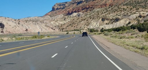
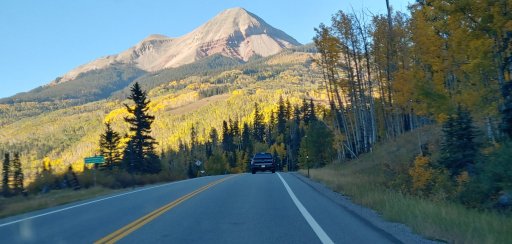
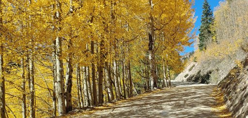
Left the following morning for Silverton. Gorgeous aspens in full golden from Durango going north. Stayed at a little hostel kind of setup that was clean and tidy.
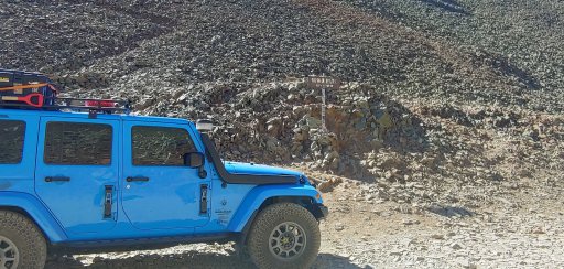
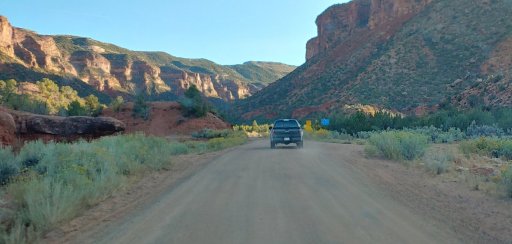
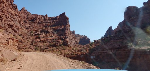
Left the following morning for Ophir Pass. The trail was in much rougher shape than last time on it. Dry, dusty, much more exposed rock. On the decent into Ophir, The shelf road was worn and narrower than previous years. Not a lot of water flowing either.
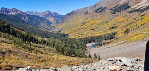
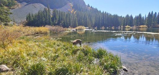
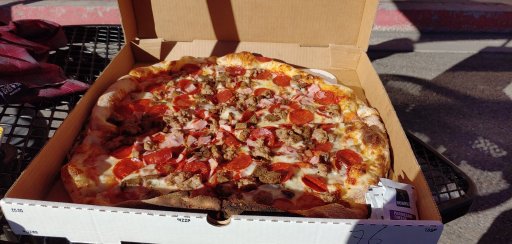
Once out, we ran up to Alta Lakes. At 12k' it was stunning topography. Crazy hippie lady on her paddle board, nude, telling us that the light and dark are colliding and we needed to be prepared. OK. Then to Telluride for a bottle of High West Distillery Bourbon. I've had their Rendezvous and Double Rye, but this was IMO, even better. Its never a stop unless you go to Brown Dog Pizza. No indoor seating but the city has closed portions of the street for outdoor dining. Then off to Ouray for the night.
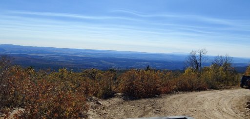
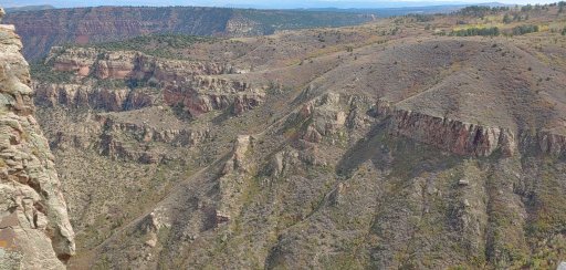
Woke the next morning and north to Montrose to catch the northern alternative to the Rim Rocker. Montrose north on Hwy 50 to Olathe and then west on an unnamed road for 74 miles that will take you to Columbine Campground and then to Nucla The road was excellent until about mile 27 where it went into what can only be described as graded bedrock for 5.6 miles. Slow, slow, slow, teeth shattering slow. Once clear, the road narrowed and went into a group of private land hunting grounds up to just shy of 10k' and then down into Nucla. It was pretty. Aspens in full color and the trail coming out on the south side gave us views over the entire expanse from roughly Ridgway to Nucla.
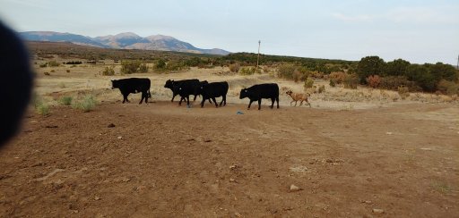
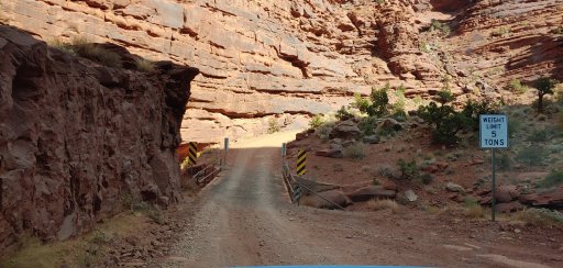
Once in Nucla I had a bad valve stem and changed out the spare. We then took the paved road of CO Hwy 141 to Gateway and then the Dolores Triangle Safari Route / La Sal Loop Rd to UT-128. This was worth the teeth shattering bedrock. Gorgeous climb from Gateway up into ranch country. Camped around 30 miles in. Cattle everywhere. Coyotes singing. Dropped to about 28°F overnight. I let Maximus out of the Jeep and 2 minutes later saw him sizing up cattle. He is a city boy so this was a whole new game. Even at 175lbs, he is still outweighed by a ton. Forest fire smoke was omnipresent and only got worse each day. Campfires banned everywhere in CO and UT currently. Propane/gas stoves are ok.
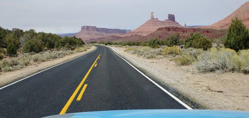
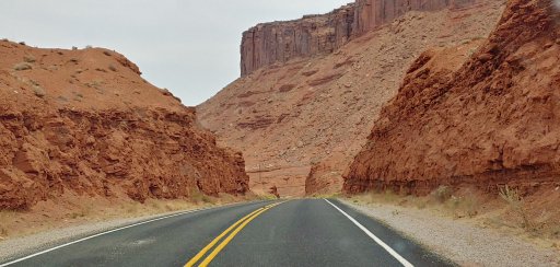
Back in the truck after pancakes, coffee, bacon and eggs. Again, fall colors were amazing. This road takes you to the Dinosaur Tracks roadside stop where dinosaur footprints were left millions of years ago. Pretty cool. It begins paved road here and drops you down into Castle Valley between Arches and Moab proper. You also come in on the opposite side of Castle Rock.
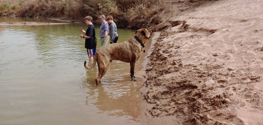
Stopped along the Colorado River for Max to get some exercise. Goats and Herons were right in front of us.
We went north near Dewey Bridge which was once the longest suspension bridge in the world. Now its just rusting away. Camped at a spot a mile or so from the road and partook in some adult herbaciousness. Next morning Maximus and I went for a long walk and found some more great scenery. What I can only surmise as nude yoga on the rock outcropping above the Colorado. Can't see them from the road, only the trail we were on. Lovely... Then off to Top of the World but it was packed. Turned around and went to Onion Creek South Trail. Great 3 hour roundtrip with terrific topography and roughly 24 water crossings each way. Water was about 22" deep at its deepest. Avoid in the rain. Slick mud and the water will get beyond snorkel deep.
Dropped into Moab proper for fuel and water. It took 2.5 hours to travel 7 miles. 5 lanes of traffic are currently only 2 lanes in town. It was packed. Left and camped north of town near the Canvas Over Moab stop north of town. Headed home via Delores and stayed in Pagosa Springs in a proper bed and I hit the hot springs. Great way to wrap up the week before a 7 hour drive home.
Left the following morning for Silverton. Gorgeous aspens in full golden from Durango going north. Stayed at a little hostel kind of setup that was clean and tidy.
Left the following morning for Ophir Pass. The trail was in much rougher shape than last time on it. Dry, dusty, much more exposed rock. On the decent into Ophir, The shelf road was worn and narrower than previous years. Not a lot of water flowing either.
Once out, we ran up to Alta Lakes. At 12k' it was stunning topography. Crazy hippie lady on her paddle board, nude, telling us that the light and dark are colliding and we needed to be prepared. OK. Then to Telluride for a bottle of High West Distillery Bourbon. I've had their Rendezvous and Double Rye, but this was IMO, even better. Its never a stop unless you go to Brown Dog Pizza. No indoor seating but the city has closed portions of the street for outdoor dining. Then off to Ouray for the night.
Woke the next morning and north to Montrose to catch the northern alternative to the Rim Rocker. Montrose north on Hwy 50 to Olathe and then west on an unnamed road for 74 miles that will take you to Columbine Campground and then to Nucla The road was excellent until about mile 27 where it went into what can only be described as graded bedrock for 5.6 miles. Slow, slow, slow, teeth shattering slow. Once clear, the road narrowed and went into a group of private land hunting grounds up to just shy of 10k' and then down into Nucla. It was pretty. Aspens in full color and the trail coming out on the south side gave us views over the entire expanse from roughly Ridgway to Nucla.
Once in Nucla I had a bad valve stem and changed out the spare. We then took the paved road of CO Hwy 141 to Gateway and then the Dolores Triangle Safari Route / La Sal Loop Rd to UT-128. This was worth the teeth shattering bedrock. Gorgeous climb from Gateway up into ranch country. Camped around 30 miles in. Cattle everywhere. Coyotes singing. Dropped to about 28°F overnight. I let Maximus out of the Jeep and 2 minutes later saw him sizing up cattle. He is a city boy so this was a whole new game. Even at 175lbs, he is still outweighed by a ton. Forest fire smoke was omnipresent and only got worse each day. Campfires banned everywhere in CO and UT currently. Propane/gas stoves are ok.
Back in the truck after pancakes, coffee, bacon and eggs. Again, fall colors were amazing. This road takes you to the Dinosaur Tracks roadside stop where dinosaur footprints were left millions of years ago. Pretty cool. It begins paved road here and drops you down into Castle Valley between Arches and Moab proper. You also come in on the opposite side of Castle Rock.
Stopped along the Colorado River for Max to get some exercise. Goats and Herons were right in front of us.
We went north near Dewey Bridge which was once the longest suspension bridge in the world. Now its just rusting away. Camped at a spot a mile or so from the road and partook in some adult herbaciousness. Next morning Maximus and I went for a long walk and found some more great scenery. What I can only surmise as nude yoga on the rock outcropping above the Colorado. Can't see them from the road, only the trail we were on. Lovely... Then off to Top of the World but it was packed. Turned around and went to Onion Creek South Trail. Great 3 hour roundtrip with terrific topography and roughly 24 water crossings each way. Water was about 22" deep at its deepest. Avoid in the rain. Slick mud and the water will get beyond snorkel deep.
Dropped into Moab proper for fuel and water. It took 2.5 hours to travel 7 miles. 5 lanes of traffic are currently only 2 lanes in town. It was packed. Left and camped north of town near the Canvas Over Moab stop north of town. Headed home via Delores and stayed in Pagosa Springs in a proper bed and I hit the hot springs. Great way to wrap up the week before a 7 hour drive home.
Attachments
-
 395.9 KB Views: 5
Last edited:


