Cool. I will keep you posted. Maybe in two weeks. Maybe.I'm ready and willing to go if you want someone to tag along with...
Kansas Members??
- Thread starter adventure_is_necessary
- Start date
-
Guest, UPDATE We went through the site migration runbook and completed all steps. We will need to complete the migration next week, but will leave the forums up for the weekend. A few days after maintenance, a major upgrade revision to the forum site will occur.

Contributor I
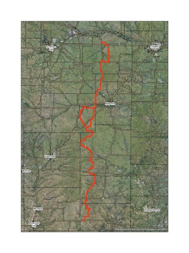
Please share when you can! I'd love to know for information if nothing else.I've got it mapped. From Alma, to Cedar Vale (camping included) 99% dirt roads. I'm going to ride it out once first to make sure none of my routes are actually privately owned (fenced off) routes. Then I will post it up for all to enjoy. Lots and lots of water crossings and some areas I'm not even sure there is actually still a road (we will see).
Sent from my SM-J320V using Tapatalk

Traveler III
- 4,007
- First Name
- Lucas
- Last Name
- Antes
- Member #
-
7082
- Ham/GMRS Callsign
- KE0ZXA
I know a good chunk of those roads. It'll be a treat! Bring your cameras.
I thought that was odd myself! Oh well, I usually end up traveling West towards the Rockies anyway, or East to the Ozarks. I'm always up for a meetup; I live in Lenexa.Somewhat baffled that Kansas is part of the Rocky Mountain region! Anyone in Kansas have any trips planned out, ideas for trips, or want to meet up?

Contributor I
I think we are close to each other. I'm in KCK on the border with Shawnee by Lake Quivira.I thought that was odd myself! Oh well, I usually end up traveling West towards the Rockies anyway, or East to the Ozarks. I'm always up for a meetup; I live in Lenexa.
Let me know if you want to hit some trails and camp. Even if it's just county roads, I'm game.I think we are close to each other. I'm in KCK on the border with Shawnee by Lake Quivira.
Ok. I had time this weekend to drive HALF the trail. And I apologize, but it was the BACK half of the trail. I started at the end and worked my way back. It took me three hours to drive from Cedar Vale to Teter Rock. I've attached the .kmz file for anyone who wants to explore thus far. I did run into a snag going further north (and I needed fuel). I ran into a "gate" issue trying to go north from Teter Rock. I will post the rest once I have resolved the path and ensured a "public access" route. Enjoy. . .


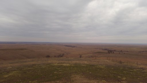
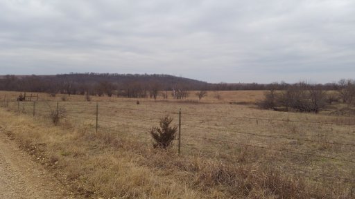
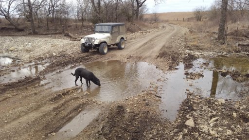
Some notes:
1) If you follow the trail all the way to Cedar Vale I have ended the trail at a great free camp site near the Caney River.
2) You will only find fuel in Cedar Vale along the trail. ***Cassoday DOES NOT have fuel****
3) There is a great historic restaurant/hotel in Beaumont (WIFI available).
4) Any amount of rain may make several portions of this trail impassable. Do not attempt to cross flooded areas.
Attachments
-
22.9 KB Views: 31

Traveler III
- 4,007
- First Name
- Lucas
- Last Name
- Antes
- Member #
-
7082
- Ham/GMRS Callsign
- KE0ZXA
Where was this gate?? Curious if we could route around it at all. I'm pretty familiar with the area. Although I didn't know the station in Cassoday had closed. That's disappointing since they had homemade goodies there :(Ok. I had time this weekend to drive HALF the trail. And I apologize, but it was the BACK half of the trail. I started at the end and worked my way back. It took me three hours to drive from Cedar Vale to Teter Rock. I've attached the .kmz file for anyone who wants to explore thus far. I did run into a snag going further north (and I needed fuel). I ran into a "gate" issue trying to go north from Teter Rock. I will post the rest once I have resolved the path and ensured a "public access" route. Enjoy. . .


View attachment 51431 View attachment 51432 View attachment 51433 View attachment 51434
Some notes:
1) If you follow the trail all the way to Cedar Vale I have ended the trail at a great free camp site near the Caney River.
2) You will only find fuel in Cedar Vale along the trail. ***Cassoday DOES NOT have fuel****
3) There is a great historic restaurant/hotel in Beaumont (WIFI available).
4) Any amount of rain may make several portions of this trail impassable. Do not attempt to cross flooded areas.
Yeah. . .I was also disappointed as I had gone 3 hours without fuel in my CJ5. I coasted into Cottonwood Falls on fumes. The gate was across road "F" which was my intended path. And since my cell network was spotty out there to say the least, I couldn't locate an alternate route.

Traveler III
- 4,007
- First Name
- Lucas
- Last Name
- Antes
- Member #
-
7082
- Ham/GMRS Callsign
- KE0ZXA
Road F....sounds like you made it to Lyon County then. I can't say I've ever encountered a gate on road F though. Interesting.Yeah. . .I was also disappointed as I had gone 3 hours without fuel in my CJ5. I coasted into Cottonwood Falls on fumes. The gate was across road "F" which was my intended path. And since my cell network was spotty out there to say the least, I couldn't locate an alternate route.
I happen to manage the GIS data for Chase County, so I know there are road right of ways through (meaning it is a public road). But the south end of road F is in Butler County. Their county GIS site says road F has about 100ft of right of way going north, then stops and become private. So I'm stumped.
http://orka.kansasgis.org/MainPage.aspx
Check this map out. It's a link for Greenwood County GIS. If you follow 300th out east from Cassoday until you hit F road you will see what I mean. However, H road has right of way. . .
Check this map out. It's a link for Greenwood County GIS. If you follow 300th out east from Cassoday until you hit F road you will see what I mean. However, H road has right of way. . .
Last edited:

Traveler III
- 4,007
- First Name
- Lucas
- Last Name
- Antes
- Member #
-
7082
- Ham/GMRS Callsign
- KE0ZXA
I see it now. Road H looks like the preferred alternative with the cattle guards on the road.http://orka.kansasgis.org/MainPage.aspx
Check this map out. It's a link for Greenwood County GIS. If you follow 300th out east from Cassoday until you hit F road you will see what I mean. However, H road has right of way. . .
Could be gated as well though. I don't remember. Someone will have to go check it out.

Traveler III
- 4,007
- First Name
- Lucas
- Last Name
- Antes
- Member #
-
7082
- Ham/GMRS Callsign
- KE0ZXA
I'm close enough to where I could go check. Google Earth made it seem like it was just a cattle guard, but the quality of the image was not ideal to be certain.Could be gated as well though. I don't remember. Someone will have to go check it out.


