Like a lot of my fellow Albertans, I have worked in Fort McMurray, AB. When I was up there for a brief stint I would hear of “The bridge to nowhere” and the sand roads that are only driveable in the winter. Ever since I heard the stories I’d always wanted to see more of the remote area and drive the winter roads. Not sure if it’s the novelty, or the sheer remoteness that appealed to me, but I wanted to see it.
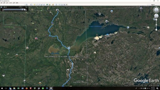
Open from usually mid January to March the road extends from Fort McMurray, AB to Fort Chipewyan and up to Fort Smith, NWT. Fort Chip has some serious history to it. One of the oldest European settlements in Alberta, the North West Company first founded it in 1788ish. In summer the small town can only be accessed by air or by boat. No roads in, no roads out. How awesome is that.
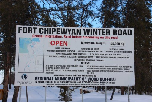
In the winter though the area is serviced by a winter road. I never really knew what that meant, but I have a better idea now, having seen it. The Provincial gov’t draws water from rivers, and lakes and waters the road to give it a good base as it freezes. Then they grade and keep it smooth for traffic. Once the rivers have a good enough ice base for traffic, they open the road up and keep it clear of snow.
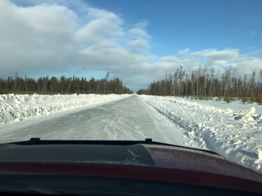
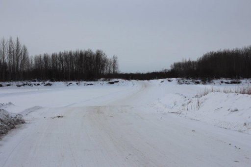
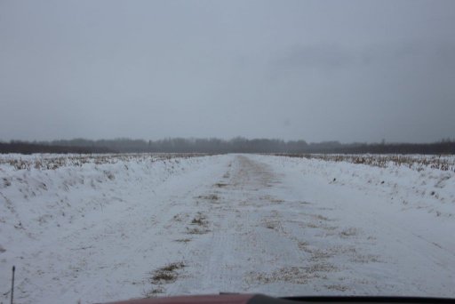
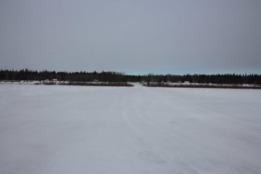
As you can see some of the stretches are looong and straight. Lots of rolling hills, and super smooth road. Sort of like driving on an extended ski run after a sunny day only more ice. Groomed, and a bit of texture, but if you catch a corner at any amount of speed… Well at least with high snow on the sides you won’t get far into the ditch. lol
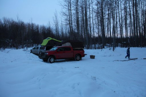
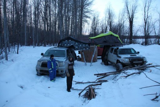
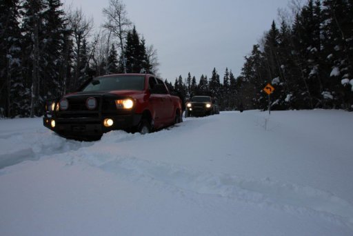
Camp the first night was right on the banks of the Athabasca river. Not overly cold. Probably in the -15Deg C (5Deg F) range. Chilly for sure in a tent. I used a Big Buddy heater in the vestibule to get the chill off before settling in, but left it off at night. Even with a window open the moisture in the tent with 3 men in it was high. If we warmed it up with the heater it rained on us. Lol
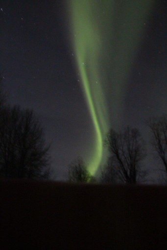
Some good northern lights that night though. It’s fun to see them dance.
Athabasca river crossing in the morning.
Fort Chip Worf. No Klingons in sight though. Lol.
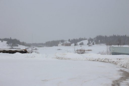
2 historic buildings in town. The Anglican Church of St. Paul’s the Apostle, and what I’m pretty sure is a Monestary?
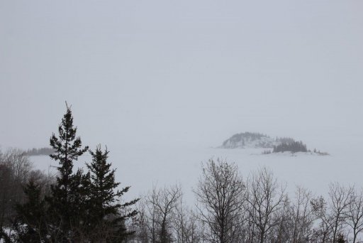
Athabasca Lake. Very cool how the Canadian shield comes up here & makes the shores & islands rocky. We also noticed how someone puts small trees across the lake so you can navigate on low visibility days presumably. Clever.
The Lake Athabasca flood plain.
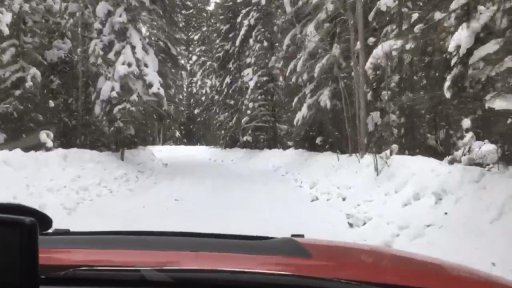
This is after leaving Fort Chipewyan and following the Peace River. Gorgeous winding roads had us down to 50Km/hr for an hour. Not a lot of speeding on an winding ice road.
Crossing the Peace River at Moose landing… I wonder where the Moose was flying in from?
Tried to get into Pine Lake. I’m not sure if it’s lucky that I got stuck quickly or if I should have chained up and tried harder. Maybe that’s an adventure for next time. I probably could have pounded in harder and deeper and then had to shovel more. Lol As it is a quick tug back and I backed out fairly easily.
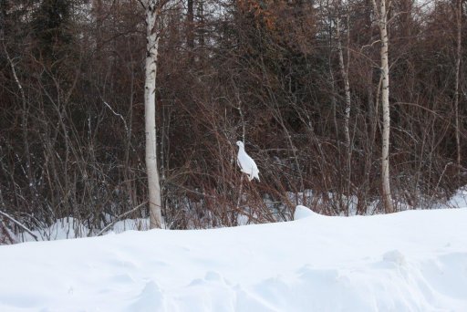
Day 3 we saw a couple of groups of Willow Ptarmigan. This guy stuck around long enough for a photo op. Check out the furry feet. He’s tough bird to stay up north in the winter… Assuming he stays north.
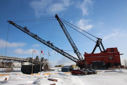
Obligatory stop at the Fort McMurray mining equipment. Schnikeys that stuff is big. Bucket wheel:
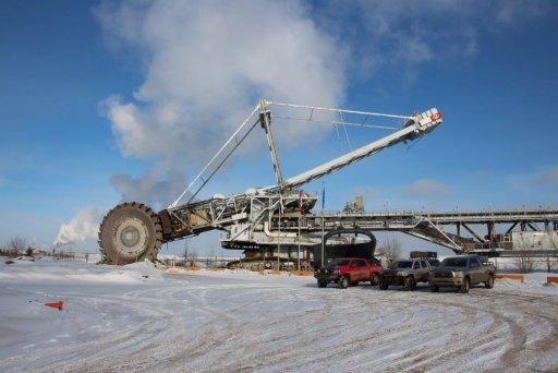
And shovel:
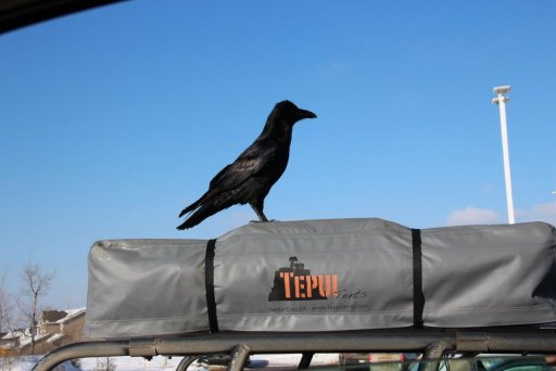
On one stop one of the guys tried to pick up a local. Friendly little Raven fellas that’d take a French fry out of your mouth if you weren’t paying attention… Of course they’d probably take an eyeball with it so I guess they’re not too friendly.
And that’s about it. Awesome winter camping road trip with good friends. Already planning next year. I hope it works out.
Open from usually mid January to March the road extends from Fort McMurray, AB to Fort Chipewyan and up to Fort Smith, NWT. Fort Chip has some serious history to it. One of the oldest European settlements in Alberta, the North West Company first founded it in 1788ish. In summer the small town can only be accessed by air or by boat. No roads in, no roads out. How awesome is that.
In the winter though the area is serviced by a winter road. I never really knew what that meant, but I have a better idea now, having seen it. The Provincial gov’t draws water from rivers, and lakes and waters the road to give it a good base as it freezes. Then they grade and keep it smooth for traffic. Once the rivers have a good enough ice base for traffic, they open the road up and keep it clear of snow.
As you can see some of the stretches are looong and straight. Lots of rolling hills, and super smooth road. Sort of like driving on an extended ski run after a sunny day only more ice. Groomed, and a bit of texture, but if you catch a corner at any amount of speed… Well at least with high snow on the sides you won’t get far into the ditch. lol
Camp the first night was right on the banks of the Athabasca river. Not overly cold. Probably in the -15Deg C (5Deg F) range. Chilly for sure in a tent. I used a Big Buddy heater in the vestibule to get the chill off before settling in, but left it off at night. Even with a window open the moisture in the tent with 3 men in it was high. If we warmed it up with the heater it rained on us. Lol
Some good northern lights that night though. It’s fun to see them dance.
Athabasca river crossing in the morning.
Fort Chip Worf. No Klingons in sight though. Lol.
2 historic buildings in town. The Anglican Church of St. Paul’s the Apostle, and what I’m pretty sure is a Monestary?
Athabasca Lake. Very cool how the Canadian shield comes up here & makes the shores & islands rocky. We also noticed how someone puts small trees across the lake so you can navigate on low visibility days presumably. Clever.
The Lake Athabasca flood plain.
This is after leaving Fort Chipewyan and following the Peace River. Gorgeous winding roads had us down to 50Km/hr for an hour. Not a lot of speeding on an winding ice road.
Crossing the Peace River at Moose landing… I wonder where the Moose was flying in from?
Tried to get into Pine Lake. I’m not sure if it’s lucky that I got stuck quickly or if I should have chained up and tried harder. Maybe that’s an adventure for next time. I probably could have pounded in harder and deeper and then had to shovel more. Lol As it is a quick tug back and I backed out fairly easily.
Day 3 we saw a couple of groups of Willow Ptarmigan. This guy stuck around long enough for a photo op. Check out the furry feet. He’s tough bird to stay up north in the winter… Assuming he stays north.
Obligatory stop at the Fort McMurray mining equipment. Schnikeys that stuff is big. Bucket wheel:
And shovel:
On one stop one of the guys tried to pick up a local. Friendly little Raven fellas that’d take a French fry out of your mouth if you weren’t paying attention… Of course they’d probably take an eyeball with it so I guess they’re not too friendly.
And that’s about it. Awesome winter camping road trip with good friends. Already planning next year. I hope it works out.
Last edited: