Enchanted Rockies Trail

  • HTML tutorial

RedRunner87

Rank V

Enthusiast III

1,749
Colorado Springs, Colorado, USA
First Name
Vince
Last Name
Torres
First overland trip for the 4Runner!

Enchanted Rockies Trail

Starting point: Show Low, AZ

I traveled from Colorado Springs to Phoenix to pick up drawers and roof rack cross bars from my buddy. We decided to get a jump on the Enchanted Rockies trail but cutting our Day 1 drive down so we shot up to Show Low, AZ to camp.

[/U]ps://flic.kr/p/2j34VM1]IMG_8558 by Vincent Torres, on Flickr
IMG_8559 by Vincent Torres, on Flickr
IMG_8560 by Vincent Torres, on Flickr

Day 1: Show Low, AZ to Lincoln, NM

Time to top off the gas tank and start our journey to Lincoln

Untitled by Vincent Torres, on Flickr

New Mexico!!

IMG_8561 by Vincent Torres, on Flickr

Pie Town, NM! To bad everything was closed and we could not get any pie in Pie Town.

IMG_8567 by Vincent Torres, on Flickr

We decided to have lunch outside of the Very Large Array Radio Telescopes

IMG_8568 by Vincent Torres, on Flickr
IMG_8569 by Vincent Torres, on Flickr

Finally made it to the trail head for the Enchanted Rockies Trail

IMG_8572 by Vincent Torres, on Flickr
IMG_8573 by Vincent Torres, on Flickr
 

RedRunner87

Rank V

Enthusiast III

1,749
Colorado Springs, Colorado, USA
First Name
Vince
Last Name
Torres
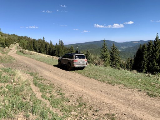
The beginning on the trail was pretty easy. Just a gravel dirt road, which was nice at the end of the day. We decided that we could get a little bit of a jump on this section of the trail while we found a camping spot.

IMG_8574 by Vincent Torres, on Flickr
IMG_8575 by Vincent Torres, on Flickr
IMG_8576 by Vincent Torres, on Flickr
IMG_8580 by Vincent Torres, on Flickr
IMG_8581 by Vincent Torres, on Flickr

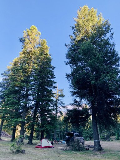
We found a suitable campsite for the night

IMG_8582 by Vincent Torres, on Flickr
IMG_8585 by Vincent Torres, on Flickr
 

RedRunner87

Rank V

Enthusiast III

1,749
Colorado Springs, Colorado, USA
First Name
Vince
Last Name
Torres
Enchanted Rockies Trail

Day 2

On Day 2 we started in Lincoln, NM and traveled to Corona, NM. This section should be approximately 106 miles.

As we traveling down the trail my buddy radios "Is that a water park ahead of us"?

IMG_8586 by Vincent Torres, on Flickr
IMG_8589 by Vincent Torres, on Flickr

It ended up being a Bible Ranch in the middle of no where.

This section of trail wasn't hard, but it was rocky enough that we could only travel about 10mph's give or take.

IMG_8597 by Vincent Torres, on Flickr
IMG_8607 by Vincent Torres, on Flickr
IMG_8609 by Vincent Torres, on Flickr
Untitled by Vincent Torres, on Flickr

Time to air up as we are about to hit the highway

IMG_8616 by Vincent Torres, on Flickr

...well that section of highway was a lot shorter than we thought. At least this section was a lot of "County" roads. So we could pick up the pace.

IMG_8617 by Vincent Torres, on Flickr
IMG_8618 by Vincent Torres, on Flickr
IMG_8620 by Vincent Torres, on Flickr

We detoured to the Roswell Incident Site. This is the debris field left from the UFO

IMG_8623 by Vincent Torres, on Flickr
IMG_8624 by Vincent Torres, on Flickr
IMG_8625 by Vincent Torres, on Flickr

The obligatory fuel up picture

Untitled by Vincent Torres, on Flickr

This was on the drive up to the camp site. Free roaming cows everywhere.

IMG_8627 by Vincent Torres, on Flickr
IMG_8628 by Vincent Torres, on Flickr

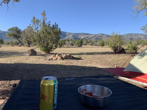
Camp! This camp site had soooo many bugs it was crazy.

Untitled by Vincent Torres, on Flickr
 

RedRunner87

Rank V

Enthusiast III

1,749
Colorado Springs, Colorado, USA
First Name
Vince
Last Name
Torres
Enchanted Rockies Trail

Day 3

For Day 3 we traveled from Corona, NM to Pecos, NM. This section is about 156 miles, but was a little bit more with the Bypass

Beginning of Day 3

IMG_8630 by Vincent Torres, on Flickr

We had some more flat "County" roads till we hit the highway. We may have accidentally hit a cattle guard a little to fast and jumped both trucks. I definitely do not recommend doing this.

IMG_8632 by Vincent Torres, on Flickr

Got a little bit of pavement time

IMG_8633 by Vincent Torres, on Flickr
IMG_8635 by Vincent Torres, on Flickr

Found a cool tunnel right before the highway to get some "Gram" worthy pictures

IMG_8642 by Vincent Torres, on Flickr
IMG_8643 by Vincent Torres, on Flickr
IMG_8652 by Vincent Torres, on Flickr

We ended up doing the Bypass because the new owners of a property locked a gate you have to take. The Bypass according to LifeStyle Overland "TRAILERS, LARGE RIGS, OR STOCK RIGS NOT RECOMMENDED". I did this trail with stock suspension but I do have 255/80's(33's). I hit my skids a couple times and completely flexed the 4Runner out. It took us around 2.5 hours to go 12 miles. It is super slow going with a lot of rocks and off camber sections. We were also the first ones threw this section in awhile, so we had to scout out some sections to figure out where we were going. Plan on some extra time taking the Bypass.

IMG_8653 by Vincent Torres, on Flickr
IMG_8654 by Vincent Torres, on Flickr
IMG_8655 by Vincent Torres, on Flickr
IMG_8656 by Vincent Torres, on Flickr
IMG_8657 by Vincent Torres, on Flickr

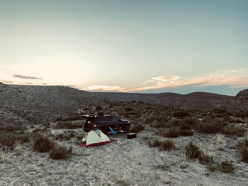
Campsite with a killer view! Was totally worth the long drive of this section.

IMG_8658 by Vincent Torres, on Flickr
IMG_8659 by Vincent Torres, on Flickr
IMG_8660 by Vincent Torres, on Flickr
 
  • Like
Reactions: Offroadnutz

RedRunner87

Rank V

Enthusiast III

1,749
Colorado Springs, Colorado, USA
First Name
Vince
Last Name
Torres
Enchanted Rockies Trail

Day 4

This section is from Pecos, NM to Angel Fire, NM. This section is about 140 miles and probably the most beautiful section.

...and we are off!

IMG_8661 by Vincent Torres, on Flickr

So many cows in NM

IMG_8663 by Vincent Torres, on Flickr
IMG_8668 by Vincent Torres, on Flickr
IMG_8669 by Vincent Torres, on Flickr
IMG_8670 by Vincent Torres, on Flickr

Air up time again for the highway
IMG_8673 by Vincent Torres, on Flickr

...so how do you know your friend is in from Phoenix? He makes you stop and take a picture when he sees snow.
IMG_8674 by Vincent Torres, on Flickr
IMG_8677 by Vincent Torres, on Flickr
IMG_8679 by Vincent Torres, on Flickr
IMG_8680 by Vincent Torres, on Flickr
IMG_8682 by Vincent Torres, on Flickr
IMG_8685 by Vincent Torres, on Flickr
IMG_8687 by Vincent Torres, on Flickr
IMG_8689 by Vincent Torres, on Flickr

RTT Problems

Untitled by Vincent Torres, on Flickr

Camp! This camp site was absolutely amazing

by Vincent Torres, on Flickr
IMG_8694 by Vincent Torres, on Flickr
by Vincent Torres, on Flickr
 

RedRunner87

Rank V

Enthusiast III

1,749
Colorado Springs, Colorado, USA
First Name
Vince
Last Name
Torres
Enchanted Rockies Trail

Day 5

Today we were supposed to go from Angel Fire, NM to Great Sand Dunes National Park in Colorado. But due to COVID-19 National Parks are closed. So we decided to detour and camp with a couple buddies in Colorado Springs, off of Rampart Range Road. One day we will have to finish the Angel Fire, NM to Estes Park.

Airing up and heading to the The Springs

IMG_8698 by Vincent Torres, on Flickr
IMG_8696 by Vincent Torres, on Flickr
IMG_8695 by Vincent Torres, on Flickr

Made it to The Springs. Found a little mud and this was the end of our trip for this time.

Untitled by Vincent Torres, on Flickr
 

RedRunner87

Rank V

Enthusiast III

1,749
Colorado Springs, Colorado, USA
First Name
Vince
Last Name
Torres
Resources


The Entire Photo Album

Day 1

Day 2

Day 3

Day 4

Day 5
 
  • Like
Reactions: Kurosawa

Kurosawa

Rank II
Member

Contributor II

404
Fort Worth, TX, USA
First Name
Jesse
Last Name
Stamper
Member #

46819

We just returned last week from doing the NM portions of the trail over 9 nights, it was fantastic. Here are a couple of notes:

We altered the route West on the first segment of the ERT to two travel days in order to stay in the National Forest as much as possible and include Cloudcroft and Ruidoso two mountain towns I wanted to see. Obviously I haven't done the more easterly route as laid out in the official ERT but I suspect our detour was a more offroad and wilderness experience so could be worthwhile if that's what you are after. We liked this route so much we stayed at one campsite for two nights just to hang out.

Segment two was great but I would say a little too long for our taste, I would recommend spending a night along the part of the trail that cuts through the Capitan Wilderness. You will see some amazing rock formations at one point that I'm sure are popular with rock climbers, stop there and camp even though you haven't made many miles from Baca you've still put in some hours. If you push on you'll have about 6 hours of rough road in one day and then you will still have a couple of hours to get to camp from there. I think doing a shorter day and stoping here was what we should have done because quality campsites are few and far between for the rest of this leg.

Segment three. The previously closed route through the obstinant ranch owner's property as you enter the Santa Fe National Forest is OPEN now! It's slow going and a very long day so if we were to do this section again (and it's worth doing) I would stop early and not try to complete the day as planned in the ERT. This rough part comes at the end of an already long day on the road and would be more fun starting off on it in the morning when you are fresh.

Segment four, we wanted to get to the top of Barillas Peak but the road to the fire tower is gated and closed due to Covid. The road once you get to the cut off to the peak is super easy on the way to Santa Fe and you can make a lot of miles this day. Be aware you have another slow road at the end of this day to get to camp and it would be fun to camp for two nights on this rough section so that is what I would do the second time around. Camp at the end of this leg was epic.

That was the end of our trip, it was just a death march 13hr drive to Fort Worth after that.

Lifestyle Overland has done a superb job of working out a route that inspired us to go check out a state we hadn't spent much time in before and we loved it. I think lessons learned for us were don't be afraid to alter the route as I feel like we were rewarded for doing so and don't feel you have to start and stop where someone else did but rather take it at your own pace. We hope to do the Colorado portion in a few weeks.


IMG_2294.jpeg
IMG_2335.jpeg

IMG_2426.jpegIMG_2228.jpeg