Enthusiast III
- 1,116
- First Name
- Russell
- Last Name
- Miller
- Member #
-
22447
Maybe there is a photo limit to the pages... I don't know, the forums still fighting me.
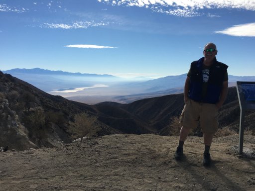
After visiting the Racetrack in Death Valley, our only way down was Lippincott Mine Road... It descends about 2000 feet in a little over 8 miles... With the top 6 miles being the roughest. This road is often called the most dangerous road in Death Valley.
With little hesitation, we began our descent...
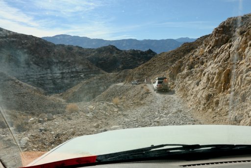
Note the rocks, the narrowness of the road and drop off... Concentration levels were high.
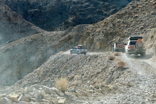
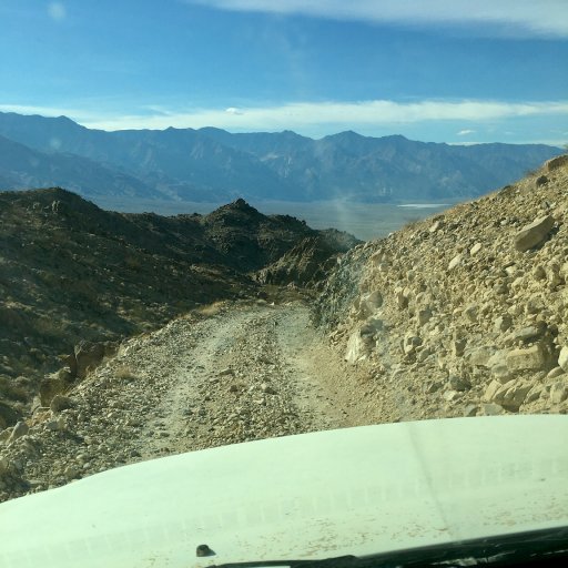
Dave and Bobby were already far ahead of the group as I shot photos out of my windshield and open side window.
There were many narrow sections and washouts... most repaired to some extent with rock piles...
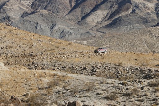
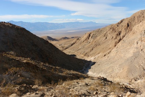
There were some spectacular views... When the dust cleared. We were heading into the sun most of the way so visibility was difficult with he dust...
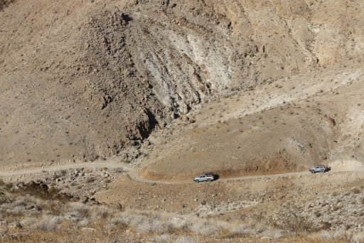
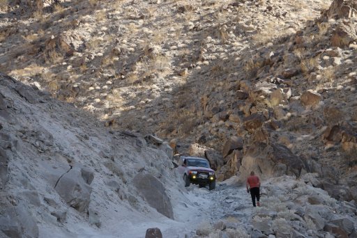
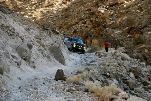
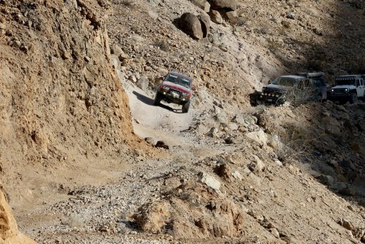
The road twists and turns through this narrow section. You can see Dave in the extreme lower right in the photo below.
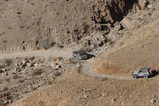
The large rocks made the driving quite challenging. Here Dave rushes uphill to help Alfredo through a tricky section.
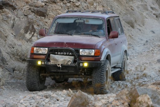
Alfredo did Great in his capable Land Cruiser!
I gotta say... I was impressed by how well my Lexus LX470 did... The only additions being Metal Tech Rock Sliders, full Asfir Aluminum Skid Plates and 32" Toyo Off-Road Tires...
The road was maybe a little too narrow and tight for Sergio's full-sized Ford Tremor. Dave's spotting really came in handy and Sergio's driving was amazing all weekend.
I have to admit... This Off-Camber section was a little nerve racking. It seemed way scarier than it looks in this photo... Good thing it was short because the drop-off out the driver's door did not look inviting...
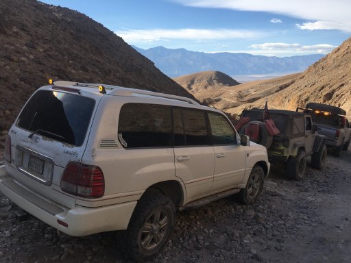
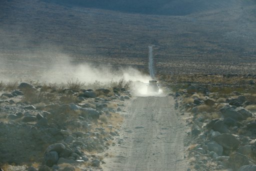
We finally made it to the last section of the road... Pretty much fast and straight to Saline Valley Road...
After visiting the Racetrack in Death Valley, our only way down was Lippincott Mine Road... It descends about 2000 feet in a little over 8 miles... With the top 6 miles being the roughest. This road is often called the most dangerous road in Death Valley.
With little hesitation, we began our descent...
Note the rocks, the narrowness of the road and drop off... Concentration levels were high.
Dave and Bobby were already far ahead of the group as I shot photos out of my windshield and open side window.
There were many narrow sections and washouts... most repaired to some extent with rock piles...
There were some spectacular views... When the dust cleared. We were heading into the sun most of the way so visibility was difficult with he dust...
The road twists and turns through this narrow section. You can see Dave in the extreme lower right in the photo below.
The large rocks made the driving quite challenging. Here Dave rushes uphill to help Alfredo through a tricky section.
Alfredo did Great in his capable Land Cruiser!
I gotta say... I was impressed by how well my Lexus LX470 did... The only additions being Metal Tech Rock Sliders, full Asfir Aluminum Skid Plates and 32" Toyo Off-Road Tires...
The road was maybe a little too narrow and tight for Sergio's full-sized Ford Tremor. Dave's spotting really came in handy and Sergio's driving was amazing all weekend.
I have to admit... This Off-Camber section was a little nerve racking. It seemed way scarier than it looks in this photo... Good thing it was short because the drop-off out the driver's door did not look inviting...
We finally made it to the last section of the road... Pretty much fast and straight to Saline Valley Road...