Off-Road Ranger I
- 1,503
- First Name
- Patrick
- Last Name
- Hung
- Member #
-
9818
- Ham/GMRS Callsign
- W6AJR
Spring Break - what better time to visit Death Valley?
With about three weeks' planning, we were on our way, in our 6-speed manual trans. 2005 Nissan Frontier 4x4 Pickup, with 200+K miles on the clock. It's equipped with full OME Medium Duty suspension (2.5" lift), full skid plates and sliders, a PRG differential cover, and some older 32" Dick Cepek M/Ts for this trip, aired down to 15 psi on all dirt trails that we encountered (these were aired back up with an on-board ARB compressor).
We spent the first night in a hotel in Lone Pine, a small town with gas and some restaurants due west of DV, in clear view of Mt. Whitney and surrounding Sierra Nevada mountains.

We left the following morning at 7 am, via S.R. 191 and made a left at the Saline Valley Road turn-off - the plan was to take Saline Valley Rd. to Lippincott Pass, and cross over into the Racetrack Valley. This is where we stopped and aired down, and a good thing too, as the going got bumpy pretty quickly (here starts one full day of washboard dirt road-driving)!

After about 30 minutes on S.V. Rd., over some narrow passes in the vicinity of Hunter Mountain, we descended into Saline Valley - vast and empty, and finally came to a big rock pile that marks the turn-off to Lippincott Pass - cairns are prohibited by the NPS, fyi, as they destroy the natural look of the park - this was probably the biggest one in the park!


And off we go on Lippincott Pass (east-bound)... for those with some off-roading experience, it's not bad at all - we encountered some washes here and there, and a rocky spot where I had to jump off the truck to pen a path through them - skids and sliders served their purpose here. Unbeknownst to us, east-bound was very much uphill the entire way, which made it more challenging... but if you've done Hollister Hills "blue" trails, you'd do fine here. About 30 minutes later, the road flattened out and we arrived at the "famed" Lippincott Pass sign, with a clear view of Racetrack Valley in the distance. This climb was not difficult, and a whole lot of fun! I highly recommend it for all modified 4x4s.


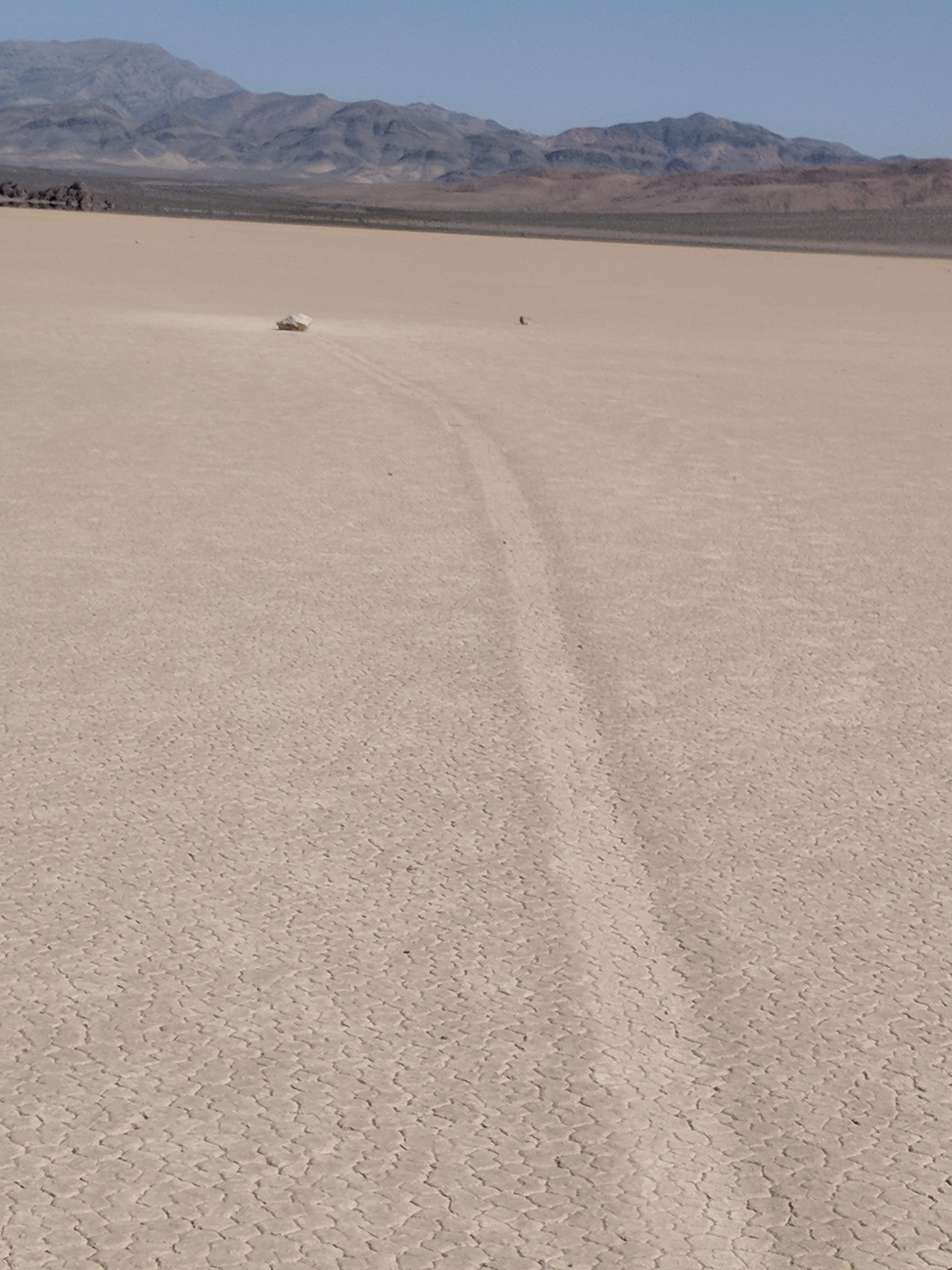
We'd now been on the road for 3 hours, and welcomed the break at the Racetrack to stretch our legs and think about how wind, water, and geology worked together to make it possible for rocks to skid across the playa!


Did I mention washboard? Racetrack Road IS washboard, for miles and miles - with aired down M/Ts and the OME suspension, I averaged about 30 mph to Teakettle Junction without issues. I'd wanted to buy a teakettle in Lone Pine in order to make my contribution, but forgot to do it!

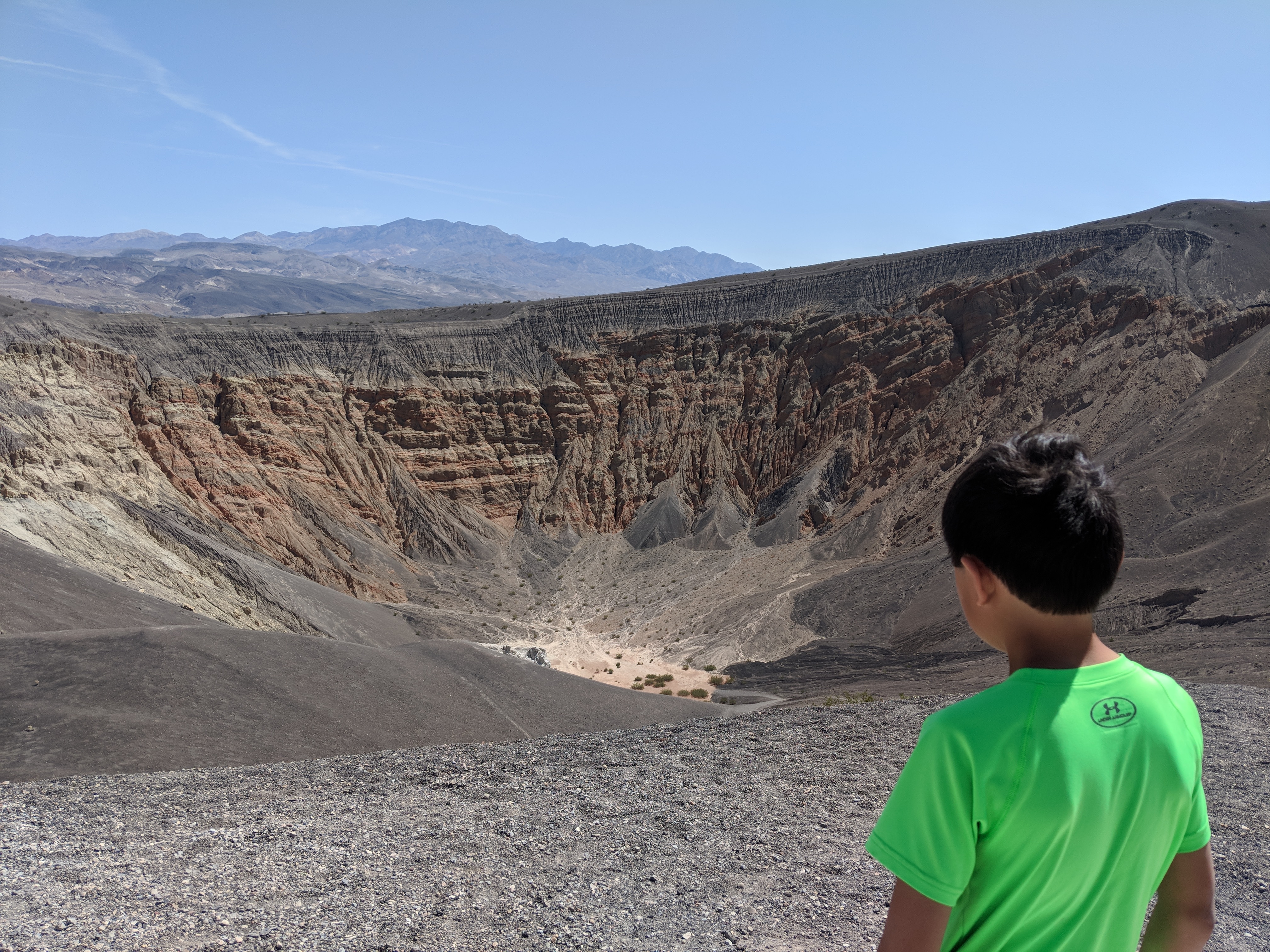
In another 30 minutes or so of bad roads and rental jeeps heading toward the Racetrack, we arrived at Ubehebe Crater, and eventually our campsite for the day at Mesquite Spring. Scotty's Castle is closed due to damage from the flash flood of 2015, but it's getting ready to re-open soon, the camp-host, Rick, told us.

On our last full day in the Park, we visited Titus Canyon (moderate blue-level climb), Devil's Gof Course, and Badwater Basin, before settling in at the Furnace Creek Campground. This is our second night in a park campground - we never had time to go find a spot to disburse-camp, which would've been wonderful, allowing us to get away from RV generators humming all evening.
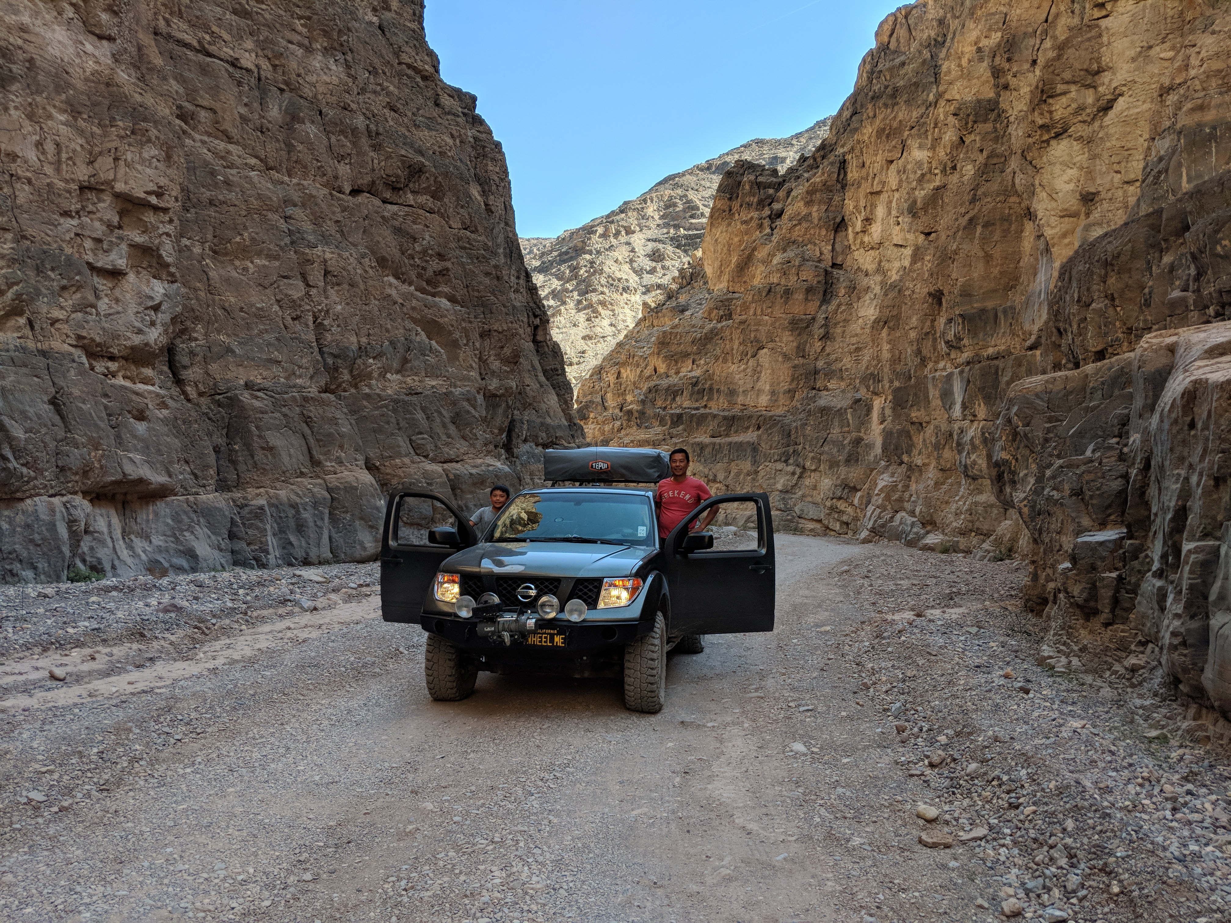
Titus Canyon - this was basically driving in a wash - no rain in the forecast!

Devil's Golf Course


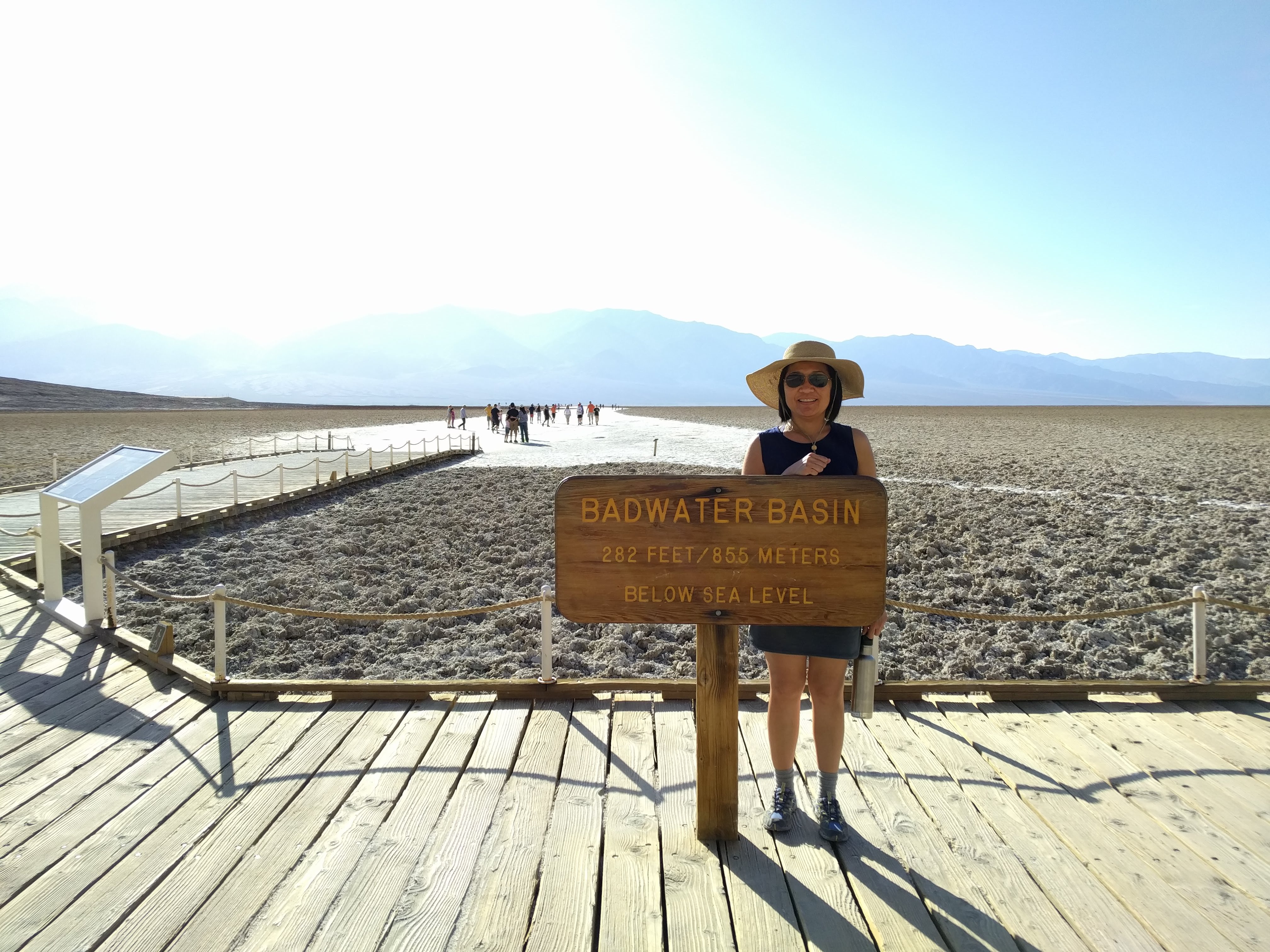
Badwater Basin - one could walk on the salt flat for miles, it seemed.

Settling in for the night in our Tepui RTT.

This was a wonderful introductory trip to Death Valley. We'll be back again to explore the less-traveled canyons where we can camp and enjoy the desert in solitude.
With about three weeks' planning, we were on our way, in our 6-speed manual trans. 2005 Nissan Frontier 4x4 Pickup, with 200+K miles on the clock. It's equipped with full OME Medium Duty suspension (2.5" lift), full skid plates and sliders, a PRG differential cover, and some older 32" Dick Cepek M/Ts for this trip, aired down to 15 psi on all dirt trails that we encountered (these were aired back up with an on-board ARB compressor).
We spent the first night in a hotel in Lone Pine, a small town with gas and some restaurants due west of DV, in clear view of Mt. Whitney and surrounding Sierra Nevada mountains.

We left the following morning at 7 am, via S.R. 191 and made a left at the Saline Valley Road turn-off - the plan was to take Saline Valley Rd. to Lippincott Pass, and cross over into the Racetrack Valley. This is where we stopped and aired down, and a good thing too, as the going got bumpy pretty quickly (here starts one full day of washboard dirt road-driving)!

After about 30 minutes on S.V. Rd., over some narrow passes in the vicinity of Hunter Mountain, we descended into Saline Valley - vast and empty, and finally came to a big rock pile that marks the turn-off to Lippincott Pass - cairns are prohibited by the NPS, fyi, as they destroy the natural look of the park - this was probably the biggest one in the park!


And off we go on Lippincott Pass (east-bound)... for those with some off-roading experience, it's not bad at all - we encountered some washes here and there, and a rocky spot where I had to jump off the truck to pen a path through them - skids and sliders served their purpose here. Unbeknownst to us, east-bound was very much uphill the entire way, which made it more challenging... but if you've done Hollister Hills "blue" trails, you'd do fine here. About 30 minutes later, the road flattened out and we arrived at the "famed" Lippincott Pass sign, with a clear view of Racetrack Valley in the distance. This climb was not difficult, and a whole lot of fun! I highly recommend it for all modified 4x4s.


We'd now been on the road for 3 hours, and welcomed the break at the Racetrack to stretch our legs and think about how wind, water, and geology worked together to make it possible for rocks to skid across the playa!


Did I mention washboard? Racetrack Road IS washboard, for miles and miles - with aired down M/Ts and the OME suspension, I averaged about 30 mph to Teakettle Junction without issues. I'd wanted to buy a teakettle in Lone Pine in order to make my contribution, but forgot to do it!

In another 30 minutes or so of bad roads and rental jeeps heading toward the Racetrack, we arrived at Ubehebe Crater, and eventually our campsite for the day at Mesquite Spring. Scotty's Castle is closed due to damage from the flash flood of 2015, but it's getting ready to re-open soon, the camp-host, Rick, told us.

On our last full day in the Park, we visited Titus Canyon (moderate blue-level climb), Devil's Gof Course, and Badwater Basin, before settling in at the Furnace Creek Campground. This is our second night in a park campground - we never had time to go find a spot to disburse-camp, which would've been wonderful, allowing us to get away from RV generators humming all evening.
Titus Canyon - this was basically driving in a wash - no rain in the forecast!

Devil's Golf Course


Badwater Basin - one could walk on the salt flat for miles, it seemed.

Settling in for the night in our Tepui RTT.

This was a wonderful introductory trip to Death Valley. We'll be back again to explore the less-traveled canyons where we can camp and enjoy the desert in solitude.


