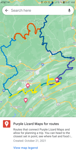
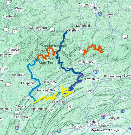
Covering 343 miles, 5 state forests and 4 Purple Lizard maps...mostly dirt

  • HTML tutorial

DevilDodge

Rank IV

Advocate I

1,135
Altoona, Pennsylvania, USA
First Name
David
Last Name
Spencer
Ok. So since this has been fun seeing this in the other apps and to showcase how many more miles exist in each Map...i added in my Rothrock and bald eagle fall foliage routes

Purple Lizard Maps for routes
Screenshot_20211021-094720.png
 
  • Like
Reactions: TSO_NJ

TSO_NJ

Rank V
Member

Explorer I

1,820
Burlington County, NJ, USA
First Name
Joe
Last Name
Mez
Member #

29853

Ok. So since this has been fun seeing this in the other apps and to showcase how many more miles exist in each Map...i added in my Rothrock and bald eagle fall foliage routes

Purple Lizard Maps for routes
View attachment 213468
Excellent! I’ll make the addition to the Garmin Basecamp GPX file this coming weekend, plus I’ll use your color code for easy reference.
 
  • Like
Reactions: DevilDodge

TSO_NJ

Rank V
Member

Explorer I

1,820
Burlington County, NJ, USA
First Name
Joe
Last Name
Mez
Member #

29853

  • Like
Reactions: DevilDodge

DevilDodge

Rank IV

Advocate I

1,135
Altoona, Pennsylvania, USA
First Name
David
Last Name
Spencer
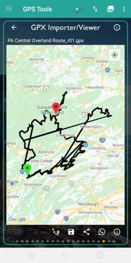
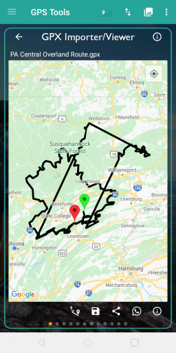
You do not need to fix it for me. May just be my GPX viewer

If it is working with your app...that is good enough for me.

I was thinking with Oct 21 being the 7th anniversary of Back to the Future day...I thought maybe we were getting close to flying cars.

And having been in Civil Air Patrol as a teen...i know all about the flight paths in the area.Screenshot_20211024-181147.png
 

TSO_NJ

Rank V
Member

Explorer I

1,820
Burlington County, NJ, USA
First Name
Joe
Last Name
Mez
Member #

29853

I could have used a flying car today. Drove down a 4 mile stretch of a washboard sand road. My CR-V shook and rattled for most of the route! I need to look for loose bolts before I leave for work tomorrow.

"Back To The Future"? Going to check the "On Demand" list now.

Civil AIr Patrol as a teen? A true adventure for the wonder years.

I caved! Subscribed to AllTrails. Hopefully the downloads will be faster and accurate.


Thank you for "... do not need to fix it ..."
 

Attachments

  • Like
Reactions: DevilDodge

akdigital3d

Rank I

Enthusiast I

231
Erdenheim, PA, USA
First Name
Adrien
Last Name
AKdigital
Thanks for putting this together. Back at you. Here is an old adventure motorcycle route I try to ride once a year. It's based on the TransPA trail and has some overlap with yours. It's mix of dirt forest roads, twisties and other scenic legs. It's all drivable and legal. A little more GPS to add to your collection.
 

Attachments

  • Like
Reactions: DevilDodge

DevilDodge

Rank IV

Advocate I

1,135
Altoona, Pennsylvania, USA
First Name
David
Last Name
Spencer
Thanks for putting this together. Back at you. Here is an old adventure motorcycle route I try to ride once a year. It's based on the TransPA trail and has some overlap with yours. It's mix of dirt forest roads, twisties and other scenic legs. It's all drivable and legal. A little more GPS to add to your collection.
Thank you. I will check that out for sure.
 
  • Like
Reactions: akdigital3d