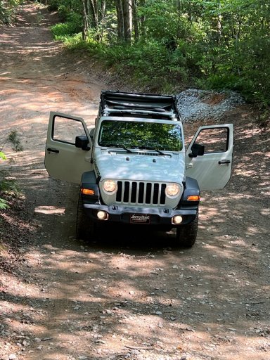
Chestnut Mountain | Auger Hole Road in Gorges StatebPark, Sapphire, NC

  • HTML tutorial

Pretzel

Rank IV

Member III

1,116
Greenville, NC
First Name
Eric
Last Name
D.
Member #

25592

Looks like a beautiful time to be there. I've not made my way to Gorges yet, too many times I get distracted in Uwharrie on my way west lol.
 

Tundracamper

Rank VI
Launch Member

Influencer I

3,068
Tuscaloosa, Alabama, USA
First Name
Steve
Last Name
Shepard
Member #

22670

Can you please provide a little more geography details? We regularly stay near Highlands during the winter holidays and I’d like to check out this place. Where exactly is it?
 

WildBlue

Rank IV
Member

Contributor III

1,076
Sapphire, NC, USA
First Name
Scott
Last Name
Essex
Member #

44957

Can you please provide a little more geography details? We regularly stay near Highlands during the winter holidays and I’d like to check out this place. Where exactly is it?
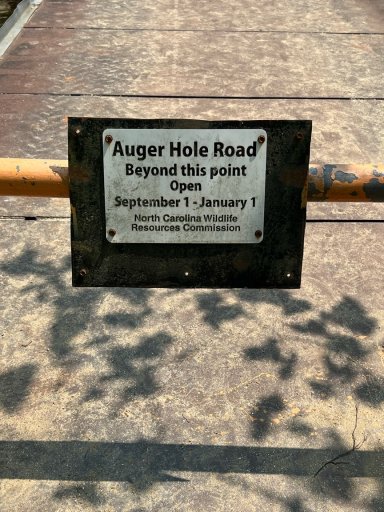
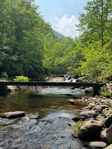
Absolutely. From Highlands take HWY 64 east through Cashiers and Sapphire, about 30 minutes to the intersection with SR 281. Take a right onto 281 and follow signs for Gorges State Park entrance less than a mile down the road. The entrance to Chestnut Mountain Road is at the rear of the parking lot for Rainbow Falls. The ride is 6 miles down to the river with the first 3 miles within the park and the second 3 miles within Toxaway Gamelands. The gate to the bridge over the Horsepasture River is open September thru December which adds another 6 miles on the other side.
 

WildBlue

Rank IV
Member

Contributor III

1,076
Sapphire, NC, USA
First Name
Scott
Last Name
Essex
Member #

44957

Uwharrie is definitely big fun. Gorges - and especially Chestnut Mountain and Horsepasture River is worth a trip one day. Have fun.
 

Tundracamper

Rank VI
Launch Member

Influencer I

3,068
Tuscaloosa, Alabama, USA
First Name
Steve
Last Name
Shepard
Member #

22670

Absolutely. From Highlands take HWY 64 east through Cashiers and Sapphire, about 30 minutes to the intersection with SR 281. Take a right onto 281 and follow signs for Gorges State Park entrance less than a mile down the road. The entrance to Chestnut Mountain Road is at the rear of the parking lot for Rainbow Falls. The ride is 6 miles down to the river with the first 3 miles within the park and the second 3 miles within Toxaway Gamelands. The gate to the bridge over the Horsepasture River is open September thru December which adds another 6 miles on the other side.
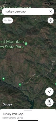
Awesome! Thanks for that info. Google Maps shows the road ending at Turkeypen Gap. However, satellite view seems to show the road continuing on to Horsepasture River. Is that bridge at Horsepasture River or prior?

On further study, I think I see the bridge on satellite view just north of where I was looking. Now I just need to find the road that get there.

Is it the lower or upper pin?
IMG_1276.jpg
 

WildBlue

Rank IV
Member

Contributor III

1,076
Sapphire, NC, USA
First Name
Scott
Last Name
Essex
Member #

44957

Absolutely. From Highlands take HWY 64 east through Cashiers and Sapphire, about 30 minutes to the intersection with SR 281. Take a right onto 281 and follow signs for Gorges State Park entrance less than a mile down the road. The entrance to Chestnut Mountain Road is at the rear of the parking lot for Rainbow Falls. The ride is 6 miles down to the river with the first 3 miles within the park and the second 3 miles within Toxaway Gamelands. The gate to the bridge over the Horsepasture River is open September thru December which adds another 6 miles on the other side.
Awesome! Thanks for that info. Google Maps shows the road ending at Turkeypen Gap. However, satellite view seems to show the road continuing on to Horsepasture River. Is that bridge at Horsepasture River or prior?

On further study, I think I see the bridge on satellite view just north of where I was looking. Now I just need to find the road that get there.

Is it the lower or upper pin?
View attachment 260550
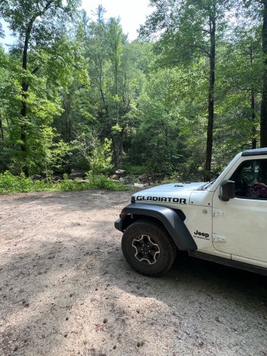
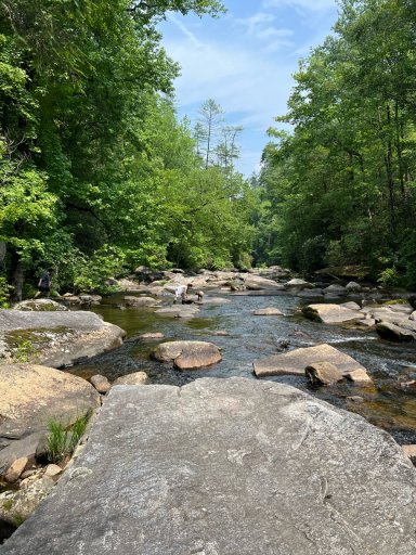
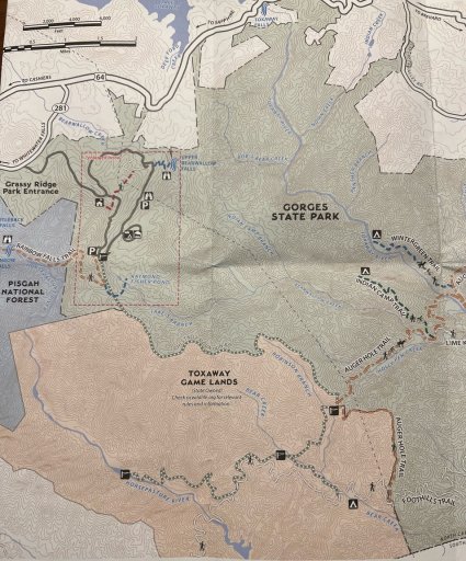
Here is a pic of the map provided at Gorges SP Visitor Center - which you pass on the way to the Chestnut Mountain Rd access point. Worth a stop in to get a map and good merch. You’re right in that about the first 3 miles of the ride brings you to Turkeypen Gap where a few trails come together with Chestnut Mtn road, including Auger Hole trail - which is a 7 mile hiking and mountain biking trail that starts at the Frozen Creek access point to Gorges SP about 10 miles east near Rosman. At this trail intersection you can go straight (this direction was blocked with a locked gate for us) or take a hard right into Toxaway Games lands where the road continues another 3 miles or so down to the Horsepasture River where the bridge is gated. There is a good camping spot near the bridge. Our dogs played in the river a bit. It’s fast flowing and pretty shallow in spots, with boulders and granite slabs strewn all over the river. We have recently moved to the area, but I have learned from locals that this whole area is referred to as Auger Hole Road. Best approach is to follow the map provided at the visitor center. It is a long way down from the Rainbow Falls parking lot - over 2000 ft descent and just under an hour to get down and the same coming up.
 

Attachments

Tundracamper

Rank VI
Launch Member

Influencer I

3,068
Tuscaloosa, Alabama, USA
First Name
Steve
Last Name
Shepard
Member #

22670

Here is a pic of the map provided at Gorges SP Visitor Center - which you pass on the way to the Chestnut Mountain Rd access point. Worth a stop in to get a map and good merch. You’re right in that about the first 3 miles of the ride brings you to Turkeypen Gap where a few trails come together with Chestnut Mtn road, including Auger Hole trail - which is a 7 mile hiking and mountain biking trail that starts at the Frozen Creek access point to Gorges SP about 10 miles east near Rosman. At this trail intersection you can go straight (this direction was blocked with a locked gate for us) or take a hard right into Toxaway Games lands where the road continues another 3 miles or so down to the Horsepasture River where the bridge is gated. There is a good camping spot near the bridge. Our dogs played in the river a bit. It’s fast flowing and pretty shallow in spots, with boulders and granite slabs strewn all over the river. We have recently moved to the area, but I have learned from locals that this whole area is referred to as Auger Hole Road. Best approach is to follow the map provided at the visitor center. It is a long way down from the Rainbow Falls parking lot - over 2000 ft descent and just under an hour to get down and the same coming up.
That is EXTREMELY helpful. Thanks for taking the time to write that. Def gonna go there this fall or winter.
 
  • Like
Reactions: WildBlue