Bald Eagle State Forest in a RAM or 2
- Thread starter DevilDodge
- Start date
-
Guest, UPDATE We went through the site migration runbook and completed all steps. We will need to complete the migration next week, but will leave the forums up for the weekend. A few days after maintenance, a major upgrade revision to the forum site will occur.
Very anxious to get out again. The family atleast entertained the idea of camping here. I hope to get back to the area near the end of February. Will be coming in down by Potters Mills coming in on sand Mountain Rd and starting the campsite scouting at site 48.

Enthusiast III
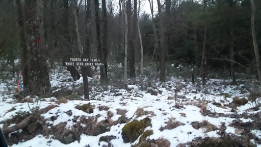
Looked over my recorded trail and I did drive Duncan Trail. Also Read through my notes on the day and it was a good but short trail. I remember that it was rocky (small rocks not rock crawling) so it was bumpy. I remember wishing o would have aired down but was still on stock tires and didn’t want to chance a sidewalk puncture. It was one of my first single track off road trails that I drive and that was about a two years ago. Glad I have the god track and took notes but wish I would have taken more pictures. Looks like you had a fun day of exploring!Then onto the next intersection and onto Duncan Trail. This is the only drivable trail we saw. It looks like fun...but it was 1738 when we got there and darkness was setting in. The family wanted to get back to the pool at the hotel, so for another day.
View attachment 138165View attachment 138166
Looks awesome though.
View attachment 138164
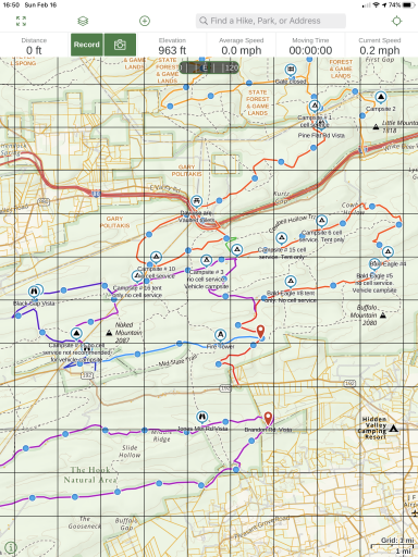
Yes, Duncan trail shows very short on the map.
One thing to remember...the map scale is perfect for the idea of how close stuff is, just also remember it is a flat representation, there are some steep hills here. Lol
Speed limit is 25 mph, I felt pretty comfortable at 20 mph. Some of the turns are sharp and are either the start up a hill or the end of a downhill, depending on direction of travel.
We saw no one else on the trails, but did see a horse and buggy going by at the end by I-80
Thanks @riss800 for the info. Guess I should have tried Duncan trail...I really wish I would have went out to campsites 4, 5, 6, and 15 while I was so close.
Thanks for the pics and report, now I have a sight suitable for my trailer saved till I explore BESF further..
I'm also hoping the warmer weather holds out, i'd like to get out that way soon.
I'm also hoping the warmer weather holds out, i'd like to get out that way soon.
@OverlandZJ site 9 was very large. We are hoping to camp very soon. Our first state park trip with our travel trailer is 10April.
Hoping to tent camp in BESF or Rothrock before then...especially if the weather cooperates.
Keep us posted when you go.
Hoping to tent camp in BESF or Rothrock before then...especially if the weather cooperates.
Keep us posted when you go.
@LGlx and others.
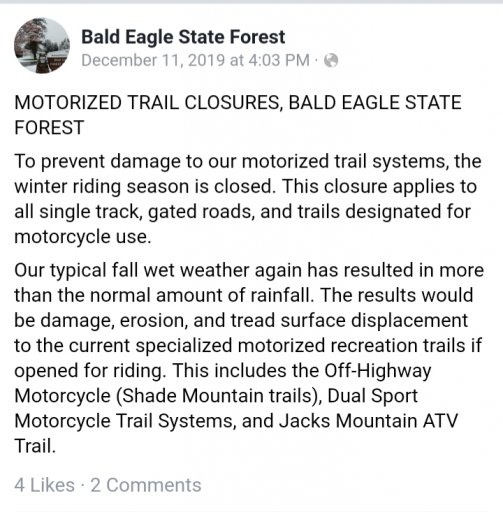
The forest service does use Facebook to alert to closures.
The ice was pretty bad there as back on 5DEC they shut the roads down
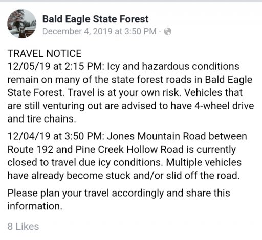
And it appears they have shut down some trails for the season.
All forest service roads appeared open. The day I was there...of course the gates on the map were in the closed position.
Hope this helps with your planning...I do not use Facebook, but may have to consider for this reason only.
The forest service does use Facebook to alert to closures.
The ice was pretty bad there as back on 5DEC they shut the roads down

And it appears they have shut down some trails for the season.

All forest service roads appeared open. The day I was there...of course the gates on the map were in the closed position.
Hope this helps with your planning...I do not use Facebook, but may have to consider for this reason only.
Very helpful. Thanks again David for the first-hand report. With almost 5 hours of driving surely, we'd like to take appreciate and experiencing the forest to the fullest. I'll push my trip to spring and be in touch in case you're around that week.@LGlx and others.
The forest service does use Facebook to alert to closures.
The ice was pretty bad there as back on 5DEC they shut the roads down
View attachment 138433
And it appears they have shut down some trails for the season.
View attachment 138432
All forest service roads appeared open. The day I was there...of course the gates on the map were in the closed position.
Hope this helps with your planning...I do not use Facebook, but may have to consider for this reason only.

Enthusiast III
I might shoot for a trip in early March. There is a loop I downloaded on Gaia that was made by Wawa that I would like to try out.
My wife has talked about camping at site 9 the last 3 nights. She really liked that one( we only saw one other no. 8)
Hopefully this will be something we get to do often this year. We camp every weekend from April to October. From May to September they get pretty busy and crowded.
Does anyone know how much use the motorized campsites get during peak season?
We want to do a four day weekend very soon, weather was great the last 3 days, now winter is returning tonight.
I plan to take from our camping equipment and set up a dispersed outfit that can be stored in our camper for our regular trips, but easily removed and contained in the truck.
We got a bunch of totes and bags. Just need to get a setup that is user friendly and includes what we need (less of what we want)
I told her I want to go one night...just the EDC of the truck, tent/sleeping equipment, cooking equipment and some food/water just to see what we can not live without.
Ok, so I really just want an excuse to camp.

Enthusiast III
i use one of the disbursed camp sites in Michaux SF a few time and it wasn't that busy, maybe one or two other campers. It was one of the more popular site as it had an out house and about 6 fire rings. I know that is a different Forrest district but on a whole i am not sure how may people know about the free disbursed camping in the SF. Every one i mention it to is always surprised you can camp in the SF and even more that it is free. There is a little hassle filling out the car camping permit but it is not hard to do. On that note, for the camping trips i took into the SF i have never seen a camper get checked for permits but I don't risk it especially with my son along, want to instill in him that we do things correctly and by the law.

Enthusiast III
Stayed at 11 this weekend. I wouldn’t recommend it for vehicle campsite. It seems to be next to a parking area.
A little cold this weekend, awesome that you camped and made it into the Forest.
Sounds like 11 will not need to be scouted.
How was the overall conditions and experience of the trip @Clifford Zwiercan ?
Sounds like 11 will not need to be scouted.
How was the overall conditions and experience of the trip @Clifford Zwiercan ?
My son and I may hit one of the cabins in the area on the last weekend of the month.
Or if the weather is nice, we may camp...but if we do that it may be in Rothrock.
Who knows what we will end up doing though.
Nice to know someone made it on an outing though
Or if the weather is nice, we may camp...but if we do that it may be in Rothrock.
Who knows what we will end up doing though.
Nice to know someone made it on an outing though

Enthusiast III
Conditions were great. No snow or ice anywhere I was. Just a bit cold.A little cold this weekend, awesome that you camped and made it into the Forest.
Sounds like 11 will not need to be scouted.
How was the overall conditions and experience of the trip @Clifford Zwiercan ?
Attachments
-
2.6 MB Views: 21
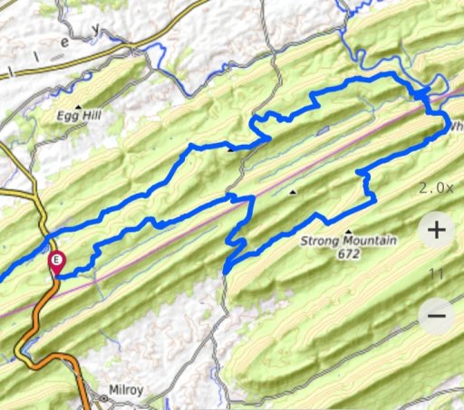
We made it into Bald Eagle today. We entered from Rothrock State Forest at 322.
We drove out Decker Valley road and onto Mountain Church road. We turned on Siglerville/Millheim pipe and came to the first campsite...#44.
We then went on Pine swamp road and near the intersection with Poe Paddy Drive was site #42 and 41. They both looked like great tent sites.
We then got to see Penns View. Ravens Knob east was quite the little climb. Beware it is a dead end though.
We then went back out and started down the very rough section of Poe Paddy Drive. Wow. It should be marked a driveable trail on the map. My fullfigured RAM fit no problem...but the HeavyDuty suspension sure did make it rough.
We then checked out Poe Paddy campground and then headed off on Havice Valley road. We turned onto Strong Mountain road. This was a driveable trail. It was interesting and fun. The RAM for no issue...but not much room to pass another vehicle. The interesting thing was it started and ended in state forest but the middle was private ground.
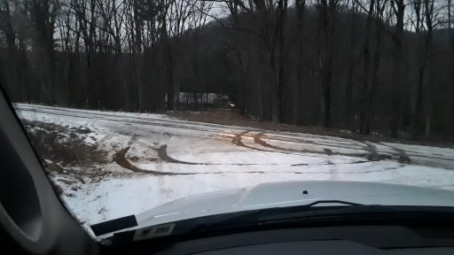
We were starting to lose daylight. I wanted to go Longwell Draft Road...but we went right instead on Flat hollow Rd. This was an awesome area for driveable trails. You definitely need some clearance...and with the slick snow...4x4 helped.
We got back on Havice valley road and then back on Siglerville/Millheim pike. We then took Sand mountain road. Saw campsites # 45 and 48. Both large sites. 48 is way off the road.
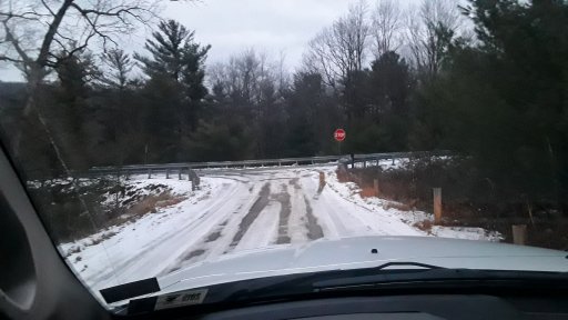
We then exited onto 322 and called the day. We may hit some trails again after breakfast in the morning.


