Pathfinder II
Welcome Dan! We're just a stone's throw from you!I'm Dan! I live in south Scottsdale at Scottsdale and McDowell. I'm an active duty army vet. I drive this thing.

LETS PARTY!

Pathfinder II
Welcome Dan! We're just a stone's throw from you!I'm Dan! I live in south Scottsdale at Scottsdale and McDowell. I'm an active duty army vet. I drive this thing.

LETS PARTY!
Welcome. Also in Surprise.Newish member here from Surprise AZ. Just browsing around. 96 Jeep XJ

Enthusiast III

Pathfinder II
I would take Senator Highway (not a highway) to Crown King for lunch! Then head back out Crown King Road to Bumble Bee and back home. Perfect for your truck. (Recommend airing down a bit)Hi guys, I'll be in the Cottonwood, AZ area from feb 13th-whenever!!. Can anyone recommend some trails that I can cut my teeth on? I have a bone stock F250 4x4. I would like to get some practice in and get to know my vehicle. Its not only my DD but it also pulls my house(Full time RVer) so I dont want to get too crazy but I want something that'll be fun. Any advice would be appreciated!!

Enthusiast III

Trail Blazer III

Enthusiast III
Can these files be imported into a Navigation type program? Like Gaia or Map.me?So I haven't seen a routes section for Arizona and I'd really be interested in a section for downloadable routes (i.e. .kmz and .gpx files). I know there is a ''Download Section'' but it seems to be lacking Arizona trails and it seems a little disorganized... Does anyone have trails mapped out in those files? I'm compiling a trails list/folder on my hard drive and would like to see what you guys have so I can add to it. Here are some of my trails

Trail Blazer III
Yes they can. I use MotionX-HD and it uses .gpx files. Kmz is typically google earth. I’m not sure what Gaia uses but you can use gpsconverter to change the file [emoji869]Can these files be imported into a Navigation type program? Like Gaia or Map.me?

Trail Blazer III

Enthusiast III
Yeah I was able to get them to run on Gaia and GPX Viewer. Those first set of trails are real close to where we're staying in Cottonwood. As soon as I get home from work on the 12th I'm gonna hit a couple. We're only gonna be in that area for a couple days before hittin the road again but thanks for the help.So I added more trails: Hassayampa/Box Canyon, Sheep Bridge Hot Springs (2+ hr drive), Senators Highway and Backway to Crown King

Trail Blazer III
Awesome! Glad they worked for you. Hope you have a good time. Just a heads up but if you aren’t wanting to go down the Devils Staircase then you’ll have to turn around and go back on the loop you took.Yeah I was able to get them to run on Gaia and GPX Viewer. Those first set of trails are real close to where we're staying in Cottonwood. As soon as I get home from work on the 12th I'm gonna hit a couple. We're only gonna be in that area for a couple days before hittin the road again but thanks for the help.

Enthusiast III
Roger that!!! I'm very inexperienced and not to proud to called it quits...thanks for the heads up.Awesome! Glad they worked for you. Hope you have a good time. Just a heads up but if you aren’t wanting to go down the Devils Staircase then you’ll have to turn around and go back on the loop you took.
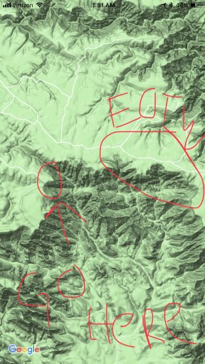
The more west, the more secluded but also the view of Sedona kind of deteriorates. There is a great finger you can camp on that is used for helicopter landings during fires and S&R that is far west of the allocated “end of the world” camp sites. A bit exposed but it’s worth it. Only problem is that you are in visual distance to the actual campsites at “end of the world” and can see camp fires and hear faint party noise if it’s that time of year. Look on google earth right where the area starts to bend southward and you’ll notice it. I’ll try to get a picture up.Hey, I'm up in flagstaff, and new to this thread, but I'm so glad I found it. I have a '13 Silverado that I've been working on. I am planning a trip out to the rim just north of Sedona (end of the world area) I was going to try and make it out more to the west, a little further from the 89. Is it any good out west, or should I stay east?
Hey, I'm up in flagstaff, and new to this thread, but I'm so glad I found it. I have a '13 Silverado that I've been working on. I am planning a trip out to the rim just north of Sedona (end of the world area) I was going to try and make it out more to the west, a little further from the 89. Is it any good out west, or should I stay east?

Awesome thanks for the advise!The more west, the more secluded but also the view of Sedona kind of deteriorates. There is a great finger you can camp on that is used for helicopter landings during fires and S&R that is far west of the allocated “end of the world” camp sites. A bit exposed but it’s worth it. Only problem is that you are in visual distance to the actual campsites at “end of the world” and can see camp fires and hear faint party noise if it’s that time of year. Look on google earth right where the area starts to bend southward and you’ll notice it. I’ll try to get a picture up.
Surprise, AZ
2011 Ram 1500
Insta: Chase_Frazee

Enthusiast I


