Moved here in 2001 with the now wife, then fiance, as she grew up here and her work brought her back here and I had little reason to stay in Seattle. Lived in Seattle prior and have never looked back.Hello All, We too are in greater Boise. We moved here in 1992........So, what is bringing the new residents to the valley?
Anyone in Boise/West Central Idaho?
- Thread starter OffroadTreks
- Start date
-
Guest, UPDATE We went through the site migration runbook and completed all steps. We will need to complete the migration next week, but will leave the forums up for the weekend. A few days after maintenance, a major upgrade revision to the forum site will occur.
I like snow. There are more people in all of Pinellas County Florida than the entire state of Idaho. That's part of it. We love the American West.
We spent the last two years traveling and decided we wanted to start building for our future. We decided to invest here in Boise with rental properties. But now I'm thinking we are ready for something more permanent after we finish fixing up the current reno we're staying in. Kinda over suburbia, but this area is still better than Florida. I'm ready for some more land. Up by McCall or maybe Garden Valley is really appealing to me.
Also open carry state. ;) Pew Pew.
New to Boise and new to this forum. I see this thread is a month or so old, but wanted to reach out. If anyone is looking to meet up, let me know. I'm in the market for a PW and came across this thread because of BoldAdventure's build. Very nice truck. Cheers.
There is a number of us Power Wagon owners in the area too.New to Boise and new to this forum. I see this thread is a month or so old, but wanted to reach out. If anyone is looking to meet up, let me know. I'm in the market for a PW and came across this thread because of BoldAdventure's build. Very nice truck. Cheers.
Would like to put together a meetup as well!New to Boise and new to this forum. I see this thread is a month or so old, but wanted to reach out. If anyone is looking to meet up, let me know. I'm in the market for a PW and came across this thread because of BoldAdventure's build. Very nice truck. Cheers.
Running out of days here, but I'd be game for a meetup as well. Although I pulled the tent off the truck and am in winter mode now. But would still be down for any day trips. Or snow wheeling.
I am open any day from the 18th-21st or the 26th-28thRunning out of days here, but I'd be game for a meetup as well. Although I pulled the tent off the truck and am in winter mode now. But would still be down for any day trips. Or snow wheeling.
Finally picked up the truck. Really liking it so far.I am open any day from the 18th-21st or the 26th-28th
Attachments
-
3.2 MB Views: 19
Congratulations on the new Power Wagon man. I think there is another guy here with one who is active on the FB Group.Finally picked up the truck. Really liking it so far.
I'm hosting Power Wagons in Moab again this year, April 30 - May 6 2018 if you're interested in really finding out how capable these rigs are.
With the snow almost here and the holidays, less to do, but maybe we could meet up sometime. Do an easy peasy run over by Succor Creek.
I would be up for that. Like I said, I'm new to the area so I'm looking for places to check out. The Moab event seems like a possibility too. Let me know if you want to set something up. We just moved to Hidden Springs but I work in downtown Boise.Congratulations on the new Power Wagon man. I think there is another guy here with one who is active on the FB Group.
I'm hosting Power Wagons in Moab again this year, April 30 - May 6 2018 if you're interested in really finding out how capable these rigs are.
With the snow almost here and the holidays, less to do, but maybe we could meet up sometime. Do an easy peasy run over by Succor Creek.
Good to see so many Boise folks on this forum... We live in Caldwell and would be interested to hear about plans for next year. So far this winter we have done mild outings to Garden Valley/Crouch, Idaho City/Robie Creek, Succor Creek/Leslie Gulch, and Pine/Featherville... Hoping to get out more next year as we are more geared up for offroading. Current rig is a 2003 Ford Expedition 4x4 with LSD.
*Ammended to include our Pine/Featherville trip.
*Ammended to include our Pine/Featherville trip.
Last edited:
Hey welcome. Well this weekend the weather looks ok, and I'd be up for something, if anyone else is.Good to see so many Boise folks on this forum... We live in Caldwell and would be interested to hear about plans for next year. So far this winter we have done mild outings to Garden Valley/Crouch, Idaho City/Robie Creek, and Succor Creek/Leslie Gulch... Hoping to get out more next year as we are more geared up for offroading. Current rig is a 2003 Ford Expedition 4x4 with LSD.
Although I'm low on ideas. We're sort of still new to the area. We came here last Septemeber, but we travel regularly out of the area.
What part of Succor Creek did you explore? Just down the main road or any of the off shoots?
I've also been thinking about trying to get back out to Indian Hot Springs from the east side.
Succor Creek: Down the main dirt road (from Homedale) to the campsite, then over the bridge at the campsite, then we took a left and went back in the mountains some. It was fun cruising around on top of the mountains, loved the views. After that we continued on to Leslie Gulch, then to the boat ramps at Owyhee Reservoir, then all the way back out to HWY 95. I'm sure there is way more to see out there, but that was a full day for us (with 3 kids and a dog)...
The last trip to Pine/Featherville was our maiden voyage with Gaia GPS app on the iPad, but we didn't have a GPS receiver for when we were out of cell tower range... Now we have a Bad Elf GPS Pro+, so next time we'll be prepared. Need to learn how to read the maps a little better, can't really tell how to differentiate a dirt road from a paved road yet...
Amending my post above to add our Pine/Featherville trip.
James
Checking in as a Boise local. I'm fairly active on the Tacoma forums but working to branch out to other local, like-minded individuals which has lead me here. I've been doing this truck camping for going on 7 years now with many miles all over the western US. My wife and I moved here a year ago from the Panhandle and absolutely love it down here due to how accessible so many awesome places are within a few hours drive from home.
Our current rigs you may see us out in are our 2017 TRD OR Inferno which rarely leaves the pavement.

Our crown jewel is our 2001 TRD OR that I have built as our ultimate adventure mobile.

Like i said, i am branching out to try to meet other people who have a passion for exploring and camping here locally and beyond! If you see us around, give us a wave!
Our current rigs you may see us out in are our 2017 TRD OR Inferno which rarely leaves the pavement.

Our crown jewel is our 2001 TRD OR that I have built as our ultimate adventure mobile.

Like i said, i am branching out to try to meet other people who have a passion for exploring and camping here locally and beyond! If you see us around, give us a wave!
I saw some talk about a meet up earlier in this thread but didn't see it go anywhere. So I started a thread over in the OB Meetups forum for one in Boise.
https://www.overlandbound.com/forums/threads/greater-treasure-valley-idaho-meet-up-01-04-18.11493/
Please use that thread to RSVP.
https://www.overlandbound.com/forums/threads/greater-treasure-valley-idaho-meet-up-01-04-18.11493/
Please use that thread to RSVP.

Contributor III
Hey guys, I am in Boise as well. I just joined the OB community. @BoldAdventure, I have followed you and your wife on Instagram for quite some time now and have thought about reaching out to you lately. I would love to connect up with more of the overland community here in the valley.
Best,
Dan
Best,
Dan
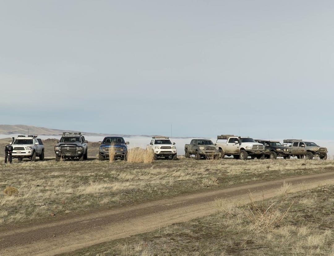
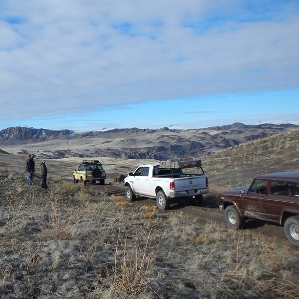
Just thought I'd post up, two weekends now I've met up with some other locals. We've got a baby due in March, so I'll be glued to my house most of that month. And I'm getting my Axle trussed the weekend of the 16th of Feb. BUT, if anyone wants to get out and explore on one of the upcoming weekends this February, I am game. Gotta get my fix in before I'm housebound.


It was a damn fun trip. Keep us posted if you're planning something. I won't be able to do anything from 2/17 - 2/25 but most everything else should be fair game.Just thought I'd post up, two weekends now I've met up with some other locals. We've got a baby due in March, so I'll be glued to my house most of that month. And I'm getting my Axle trussed the weekend of the 16th of Feb. BUT, if anyone wants to get out and explore on one of the upcoming weekends this February, I am game. Gotta get my fix in before I'm housebound.


