Enthusiast III
As a bit of a shake-down, and after discussing the idea at our last monthly meetup, several of us (Myself, Raul, Joe and Chris) met up at the Flying J in Lebec this morning.
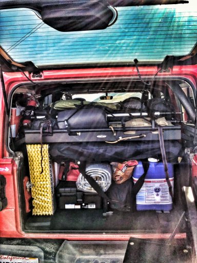
I’m doing the Mojave Road in a couple weeks, so this was an ideal chance to load up the Jeep and see how it would perform.
Joe brought the G-wagon, Raul had his TLC-80 and Chris was rocking his FJ. I was rollin’ dusty in the Rubicon.
Gassed up, we hit the Gorman entrance, and immediately grabbed the Powerline Road to get bumpy. After reaching the far end of that trail, we decided we wanted something a bit more challenging. So...the map was telling us the Pronghorn Trail was a black square trail (moderately difficult). Naturally, this felt like the right choice. And things got real in a hurry. LOL
The next trail sign informed the trail was a black diamond - most difficult. With no agreement between the official signs and the official maps, we opted to push on, one hand on the wheel, one hand on the rip cord in case we decided to bail.
And bail we did! After cresting a hill, the trail took a hard right over a ...cliff? Ledge? Drop off? All seem appropriate. It was a steep, sandstone slope, probably close to 30 degrees or so. We did watch a few motorcycles go down (easy), and watched one Jeep come up (almost flopped on his side, but he made it). We opted to just overland our backsides back the way we came. LOL
After our stop atop that hill for lunch, we tooled around a few of the other green (easy) level trails. In an homage to overlanding, we stopped for a final snack and photo opportunity before hitting the highway for our respective abodes. Overall, an excellent day outdoors!


Last edited:


