Do you think that will be the case in the spring? I was just trying to cover all the bases. I have led trail rides that turned ugly when people got scratches, I can only imagine hydro locking would piss people off a bit more than that. I want people to realize there is real stuff out there that can happen, I've seen it. I've had it happen to me. For me a snorkle is just basic kit. I have no problem with people not having one, just be prepared for it to possi ly be an issue....just came back from 4 days in red river gouge area which has parts of the KAT mixed in. I will second the no trailer and no need for snorkel. most of KAT would be ok for trailer but there are some pretty tight sections also. we have had very little rain like 2-3 day in the last 3 months here in KY with that said the gouge area hold water bad still nothing over 20inch or so and you literarily drive down the creek/river in some parts. you can checkout our trip video on this threat i posted "Daniel Boone Back country Byway" to get a idea of trail
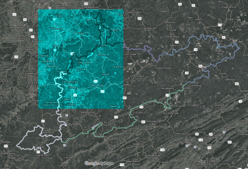
2020 Spring Run Kentucky Adventure Trail
- Thread starter Overland_Serenity
- Start date
-
Guest, UPDATE We went through the site migration runbook and completed all steps. We will need to complete the migration next week, but will leave the forums up for the weekend. A few days after maintenance, a major upgrade revision to the forum site will occur.

Contributor II
I would say very unlikely to need a snorkel on KAT but you never know right. I will say for people that don't want to scratch up their ride they should stay away from this part of the world because its tight and your defiantly going to get some pin striping on the KAT 100%
also Im putting this on the watch list very possible that i will join
also Im putting this on the watch list very possible that i will join
Awesome, can't wait to hear... also, how accurate are the time estimates as far as sections to day ratio?I am running this section next week, which contains the 2 deepest water crossings on the KAT right around Livingston. Ill let you know how it goes.
View attachment 125833

Contributor I
Trip is a go for sure. Plan is to meet either sunday night March 22nd, or monday morning March 23rd in Jellico TN and hit the trail clockwise from there. I'll be getting final head counts sometime after first of the year.Interested if the trip is still a go. [emoji869]

Contributor I
Awesome. I'm new to the group so just let me know what I need to do to helpTrip is a go for sure. Plan is to meet either sunday night March 22nd, or monday morning March 23rd in Jellico TN and hit the trail clockwise from there. I'll be getting final head counts sometime after first of the year.
Great trip! Water is pretty low.
"Horse Lick Creek" was not deep enough to even warrant a picture.
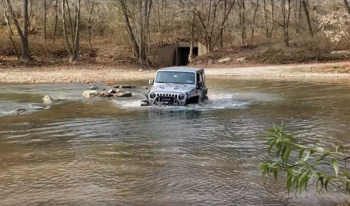
The water at "Rockcastle River" is 34" right now. This JKU Rubicon has 34" tires and its right to the top of the wheels:
BTW/Clarification: ""Deep Crk 2 byps" is the EASY Alternative to Rockcastle River and KAT.
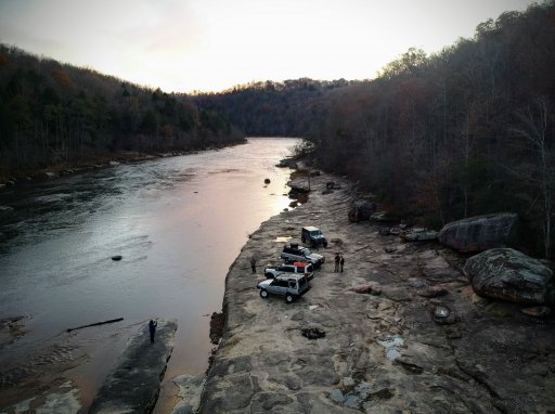
So low, some of us could even cross the Cumberland river at pitch rapids (NOT PART OF THE KAT):
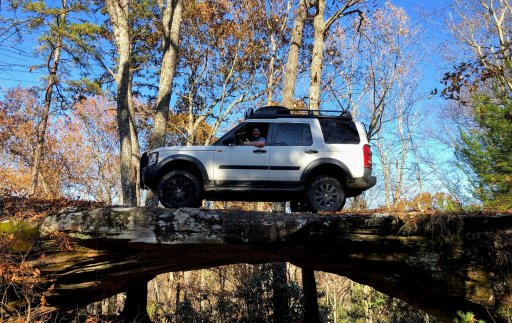
"Natural Arches" approach required some traction mats for a cool pic opportunity:
Mullin's Mine is a unique camp site, but there are about 10,000 old nails on the ground. We brought a shop magnet and picked up at least 5,000 nails, but the Aluminum are going to need a different solution to clean up.
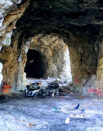
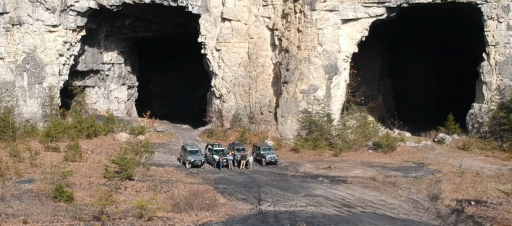
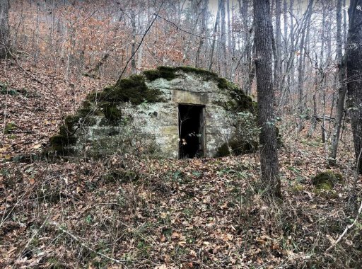
The road to "Turkey Foot Camp" is closed. The detour back to the KAT is about an hour of pavement. We found an old trail around to the south, along "Steer Fork Creek" but it a days worth of fallen-tree clearing. There is an unlocked gate on the one end of the trail, but it is unclear why. Along the trail found this structure from March 1938:
Lots of mud, erosion, and fallen trees to work though on the hard (rewarding) sections. Over 3 solid days (23 hours of driving) on the trail we covered 137 miles. It only a small fraction of the KAT. If we didnt "camp" so hard and rode dirt bikes or skipped the hard sections it could be done in 5 days. It will more likely take us 5 years to enjoy it all. Thank you again to everyone that has worked to map this out.
"Horse Lick Creek" was not deep enough to even warrant a picture.
The water at "Rockcastle River" is 34" right now. This JKU Rubicon has 34" tires and its right to the top of the wheels:

BTW/Clarification: ""Deep Crk 2 byps" is the EASY Alternative to Rockcastle River and KAT.
So low, some of us could even cross the Cumberland river at pitch rapids (NOT PART OF THE KAT):

"Natural Arches" approach required some traction mats for a cool pic opportunity:

Mullin's Mine is a unique camp site, but there are about 10,000 old nails on the ground. We brought a shop magnet and picked up at least 5,000 nails, but the Aluminum are going to need a different solution to clean up.


The road to "Turkey Foot Camp" is closed. The detour back to the KAT is about an hour of pavement. We found an old trail around to the south, along "Steer Fork Creek" but it a days worth of fallen-tree clearing. There is an unlocked gate on the one end of the trail, but it is unclear why. Along the trail found this structure from March 1938:

Lots of mud, erosion, and fallen trees to work though on the hard (rewarding) sections. Over 3 solid days (23 hours of driving) on the trail we covered 137 miles. It only a small fraction of the KAT. If we didnt "camp" so hard and rode dirt bikes or skipped the hard sections it could be done in 5 days. It will more likely take us 5 years to enjoy it all. Thank you again to everyone that has worked to map this out.
Last edited:

Contributor II

Contributor I
I rode the KAT a few years ago on a motorcycle and plan to do it soon in our jeep with wife and friends. Jeff does a good job of keeping things updated. Its one of the best trips I have been on but I'm a little bit prejudice since I'm from Ky. I've ridden the Majority of the TAT and the CDR and the KAT is right up there with them. Water levels depend on rainfall so good judgment is the main thing. I personally never understood why people wanted to drive through water as entertainment? I've got a boat for that. Last year a friend had to take his 650 BMW across a river in Arkansas and drown it? Took 2 of us wading in to rescue and almost 2 days to revive it.
The worst water crossing has a go around but we simple rode down stream and crossed there, never got over 16" deep. Straight across is the deepest. There's plenty of videos of how we went.
The RED trails will be an adventure the Main route shouldn't be a problem for most. But whats tough for some is easy to others.
Adventure Rider has loads of info on it.
Enjoy
I'm interested as well. The trip sounds awesome, but work schedule will be a factor. I should know more after the holidays. Thanks for the open invitation and for keeping this thread updated.

Enthusiast III
Alrighty folks. Looking to try and get a final head count for this trip. If you can commit at this point it would be pretty helpful for trying to finalize plans. I think the easiest way may be to start a public Facebook event for it. I'll try and get it going and post the link.
jazzy7
Rank 0

Off-Road Ranger I


