2 weeks on the NMBDR, ERT, and some wandering.

  • HTML tutorial

Offroadnutz

Rank VI
Launch Member

Member III

3,257
Texas/Missouri
First Name
Steven
Last Name
M
Member #

21045

I was having difficulty deciding which of the 2 to do, the New Mexico Backcountry Discovery Route, Enchanted Rockies trail, or the Shadow of the Rockies trail. I decided I certainly wanted to do the NMBDR heading north (after the urging of @Downs ) and I would decide the way south sometime during the journey. I allotted 3 weeks for the journey and ended up taking only 2.
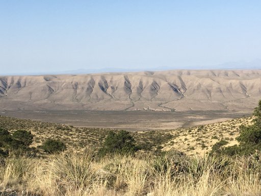
I left DFW and headed west. I started the adventure out at Carlsbad instead of Dell city. I crossed a bunch of BLM land along Dark Canyon road and set up camp at the end of some forest service road on a peak.
Views of my first nights camp.
35F1070E-D863-4D80-BE77-F247F49B0A50.jpegCC861BAB-CCFB-4622-B251-6018DBF43D66.jpeg
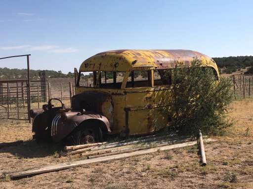
Not sure what this used to be but it was on the FS road I camped on.
C090840C-D33A-45A8-AFA5-D5263494B640.jpeg52087319-C377-4B46-BAA3-3D4CCC044D43.jpeg
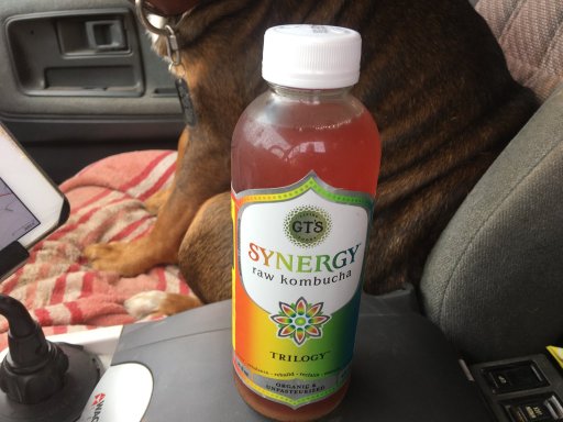
My trusty copilot for the adventure.
7B96EE97-B3B4-431E-893E-202F89D54143.jpeg
more to come....
 
Last edited:

Offroadnutz

Rank VI
Launch Member

Member III

3,257
Texas/Missouri
First Name
Steven
Last Name
M
Member #

21045

After the first night I headed through Queen, which was locked down tight, and met up with the NMBDR and headed north along the Guadalupe rim.
0B4EE90B-9B3E-40C9-B78C-C44F796D1D08.jpegCE483B3E-91B3-4137-A59A-CC50A17F9A9D.jpegD83794BA-B2F4-49EB-83F0-42905628A604.jpeg
From here I headed toward Weed. As an FYI, there is now gas available in Pinon. There is a quaint little general store with one pump. People were very nice here too.
Once back on the NMBDR I came across this. Since I’m in the “skoolie” world I could appreciate it.
92CD074F-5672-4BF0-A07F-BCF1E24A7879.jpeg
stopping for a fill up on some blm land. I carried 2 Jerry cans not knowing the fuel situation with the covid nonsense going around and reports of Weed not having gas. They do now. Still had to use one can 3 times to make it.
B973C17E-46B6-4ED3-96F6-CE154D97977B.jpeg
A few pics of the drive through Lincoln national forest.
1F5D67FF-9972-4E7E-BF9F-5074C67F79C9.jpeg
BF38AC2C-A87B-4A83-BC1A-E34DBE4BAB89.jpeg
more to come...
 

Attachments

Offroadnutz

Rank VI
Launch Member

Member III

3,257
Texas/Missouri
First Name
Steven
Last Name
M
Member #

21045

On my 3rd day I knew storms and cold weather were blowing in. I setup camp early because the storms were supposed to roll in early afternoon. 5AF50FF9-1451-4D38-B87D-F68A40C36081.jpeg
The storms blew in around 2 and didn’t stop till around 10 the next morning.
1EA3B1F0-9FB1-44C8-93CF-EBD37B746CFE.jpeg
During this time it hailed on me 4 times.

View attachment trim.38985540-4489-4944-9CFC-0516AEFC4C43.MOV
 

Offroadnutz

Rank VI
Launch Member

Member III

3,257
Texas/Missouri
First Name
Steven
Last Name
M
Member #

21045

A few pics of the storms still hanging around the next morning.
E28FDA50-C7AB-402B-99C9-50DB395B33B7.jpeg840F11EB-C7B5-4471-9CCD-084142D8DA1E.jpeg37B37E3B-714C-4B2A-A145-2E7678EC855B.jpeg
Needless to say it was a muddy sloppy mess on the trails. I encountered many fallen trees across the trail that I had to winch out of the way. As well as winching myself out. Lol
850F71EF-33C1-4C7F-9A69-56C83204465A.jpeg
EF47B115-A906-440F-86DA-70C54D203C2F.jpeg
Finally made it out of the muck. Most of the NMBDR can be done in a 2wd high clearance vehicle. But forget it if it’s wet or been raining.
E3798675-E445-40F5-9CA2-3A6FFC767161.jpeg
more to come...
 

Offroadnutz

Rank VI
Launch Member

Member III

3,257
Texas/Missouri
First Name
Steven
Last Name
M
Member #

21045

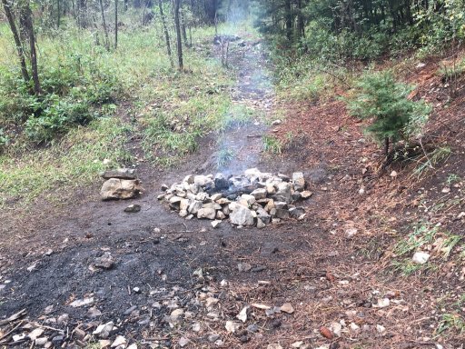
There is a lot of forest in New Mexico that has been damage by fire so with all the visual evidence around it was distressing to see this after the camper left. Come on, how hard is it to put out?
F0AC40C0-60EB-4D94-89B7-04A5CBBBAE3C.jpeg
Not hard to tell my chips were bagged at a lower elevation.
86814A37-4760-44F4-9C05-0CA0595E5C4B.jpeg
This is Bonita lake. Normally a beautiful alpine lake. It is currently being dredged and being made larger.
0DDC8220-A606-40F7-AAA3-D9B38F52476A.jpeg
3DCAD7B4-3529-4A47-9180-C355FAA43B34.jpeg

more to come....
 

Attachments

Offroadnutz

Rank VI
Launch Member

Member III

3,257
Texas/Missouri
First Name
Steven
Last Name
M
Member #

21045

Found a cool place to camp on some blm land on the northeast corner of White Sands Missile range. Pretty cool area with rolling hills.
5A9D8510-1BB4-4960-810F-4C3475F74095.jpeg
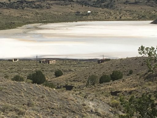
Found this while hiking nearby with my dog. Not sure what it originally was but there is evidence of a long ago homestead on site. Anyone have any idea?
4C05F731-6F49-47FC-A08D-62D1389AB5E4.jpeg
C6E6892C-200A-4FE9-93FD-904A8047A3A0.jpeg
8241F851-E949-4D3D-A52B-9ED1CA25FB37.jpeg

9D47F159-80C4-41CE-9AC1-EF1A346E52EB.jpeg
E48F776E-CCCD-4D40-A2EE-83BB6A75B55A.jpeg
More to come...
 

Offroadnutz

Rank VI
Launch Member

Member III

3,257
Texas/Missouri
First Name
Steven
Last Name
M
Member #

21045

The area around White Sands was my favorite as far as driving is concerned. Wide open, flat, and seems to go on forever. Was able to make some good speed here and even jumped my truck twice. I didn’t however do it on the ranch land and respected the property owners.
46D243E3-DF45-492D-B8C6-4C15801FFF16.jpeg
8B2C9626-F71A-49CE-8C6F-89517E1A4C6E.jpeg
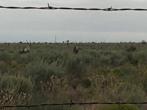
Saw these on the northwest corner of White Sands. Anyone know what they are?
60CA2CC8-6E18-4D61-B20A-27974870CFE2.jpeg
Also, as has been mentioned before, your gps will go hooey in this area so be prepared. I had to backtrack and get back on course.
More pickS from area.
1267FCD1-6D45-4E3A-89FC-728EE9BA752C.jpeg

360D35CA-7F83-4E8D-8C11-4B2815992E66.jpeg
 

Offroadnutz

Rank VI
Launch Member

Member III

3,257
Texas/Missouri
First Name
Steven
Last Name
M
Member #

21045

The section between Winston and Reserve was my hand down favorite section. I expected a lot and it delivered.
On a side note, there is a sporting gear store/gas station in Winston that is super cool. What they have surprised me and the people were super cool and nice. I would recommend supporting their business if your ever in the area.

These picks are of the “goats town” Chloride.
73A2A77C-77AD-409D-8228-992AB7C156FC.jpeg
31B30AA3-9F8A-4D99-84B0-BE93A64FAF91.jpeg
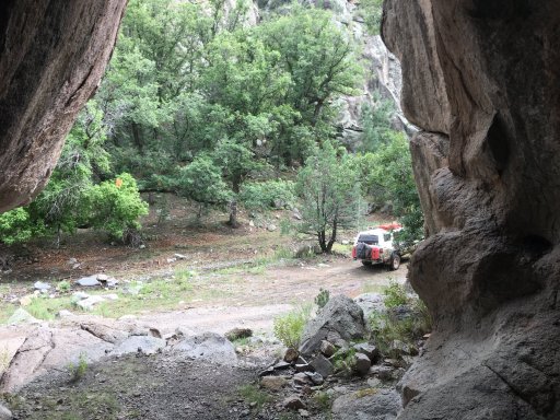
entrance to the canyon
A4CF7170-9157-443D-9B2D-AE34FF20E6AD.jpeg
View attachment trim.E49A7B91-056A-4C8A-97DA-603C8642492C.MOV
 

Attachments

Offroadnutz

Rank VI
Launch Member

Member III

3,257
Texas/Missouri
First Name
Steven
Last Name
M
Member #

21045

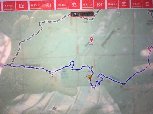
My Gaia started acting up as soon as I entered Chloride canyon. The background got blurry and didn’t correct itself till I left. Anyone experience this before?
C695FCD5-098B-4181-BDD5-0890AB2ECFA3.jpeg
 
  • Like
Reactions: Traxx and Downs

Offroadnutz

Rank VI
Launch Member

Member III

3,257
Texas/Missouri
First Name
Steven
Last Name
M
Member #

21045

Where the NMBDR gets its closest to Arizona, I detoured on another forest service road and went there to do some exploring along the Blue River. I followed that north to Alpine and then cut back east to rejoin the NMBDR.
6E6FF7F1-9DA7-4BDF-BB98-D142CE72130D.jpeg
514E8820-C27C-4E52-8EE5-FEB6BA2C1638.jpeg
66185B22-24EA-467F-AEBD-E0D8805E6AD4.jpeg
6BF9BE46-6248-4EB9-9540-67071D1E31ED.jpeg
This is lake Luna just outside Alpine Az
C974E0BB-0650-4A5D-A9F1-83030BE0413A.jpeg
more to come...
 

Attachments

Lanlubber In Remembrance

Rank V
Launch Member

Member III

2,827
Mimbres, NM, USA
First Name
Jim
Last Name
covey sr
Member #

16986

Ham/GMRS Callsign
none - BREAKER BREAKER HAND HELD CB AND WALKIE TALKIE
The area around White Sands was my favorite as far as driving is concerned. Wide open, flat, and seems to go on forever. Was able to make some good speed here and even jumped my truck twice. I didn’t however do it on the ranch land and respected the property owners.
View attachment 170599
View attachment 170600
Saw these on the northwest corner of White Sands. Anyone know what they are?
View attachment 170601
Also, as has been mentioned before, your gps will go hooey in this area so be prepared. I had to backtrack and get back on course.
More pickS from area.
View attachment 170602

View attachment 170603
I believe they or Oryx from Africa. I may have spelled the name wrong. Imported about 30 + years ago and placed on White sands missile range property.
 

Lanlubber In Remembrance

Rank V
Launch Member

Member III

2,827
Mimbres, NM, USA
First Name
Jim
Last Name
covey sr
Member #

16986

Ham/GMRS Callsign
none - BREAKER BREAKER HAND HELD CB AND WALKIE TALKIE
Where the NMBDR gets its closest to Arizona, I detoured on another forest service road and went there to do some exploring along the Blue River. I followed that north to Alpine and then cut back east to rejoin the NMBDR.
View attachment 170623
View attachment 170624
View attachment 170625
View attachment 170626
This is lake Luna just outside Alpine Az
View attachment 170630
more to come...
Good trout fishing there, no motorized boats allowed on any of the lakes in NM in that region.
 
  • Like
Reactions: Offroadnutz