
All Going
Trans Euro Trail North to East Germany
-
START DATE
Saturday, March 01, 2025
10:00 AM Brussels, Copenhagen, Madrid, Paris10:00 Hrs GMT +1:00 -
END DATE
Sunday, March 02, 2025
05:00 PM Brussels, Copenhagen, Madrid, Paris17:00 Hrs GMT +1:00
 RALLY POINT EVENT
 OVERLAND BOUND REGION
EU Mid Europe
 EVENT TYPE
Trip
 DIFFICULTY
2 - EASY 2
Rally Point Event

Terrain Type
- Dirt Road
- Highway
- Mud

Recommended
- 4WD
- Off Road Tires

Channel
- CB 16
Rally Point Details:
We want to ride the last part of the TET in Germany and get a picture. The starting point is the IKEA car park in Lübeck (erobern.geologin.gebühr)
From there, the first day will take us via Schwerin, Krakow am See to Teterow. Here we find a nice place to spend the night.
On the second day we continue via Neu Strelitz, Fürstenberg, Stegelitz and Schwedt/Oder to the Polish border.
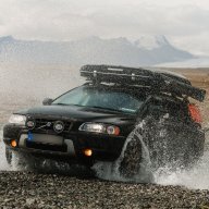
The parts of the TET that we had already travelled were already rideable and, depending on the weather, always good for a few surprises. However, if you are expecting a tough off-road tour, you are in the wrong place.
Catering and equipment are the responsibility of each individual. Of course we will help out with equipment and power (should this be necessary).
XC70_OVERLANDER
Local Expert Northern Germany- Hamburg, Germany
- @XC70_OVERLANDER
- 07/22/19


XC70_OVERLANDER
Member# 40915

- Start Point: Dänischburger Landstraße 72, 23569 Lübeck, Germany GPS Coordinates: 53.91364, 10.73775 Notes:
This Rally Point location and route can be downloaded if the buttons are active. The “Launch Google Earth" option will allow you to review the location in 3D. Please keep in mind, actual terrain may vary greatly. This should be used for reference only.
Save KML Save GPX PDF Launch in Google Map Launch in Google Earth
Comments