Member III
we did the majority of the western side of the OAT starting May 3. we started off in Davis, OK headed west. here is what we found along the way..
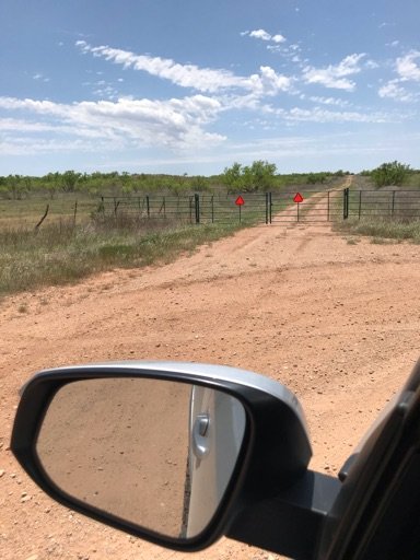
the section that @Offroadnutz had mentioned looked as if you are in someone's field had a closed gate across it. this is in the section while travelling on E1700, it was also marked by the ".5 mile section closed during hunting season" on out gpx we downloaded from advrider. we went north to the next raod and simply bypassed it. also on day 1, we found an area where the road was narrowed to one lane trail type in a swamp like area. this would likely be much harder during rainy times. unfortunately, i did not think to mark it on my map for later reference...
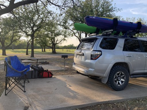
we stopped at the wichita wildlife management area for the night. as Doris Campground is closed at this time. we found a site at Robinson's Landingon the north side of Lake Lawtonka. it is east of Meers, OK on NW Meers Porter Hill Road. it is a first come first served campsite, no reservations needed or possible. no bathroom/showers of any kind. sites are concrete pad(RV sites). the electric boxes say no tents on them, but we stayed and nobody said anything. it was $20 for the night, waterfront site.
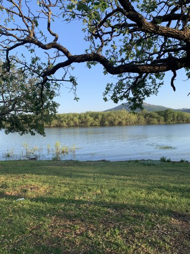
next morning we continued from Meers on the OAT. the water crossing at the north of altus-lugert wildlife management are is impassible, puctiured below. guessing 30-40 feet wide, probly 4ish feet deep with very steep drop off/climb to get into and out of it. i wouldn't have tried it in my RZR lol. it was 103F in altus at the end of that day, so we stayed at quartz mountain resort lodge that night. air conditioning won that one. but there is first come first serve camping available at quartz mountain state park.
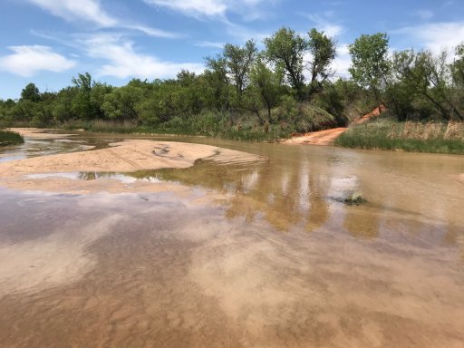
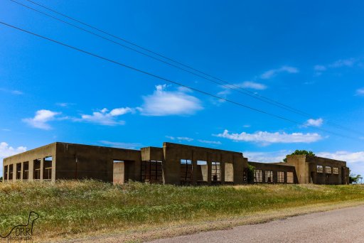
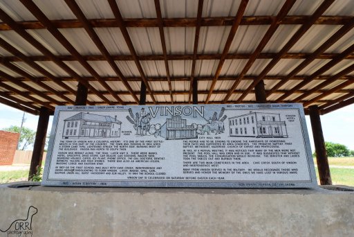
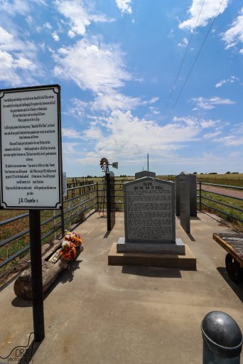
next morning, we continued and found that just south of scott airfield on our map aliong E1470 Rd, the map shows us cutting straight through, where the road now makes a loop to the south. very simple bypass, but differed from gpx none the less. After turning south on to N1840 Rd off of E1470 Rd we found that the road was now blocked by closed gates going toward the second water crossing. gates appear to be fairly new. we went west E1480, E1483, south on N1820, west on E1490, north on N1790, west on E1480 then found a neat little memorial to a man and his wife at the intersection of N1770 and E1480 Rd. we continued through the ghost town of Vinson, OK at highway 9 continuing west. we went south on Hwy 30 to meet back up with the trail at E1530 Rd. we followed a historical marker at that intersection to locate the old Ron School schoolhouse that is now abandoned in a field. it's 3 mile east 1/2 mile south of here. as we neared the next river crossing the road narrows, almost begins to look as if its a trail cut into the sand, but done with dozer/maintained fairly well, just sandy and rutted in spots, but dry on that day. at the river crossing, we met a family that was super nice, swimming for the day, the man and my wife waded it for us, only about 8-10" of water with decently solid sandy bottom. we crossed with no issue. form there it got a little bit more sandy, the dry powdery type you expect in far western OK/West Texas. not impassable by any means, but soft in spots. if you've never been in powder sand, just keep throttle in it, and keep it moving, don't stop in it any you'll be fine. we continued on the OAT out of this area headed toward the Sandy Sanders WMA.
3rd water crossing
on our way the Sandy Sanders WMA, we went on up to Erick, Ok to refuel.
once back on the OAT going into the WMA, we verified that there is a primitive campsite located along D1378 Rd not far after entering the actual WMA. you pass through a farm first, then a cattlegaurd into the WMA. we saw an old structure on the south, with a sign that said camping something or other. we followed the trail just after that sign to the south and found a campsite with fire ring along the west side of the trail. room for probably 4 vehicles in there if travelling together, maybe more. depends on how much space you really want. being rattlesnake country, i continued on....
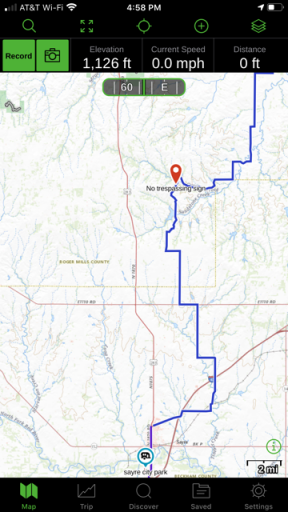
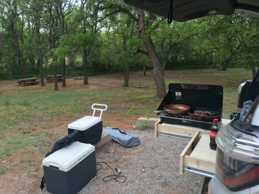
the trail meanders you through the valleys/mesas through the area and lands you in sayre, Ok. they have a city RV park you can stay at, though it is an RV park... we continued on north on the OAT, until we found a no trespassing sign on a cattlegaurd just south of Taylor Lake on D1890 Rd. unfortunately, i did not think to grab a photo of it. it was around 6:30, so we were both tired. we doubled back to hwy 283 and stayed at Dead Warrior Lake north of cheyenne, ok. it was peaceful, NF camping, no elec/water, did have a bathroom that was clean enough to use though. we parked at the south end, there were a few other campers there, not super busy though.
only pic i grabbed at campground
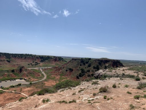
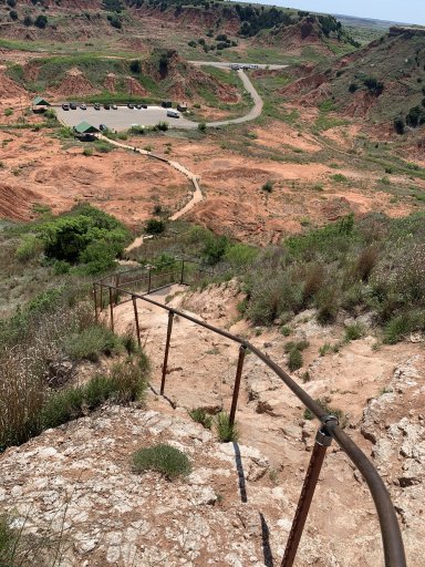
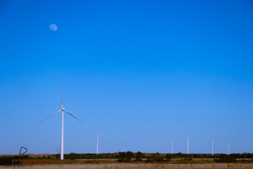
the rest of that section, wanders up through until you reach gloss mountain state park, it was worth the hike to the top of it, it takes you through the windmill gardens, closer than i had previously been to them. truly marvels to look at for me. we ended our trip at great salt plains state park. we did not have a camp reservation, the office there would not answer the phone on the way in, and could not camp without reservation. we got a hotel in Enid for the night, then headed home to get the camper and head to the lake for a few days.
The Ron School
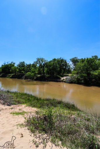
taken at quartz mountain state park
memorial to Oline
the section that @Offroadnutz had mentioned looked as if you are in someone's field had a closed gate across it. this is in the section while travelling on E1700, it was also marked by the ".5 mile section closed during hunting season" on out gpx we downloaded from advrider. we went north to the next raod and simply bypassed it. also on day 1, we found an area where the road was narrowed to one lane trail type in a swamp like area. this would likely be much harder during rainy times. unfortunately, i did not think to mark it on my map for later reference...
we stopped at the wichita wildlife management area for the night. as Doris Campground is closed at this time. we found a site at Robinson's Landingon the north side of Lake Lawtonka. it is east of Meers, OK on NW Meers Porter Hill Road. it is a first come first served campsite, no reservations needed or possible. no bathroom/showers of any kind. sites are concrete pad(RV sites). the electric boxes say no tents on them, but we stayed and nobody said anything. it was $20 for the night, waterfront site.
next morning we continued from Meers on the OAT. the water crossing at the north of altus-lugert wildlife management are is impassible, puctiured below. guessing 30-40 feet wide, probly 4ish feet deep with very steep drop off/climb to get into and out of it. i wouldn't have tried it in my RZR lol. it was 103F in altus at the end of that day, so we stayed at quartz mountain resort lodge that night. air conditioning won that one. but there is first come first serve camping available at quartz mountain state park.
next morning, we continued and found that just south of scott airfield on our map aliong E1470 Rd, the map shows us cutting straight through, where the road now makes a loop to the south. very simple bypass, but differed from gpx none the less. After turning south on to N1840 Rd off of E1470 Rd we found that the road was now blocked by closed gates going toward the second water crossing. gates appear to be fairly new. we went west E1480, E1483, south on N1820, west on E1490, north on N1790, west on E1480 then found a neat little memorial to a man and his wife at the intersection of N1770 and E1480 Rd. we continued through the ghost town of Vinson, OK at highway 9 continuing west. we went south on Hwy 30 to meet back up with the trail at E1530 Rd. we followed a historical marker at that intersection to locate the old Ron School schoolhouse that is now abandoned in a field. it's 3 mile east 1/2 mile south of here. as we neared the next river crossing the road narrows, almost begins to look as if its a trail cut into the sand, but done with dozer/maintained fairly well, just sandy and rutted in spots, but dry on that day. at the river crossing, we met a family that was super nice, swimming for the day, the man and my wife waded it for us, only about 8-10" of water with decently solid sandy bottom. we crossed with no issue. form there it got a little bit more sandy, the dry powdery type you expect in far western OK/West Texas. not impassable by any means, but soft in spots. if you've never been in powder sand, just keep throttle in it, and keep it moving, don't stop in it any you'll be fine. we continued on the OAT out of this area headed toward the Sandy Sanders WMA.
3rd water crossing
on our way the Sandy Sanders WMA, we went on up to Erick, Ok to refuel.
once back on the OAT going into the WMA, we verified that there is a primitive campsite located along D1378 Rd not far after entering the actual WMA. you pass through a farm first, then a cattlegaurd into the WMA. we saw an old structure on the south, with a sign that said camping something or other. we followed the trail just after that sign to the south and found a campsite with fire ring along the west side of the trail. room for probably 4 vehicles in there if travelling together, maybe more. depends on how much space you really want. being rattlesnake country, i continued on....
the trail meanders you through the valleys/mesas through the area and lands you in sayre, Ok. they have a city RV park you can stay at, though it is an RV park... we continued on north on the OAT, until we found a no trespassing sign on a cattlegaurd just south of Taylor Lake on D1890 Rd. unfortunately, i did not think to grab a photo of it. it was around 6:30, so we were both tired. we doubled back to hwy 283 and stayed at Dead Warrior Lake north of cheyenne, ok. it was peaceful, NF camping, no elec/water, did have a bathroom that was clean enough to use though. we parked at the south end, there were a few other campers there, not super busy though.
only pic i grabbed at campground
the rest of that section, wanders up through until you reach gloss mountain state park, it was worth the hike to the top of it, it takes you through the windmill gardens, closer than i had previously been to them. truly marvels to look at for me. we ended our trip at great salt plains state park. we did not have a camp reservation, the office there would not answer the phone on the way in, and could not camp without reservation. we got a hotel in Enid for the night, then headed home to get the camper and head to the lake for a few days.
The Ron School
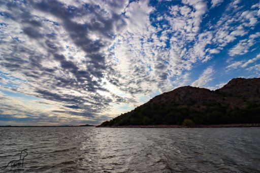
taken at quartz mountain state park
memorial to Oline
Last edited: