S/how do you carry paper maps and books?

  • HTML tutorial

genocache

Rank V
Launch Member

Advocate I

1,872
Boulder Creek, CA, USA
First Name
gene
Last Name
L
Member #

24181

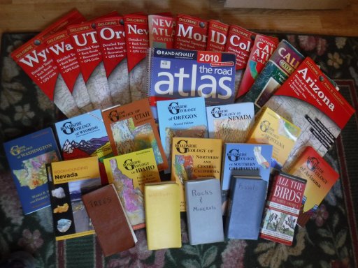
I'll be the first to admit my 109 is not weathertite, not like a new car at all. If I want to hit the trail for multiple State, long time travel I have to take into consideration potential damage to maps and books. Even if it was weathertite there is still a storage issue and daily wear-n-tear floating around in the Rover.
DSCF8400.JPG

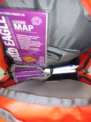
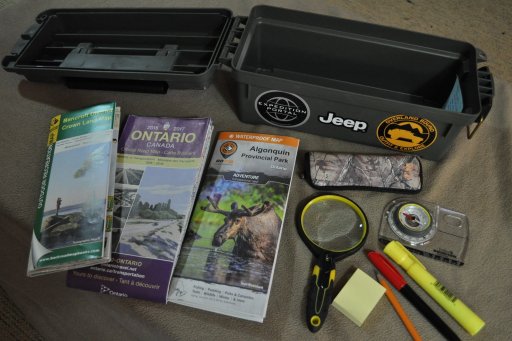
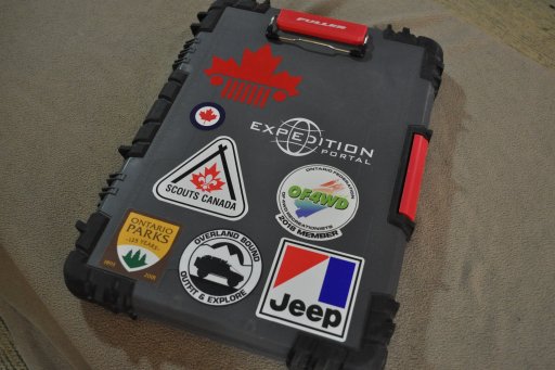
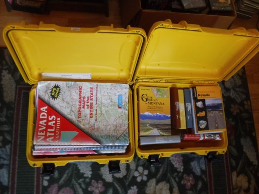
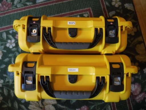
I found a couple of Nanuk cases are working for me. I have a 923 and a 925, the 925 is a 1/2" deeper.
DSCF8401.JPG
DSCF8402.JPG


Made in Canada, eh!

So what do you use?
 

El-Dracho

Ambassador, Europe
Moderator
Member
Supporter
Investor

Off-Road Ranger III

13,288
Lampertheim, Germany
First Name
Bjoern
Last Name
Eldracher
Member #

20111

Ham/GMRS Callsign
DO3BE
I keep the paper maps I have in use in a small luggage net right at hand near the front seats. Other maps - e.g. for longer tours - in a small textile folder. But your idea with the small cases is really great!
 

lhoffm4

Rank III

Advocate I

778
Boise, Idaho
First Name
Lee
Last Name
Hoffman
Service Branch
US Navy
Keep a road atlas in the pouch behind the passenger seat. GPS fails, Atlas doesn’t. Albeit my truck IS weatherproof. But I’m reasonably sure they make weather resistant sleeves for the atlas... hmmm.
 
  • Like
Reactions: El-Dracho

El-Dracho

Ambassador, Europe
Moderator
Member
Supporter
Investor

Off-Road Ranger III

13,288
Lampertheim, Germany
First Name
Bjoern
Last Name
Eldracher
Member #

20111

Ham/GMRS Callsign
DO3BE
If I want robust and waterproof maps, I like to use maps from the German publisher "Reise Know-How Verlag". The map series "world mapping project" offers really durable maps for travel destinations in almost the entire world. The publisher uses a waterproof and durable special material for these robust maps. I have something similar as a first aid guide booklet (his lists the most important emergency situations in the outdoors). The little booklet is also printed on a water-resistant and rugged material, which I understand is also used by the military. Such maps may also be available in North America. You'll have to take a look.
 

Dimitri_Raptis

Rank IX
Launch Member
Member

Trail Mechanic I

13,638
Riyadh, Riyadh, Saudi Arabia
First Name
Dimitri
Last Name
Raptis
Member #

22608

Ham/GMRS Callsign
4
With me it’s quite simple. I don’t. Everything is digital and backed up in at least two devices. Maps are good to plan in advance but I do not take them with me. Offline GPS maps are in my opinion the best.
 

Alanymarce

Rank IV

Trail Mechanic III

1,392
Colombia
Similarly, we carry maps and guides in our iPad and iPhones. Apart from being eaiser to protect, they take up less space and are a bit lighter.

When we do acquire paper maps it's on the road and when needed for local guidance - e.g., National Park maps. We keep them to a minimum, and if possible (e.g., when they are a singe page or two) we photograph them with the iPhone and leave the paper ones at the park entrance/wherever.

In addition to Reise maps, ITMB publishes many of their maps in waterproof form, if you do want paper maps.
 

Kent R

Executive Director
Staff member
Mod Team
Moderator
Member

Pathfinder III

5,200
El Dorado, Ca
First Name
Kent
Last Name
Reynolds
Member #

1632

Ham/GMRS Callsign
K6KNT
Service Branch
Retired Firefighter
I still cary maps, map books, and trail books as backups to the electronics. I also keep a regional map near me so I can see the big picture than scrolling through a nav program.
I put them in a seat organizer that attaches to the back of the driver or passenger seat. If it is just me on a trip I can put it on the front of the passenger seat.
Not the best solution but it seems to work OK.
 

KonzaLander

Rank VI
Member

Traveler II

3,402
Junction City, Kansas, USA
Member #

15814

Ham/GMRS Callsign
KE0EBF
I keep the Benchmark/Delorme Atlas in the seatback pockets. Folded paper maps (usually water/tear resistant) are put in the door pockets. It is very helpful to use these paper maps while planning a trip at home and I study them at camp after using digital maps throughout the day. I am a self admitted map nerd that should have become a cartographer.
 

Ethan N

Local Expert, East Region USA
Member

Expedition Master III

10,785
Ocean County, NJ, USA
First Name
Ethan
Last Name
Newago
Member #

30968

Service Branch
US Army
When I'm visiting a particular place, I'll research ahead and if NFS maps are available I'll print them right here at home and just put them in a sheet protector during my trip. It's been a long time since I actually used a wide map that covers a large area, but back then I had huge yard rolls of laminate and I would laminate my own maps. Takes a calm hand and some great folding skills but they last forever.
 

PCO6

Rank V
Launch Member

Member III

2,268
Newmarket, Ontario
First Name
Stew
Last Name
Beatty
Member #

12534

I generally rely on my GPS or Google maps while travelling but definitely carry paper maps as well as books and other resources for the areas I am going to. I often sit and read them at night both to see where I've been and for planning where I'm going.

One of the funniest things I've encountered on a trail was when I got lost. I parked my Jeep and spread a map out on the hood. Two 20 something couples pulled up on ATV's were excited to see real maps. They thought "old school" (their words) was pretty neat. They also helped me find my way.

I use a small ammo box for maps and a few other things and a contractors box for books, travel notes, etc.

19-04-20 2.JPG

19-04-20 3.JPG
 

grubworm

Rank V
Launch Member

Member III

2,358
louisiana
First Name
grub
Last Name
worm
Member #

17464

Service Branch
USN-Submarines
like several have already said on here, i also keep my paper maps/atlas in the pouch behind the seat. out of the way, well protected and very easy to access.
when we're actually on the road traveling, i quite often keep the atlas up on the dash open to the state i'm in. im sure it looks quite "touristy" doing that, but i like the quick access of having it there.
 
  • Like
Reactions: Ebrinker

ZombieCat

Rank V
Member
Investor

Advocate I

1,421
Maryland
First Name
Adventure
Last Name
Awaits!
Member #

8736

I have electronics that use Google/Apple/Gaia maps and a Gamin satellite navigation device, which I use primarily for roads. But…I always have “old school” maps, too. The 50-state Rand McNally resides in the seat back pocket and I have trail maps for many National Parks, forests and wilderness areas. Understanding how to read a topographical map and navigate are essential backcountry skills. I study them before and during trips for inspiration: Can I reach that high alpine lake? How many miles and how much elevation gain? Apps only cover established routes, but paper maps have endless possibilities for exploration!
 
  • Like
Reactions: genocache

MOAK

Rank V
Launch Member

Off-Road Ranger I

2,865
Wherever we park it will be home !!
First Name
Donald
Last Name
Diehl
Member #

0745

Ham/GMRS Callsign
WRPN 506
We use a Rand McNally road atlas of North America for the big picture and keep it handy. Before a trip we pack topo/trail maps from Nat Geo, NF, NP, BLM or any other published maps for the locales we will be in. Sometimes we will have 9-12 local topo maps. While traveling the paper maps are stored in the big side pocket of our ARB fridge insulating cover. There’s enough room in that pocket for at least 12 maps. As we travel, individual maps are cycled to the navigators front door pocket, as needed. When done exploring a region, the map gets put back in the ARB pocket. When I was driving for a living before cell phones and such, it was necessary to drag around a briefcase full of maps. Making a delivery in Chicago’s south side? I had a map for that. LA/Orange county? Thomas guide. I learned to keep ‘em all organized a long time ago, same as I do now. I don’t care for digital maps, at all. I’ve been exposed to them and given them a try. As Kent stated, I like to see the big picture. I like opening up a map and immediately recognizing where we are in relationship to major landmarks, cities, towns, etc. having said all of this, I’m going out to my pickup truck now and will be using google maps to get me to an unfamiliar address right here in my county. It is handy.