Oklahoma to Colorado

  • HTML tutorial

GladiGator

Rank III
Launch Member

Enthusiast I

874
Oklahoma City, OK
First Name
Michael
Last Name
Smith
Member #

12220

I am planning a trip for a 2 truck trip to Colorado in August. We will be leaving Oklahoma City with the idea to trek around W/NW Colorado ending up somewhere around the Alpine Loop. I want to plan out the trip on Gaia and provide the map to the other truck. Where I am getting stuck is figuring out where to camp each night. Trying to stay out of KOA's etc. and stay full wilderness. I need some advice from the experts here. Where do I get started, should I just pick a National Forest or BLM land and explore? I'm a complete greenhorn.

Thanks in advance. Sharing my rig for attention.
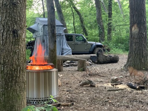
D0A4BA47-F1A1-4B0B-9AA9-88E8503B71F8_1_105_c.jpeg

Side note: I know the site is messy. It was like that before we arrived and we left it better than we found it.
 

Neal A. Tew

US Rocky Mountain Local Expert
Mod Team
Member
Member

Member III

3,817
Pueblo West, CO
First Name
Neal
Last Name
Tew
Member #

12384

Ham/GMRS Callsign
N1TEW
Try iOverlander.com for starters. They have an app.

While you're in the area, I strongly suggest you look at doing Imogene Pass, Ophir Pass, and Corkscrew/Hurricane/California/Placer/Picayune. Look at Stony Pass too. It's a good one to spend a night or two on. It's pretty long. Last Dollar road is easy, but very scenic and has camping along the way.

Here's some good sources of trail info:

Let us know more about your route as we may have some specific camping ideas. For example, I've camped at the bottom of Corkscrew several times.
 
  • Like
Reactions: GladiGator

Neal A. Tew

US Rocky Mountain Local Expert
Mod Team
Member
Member

Member III

3,817
Pueblo West, CO
First Name
Neal
Last Name
Tew
Member #

12384

Ham/GMRS Callsign
N1TEW
Also, look us up if you happen to be in the area on these dates:
 

Prerunner1982

Local Expert, Oklahoma USA
Launch Member
Member

Member III

3,372
Navina, Oklahoma
First Name
Jon
Last Name
B
Member #

16274

Also, looks at the MVUM (Motor Vehicle Use Maps) either online or stop into the local Ranger office to get a paper copy.
They will show what roads allow dispersed camping, some up to 300 ft off of the road.
 

Neal A. Tew

US Rocky Mountain Local Expert
Mod Team
Member
Member

Member III

3,817
Pueblo West, CO
First Name
Neal
Last Name
Tew
Member #

12384

Ham/GMRS Callsign
N1TEW
  • Like
Reactions: GladiGator

Prerunner1982

Local Expert, Oklahoma USA
Launch Member
Member

Member III

3,372
Navina, Oklahoma
First Name
Jon
Last Name
B
Member #

16274

Also the Forest Service Interactive Visitor map is pretty easy to navigate to see what routes are open and where the FS camp grounds are.
 
  • Like
Reactions: Neal A. Tew

Pathkiller

Rank IV
Launch Member

Enthusiast III

933
Effingham, South Carolina, USA
First Name
Tim
Last Name
Cox
Member #

24973

Ham/GMRS Callsign
NA
I am planning a trip for a 2 truck trip to Colorado in August. We will be leaving Oklahoma City with the idea to trek around W/NW Colorado ending up somewhere around the Alpine Loop. I want to plan out the trip on Gaia and provide the map to the other truck. Where I am getting stuck is figuring out where to camp each night. Trying to stay out of KOA's etc. and stay full wilderness. I need some advice from the experts here. Where do I get started, should I just pick a National Forest or BLM land and explore? I'm a complete greenhorn.

Thanks in advance. Sharing my rig for attention.
View attachment 156050

Side note: I know the site is messy. It was like that before we arrived and we left it better than we found it.
You can overlay the US Forest Roads & Trails, the MVUM (USFS) and the Outdoors maps which should show some sites.
 
  • Like
Reactions: GladiGator

GladiGator

Rank III
Launch Member

Enthusiast I

874
Oklahoma City, OK
First Name
Michael
Last Name
Smith
Member #

12220

Try iOverlander.com for starters. They have an app.

While you're in the area, I strongly suggest you look at doing Imogene Pass, Ophir Pass, and Corkscrew/Hurricane/California/Placer/Picayune. Look at Stony Pass too. It's a good one to spend a night or two on. It's pretty long. Last Dollar road is easy, but very scenic and has camping along the way.

Here's some good sources of trail info:

Let us know more about your route as we may have some specific camping ideas. For example, I've camped at the bottom of Corkscrew several times.
This is great! I am going to start mapping it out and come back with a route. Stony Pass was on my list as I've heard some good things from a couple of guys here in OK. Thanks for the great info!
 
  • Like
Reactions: Neal A. Tew

Aequitas1916

Rank IV
Launch Member

Advocate I

1,295
Florida, USA
First Name
Jon
Last Name
Weet
Member #

18382

Service Branch
U.S. Navy
Check out freecampsites.net as well. Between ioverlander.com and that one, you can probably find some previously reviewed camping along your route, if you don't feel like blazing a trail based on MVUMs and such. Dispersed camping is awesome and I highly recommend it. But, sometimes a spot that looked promising on map doesn't turn out that good, or even viable. And, when your timetable for your next destination depends on reaching a campsite for rest before continuing the next day, it can be difficult to call an audible in the middle of nowhere with no cell signal available to help you find another spot.

I guess it depends how safe you want to play it. Mix in some exploration with known camping spots, plan alternatives to your selected explorations, or just wing it.
 
  • Like
Reactions: Neal A. Tew

GladiGator

Rank III
Launch Member

Enthusiast I

874
Oklahoma City, OK
First Name
Michael
Last Name
Smith
Member #

12220

Check out freecampsites.net as well. Between ioverlander.com and that one, you can probably find some previously reviewed camping along your route, if you don't feel like blazing a trail based on MVUMs and such. Dispersed camping is awesome and I highly recommend it. But, sometimes a spot that looked promising on map doesn't turn out that good, or even viable. And, when your timetable for your next destination depends on reaching a campsite for rest before continuing the next day, it can be difficult to call an audible in the middle of nowhere with no cell signal available to help you find another spot.

I guess it depends how safe you want to play it. Mix in some exploration with known camping spots, plan alternatives to your selected explorations, or just wing it.
This is super helpful. I do know that saying "2 is 1 and 1 is none" holds true with overlanding. Exploring the Ozark-St. Francis forest is one place where you never know if your spot is taken already. I appreciate the help.
 
  • Like
Reactions: Neal A. Tew

Neal A. Tew

US Rocky Mountain Local Expert
Mod Team
Member
Member

Member III

3,817
Pueblo West, CO
First Name
Neal
Last Name
Tew
Member #

12384

Ham/GMRS Callsign
N1TEW
This is great! I am going to start mapping it out and come back with a route. Stony Pass was on my list as I've heard some good things from a couple of guys here in OK. Thanks for the great info!
I haven't run Stony in a couple years. If you're game for any company, hit me up!
 
  • Like
Reactions: GladiGator