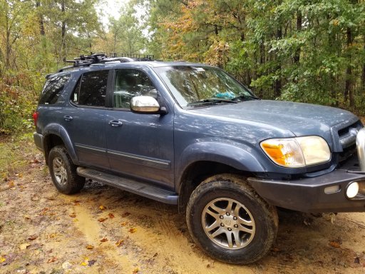
Georgia traverse question.

  • HTML tutorial

Cory B

Rank III
Launch Member

Enthusiast II

547
Cullman
First Name
Cory
Last Name
Britton
Member #

20219

I am planning a trip to GA and going to take the opportunity to take the Ga traverse. I am going west to east and only plan on completing about half of the trail. I would like to at least make it to the iron bridge general store. I know that stops between the AL line and there will vary for everyone but how long will it take? I will have kids and possibly our dogs with us and plan on stopping at the overlooks along the way. Any info will be helpful. Thanks!
 

Attachments

  • Like
Reactions: grubworm

grubworm

Rank V
Launch Member

Member III

2,358
louisiana
First Name
grub
Last Name
worm
Member #

17464

Service Branch
USN-Submarines
i'll second the request for some info. the wife and i got married 2 yrs ago and honeymooned camping in north georgia, so now georgia is one of our go-to places. we've done a lot of hiking around the helen area and have been hearing about the GAT georgia adventure trail and that is probably going to be our next trip
@Cory B , here is a link from the southeast region thread that might have some info for you and if i find out more, i'll be sure to post on here. also, here is a link to a really good map i found on amazon that we use a good bit to find hiking trails and sights


  • Like
Reactions: Lil Bear

Cory B

Rank III
Launch Member

Enthusiast II

547
Cullman
First Name
Cory
Last Name
Britton
Member #

20219

i'll second the request for some info. the wife and i got married 2 yrs ago and honeymooned camping in north georgia, so now georgia is one of our go-to places. we've done a lot of hiking around the helen area and have been hearing about the GAT georgia adventure trail and that is probably going to be our next trip
@Cory B , here is a link from the southeast region thread that might have some info for you and if i find out more, i'll be sure to post on here. also, here is a link to a really good map i found on amazon that we use a good bit to find hiking trails and sights


Much appreciated! Getting the map on the way too
 
  • Like
Reactions: grubworm

gungriffin

Rank 0

Contributor I

60
Denver, CO, USA
First Name
Ryan
Last Name
K
I just got back to CO from running this trail. It was fun. There will be some closures along the way, but they were all easy to get around using paved roads. A fair amount of the far West side was paved roads. Probably 60% of the final 60 miles. You will make good time on those. Be sure to time your mileage to be around camp sites when you want to call it a day. Probably about 50% of the camp sites were marked under the points of interest. I just winged it on camp sites and that was not the best choice. You can look at the GPX and see the pacing that will work to have you end up at the sites you want to be. The Cohutta park region was definitely a high point of the entire trip and the best part of the western side of the trail. I didn't do the entire circle, but looking back I wish that I would have. There were quite a few prime primitive campsites in that area. The GPX from Welcome to Georgia Overland was top notch for keeping on the trail.
 

BRM98

Rank II

Enthusiast I

374
Duluth, GA
First Name
Brad
Last Name
Miller
Member #

25761

I am planning a trip to GA and going to take the opportunity to take the Ga traverse. I am going west to east and only plan on completing about half of the trail. I would like to at least make it to the iron bridge general store. I know that stops between the AL line and there will vary for everyone but how long will it take? I will have kids and possibly our dogs with us and plan on stopping at the overlooks along the way. Any info will be helpful. Thanks!
When are you planning to make the drive?
 

Cory B

Rank III
Launch Member

Enthusiast II

547
Cullman
First Name
Cory
Last Name
Britton
Member #

20219

When are you planning to make the drive?
Right now we are planning to start on 11/20 or 12/4. Thanksgiving week will be too busy and want plenty of time to plan and get the sequoia ready.
 

Cory B

Rank III
Launch Member

Enthusiast II

547
Cullman
First Name
Cory
Last Name
Britton
Member #

20219

We would be up for the trip as well, from Middle Tennessee it is a short trip.
If you want company...
No problem but i will forewarn you, we will have our 5 kids with is. Ages 8,6,3 and 1 year old twins. Not sure how often the stops my be. This will be our first trip (overlanding) this far with them.
 
  • Like
Reactions: Lil Bear

Jenks

Rank I
Launch Member

Member I

233
Elizabeth City, NC
Member #

17825

Sorry I don’t have a good answer for you about time running West to East but I just ran the middle section from East to West. You really can make good time if you need too. Most of the roads/trails are very easy. The only one that really makes you go slow is Chariles Creek. That one put my Jeep and trailer to work. It would have been a lot less stressful if there was another vehicle with me and it was just me, two kids And a dog.

My biggest piece of advice is to take advantage of sites you find In the middle afternoon. We always seemed to find great sites around 2 or 3pm and would pass hoping to put more miles and find somewhere better but would end up hitting a section with no sites then scrambling to find something right before dark. If I did it over we would have slowed down and enjoyed the good sites and not worried about the amount of miles/sections we covered.

But enjoy the ride and have fun making memories, my boys 8 and 12 love the experiences and ask constantly when we are going on another Jeep adventure!
 
  • Like
Reactions: Cory B